National Hurricane Center
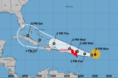
As of 11 a.m. Eastern on Tuesday, September 5, Hurricane Irma, a Category 5, is located approximately 225 miles east of the Caribbean island of Antigua and is moving west at 14 mph.
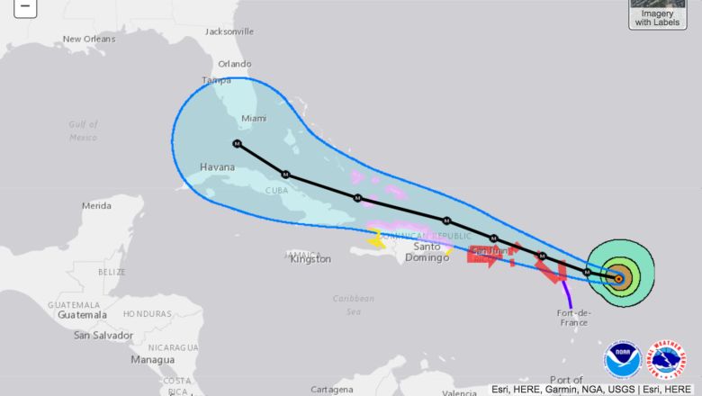
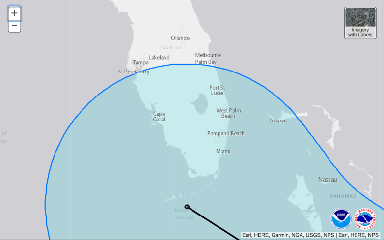
The newest maps that show Irma’s projected path suggest that she will be moving north west after she passes Cuba. The current map shows that Irma could be headed for Tampa, Florida, giving St. Pete a good chance of seeing heavy sustained winds and an ample amount of rainfall.
The storm will reach the state of Florida by the weekend, and Tampa and St. Pete could see increased wind speeds and heavy rain by Saturday.
Check out the map below.
According to Tampa’s Klystron 9, winds will pick up in the Tampa/St. Pete area on Saturday. On Sunday and into Monday, winds will intensify, though it’s too early to report how high the sustained winds will be. As of today, showers are in the forecast for St. Pete on Sunday and Monday.
There is not a mandatory evacuation for Pinellas County at this time. However, if Irma is going to hit the Tampa Bay area directly, that may change. For a map of evacuation routes in St. Pete, click here.
Flooding is already a concern for the coastal city, and sandbags are available at three locations, according to AccuWeather. The locations listed below are open to residents today from 4 p.m. to 8 p.m. and again tomorrow (Wednesday) beginning at 7:30 a.m.
– Northeast Park: 875 62nd Avenue NE
– Bartlett Park: 2000 7th Street South
– Northwest Pool Parking Lot: 2331 60th Street North
To find a Hurricane Shelter in St. Pete, click here.
For alerts in the St. Pete area, click here.
Below are important phone numbers to keep close by in a weather emergency.
Pinellas County Emergency Management at 464-3800
St. Petersburg Emergency Management at 892-5200
St. Petersburg Citizens Information Center at 893-7111