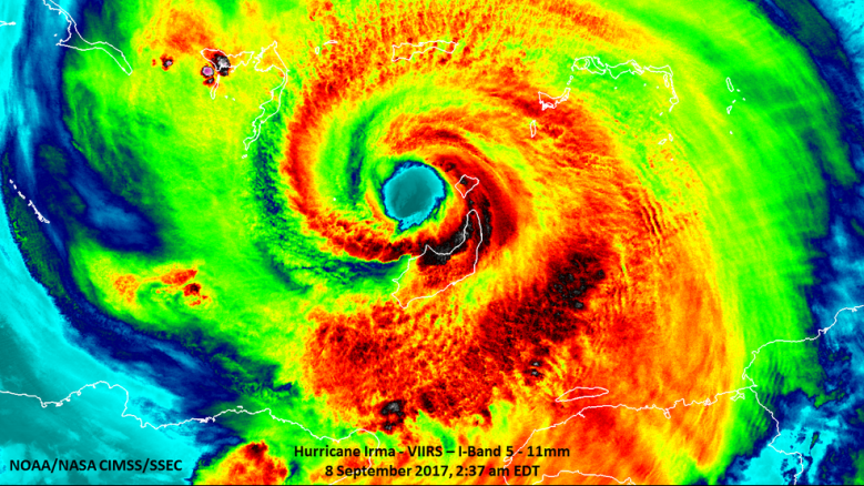
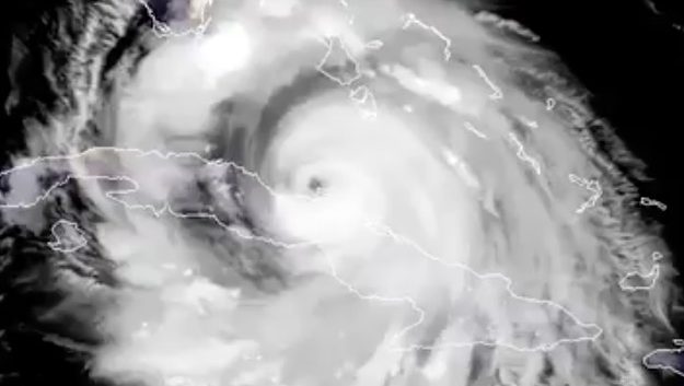
Credits: NASA/NOAA/UWM-CIMSS, William Straka Hurricane Irma from space.
Where is Irma right now? What’s the storm’s current location? There are many tools available for you to track Hurricane Irma in real time. This article will provide a roundup, with links, so you can check out some of the best and most respected websites online that are tracking the hurricane with updated and real-time information on where it is, how strong it is, and where it’s likely to land.
The massive storm is affecting millions of people across Florida, and it’s frightening people on the western coast of the state, especially. By 5 p.m., the hurricane had made its second landfall along Marco Island, and it was over Naples, Florida shortly thereafter. It’s now projected to be heading toward Georgia as a tropical storm.
However, information on this storm becomes outdated the second its published. Thus, here’s a roundup of some of the Irma trackers and path maps that you can use to watch the storm’s path and progress in real time.
National Hurricane Center
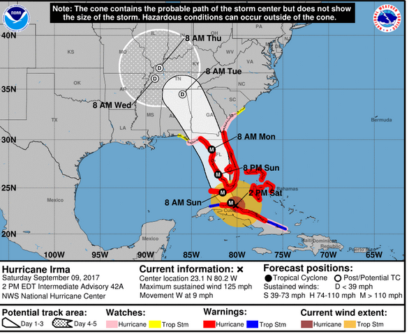
NWSHurricane Irma Saturday afternoon forecast.
The National Hurricane Center is a comprehensive source of regularly updated information on the storm. You can access its site and maps here. Here’s another NOAA page with real-time hurricane information. See this page also. In addition to trackers and satellites, this page also provides regular written updates on the hurricane.
Advisory 45 Key Messages for #Irma

The news media heavily rely on the National Hurricane Center updates, maps, and other trackers. You can find wind speed, rainfall, arrival time, hurricane warnings, and many other data points on the page. The center also has an interactive map of Florida that allows you to get estimates of the former threats. Click on threats and impacts as well as radar and satellite tabs.
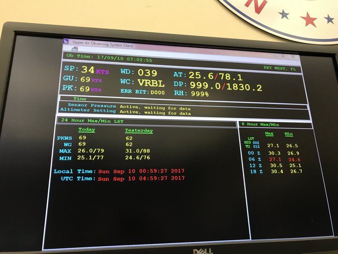
Whoa… Just recorded a 69 knot gust here at the office in Key West! That’s 79 mph!!! Again, please, please shelter in place, inside! #Irma
The National Weather Service has a tracking map here.
See the main NWS Irma page here. It has a lot of real-time data and imagery.
National Center for Atmospheric Research

GettyA woman carries her dog as people arrive at a shelter at Alico Arena where thousands of Floridians are hoping to ride out Hurricane Irma in Fort Myers, Florida.
This education site has a real-time page on Hurricane Irma that includes spaghetti plots and other up-to-the-minute data points.
The site also tracks other hurricanes, such as Jose and Katia, here.
University of Wisconsin
Getty
The University of Wisconsin-Madison has a real-time page of Irma information and maps. Click on the little yellow hurricane icon for Irma to get even more real-time imagery from the site.
The Weather Underground & Wunderground
National Hurricane Center
The weather underground has tracking maps that are updated frequently.
Wunderground also has a tracking map.
Then there’s Windy.com. It has a pretty interesting weather map you can use to track the horrific storm.
Cyclocane
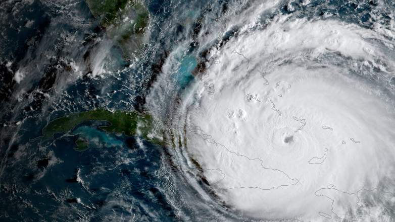
GettyHurricane Irma will be in Florida as early as Saturday night.
Cyclocane is a go-to site for updated spaghetti maps on Irma. See other Cyclocane maps here.
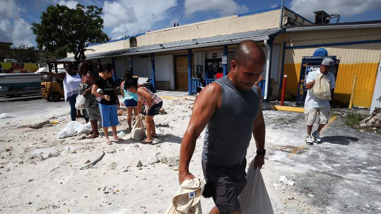
South Florida Waste Management District

Workers board up the Mango’s Restaurant and Night Club as the city prepares for the approaching Hurricane Irma on September 7, 2017 in Miami Beach, Florida.
This government site has some of the best spaghetti models that people have been sharing. You can access the real-time data here.
Local TV & Weather Channel
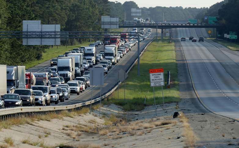
Southbound lanes of I-95 near the Georgia-South Carolina border are empty as northbound lanes are packed as pepole evacuate ahead of the arrival of Hurricane Irma.
Some local TV stations also have maps where you can monitor Irma’s path.
Weather.com has a roundup of real-time maps and trackers for Irma here.
RT: Here’s a low data bandwidth radar image from Key West, Florida if you need to keep an eye on #HurrcaneIrma:
t.co/pQPoI9U6eT
You can also watch live satellite radar and video feeds of Hurricane Irma. You can find live streams of those here: