NOAA Hurricane Michael Path
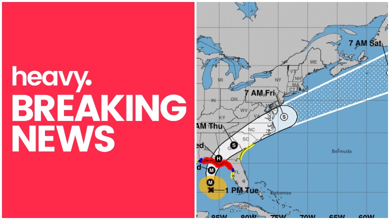
Hurricane Michael is slowly moving toward the U.S. coast. Current forecasts predict that it might be a Category 3 by the time it makes landfall, possibly in Florida. It’s currently a Category 2. Read on to see maps and trackers of Hurricane Michael’s path as of October 9, along with the storm’s projected path for the coming days. Hurricanes are a bit unpredictable at this stage, so stay tuned as details can change over time.
Live Hurricane Michael Interactive Map Tracker
You can track Hurricane Michael’s location via the Google Crisis Map hurricane tracker here. You can also view an embedded version of the interactive map below. If the embedded map goes down, you can still see it on the link here. You may need to zoom into the map below in order to see Michael’s track.
Additional live maps can be found on Weather.com and with NOAA here.
Hurricane Michael’s Projected Path as of October 9

NHC
First, here’s a map above from the National Hurricane Center showing a forecast cone and coastal watches and warnings released on October 9. This map does not indicate the hurricane’s size, but it does show the hurricane’s current projected path. The hurricane is expected to make landfall sometime on Wednesday.
This next map may give you a better idea of when to first expect to feel the effects of the hurricane. This map shows the estimated arrival time of tropical storm force winds.

NHC
Next is a different look at the hurricane’s projected path. Keep in mind that this map has an interactive component that you can view here.
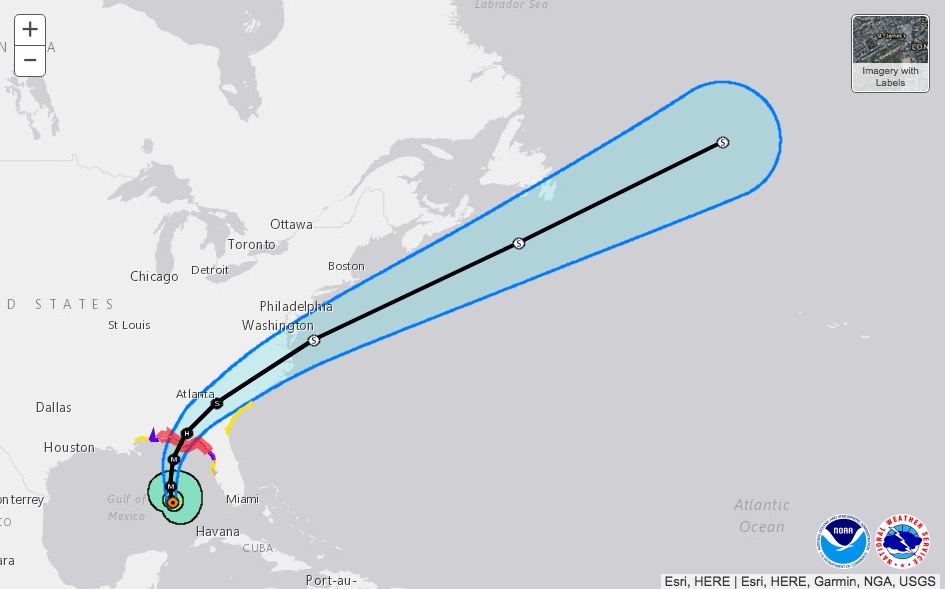
NHC
The Navy has a tracking map for storms too. This is the Navy’s tracking map, provided by ATCF – Naval Research Laboratory: Marine Meteorology Division:
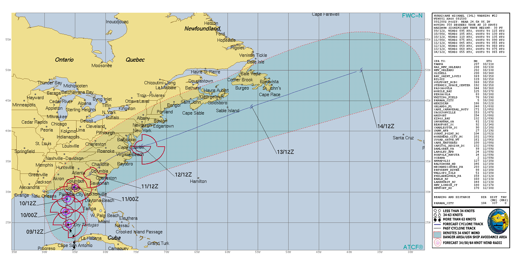
Navy
Wind Projection Maps of Hurricane Michael on October 9
Next up are wind-speed probability maps. The first shows the probability of tropical storm force winds, as predicted on October 9.
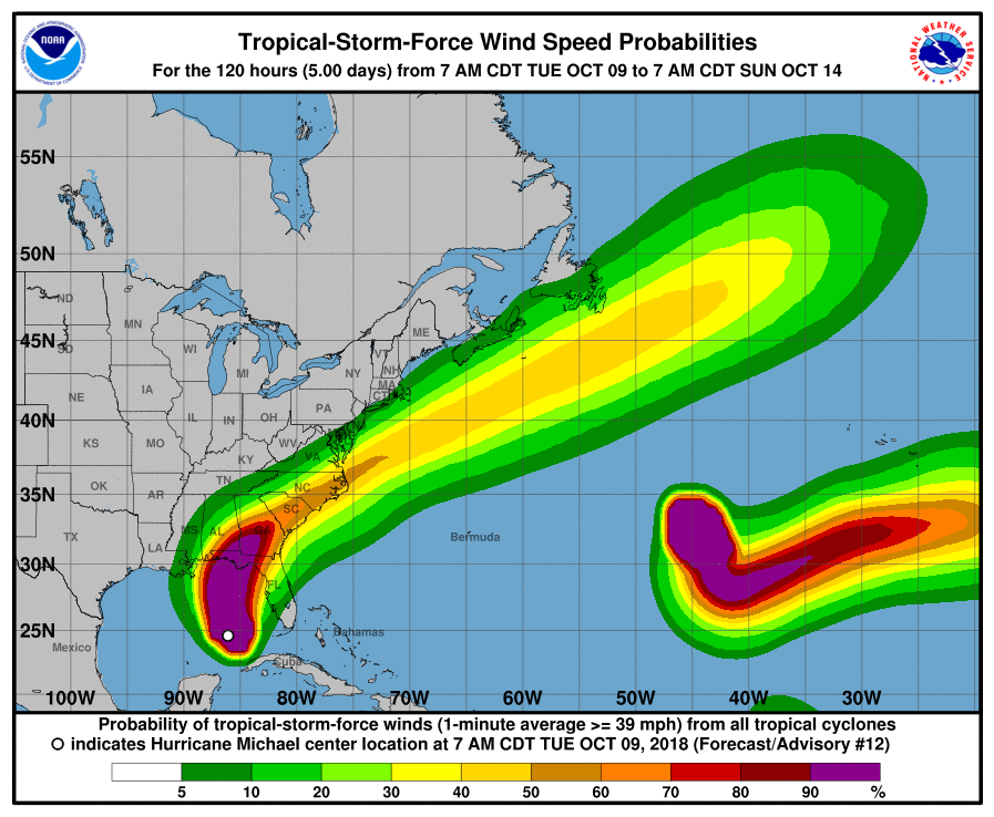
NHC
This next map shows the probability of hurricane-force winds.
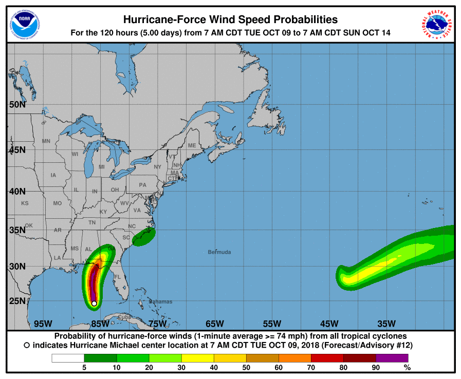
NHC
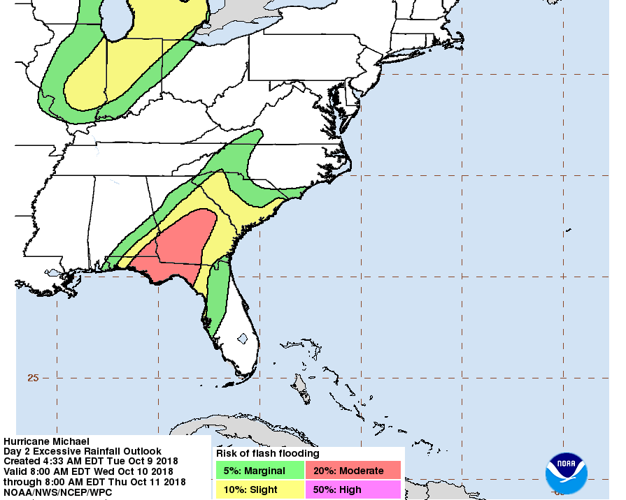
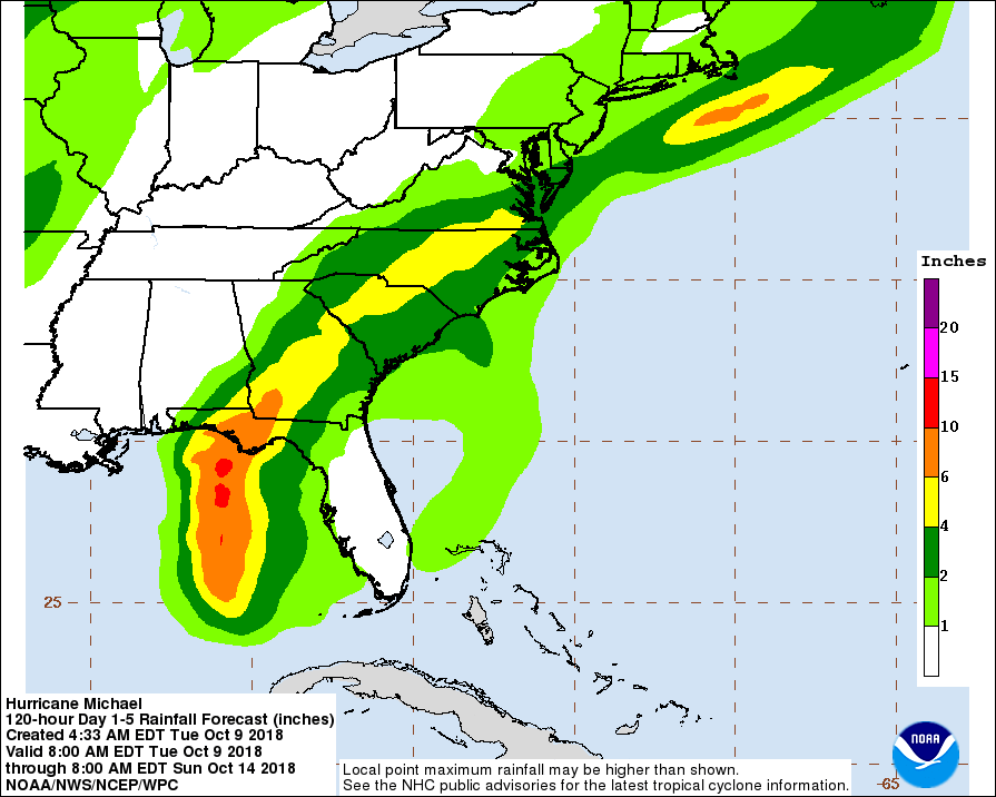
Rainfall & Flooding Potential Maps
These next maps from NOAA show the flash flooding potential and then the rainfall potential.
NHC
According to the National Hurricane Center on October 9 at 1 p.m., Hurricane Michael is currently at 25.4 N, 86.4 W about 335 miles South of Panama City, Florida and 310 miles SSW of Apalachicola, Florida. Maximum winds are currently 110 mph and it’s moving north or 350 degrees at 12 mph. The minimum central pressure is 965 mb.