
Inciweb California Fire map
It’s fire season in California, and new fires are developing nearly every day. Here are the latest updates on California fires for Friday, July 26, 2019. New fires have been reported on July 26, including a Portrero Fire near homes. This article first includes interactive maps for all of California, including Cal Fire and other sources. Then the second section details specific fires in the region in alphabetical order.
For the most updated information, visit Heavy’s July 27 story here.
Interactive Maps of California Fires
There are three interactive maps to follow to get the best updates about California fires this summer. In many cases, the fires don’t always overlap so it’s good to review all the maps for the latest information.
The first is this map below, which is an interactive map of the more significant fires in California, provided by CAL FIRE and Google. Fires in red are active and fires in black are contained. If the map doesn’t show below, just go here. Depending on how your browser works, you may need to zoom into the map below for more details, using the + button within the map. Interestingly, this Cal Fire map used to be the best source for tracking fires in California, but now the two interactive maps described below it are actually better sources that are updated more frequently.
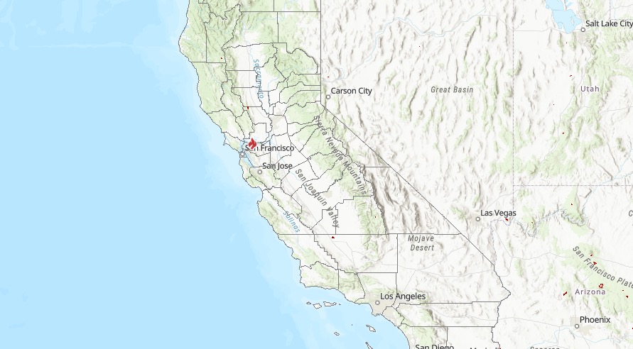
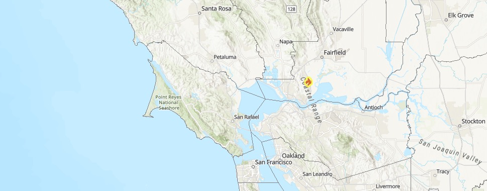
The second good interactive map is Inciweb’s map. You can see the full map here. There’s an embeddable Google Map that includes Inciweb fires which you can see below. Depending on your browser, you may need to zoom in using the + button within the map or change settings on the Layers tab of Legend to only show Inciweb fires:
Another good map can be found here from Ca.gov. A screenshot is below, but you’ll want to see the full map for all the details.
CA.gov
Each of these maps often contains details the others are missing, so you’ll need to view all three for a full update on the fires. However, brand new fires may not be listed on any of the above maps until they’ve been around for a few hours.
Next are more specific details on the fires for July 26, 2019. If you are looking for a specific fire, search for the name so you can find it faster, or just scroll down and look at the fires, listed in alphabetical order.
List of Active Fires in California on July 26, 2019
Here are the active fires and updates about them. Most of these are in alphabetical order.
Bowler Fire
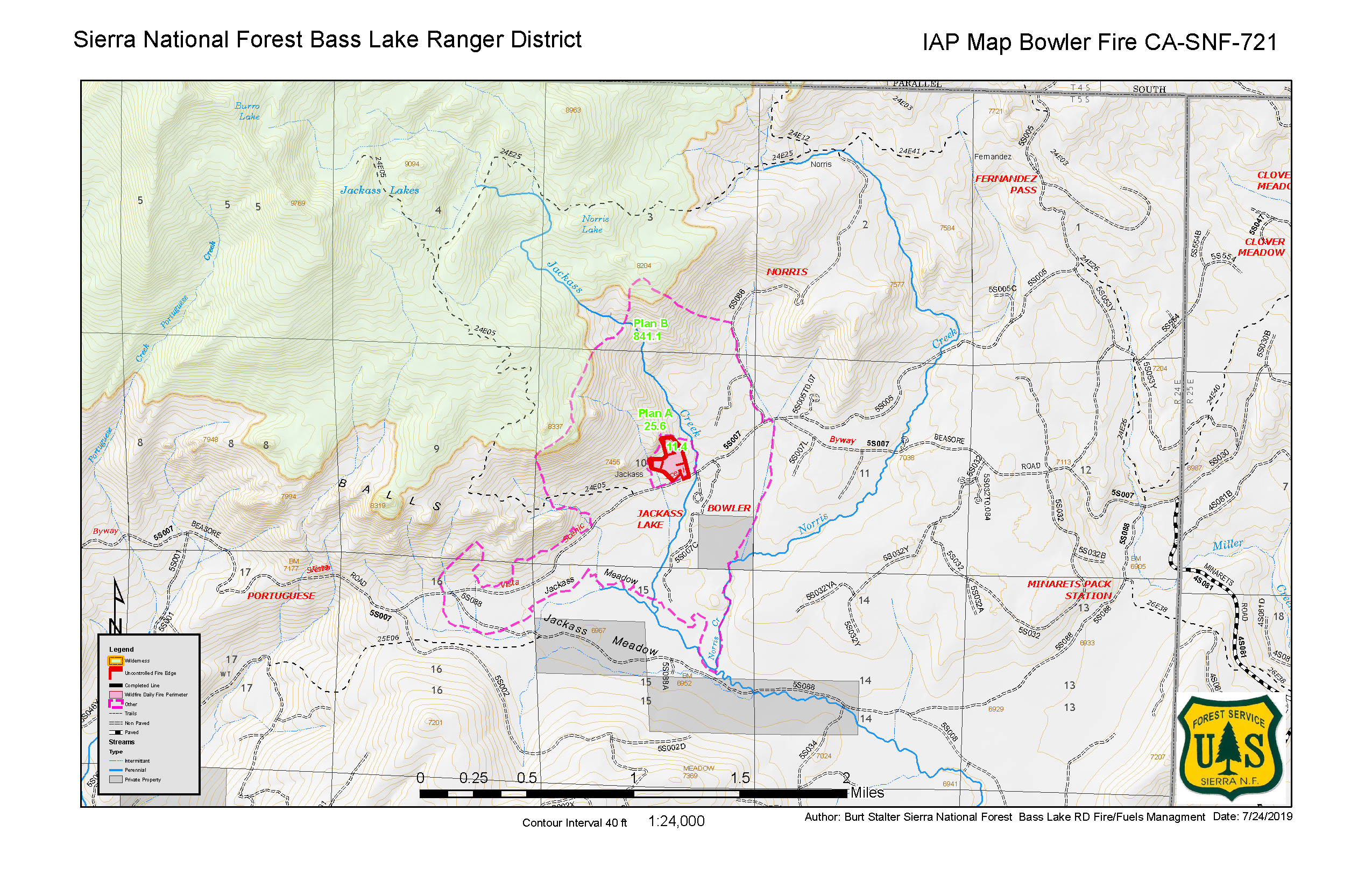
This fire was first spotted on July 24. As of July 25 (the latest update from Inciweb), the fire was 35 acres in size, located north of Bowler campground off Beasore Road, west of Jackass Creek. The fire was caused by lightning.
Creek Fire
#creekfire [update] 12000 Marsh Creek Rd southeast of the community of Clayton (Contra Costa County) Forward progress of the fire has been stopped at approx. 10-12 acres. Fire crews from CAL FIRE, Contra Costa County Fire and East Contra Costa County Fire at scene mopping up.

Forward progress for the fire in Clayton at 12000 Marsh Creek Road in Contra Costa County has been stopped. The fire grew to 10 to 12 acres.
Fish Fire
Listed on Inciweb’s map as an active fire, the Fish Fire was 77 acres is now 100 percent contained as of July 19. It was in the Sierra National Forest and was discovered on the afternoon of July 15, near the Fish Creek Campground. No structures were threatened.
June Lightning Fires 2019 (Bald Fire and Lost Fire)

Inciweb
In Kernville, California, two fires were discovered in the Sequoia National Forest from lightning, Inciweb wrote. These are the Bald Fire and the Lost Fire. Together they have burned about 122 acres as of July 16. The good news is that as of July 23, both fires are 100 percent contained at 122 acres.
The Bald Fire, discovered June 17, was 5 miles northeast of Bald Mountain Lookout.
The Lost Fire, discovered June 18, was east of Jackass and north of Dead Horse Meadow.
Lonoak Fire
This fire, listed as active on Cal Fire’s map on July 23, is off Lonoak Road and Airline Highway, east of King City in Monterey County. It’s 2,500 acres and 80 percent contained. Forward spread has been stopped, Cal Fire noted.
Marshview Fire
Ca.gov
This fire was discovered on July 24. As of July 26, it’s 183 acres and 95 percent contained. It’s off Marshview Road and Highway 680, south of Cordelia, Ca.gov noted.
The cause is under investigation.
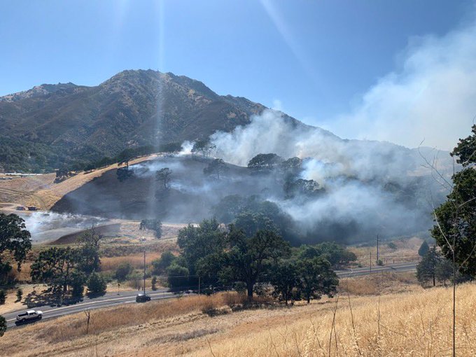
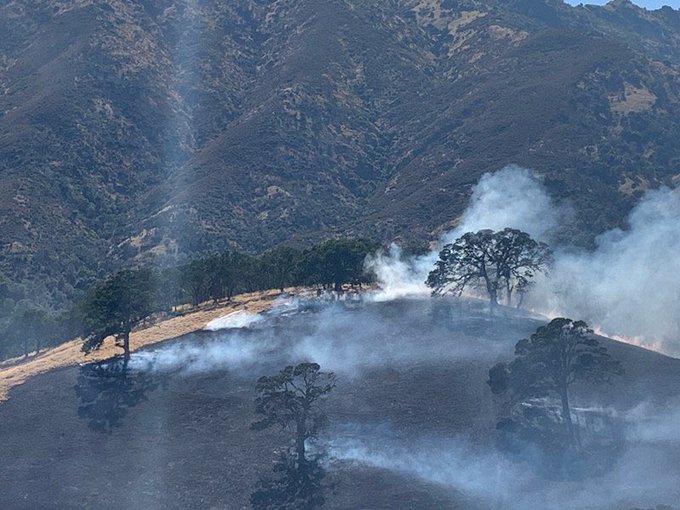
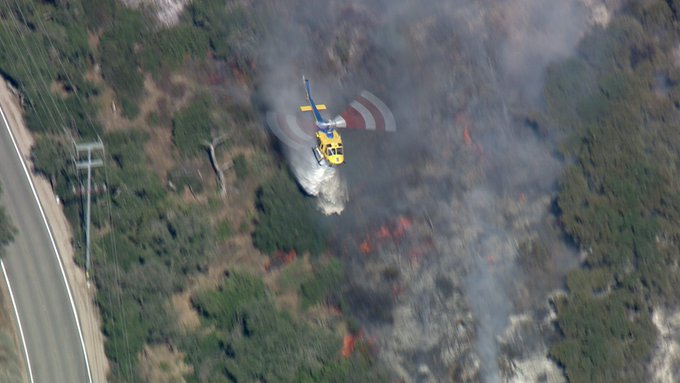
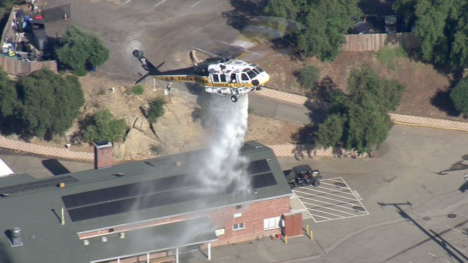
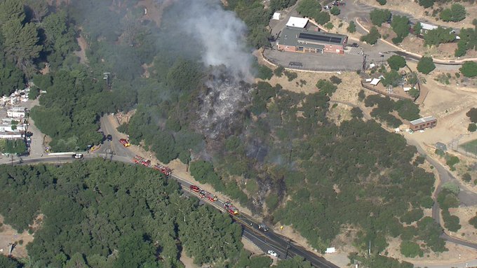
Portrero Fire
Thousand Oaks Brush Fire 2920 Potrero Road Ventura Fire on the ground and in the air battling flames Cal Fire brought in a fix wing aircraft. Homes threatened but so far safe. @KCBSKCALDesk

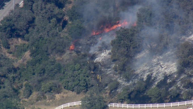
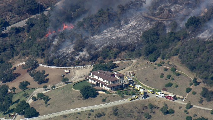
A fire started in Newbury Park near the 2900 block of Portrero Road on Friday, ABC 7 reported.
#PortreroFire fire is located off Portrero Rd between Wendy and White Stallion Rd. The fire is expected to stay within our control objectives and no evacuations are ordered. The residents of @CityofTO and Newbury Park will see a lot of smoke. @VCFD
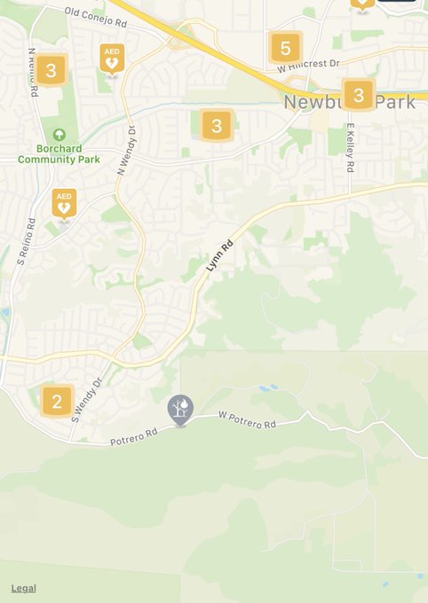
It’s six acres and moving at a moderate rate, possibly threatening some nearby structures.
#PortreroFire Is 6 acres and has slowed drastically. Structures are still in harms way but we have resources on-scene to protect them and directly attack the fire. No evacuations are ordered or expected to be ordered. @VCFD @VCAirUnit @CityofTO
Portrero Road is closed from Wendy Drive to Hidden Valley Road. The fire’s progress has been slowed.
Sherman Prescribed Burn
Listed on Inciweb, this is a prescribed fire to help prevent wildfires from getting out of control.
Topanga Canyon Fire
Topanga Canyon off of Topanga Cyn Blvd car fire spreads into the hills. @LACOFD and @LAFD drop water from the air while Hand Crews from LACOFD battle flames on a step hillside making good progress to get the fire out no injuries @KCBSKCALDesk

A fire off Topanga Canyon Boulevard in the Los Angeles area started as a car fire and then spread into the hills.
Traffic from Mulholland to PCH on Topanga Canyon has been stopped.
TRAFFIC ALERT: Topanga Canyon closed from Mulholland to PCH as fire crews battle small brush fire
It looks like forward progress has been stopped.
Topanga brush fire forward progress stopped; working on containment; aircraft cancelled except for one copter.