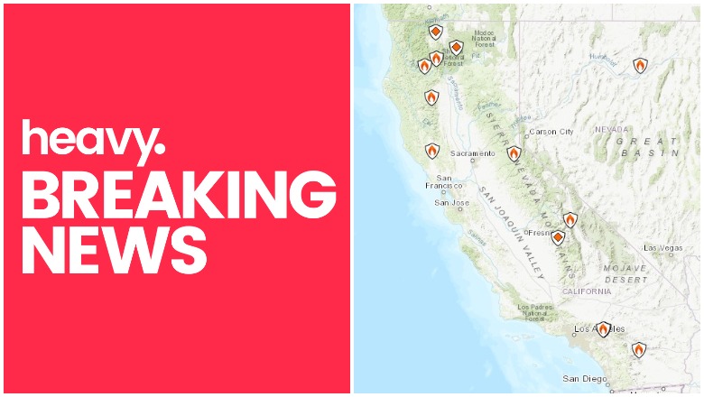
Inciweb California Fire Near Me
Wildfires in California are still an issue this weekend due to increased winds and Red Flag conditions in the region. Here’s a look at the latest wildfires in California on Sunday, November 3, including the Maria Fire, the Atwater Village fire that has caused smoke advisories, the Ranch Fire, and more.
This article will first include interactive fire maps for all of California, including Cal Fire and other sources. You can use these maps to track reported fires in your area. The second section will include air quality reports and Red Flag warning maps. Then the third section details specific fires in the region in alphabetical order.
If you’re looking for a specific fire, scroll down to that section or search for its name. Details like evacuations can change quickly, so stay tuned to your local news sources. When available, the sections on specific fires will also mention who you can follow for the latest updates.
Interactive Maps of California Fires
A number of interactive fire maps below can help you stay updated on the latest details about California fires. Don’t rely on just one map, since details can change quickly and some maps will have fires listed that others do not.
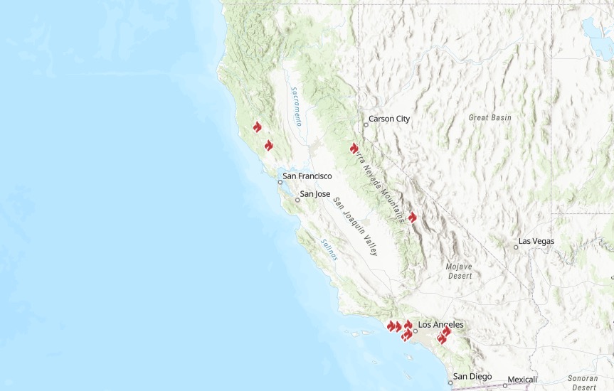
One of the best interactive maps available right now is Inciweb’s map. You can see the full map here. There’s an embeddable Google Map that includes Inciweb fires which you can see below. Depending on your browser, you may need to zoom into the map below using the + button within the map or change settings to only show Inciweb fires:
Another helpful interactive map is provided here from Ca.gov. A screenshot is below since the map can’t be embedded, but you’ll want to go to the full map for details, where you can input your address to see the fires near your location.
Ca.gov
A new interactive fire map is below, provided by UCANR.edu. Note that this map is only updated up to twice daily, so it may not be not as current as the two interactive maps above. Because of this, you may need to click “OK” on the map below to indicate that you’re not using it for emergency planning. If you are only seeing a blank map below, that just means your connection is slow and it will take a second for the fire information to fill in.
The California Governor’s Office of Emergency Services also has an interactive map of red flag warnings and new and active fires. The map is here and a screenshot is below. This map is updated every weekday morning, so it’s not the best for emergency planning but is still informative. A screenshot of the map is below.
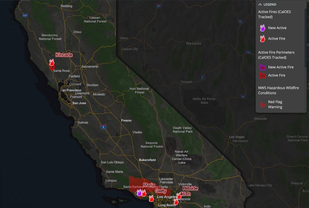
Cal OES
Newer fires may not be listed on the above maps until they’ve been around for a few hours.
Air Quality Map & Red Flag Warnings in California
Next are sources for tracking air quality in California near you. First, you can sign up for Air Alerts in your region here. This is specifically for southern California residents.
You can see a map of air quality reports on AQMD’s page here.
You can see a map of the current Red Flag Warnings in California provided by MappingSupport.com here.
Next are more specific details on the fires for Sunday, November 3, 2019. If you are looking for a specific fire such as the Maria Fire, search for the name so you can find it faster, or just scroll down and look at the fires, listed in alphabetical order.
List of Active Fires in California on November 3, 2019
Here are the active fires and updates about for Sunday, November 3, 2019. Most of these are in alphabetical order.
46 Fire
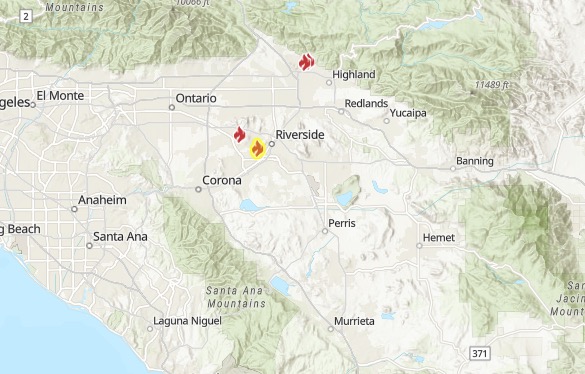
Ca.gov
The 46 Fire, which started on October 31, is the yellow fire on the map above from Ca.gov. The fire started near the 5300 block of 46th Street in East Jurupa Valley. As of November 3, it’s 328 acres and 95 percent contained.
All evacuation orders have been lifted.
The map above shows where the evacuations were and that they have now been lifted. You can see the full map here. Updates are being shared by Riverside County here. This map will change if there’s a new Riverside County fire.
Atwater Village Recycling Fire Near Burbank (Outside Fire)
A fire at an Atwater Village recycling center on the night of Friday, November 1 caused heavy smoke in the region, ABC 7 reported. (This is now being referred to in some places as the Outside Fire.) The Los Angeles Fire Department asked residents and local businesses to keep their doors and windows closed, and asked motorists to turn off their A/C or change the settings to recirculate cabin air.
LAFD shared this map for the fire’s location:
The fire was first reported around 5 p.m. on November 1 at the recycling yard at 4560 W. Doran St., in Los Angeles near the border with Glendale.
That recycling yard fire in Atwater Village is causing a smoky nightmare here at @ABC7 and other parts of Glendale, Burbank and the Valley. We are masking up inside the building. The smokiest area here is the studio wjete we do the news.
The fire has been contained to the recycling yard. Smoke was also reported in Burbank and the Valley, but that smoke is from this fire, ABC 7 shared.
People were still reporting smoke in the area on November 2.
LAFD noted on November 1: “79 firefighters are working to ‘surround and drown’ this fire with large hose streams, utilizing the aerial ladder for extra reach and penetration. There are no reported victims or structures threatened. This will be an extended operation, as firefighters continue to take a defensive posture. Residents and local businesses: keep doors and windows closed and stay indoors. Motorists: Turn off A/C or modify your settings to recirculate cabin air. Unknown cause.”
The fire burned in the recycling yard for several hours. LAFD spokesman Nicholas Prange told The Eastsider LA that this and a fire in North Hollywood are still smoldering on November 2. “They continue to put out smoke,” he said, and firefighters remain on the scene.
Ah, the smell of burning tires in the morning. #AtwaterVillage #fire #SilverLake
He said to keep windows closed and stay indoors if you notice a smoky smell. Hours later, AQMD is acknowledging a smoke advisory from the fires.
The full air quality smoke advisory from AQMD can be read here. It is valid through November 3. It reads, in part:
This advisory is in effect through Sunday Afternoon. South Coast AQMD will issue an update if additional information becomes available. A fire at a recycling facility called the Outside Fire is currently smoldering in the 4500 block of West Doran St. in Los Angeles at the intersection of the CA-134 freeway and the 5 Freeway. As of Saturday afternoon, the fire is contained but is generating smoke that is affecting air quality in adjacent areas. Low cost air quality sensors in the immediate vicinity are recording Moderate air quality index values on Saturday afternoon.
On Saturday afternoon, winds are blowing from the southwest, pushing smoke to the north east into Glendale. Overnight on Saturday night until late Sunday morning, winds are expected to push any remaining smoke to the west into Burbank. Low atmospheric mixing layer heights overnight may lead to elevated PM2.5 concentrations. If the fire continues to generate smoke on Sunday afternoon, winds may again push smoke to the northeast, into Glendale.
Overall, air quality may reach Unhealthy for Sensitive Groups in localized areas directly downwind of the fire.
In any area impacted by smoke: If you smell smoke or see ash due to a wildfire, limit your exposure by remaining indoors with windows and doors closed or seeking alternate shelter, and avoiding vigorous physical activity…
Areas of direct impacts and poor air quality may include portions of … Los Angeles County: Central Los Angeles (Area 1), East San Fernando Valley (Area 7)”
Burris Fire

Ca.gov
This fire started on October 27. As of November 3, it’s 703 acres and 98 percent contained. It started east of Calpella in Mendocino County, as Potter Valley Road and Highway 20, CA.gov noted. All evacuation orders and warnings have been lifted.
Caples Fire (Prescribed Burn)
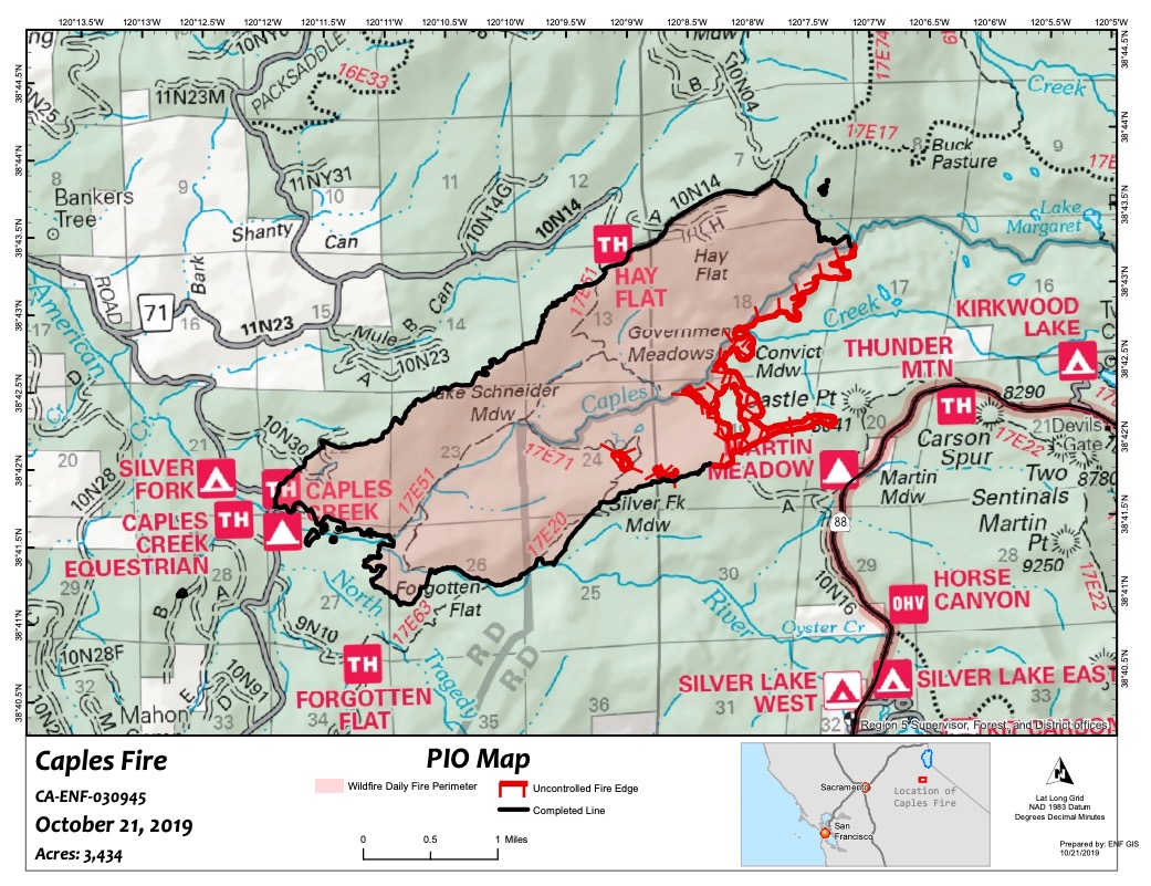
Inciweb
Prescribed burns are purposefully set to help decrease the possibility of unexpected, damaging fires in the future. This one is in the northern ridge region above Caples Creek north of Highway 88.
The fire is 3,435 acres and 100 percent contained as of November 1, the latest update on Inciweb. On October 10, this was converted from a prescribed burn to a wildfire to allow for additional resources to maintain full suppression.
On November 1, Inciweb noted: “The fire area will be closed to the public until spring due to the hazards of fire weakened and dead trees. Some of these trees will fall in upcoming winter storms which will reduce the risk to visitors when the trail reopens.”
Inciweb still has the fire listed as active on its map, but CA.gov has taken the fire off its map.
Getty Fire
The Getty Fire in Los Angeles is 745 acres and 79 percent contained on November 2, according to LAFD (the last update LAFD is releasing for the fire.) It started near the 405 Freeway at Getty Center Drive. The fire was caused accidentally when a tree branch broke and landed on powerlines during high wind, igniting nearby brush, LAFD noted.
Twelve residences were destroyed and five were damaged by the fire.
Mandatory evacuations have all been lifted for this fire. A local assistance center has been established for disaster recovery information. It’s at Westwood Rec Center at 1350 South Sepulveda Blvd. It will be open Sunday, Nov. 3 from 10 a.m.-5 p.m. and Monday, Nov. 4 from 12 p.m.-8 p.m.
LAFD noted on November 2: “Due to continued progress, the LAFD Field Incident Management Team will be demobilizing and transitioning the Getty Fire incident to the local Battalion at 8:00 AM, Sunday, November 7th. Firefighters will remain on scene for the next several days extinguishing hot spots and patrolling the area to identify any potential hazards. This will be the final Incident Update for the Getty Fire.”
The best source for updates on LAFD fires is LAFD’s webpage here. You can also find updates on the LAFD’s Facebook page here. The LAPD HQ and LAFD on Twitter are also providing updates.
Hillside Fire
The Hillside Fire is in San Bernardino National Forest, off W 59th and Hill Drive. It was 200 acres and 70 percent contained as of November 1 at 12:59 p.m., Inciweb noted in its most recent update. It was burning off Highway 18 and into neighborhoods north of San Bernardino.
Mandatory evacuations were issued, but repopulation began the evening of October 31. There are no evacuations at this time, but previously evacuated areas may be experiencing power outages.
#HillsideFire (Update): Investigators have determined the area of origin. Cause remains under investigation. There are NO power lines near the area of origin. @SCE @SanBernardinoNF @SanBernardinoPD ^eas
The cause of the fire isn’t known. The area of origin was located but there are no powerlines in that area. Containment lines are being reinforced for anticipated wind shifts.
Updates can be found at SB County Fire’s Twitter, Inciweb, and Facebook.
Kincade Fire
CA.gov
The Kincade Fire (spelled Kincaid in some hashtags) started on October 24 around 4:26 a.m. near John Kincade Road and Burned Mountain Road, just northeast of Geyserville, according to CA.gov. It’s now 77,758 acres in size and containment is up to 76 percent according to CA.gov on November 3 at 7:30 a.m.
A satellite hotspot map is below provided by MappingSupport.com. This is not a real-time map, but shows where the fire burned about three hours ago.
Evacuations:
The map above is an evacuation and road closure map provided by Sonoma County that is being kept updated. See the full map here.
Mandatory evacuation orders remain for the following areas. (This information isprovided by SoCo Emergency as of November 3.) Because this is the latest update on SoCo’s page, it’s best to refer to the map above for the most recent information.
- Zone 1C: The Briggs Ranch Road Area. North of Hwy 128. South of the Sonoma County/Lake County Line. West of Ida-Clayton Road. East of Zone 1D.
- Zone 3C: The Chalk Hill Road Area. North of Faught Road. South of Hwy 128. East of Zone 3D. West of Zone 5B.
- Zone 5B: The Franz Valley Road Area. North of but not including Porter Creek Road, Mark West Springs Road, and Shiloh Meadow Road. West of Zone 2/Zone 21.
- Zone 2: Knights Valley
Here is a list of areas most recently under evacuation orders that are now under warnings and open for re-entry:
-
- Zone 1D: The Pine Flat Road Area. Areas East of and including Pine Flat Road. North to County Line. East of Zone 1B. West of Zone 1C.
- Zone 3D: Areas West of but not including Chalk Hill Road. South of West Soda Rock Lane. North of the Windsor Town limits. West of Zone 3C.
The following evacuation orders were most recently lifted:
- Zone 5C: Areas to the South and East of Shiloh Meadow Road, including Mark West Spring Road, Porter Creek Road, and Loch Haven Drive. East of Calistoga Road. Shiloh Ridge Road, Leslie Road, and Franz Valley Road are excluded.
- Zone 1B: Area North of but not including Pine Flat Road, Dillingham Road, Socrates Mine Road, to the northern boundary of Zone 1B and East of Hwy 128 to the Lake County Line.
The following evacuation centers will remain open through Sunday, November 3 until noon. They are all small animal friendly. The information is being updated on SoCo’s emergency site here.
- Santa Rosa Veterans Memorial Building
1351 Maple Ave, Santa Rosa (may remain open longer depending on evacuees’ needs) - Sonoma County Fairgrounds Finley Hall/Grace
1350 Bennett Valley Rd, Santa Rosa
Open shelters for large animals: “If you need shelter for a large animal or are trying to locate your large animal, contact Animal Services at 707-565-7100,” SoCo Emergency recommends.
If evacuating, SoCo emergency says to bring:
- Pets, critical pet supplies (medications, food, pet carrier)
- A change of clothes and sturdy shoes
- Medications and copies of all prescriptions
- Copies of important documents (e.g. ID, insurance cards, deeds, passport)
- Extra eye glasses, batteries for hearing aids
- Credit cards, ATM, and cash
- Cell phones and chargers
If you need evacuation and can’t reach the locations, call 707-573-3377. For non-emergency evac information, call 211.
The cause of the fire is under investigation.
To stay updated on the fire: The Sonoma County Sheriff’s Office is providing updates on Nixle here. You can also text your ZIP Code to 888777 for mobile alerts. The fire information number is 707-967-4207.
Sonoma Sheriff’s Facebook page is also providing updates, along with the County of Sonoma. SoCo Emergency is providing updates here. You can sign up for alerts here. CAL FIRE Sonoma-Lake-Napa Unit Facebook Page provides fire updates.
The cause of the fire isn’t known, but a PG&E report to CPUC noted a transmission tower had a broken jumper cable near the site of the fire around 9:20 p.m. on Wednesday.
PG&E report to CPUC says there was a transmission tower with a “broken jumper” cable found around 9:20 p.m. Wednesday near site of #KincadeFire. Documents from CPUC attached t.co/L1Bc3LRihk

Klamath NF Fall RX Burning
These are prescribed burns in the Klamath National Forest area to cut down on damage from unplanned fires.
Maria Fire
The Maria Fire started at 8:58 p.m. on October 31. near the top of South Mountain in Santa Paula, off Bradley Road and Solano Verde Dr. As of November 3 at 9:08 a.m., it’s now 9,412 acres and 50 percent contained. The best source for staying updated on this fire is VC Emergency.
A map of evacuation orders in Ventura County can be seen here or below. All evacuations for the Maria Fire were lifted on November 2. Areas outlined in green indicate where evacuations were lifted and the yellow shaded area is the perimeter of the Maria Fire.
All mandatory evacuations were lifted as of 2 p.m. on November 2.
All Red Cross shelters and animals shelters are demobilized.
Cleaning up a home after the spraying of toxic chemicals like Phos-Chek can be difficult. VC Emergency suggests the following:
Chemicals used to fight fires contain toxic materials and can contaminate food and cookware. The chemicals cannot be washed off the food. Foods that are exposed to chemicals should be thrown away.
Do:
- Phos-Chek is designed to rinse off with running water. Wet the retardant down, wash it away, wait 15 minutes and repeat, and it should come off.
- If Phos-Chek sticks to surfaces like a roof, wood or sidewalk, a soft bristle brush or a biodegradable cleaner can be used to help speed its removal.
- To remove it from your skin, wash with gentle soap and water.
Do Not:
- Do Not use a high pressure power-washer, which can push the product further into surfaces like stucco or concrete. It it’s deeply embedded, it may not come out.
- Do Not use hard brushes or stiff bristles to scrub it off, for the same reason.
- Do Not use bleach or harsh chemicals to clean decks, outdoor furniture or homes. Harmful fumes can result.
- Do Not Leave Phos-Chek standing in puddles or pools, where pets or wildlife might drink it. After the rains, be particularly vigilant. Fill with sand, soil or other absorbent material that can be removed if necessary.
Martinez 3 Fire
This fire is 52 acres and 100 percent contained as of November 3, the latest update on Inciweb. The cause is under investigation. It was on the Torrez-Martinez Indian Reservation. The fire is in the county of Thermal, California.
Inciweb noted on November 3: “Firefighters and heavy equipment continue to make significant progress on the Martinez 3 fire. Now at 93% controlled, fire officials anticipate full control early next week. Firefighters have approximately 3 acres of mulch piles remaining to be extinguished. Martinez 3 fire resources are available to assist with any new fires in the area.” (Note: After a fire is 100% contained, officials then work at getting it to 100% controlled, so it can be declared out.)
Inciweb also noted: “The Riverside County HAZMAT Team took samples from various areas within the interior of the fire as well as the perimeter on Thursday the 31St and determined that it was safe for firefighters to continue with fire suppression efforts. All results came back to be well below the level of concern for firefighters and public safety, which remains the top priority for fire officials. Firefighters will continue to periodically monitoring the air at the incident with handheld devices… The South Coast Air Quality Management District (South Coast AQMD) issued a smoke advisory through November 3rd and continues to monitor conditions. Advisories will be updated as needed. Updates can be found at: www.aqmd.gov/advisory. The Martinez 3 Fire is not the only source of smoke in the valley. Various farming operations conduct agricultural (AG) burns weekly, building the concentration of smoke in the local area. AG burns will continue to happen when air quality is within the allowable parameters.”
Middle Fire
Inciweb
The Middle Fire is 1,339 acres as of October 6 and now listed as 100 percent contained according to Inciweb. It’s still listed as active on the map. It was located one mile east of Canyon Creek Trailhead and was caused by lightning. It started on September 5 and is in the Trinity Alps Wilderness. “Please be aware that the forest’s Middle Fire Closure Order remains in effect until the fire is declared out.”
Palisades Fire
Ca.gov
The Palisades brush fire in Los Angeles is located near 500 Palisades Drive in the Pacific Palisades. It was first reported on October 21 at 10:39 a.m. It’s 42 acres in size and 75 percent contained as of LAFD’s last and final update for the fire. It’s still listed as active on CA.gov’s website. Evacuation orders were briefly in place but lifted by 8 p.m. on October 21.
Ramshorn/SHF Lightning Fires 2019
The lightning fires from storms that moved into the area in September are now 100 percent contained and declared out, according to Inciweb, but it’s still listed as active on the map.
Ranch Fire
The Ranch Fire started on November 3 off Colyer Springs Road and Raglin Ridge Road, southwest of Red Bluff. It’s in Tehama County.
#RanchFire 🔥 unofficial, automated update.
~10mi WNW of Rancho Tehama Reserve, CA. ⚠️ DO NOT USE FOR SAFETY PURPOSES – See officials instead. May be incorrect; disclaimers in images.
t.co/HJ0QY9sV0T
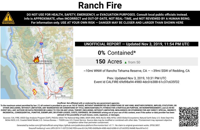

The fire had already grown to 150 acres by around 3:45 p.m. By around 4:15 p.m. it was up to 350 acres in size. And by 6:30 p.m., it was 476 acres with 0 percent containment.
#GOES17 is showing the #RanchFire burning in Tehama Co this afternoon. #cawx
You can see its location above.
This next map is an interactive map that shows satellite hotspot data for the Ranch Fire. This should not be used for emergency planning, since data in the map is typically about three hours old. The map is provided by MappingSupport.com. You can see the webpage with the map here.
Joseph Elfelt of Mapping Support noted on Twitter: “Interactive map for #RanchFire SW of Red Bluff, CA. Satellite hotspot data is several hours old. Map has 20+ #GIS overlay layers you can turn on/off/restack. Click top layer, see attribute data. Click Map tips for help. Open #GISsurfer map.”
The Tehama County Sheriff’s Office issued evacuation warnings for all of Colyer Springs Road to the Forest boundary, up north to Mary Ellen Place, and with an eastern boundary of Red Bank Road. Note that this was an advisory and not an evacuation order, KCRTV reported at 5:15 p.m. That means residents in the area should be ready to leave at any time.
Saddleridge Fire
The Saddleridge Fire quickly exploded in size and caused tens of thousands to evacuate, but now it’s under control. Inciweb’s page for this fire is here. The fire is now 8,799 acres in size with 97 percent containment as of November 1 at 6:49 a.m, according to CA.gov. (Inciweb lists containment on October 30 as being 98 percent.) The fire has now been removed from Inciweb’s map but is still on Ca.gov’s map. Ca.gov won’t be providing further updates.
It started near I-210 at the Yarnell exit on October 10 around 9 p.m. Pacific. There was one death from this fire: a civilian went into cardiac arrest and died on the way to the hospital. At least 88 structures were destroyed.
All evacuations related to Saddleridge have been lifted, LAFD reported on October 15, and evacuation centers have been closed.
The cause of the Saddle Ridge Fire remains under active investigation. Inciweb noted on October 30: “Firefighters will work through the day in rugged terrain throughout the burn area to increase containment lines. Tactical patrols will remain in place to monitor the area for smoldering debris. The cause of the Saddle Ridge Fire remains under active investigation.”
If you live in the LA area, sign up for updates about evacuations and other emergency alerts here: emergency.lacity.org/notifyla. You can also text READY to NotifyLA at 888777 for updates on the fire.
Shasta-Trinity Prescribed Fires
These are prescribed fires in the Shasta-Trinity National Forest area used to mitigate damage from unplanned fires in the future.
Sherman Prescribed Burn
Prescribed burns are purposefully set to help decrease the possibility of unexpected, damaging fires in the future. These are in the Giant Forest area of Sequoia National Park.
Sobrante Fire
This fire was 35 acres and started on November 1 in Riverside County according to CA.gov. It started east of Corona off of La Sierra Ave. and Tin Mine Road. The fire was fully contained at 5 p.m. on November 1 and then mapped at 19 acres, according to Riverside County. Ca.gov’s map still says it is 0 percent contained, so refer to Riverside County for the latest details.
South Fire
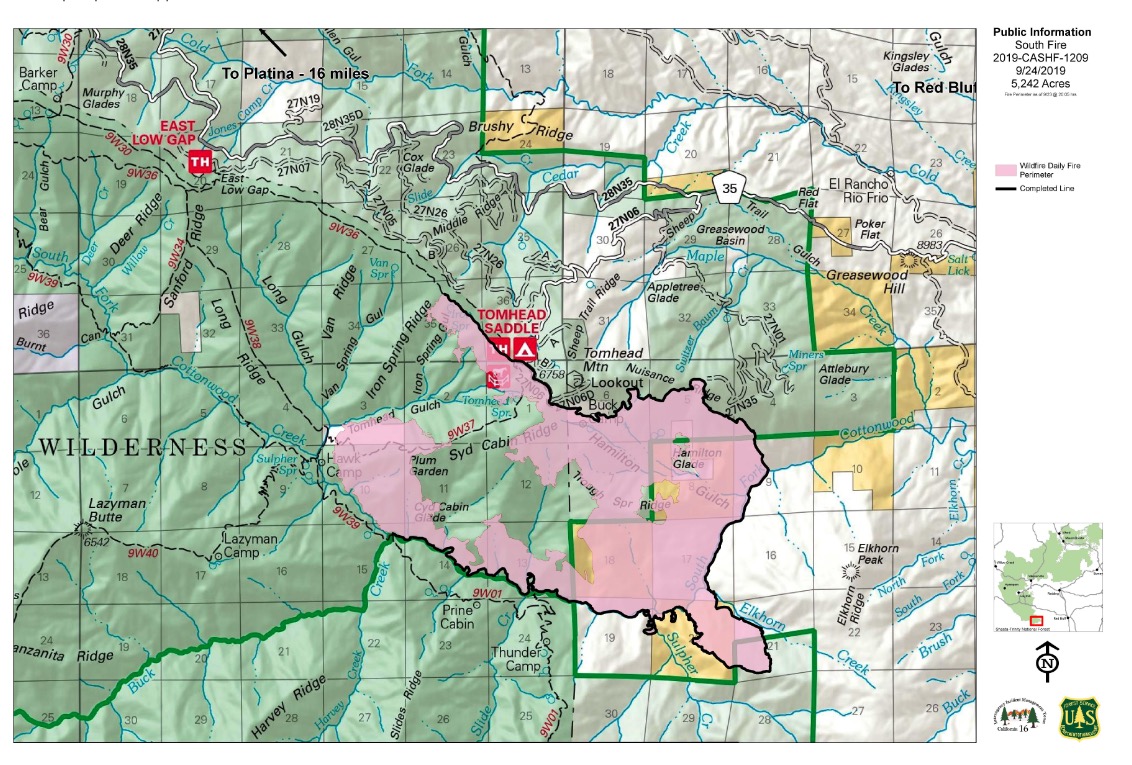
Inciweb
The South Fire started in Shasta-Trinity National Forest in Tehama County, located in the southeast aspect of Tomhead Mountain, south of Platina. As of October 17, the fire was 5,332 acres in size and 75 percent contained, according to Inciweb. That was the latest update for the fire, which is still listed as active on Inciweb’s map.
The fire is 15 miles south of Platina, California. The map above is the most recent map on Inciweb, but may not quite match the fire’s current size and containment.
Inciweb notes that the plans for this fire are to “Monitor fire activity and patrol existing containment and confinement lines. Complete unfinished repair to Suppression Repair Plan standards. Be prepared to take appropriate action if fire crosses established Management Action Points.”
Taboose Fire
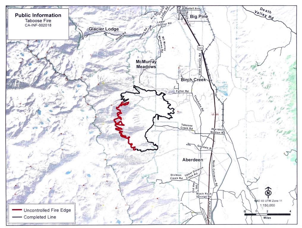
InciwebFire map from September 24, the most recent map
This fire is 10,296 acres and 75 percent contained as of October 7, the most recent update on Inciweb. It’s southwest of Big Pine and northwest of Aberdeen. It was caused by lightning. It’s still listed as active on Ca.gov’s fire map.
Inciweb noted on October 24: “The Taboose Fire has been inactive in recent days. The fire remains 10,296 acres and at 75% containment. The western flank is in steep and inaccessible terrain in the John Muir Wilderness. Here the fire will be confined by either rain or snow or its spread will be stopped by rock barriers. Visitors and residents may see smoke, especially along the Hwy. 395 corridor. Please do not report the smoke. Currently, the south, east, and north flanks are secure and there is no threat to life or property. Visitors and residents will see smoke, especially along the Hwy. 395 corridor. Please do not report the smoke. Currently, the south, east, and north flanks are secure and there is no threat to life or property. Gusty wind and low relative humidity are in the forecast for this week and fire crews will continue to monitor and patrol in areas where the fire is active.”
Williams Fire in Orange County
Aerial photo of #WilliamsFire from FIRIS in Santiago Canyon. Helos are handling a spot fire but forward rate of spread has been stopped. Firefighters are working on containment. Approximately 2 acres has burned in state area that OCFA protects.
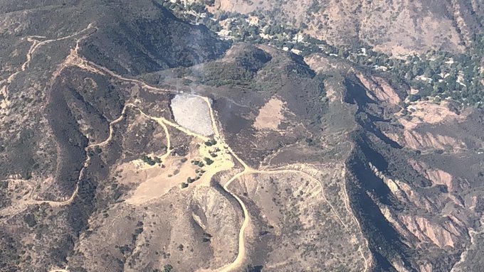
The Williams Fire in Orange County just started on November 3 around 12 p.m. It’s two acres in size and listed as a two-alarm fire. Forward spread has been stopped, OCFA reported.
@OCFA_PIO @OCFAAirOps Copt 2 initial sizeup of the #Williamsfire is 1.5 acres slow rate of burn in light to medium fuel, potential for 30 acres.
The #Williamsfire is burning near Gate 18 on the Mesa Trail.
Per #WilliamsIC Williams Canyon Rd is the best access for crews to reach the fire.
It’s reportedly burning near Gate 18 on Mesa Trail.
Good samaritans stopping by the #WilliamsFire with a horse trailer, just in case. Always good to see such kind hearted people willing to help.
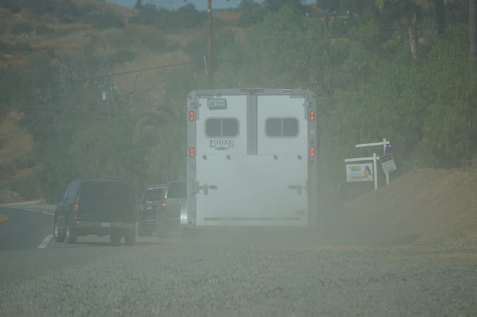
Good Samaritans stopped to offer their help in case it was needed.
A photo of the fire is above. The fire was in the Cleveland National Forest near Silverado Ranch, OC Register reported.
READ NEXT: PG&E Power Shutdown: Best Memes