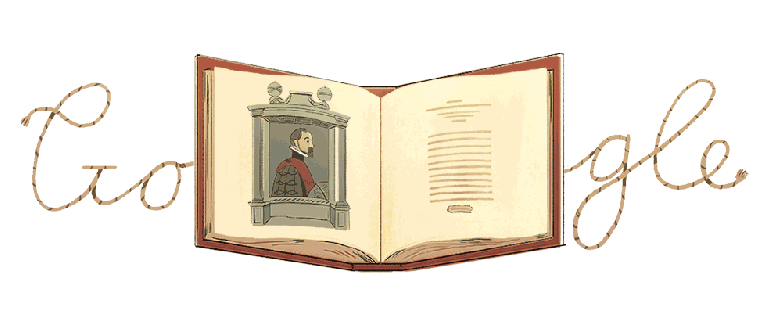
Abraham Ortelius is being celebrated with a Google Doodle.
Abraham Ortelius, a Flemish cartographer and geographer who is credited with creating the first modern day atlas, is being celebrated with a Google Doodle on May 20, 2018.
“Long before we were able to map the world and put it online, Abraham Ortelius made a lasting impact by collecting the latest information from scientists, geographers, and cartographers and transforming it into what the world now knows as the modern day atlas,” Google writes in its Doodle description. “As every atlas is an aggregation of many maps, Ortelius was also one of the first cartographers to consistently add sources and names to the creators of the original maps, as evidenced by the first map pictured in today’s animated Doodle.”
Google continues, “Adding his fellow scientists’ names to the atlas wasn’t just a professional courtesy – Ortelius was known for corresponding with prominent scientists and humanists from all over Europe, a practice that yielded much insight into the great thinkers of his time. Here’s to Abraham Ortelius, whose cartographic innovation helped give all a truly global view.”
Here’s what you need to know:
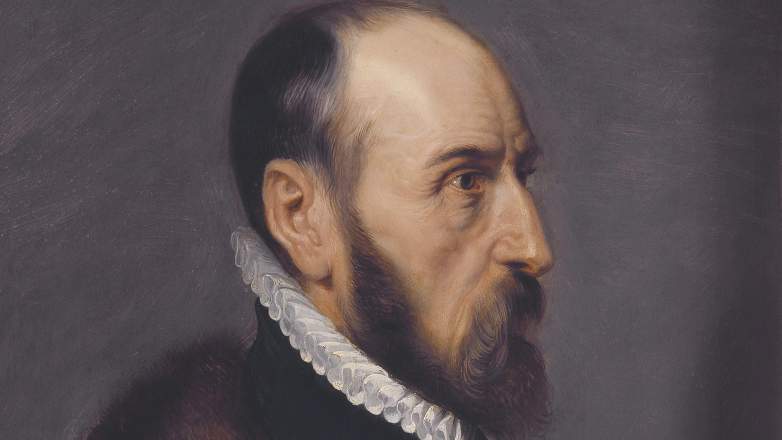
1. Ortelius Was Born in Antwerp in Modern-Day Belgium in 1527
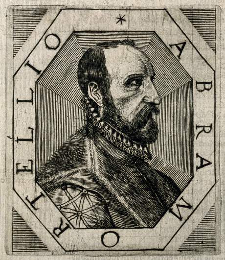
Abraham Ortelius.
Abraham Ortelius was born April 14, 1527, in Antwerp, which was then part of the Habsburg Netherlands and is now part of Belgium. He was part of an influential family from Augsburg, part of the Holy Roman empire, who had fallen under suspicion of Protestantism. He was the eldest of three children.
His father, a wealthy merchant, died in 1535, according to Catholic.com. His father’s death, “seems to have placed the family in difficulties, for Ortelius began to trade or peddle geographical charts and maps while still a mere youth,” the website explains.
He was raised by his uncle, Jacob van Meteren, who returned from religious exile in England after Ortelius’ father’s death, according to the University of Oxford. His uncle was a financier and publisher of early English versions of the bible. Ortelius was close to his cousin, Emanuel van Meteren, who was a Flemish historian and consul for “the Traders of the Low Countries” in London.
2. He Began His Career as a Map Engraver & Then Entered the Guild of St. Luke as a Map Illuminator, While Selling Books, Prints & Maps
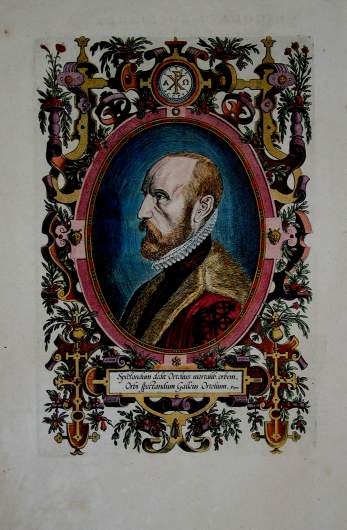
Abraham Ortelius.
Ortelius began his career as a map engraver. “Trained as an engraver, Ortelius about 1554 set up his book and antiquary business. About 1560, under the influence of Gerardus Mercator, Ortelius became interested in mapmaking. Within a decade he compiled maps of the world on a heart-shaped projection (1564), of Egypt (1565), and of Asia (1567),” according to Britannica.
He then entered the Antwerp Guild of St. Luke as an illuminator of maps and worked as an engraver. He also traveled around Europe selling books, prints and maps. According to a biography on Catholic.com, “When twenty years of age he joined a guild as a colorer of charts. By purchasing as valuable maps as possible, mounting them on canvas, coloring, and reselling them, he managed to assist in supporting the family, as may be gleaned from a contemporary letter.” His travels throughout Europe helped him begin his work compiling and publishing maps.
“This trading in maps was probably one of the chief reasons for his unusually extended trips to Germany, England, Italy, and particularly for his annual visits to the great fair at Leipzig. Mean-while he did not confine himself entirely to trafficking in charts,” Joseph Fischer writes for Catholic.com.
3. Ortelius Published the ‘First Modern Atlas’ on May 20, 1570, Known as the ‘Theatrum Orbis Terrarum’
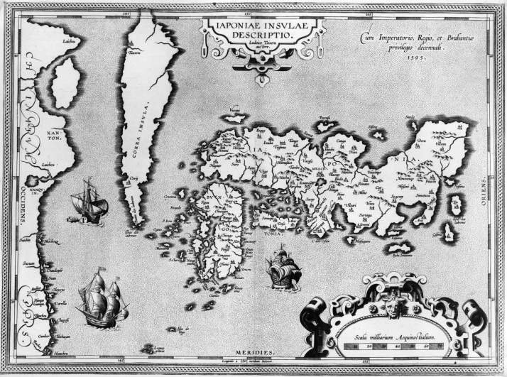
Circa 1595, A map of Japan by the Flemish geographer and cartographer Abraham Ortelius, (1527 – 1598).
Ortelius published the first modern atlas, known as the Theatrum Orbis Terrarum, which translates to Theatre of the World, on May 20, 1570. “Flipping through the pages, you may also notice a sea monster or two in the water – these mythical creatures were a subject of fascination in Ortelius’ generation, and often appeared alongside the ever changing landscapes of the atlas maps,” Google writes.
According to Britannica, Theatrum “contained 70 maps derived from 87 authorities and engraved in a uniform style. Enlarged and kept up to date in successive editions until late 1612, the Theatrum appears to have been the most popular atlas of its time.”
“It was the first uniformly sized, systematic collection of maps of the countries of the world based only on contemporary knowledge since the days of Ptolemy, and in that sense may be called the first modern atlas,” R.V. Tooley wrote. According to the Paulus Swaen Auction & Gallery:
The Theatrum consists of two elements; text and maps. Ortelius reduced the best available maps to a uniform format. Further, the Theatrum was the first major printed work of any kind to include scholarly citations of authorities (i.e. the original mapmakers), thus introducing for the first time the concept of footnoting to Western scholarship. Beside this he added the names of many other carthographers and geographers to his list. This “Catalogus auctorum tabularum geographicarum”, is one of the major peculiarities of the atlas. Ortelius and his successors kept his list of map authors up-to-date. In the first edition of 1570 the list included 87 names. In this posthumous edition of 1603, it contained 183 names.”
Ortelius was appointed as the geographer to Philip II of Spain in 1575. He continued to publish maps until his death, including “Nomenclator Ptolemaicus” and “Parergon,” which were maps of ancient history, both sacred and secular, along with, “Itinerarium per nonnullas Galliae Belgicae partes,” an exploration of Belgium and the Rhineland and Maris Pacifici, the first dedicated map of the Pacific.
4. He Was the First to Observe the Geometrical Similarity Between the Coasts of the Americas & Europe-Africa & to Propose Continental Drift as an Idea
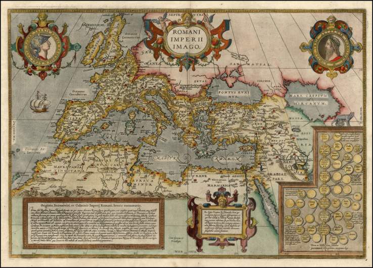
A map by Abraham Ortelius.
Along with his contributions to cartography and geogrpahy, Abraham Ortelius is credited with being the first to observe the geometrical similarity between the coasts of the Americas and Europe-Africa and to propose the theory of continental drift as a reason for it.
W. Jacquelyn Kious and Robert Tilling wrote in “This Dynamic Earth: The Story of Plate Tectonics,” that “Abraham Ortelius in his work Thesaurus Geographicus … suggested that the Americas were “torn away from Europe and Africa … by earthquakes and floods … The vestiges of the rupture reveal themselves, if someone brings forward a map of the world and considers carefully the coasts of the three [continents].”
In 1596, Ortelius, “noted that the coastlines of the continents appear to fit together. He suggested that the continents were once joined and that the Americas were “torn away” from Europe and Africa,” according to Brittanica.
5. Ortelius, Whose Maps Are Now Collectors’ Items That Sell for Tens of Thousands of Dollars, Died in 1598 in Antwerp
Wikimedia CommonsAbraham Ortelius.
Ortelius died June 28, 1598, in Antwerp, according to Catholic.com. He was not married and did not have any children. He lived his life in his hometown of Antwerp with his mother and unmarried sister, Anne. Ortelius was buried at St. Michael’s Abbey in Antwerp, and his death was marked with public mourning. His tombstone reads, “Quietis cultor sine lite, uxore, prole,” which translates to, “served quietly, without accusation, wife, and offspring.”
Today, Ortelius’ maps are collectors’ items that sell for tens of thousands of dollars. “The first modern atlas, or book of maps, is considered that of Abraham Ortelius with his Theartrum Orbis Terrarum. There followed the golden age of map-making in Europe and in Britain. It is these maps which have seen rapidly rising prices,” The Guardian writes.
“In 1570 the first modern atlas, the Theatrum Orbis Terrarum, was produced by Abraham Ortelius. It was so successful that many editions were produced. Even today pages can be picked up for £400 to £600,” Philip Curtis of the Map House in Knightsbridge told This Is Money in 2009.
According to This Is Money, “Curtis points out that a complete Ortelius atlas may cost as much as £200,000, yet it could have been picked up for £10,000 in the Sixties. He says the most appealing market for investors is the golden age of 17th Century map-making when mythical artwork was included.
“There were magnificent decorations with sea monsters, galleons and angels blowing horns,’ he told the Daily Mail’s financial website. “The Dutch were particularly skilled and today provide the most sought after maps of the era.”