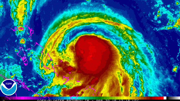
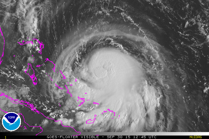
Tropical Storm Joaquin has strengthened into Hurricane Joaquin. (NOAA satellite image)
A tropical storm swirling in the Atlantic Ocean has strengthened into a hurricane, the National Hurricane Center says.
Hurricane Joaquin formed early Wednesday morning. The storm is still tracking toward the East Coast, with a potential landfall between the mid-Atlantic and New England.
“It could be a significant situation,” Brian Fortier, senior meteorologist at The Weather Channel, told NBC News. “Everyone along the Northeast coast, right up to New England, should keep a close eye on the forecasts.”
The National Hurricane Center says, “A general motion toward the west-southwest or southwest is expected to continue through tonight. A turn toward the west and a decrease in forward speed are forecast on Thursday. On the forecast track, the center of Joaquin is expected to move near or over portions of the central Bahamas tonight and Thursday.”
Here’s what you need to know:
1. It Is Still Too Early to Know the Storm’s Path
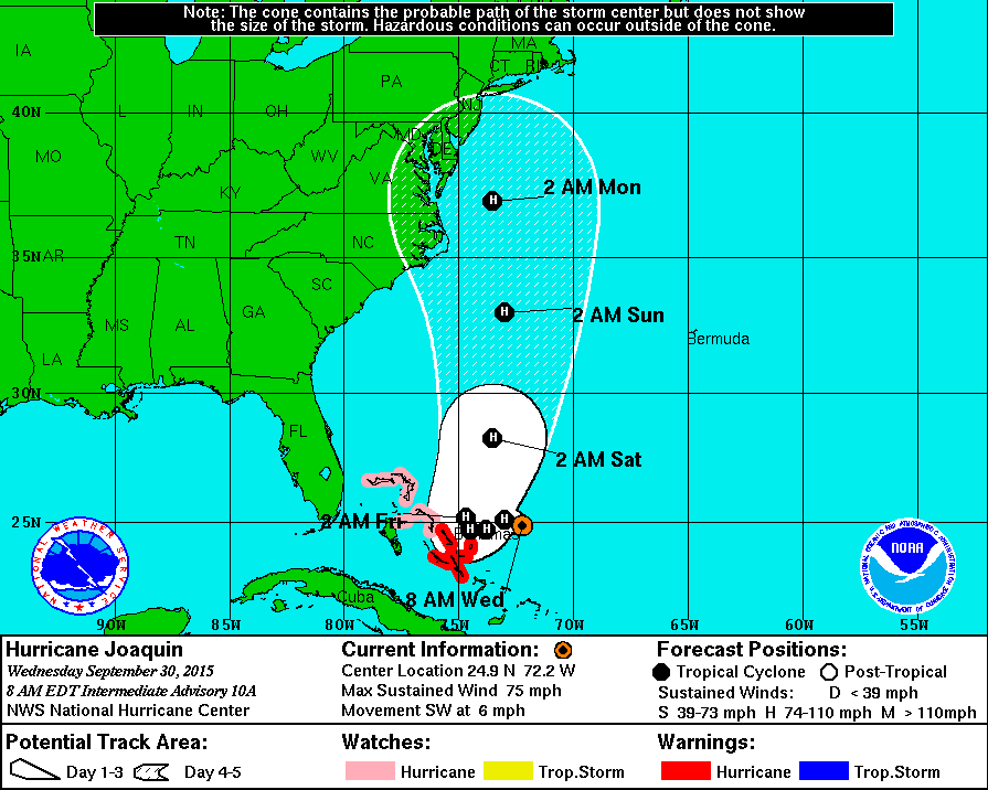
(National Hurricane Center_
It is still not known if Joaquin will make landfall in the United States, or where that would occur. Meteorologists are saying that North Carolina all the way to New England should be watching the storm as it moves closer.
The storm is not expected to arrive in the United States until the weekend.
“If there’s anywhere in this country that could take a Category 1 hit, it would be eastern North Carolina,” NBC News meteorologist Bill Karins said.
Weather.com says the storm is a “particularly challenging” one to forecast.
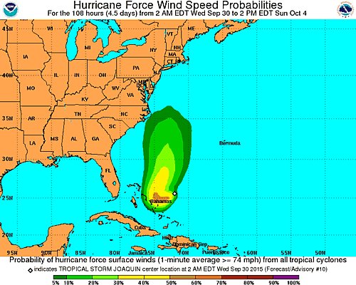
2. A Hurricane Warning Is in Place for Parts of the Bahamas
UPDATE: Joaquin still a strong Tropical Storm. Hurricane WARNING now issued for the central Bahamas. #WBZThisMorning http://t.co/gXkckJbdKr

The National Hurricane Center says a hurricane warning is in place for parts of the Bahamas: Central Bahamas including Cat Island, the Exumas, Long Island,
Rum Cay, and San Salvador. A hurricane watch is in place for Northwestern Bahamas including the Abacos, Berry Islands, Bimini, Eleuthera, Grand Bahama Island, and New Providence, but excluding Andros Island.
Weather.com says the effect of Joaquin on the Bahamas will depend on how close it gets and how much time it spends there before it turns north.
3. The Storm Is Expected to Strengthen Into a Category 2 Hurricane
Joaquin is expected to strengthen into a Category 2 hurricane as it continues to move through the Atlantic Ocean.
The National Hurricane Center says, “reports from an Air Force Reserve Hurricane Hunter aircraft indicate that maximum sustained winds have increased to near 75 mph
(120 km/h) with higher gusts. Additional strengthening is forecast during the next 48 hours. Hurricane force winds extend outward up to 30 miles (50 km) from the center. Tropical storm force winds extend outward up to 125 miles (205 km) from the center.”
4. Joaquin Could Combine With Another Storm System to ‘Soak’ the East Coast
Joaquin becomes a hurricane and a warning has been issued for the Bahamas, according to @NHC_Atlantic http://t.co/InxmpFKs5K
Whether Hurricane Joaquin makes landfall in the United States or not, it is still expected to bring heavy rain to the East Coast.
AccuWeather.com says Hurricane Joaquin could combine forces with another slow-moving storm system to bring heavy rain that will soak the northeast this week and through the weekend, causing an increased risk of flooding.
“While it will not rain continuously in the Northeast this week, this is a significant pattern change for the upper mid-Atlantic to New England following many days and weeks of dry weather,” AccuWeather Chief Meteorologist Elliot Abrams says.
5. It Is the 10th Named Storm of the Hurricane Season
According to National Hurricane Center, Joaquin is the 10th named storm of the Atlantic Ocean’s hurricane season.
The last named storm was Tropical Storm Ida, which was named on September 18, but then was downgraded back to a tropical depression on September 24.
Two storms have reached the hurricane level, Hurricane Fred and Hurricane Danny, both in August.