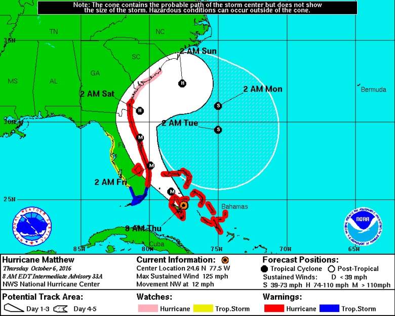
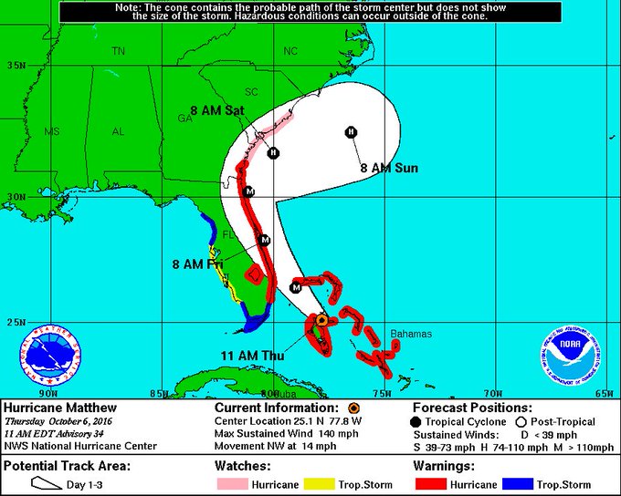
The above map from the NOAA shows the storm trajectory, as of 5 a.m. Thursday. (NOAA)
Hurricane Matthew was just upgraded to Category 4 and is expected to make landfall north of Palm Beach. If it does, it could be the first ever Category 4 hurricane to make landfall that north on record, as Eric Blake of the National Hurricane Center noted.
#Matthew could be unprecedented since there are ZERO hurricanes this strong in the historical record N of Palm Beach near landfall forecast
As Weather.com notes, Matthew was a Category 4 when it made landfall in Haiti, becoming the first storm that strong to make landfall there in 52 years.
As Gainesville.com reported earlier this week, models had the storm making landfall between Melbourne and Titusville in Brevard County, which is north of Palm Beach County.
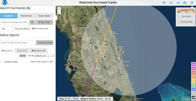
One of the most recent Category 4 hurricanes to make landfall in Florida that strong was Hurricane Charley in 2004, which made landfall in Southwestern Florida.
In order for a hurricane to be classified as a Category 4, winds need to reach between 130 and 156 mph. A Category 5 reaches 157 mph or higher. A Category 3 storm reaches wind speeds between 111-129 mph.
The NOAA notes that “catastrophic damage” will occur during a Category 4.
Well-built framed homes can sustain severe damage with loss of most of the roof structure and/or some exterior walls. Most trees will be snapped or uprooted and power poles downed. Fallen trees and power poles will isolate residential areas. Power outages will last weeks to possibly months. Most of the area will be uninhabitable for weeks or months.
Blake also tweeted a GIF, which shows the projected path of Matthew. Many show that the storm will take a U-turn and head back to Florida after moving up the coast to the Carolinas.
This post will continue to be updated.
For information on evacuation zones, click here: