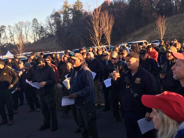
Rescuers at a command meeting on December 2. (Chimney Tops 2 fire).
The Gatlinburg fire had hit a “lull” on December 2 with active fires dwindling due to rain. However, fire officials warned people to not be fooled into a “false sense of security.” That’s because they said the rain has knocked the fire down but not yet out.
The Tennessee Department of Agriculture provides detailed maps and information for the public. The latest such update was on December 1 at noon central standard time. The TDA reported the following:
Active fires: 5
Acres burned: 21,204
Here is an interactive map (be aware that because of volume it’s periodically had some technical difficulties:)
That stood in contrast to 26 active fires on the day before. However, the fire was burning fast; the November 30 report said that 11,787 acres had burned.
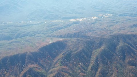
The Chimney Tops 2 Facebook page wrote on December 1 of this photo: “Aerial views of Great Smoky Mountains National Park (facing north), showing large strips of unburned forest intermingled with areas that burned in the Chimney Tops 2 Fire. The fire perimeter includes lots of areas that were not touched by the fire. In these photos, you can see Gatlinburg in the distance.”
The Tennessee Department of Agriculture reported on December 1, “The TDA Division of Forestry responded to no new fires statewide over the past 24 hours.” However, the current fires were still burning in “brush, hardwood slash, and leaf litter.” Fire officials were still working to locate the fire’s edge to stop it from burning more. The City of Gatlinburg still had an evacuation order on December 1, the latest update available on the morning of December 2.
A local television station created an interactive map:
You can click here to see an updated, interactive map of the fire’s footprint on ArcGIS.
On December 2, the government’s Chimney Tops 2 Facebook page said, “Good morning from the Incident Command Post for Chimney Tops 2 Fire. While area residents, business owners, and visitors to the area patiently await re-entry, firefighters prepare to hit the ground to ‘Stomp it while it’s down,’ as Operations Section Chief Mark Jamison instructed the firefighters to do.”
The site said that rain was helping the situation.
“Recent rain has given us a much appreciated ‘lull’ in fire activity. Our priority is to protect the valuables that remain. Our hearts are with residents and others as they come face-to-face with their individual realities today. We stand ready to assist where we can.” Here is a fire map from December 1, the latest available:
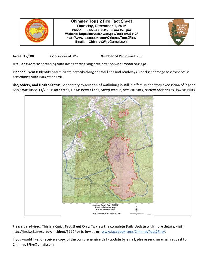
The Gatlinburg fire as of December 1.
Here is a detailed December 1 update:
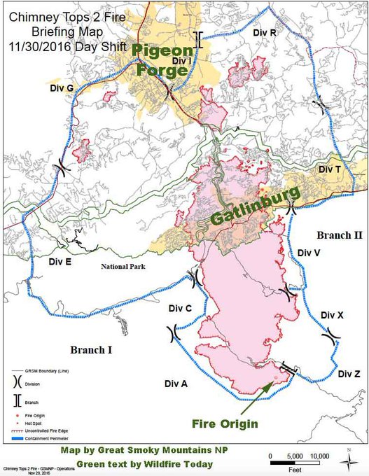
Here is a November 30 map:
Map of the Chimney Tops 2 fire at Gatlinburg, TN t.co/XeJrGyfRzK
Officials have said they believe the fire was caused by human origins, although they have not said much more than that. The TDA release says: “The state’s arson reward fund is now at $2500 for a tip that leads to an arson arrest and conviction.”
The Tennessee governor has established a website that rounds up assistance that is available to people affected by the Sevier County fires, which are also known as Chimney Tops 2.