National Hurricane Center
Tropical Storm Maria – soon to be Hurricane Maria – is taking a similar path, at least so far, as Hurricane Irma. That has a lot of people in Florida and, especially, throughout the Caribbean, on edge.
However, is Hurricane Maria really taking a similar path to Hurricane Irma? The answer is yes, in its early stages (and you can see the forecast cones for both later in this article). However, the September 18 spaghetti and forecast cone models show that Maria may then veer to the north and miss the United States and Florida completely. Be aware, though, that these are just projections, and they also preliminarily showed Irma hitting the east coast or veering out to sea before she shifted course and struck the western coast of Florida.
Cyclocane has some of the best updated spaghetti models on Maria. See the Cyclocane Tropical Storm Maria spaghetti model page here and here. The weather tracking site also has a page of other models for following the storm’s path. The models also show Maria twisting north before striking Florida.
Spaghetti plots for #Maria. #FirstAlertWx

SebastianDaily.com notes, “The latest Spaghetti model for Tropical Storm Maria may show no threat to Florida at this time, but the National Hurricane Center warns it’s too early to predict a path.” After all, again, Irma shifted course, with models originally predicting an east coast landfall – and then hitting Miami and even South Carolina – or showing the storm heading back to sea. Then, she struck in the Naples area. However, the Maria models look somewhat more favorable for Florida than Irma’s did.
Let’s compare some of the forecast cone models put out by the National Hurricane Center for Maria and Irma. One difference, though: Wind strength. Irma was a monster, with wind speeds of 185 mph as she hit the Caribbean. Although Maria is expected to become a hurricane on Sunday, and she’s nearing the Leeward Islands (sound familiar?), her wind speeds on Sunday were 65 mph, according to CNN. The wind speeds grew to 110 mph on Monday.
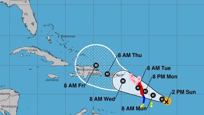
Here’s a September 18 model for Maria:
NHC/NOAAHurricane Maria forecast at 8 a.m. from the National Hurricane Center.
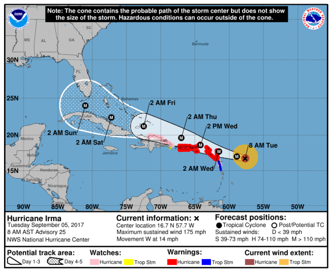
Here’s an early cone projection for Irma:
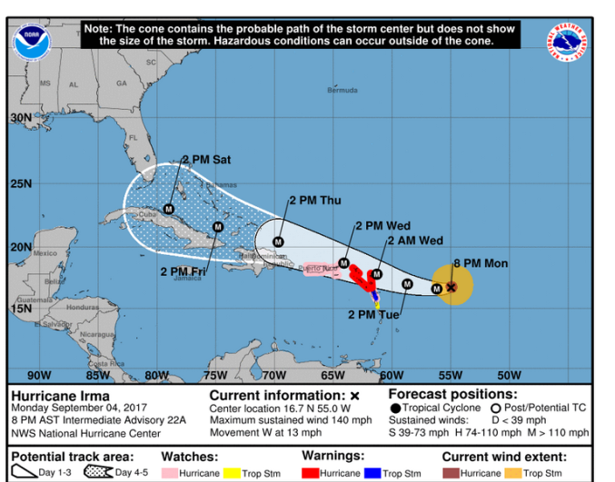
National Weather ServiceThe path of Hurricane Irma on September 4 at 8:30 p.m. Eastern Time.
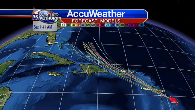
Here’s a spaghetti model for September 18 for Maria:
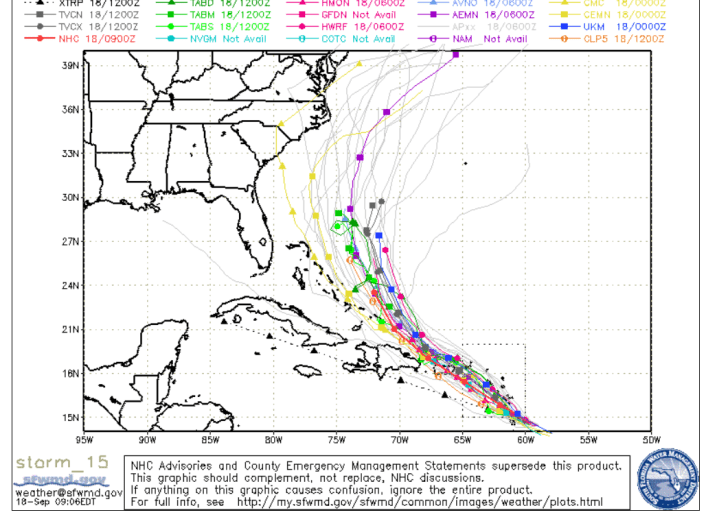
SFWMDSeptember 18 spaghetti model for Maria.
Here’s an early spaghetti model for Irma:
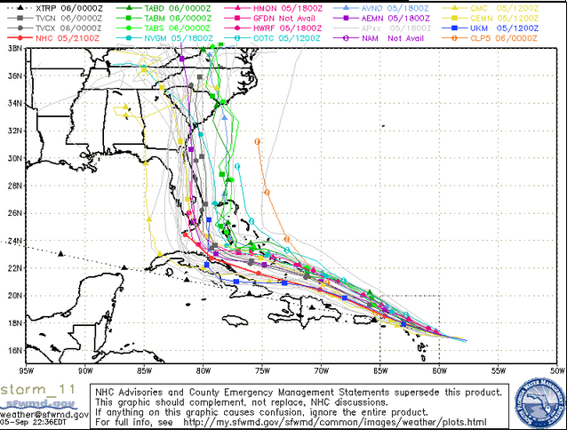
South Florida Water Management DistrictSpaghetti model of Hurricane Irma on September 5.
Now, let’s revisit how the path of Irma shifted over the days before it struck Florida. Here are the cones from oldest to the point it struck:
NOAAHurricane Irma projection from the NOAA as of 8:00 a.m. September 5.
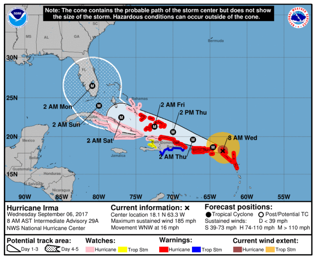
NHC/NOAAThe National Hurricane Center’s map from 8 a.m. Sept. 6.
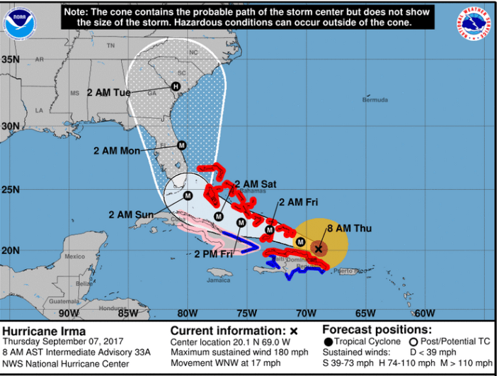
NWSThe Irma forecast cone as of the morning of September 7.
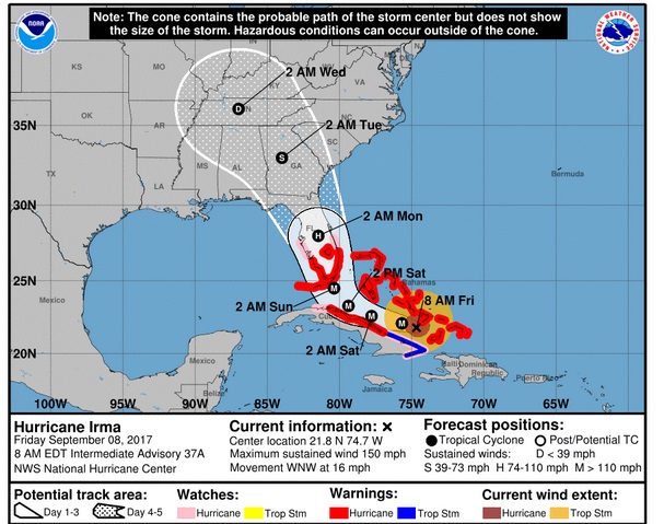
NHCHurricane Irma forecast for September 8 in the morning.
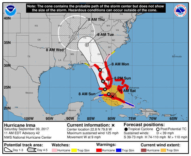
National Hurricane CenterThe latest map of Hurricane Irma as of 11 a.m. on September 9.
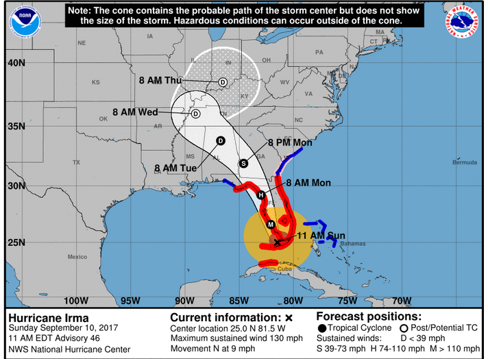
NHC11 a.m. Sunday Sept. 10 Irma forecast.
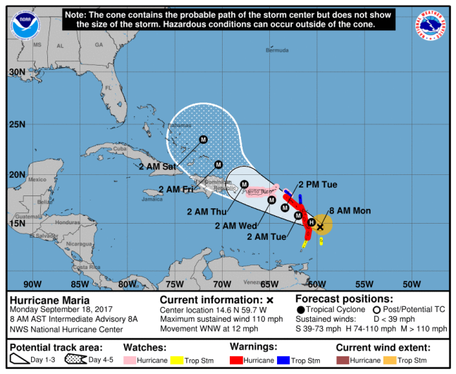
Here are some of the September 17 Hurricane Maria maps from the National Weather Service:
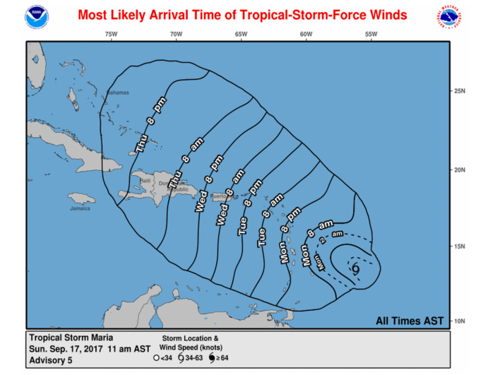
National Hurricane Center
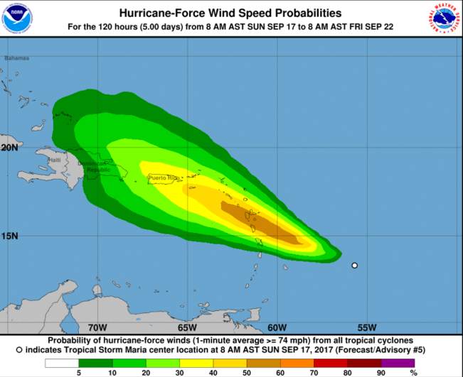
National Hurricane Center
Nothing in Florida – including Key West and the Florida Keys – makes the September 17 list of hurricane watches and warnings put out by the National Hurricane Center:
SUMMARY OF 200 PM AST…1800 UTC…INFORMATION
———————————————-
LOCATION…13.6N 56.9W
ABOUT 405 MI…655 KM SE OF THE LEEWARD ISLANDS
MAXIMUM SUSTAINED WINDS…65 MPH…100 KM/H
PRESENT MOVEMENT…WNW OR 290 DEGREES AT 15 MPH…24 KM/H
MINIMUM CENTRAL PRESSURE…994 MB…29.36 INCHES
WATCHES AND WARNINGS
——————–
CHANGES WITH THIS ADVISORY:
The government of France has issued a Hurricane Warning for
Guadeloupe and a Tropical Storm Warning for Martinique.
SUMMARY OF WATCHES AND WARNINGS IN EFFECT:
A Hurricane Warning is in effect for…
* Guadeloupe
* Dominica
A Tropical Storm Warning is in effect for…
* Martinique
* St. Lucia
A Hurricane Watch is in effect for…
* Antigua, Barbuda, St. Kitts, Nevis, and Montserrat
* Saba and St. Eustatius
* St. Maarten
* St. Martin and St. Barthelemy
* Anguilla
A Tropical Storm Watch is in effect for…
* Barbados
* St. Vincent and the Grenadines
See the National Hurricane Center’s Maria page here.