National Hurricane Center
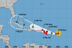
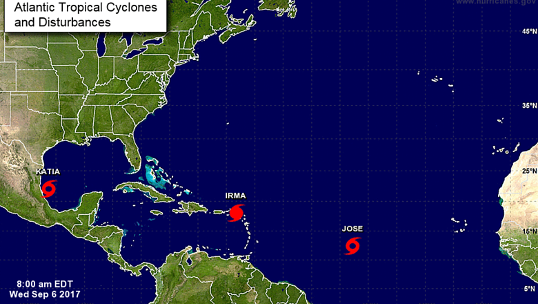
Hurricane Irma is still a very powerful category 5 hurricane. The storm is located around 15 miles east of St. Maarten and 15 miles west-southwest of Anguilla. It is moving west-northwestward at about 15 mph, according to The Weather Channel.
Irma is moving past the Leeward Islands and is moving toward Puerto Rico and the Dominican Republic. From there, Irma will head to the Bahamas, arriving in the area by Friday. The brunt of the storm will clip the southernmost coast. A hurricane watch is currently in effect.
Residents of East and Gulf coasts are urged to prepare now for the arrival of Hurricane #Irma. t.co/L4ki7vJpin
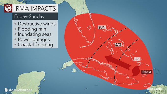
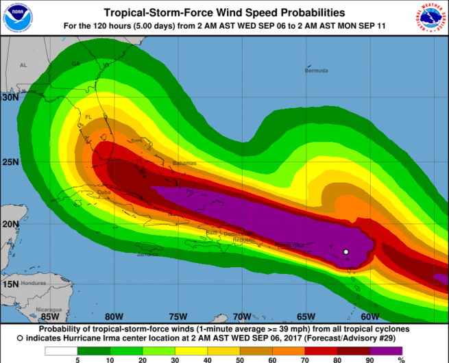
Irma is expected to drop 12″ to 18″ of rain in the Bahamas before moving on to parts of Cuba and into south Florida. The storm surge will be 15-20 feet in the southern Bahamas. Wind speeds will vary depending on the island. Check out the map of the wind speed probabilities below.
Steady showers will move into the Bahamas on Friday and will become heavy in the evening and overnight hours. The heaviest rain is expected to fall on Saturday. Irma will not linger and will move out of the area by Sunday evening. On Monday, the weather will return to normal for the area. A scattered thunderstorm is possible and there is a 50 percent chance of a passing shower.
According to Bahamas Prime Minister Hubert Minnis, a mandatory evacuation of the southern islands in the Bahamas has been instated. He warned that residents who choose to stay behind may be stranded.
“Minnis says the Category 5 storm poses a dire threat to the islands of Mayaguana, Inagua, Crooked Island, Acklins, Long Cay and Ragged Island. People who live on the islands will be flown Wednesday to Nassau on the island of New Providence. Minnis says it will be the largest hurricane evacuation in the history of the Bahamas.”
More information about how Irma will affect the Bahamas will become available over the next 12-24 hours.