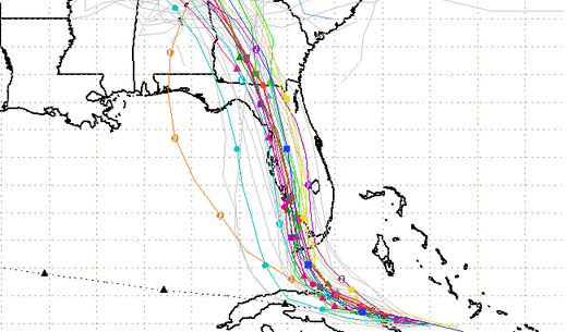
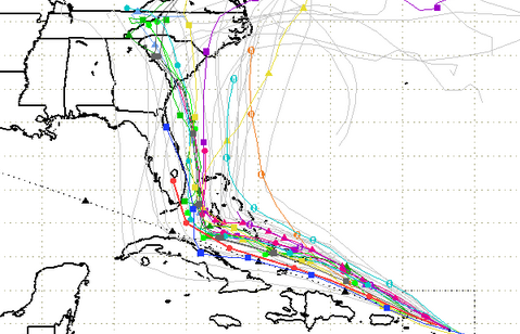
South Florida Waste Management District Spaghetti model for Friday evening.
For several days, the forecasting models for Hurricane Irma showed the massive storm shifting to the east. This was bad news for cities on the eastern coast of Florida, and it looked ominous for South Carolina too.
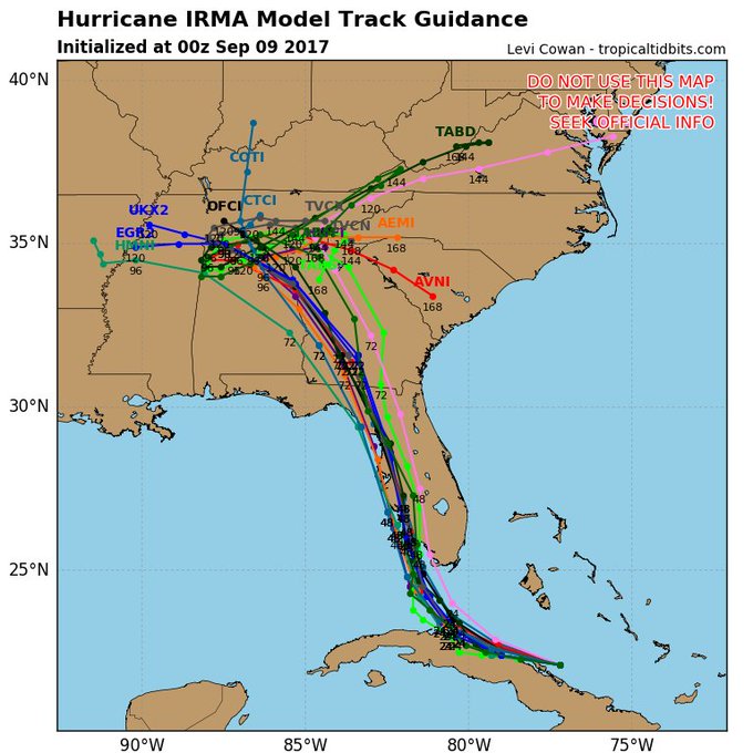
However, with landfall looming, Irma shifted westward on Friday, September 8, a pattern that became more pronounced by evening. See Cyclocane updated spaghetti model paths showing the western trend here.
The Sun Sentinel noted this trend, writing on Friday evening, “Hurricane Irma regained Category 5 strength late Friday night and shifted its likely course farther west, away from the heavily populated southeast Florida coast…The shift in course could be good news for Broward, Miami-Dade and Palm Beach counties and bad news for Naples, Fort Myers and Tampa.”
The newest run of the spaghetti models shows lots of agreement but have shifted to the west again, taking #Irma over western Florida coast.
The National Weather Service noted on the evening of September 8: “Powerful Category 5 Hurricane Irma continues to move west northwest near the northern coast of Cuba. The latest forecast track takes Irma northward over the far western part of the Florida Peninsula. Irma is a large hurricane and will produce far-reaching effects regardless of where the exact center of the storm moves. The primary concerns given the current forecast track would be excessive rainfall leading to flash flooding, and the potential for tornadoes. … Irma would still generate at least tropical storm force winds, and possibly hurricane-force winds across northeast Florida.”
However, that doesn’t mean that people in the rest of Florida or states like South Carolina should breathe a sigh of relief yet; the storm is unpredictable and all of South Florida, in particular, is in peril. An error of just 50 miles could be very bad for the east coast of Florida, the newspaper reported.
Current track of #HurricaneIrma as of 8pm tonight. Moved slightly to west. #Florida #IrmaHurricane #Irma #Irma2017
Let’s take a look at the progression of this path, using the South Florida Waste Management District’s spaghetti models, and then the National Oceanic and Atmospheric Administration’s cone forecast approach.
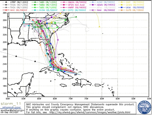
Friday evening, the westward trend was clear, and a new state came into play: Part of Alabama. Imperiled: The west coast of Florida, parts of Georgia, and then Alabama. That doesn’t mean South Carolina is out of the woods yet; the National Hurricane Center’s late Friday evening update predicted heavy rains for that state as well as Georgia, western North Carolina, and the Florida panhandle.
South Florida Waste Management DistrictFriday evening spaghetti model.
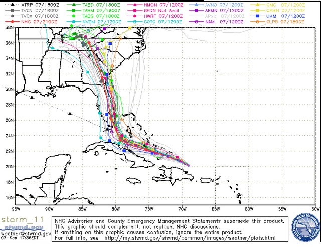
Friday morning: The storm was shifting west, but it was imperiling most of Georgia and Tennessee.
South Florida Waste Management DistrictFriday morning September 8 spaghetti model.
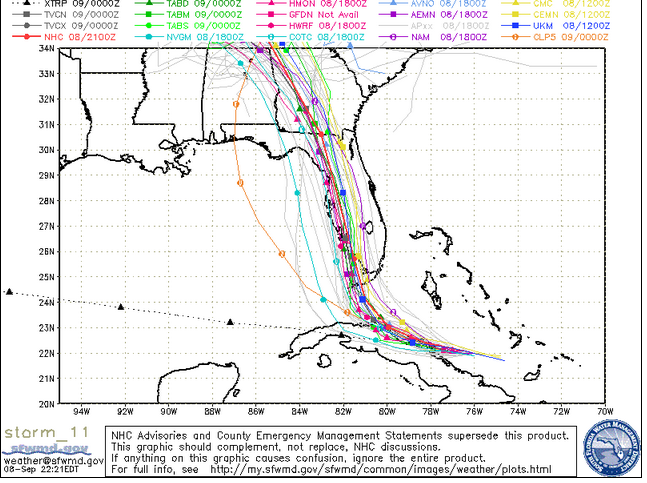
Thursday evening: The storm’s westward trend was already clear, but its imperiling of western Florida was not.
South Florida Waste Management DistrictThursday evening spaghetti model for Hurricane Irma.
Thursday morning: South Carolina was clearly in play.
South Florida Water Management DistrictA September 7 spaghetti model.
Now, let’s look at the NOAA forecast cone. As with the spaghetti models, NOAA’s map is simply a projection. The storm is unpredictable.
Friday evening:
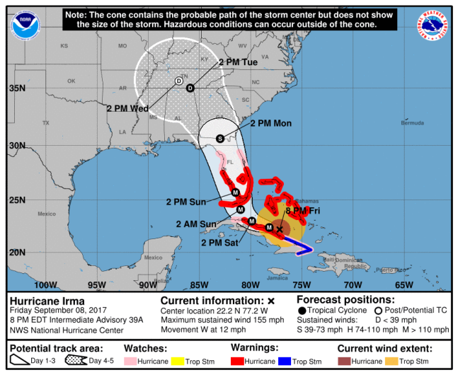
NOAA/NHCHurricane Irma forecast as of 8 p.m. Friday.
Friday morning:
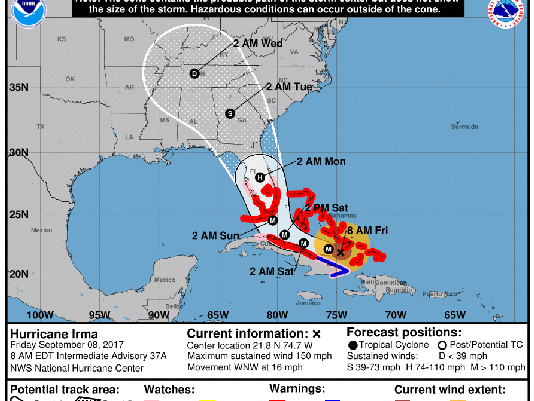
National Hurricane CenterThe latest track of Irma as of 11 a.m. Eastern on September 8.
Thursday evening:
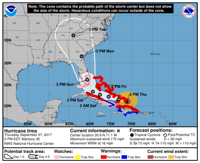
NOAA/NHCHurricane Irma forecast at 5 p.m. ET
Wednesday evening:
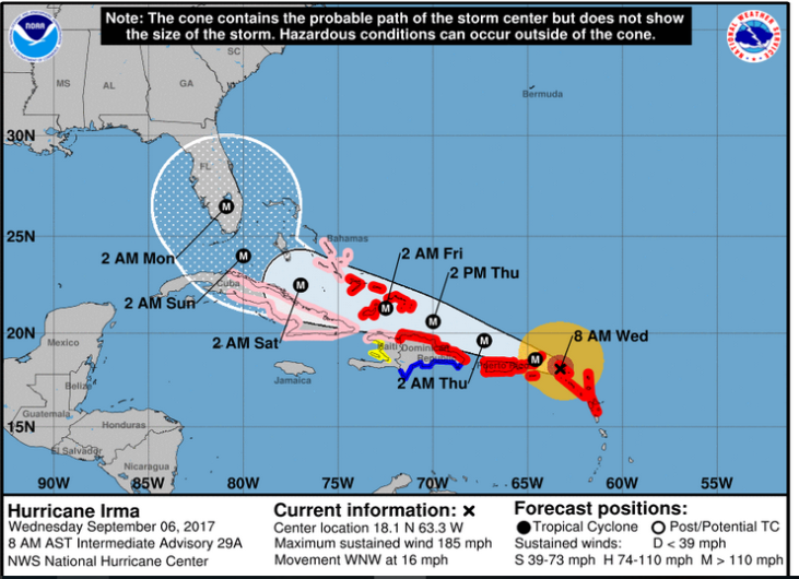
National Hurricane CenterHurricane Irma forecast cone on September 6.
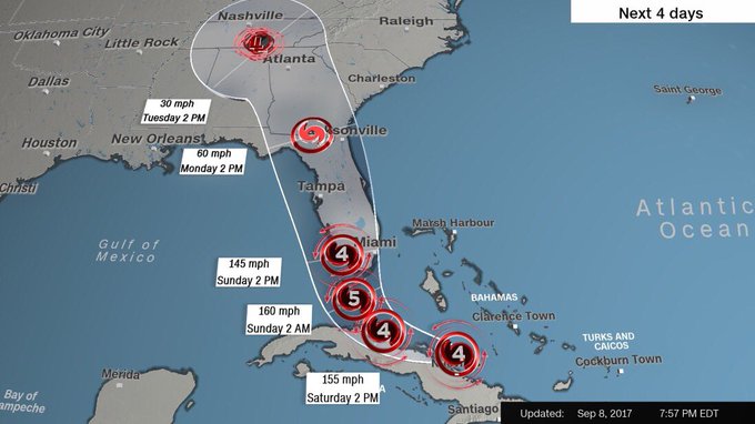
The 11 p.m. update from the National Hurricane Center on September 8 said that “Irma will continue to bring life-threatening wind, storm surge, and rainfall hazards to portions of the Bahamas and the north coast of Cuba, especially over the adjacent Cuban Keys, through Saturday.”
The update said, “Irma is expected to make landfall in Florida as an extremely dangerous major hurricane, and will bring life-threatening wind impacts to much of the state regardless of the exact track of the center. There is the danger of life-threatening storm surge inundation in portions of central and southern Florida, including the Florida Keys, during the next 36 hours, where a Storm Surge Warning is in effect. The threat of significant storm surge flooding along the southwest coast of Florida has increased, and 8 to 12 feet of inundation above ground level is possible in this area.”
The key message continued, “Irma is expected to produce very heavy rain and inland flooding. Total rain accumulations of 8 to 15 inches, with isolated amounts of 20 inches are expected over the Florida Keys and much of the Florida peninsula through Tuesday night. Irma will likely bring periods of heavy rain to much of the Florida Panhandle, Georgia, South Carolina, and western North Carolina early next week, including some mountainous areas which are more prone to flash flooding. All areas seeing heavy rainfall from Irma will experience a risk of flooding and flash flooding.”
As of 8 p.m. on September 8, the storm was located 315 miles southeast of Miami.
Follow the hurricane on the NOAA site here.