NHC September 18 evening forecast for Hurricane Maria.
As Florida and the Caribbean are still picking up the pieces from Hurricane Irma, now comes news that Hurricane Maria is brewing along the same possible path. However, some spaghetti models for Maria show this storm is projected to possibly shift north before hitting the U.S.
What exactly do the latest spaghetti models for Maria show? As of September 18, they showed the storm was in the Caribbean, and churning in the general direction of the U.S., but that it might turn north and miss Florida. (Update: You can see the September 19 spaghetti models for Maria here.)
This projection became more pronounced on Monday as the storm strengthened to a Category 4 hurricane with 130 mph winds.
However, there is enough uncertainty with the storm’s path that it’s still making people nervous. Be aware that the storm’s path could change, and all of the models are simply projections. As everyone knows, Irma projections originally showed that storm hitting the east coast or heading out to sea, but the storm then shifted and struck the Naples area. According to The National Weather Service, Maria is projected to approach “Puerto Rico and the Virgin Islands Tuesday night and Wednesday.”
Models have projected for days that the storm might miss Florida, and those projections continued on September 18.

Some of the models showed the Carolinas in peril for landfall over the weekend, but the National Center for Atmospheric Research’s model for September 18 shows the storm heading to sea. Tropical Storm Maria became a hurricane on Sunday.
Tropical Storm #Maria predictive models have her becoming a major hurricane over Puerto Rico – US impact TBD
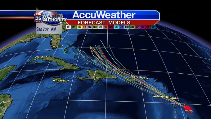
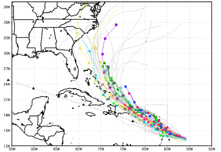
Cyclocane has some of the best updated spaghetti models on Hurricane Maria. See the Cyclocane Tropical Storm Maria spaghetti model page here and here. The weather tracking site also has a page of other models for following the storm’s path. Cyclocane has a page for Tropical Storm Lee too.
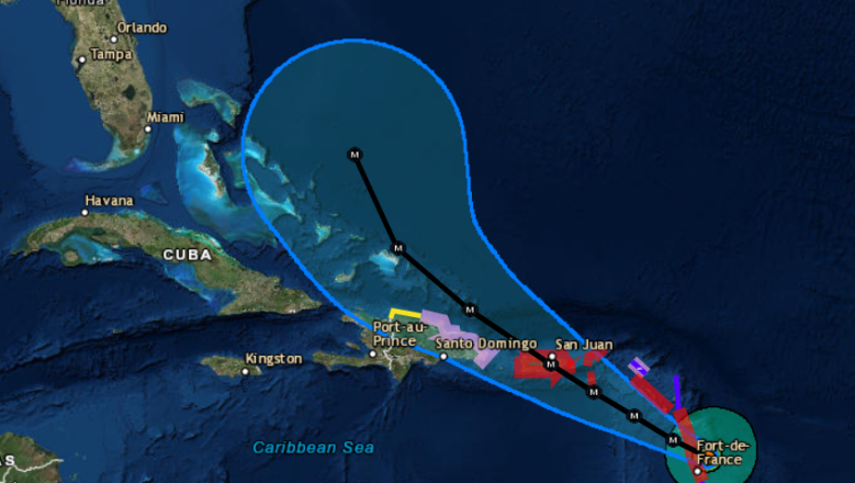
The South Florida Waste Management District also has updated spaghetti plots. Here’s its plot for the evening of September 18:
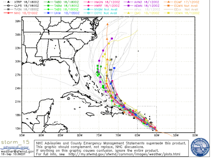
SFWMDMaria spaghetti plot for the evening of September 18.
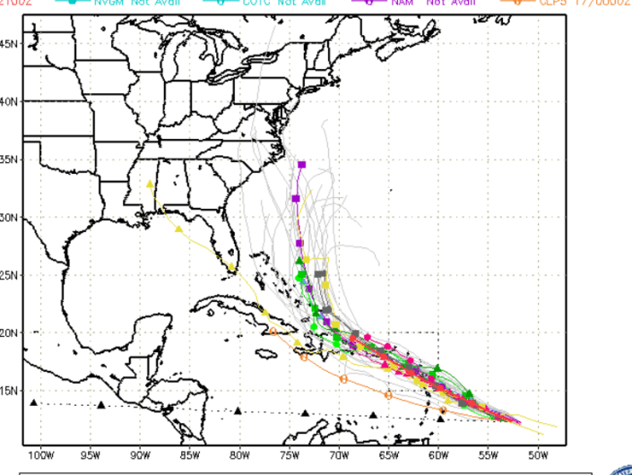
Here’s the plot for September 17 so you can see the storm’s progression:
SFWMDSpaghetti model for Maria for September 17.
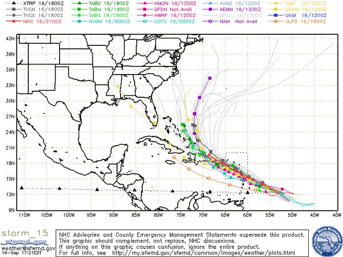
This is how it looked the night before:
South Florida Waste Management District spaghetti plot.
Weather Underground also has updated soon-to-be Hurricane Maria maps.

Wunderground’s tracker for the storm shows it veering to the north and not hitting the American coast. According to CNN, “Maria is expected to gain strength through the weekend and become a hurricane by late Monday.”
Behind Maria, lurks Tropical Storm Lee, and Tropical Storm Jose is twisting in the general direction of the eastern seaboard.
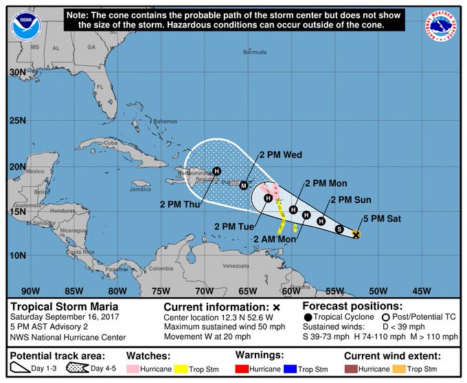
The National Hurricane Center uses a forecast cone model instead of spaghetti models. You can see the NHC page for tracking Hurricane Maria here.
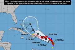
This is the cone for the evening of September 18:
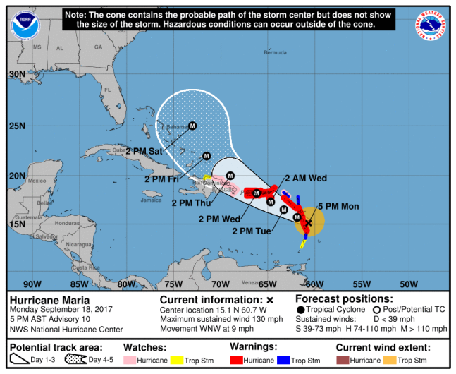
NHC/NOAAHurricane Maria forecast at 5 p.m. ET from the National Hurricane Center.
It’s starting to show the northward turn that has been present for a day or so in the spaghetti models. The storm is also weaker than Irma, although its winds have increased to a maximum of 130 mph (Irma was registering 185 mph at this stage.)
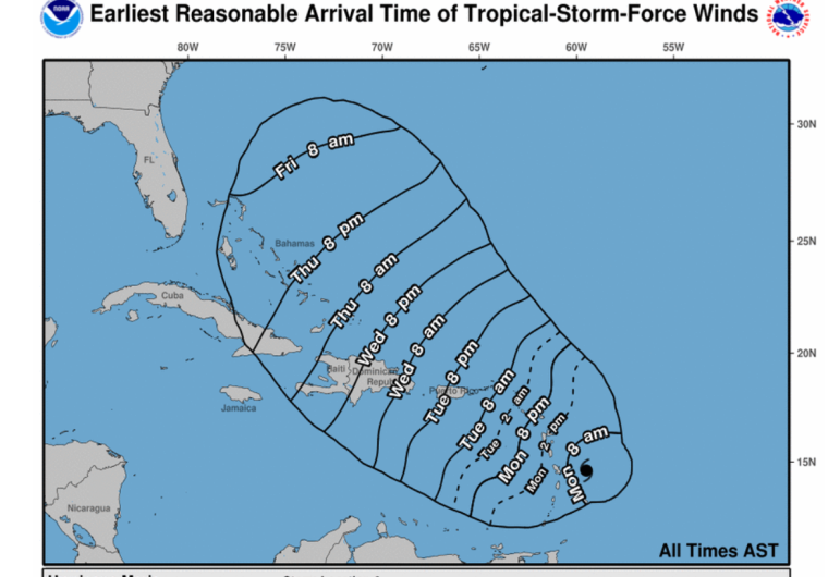
Wind arrival times.
This was the Irma forecast path early on for comparison purposes.
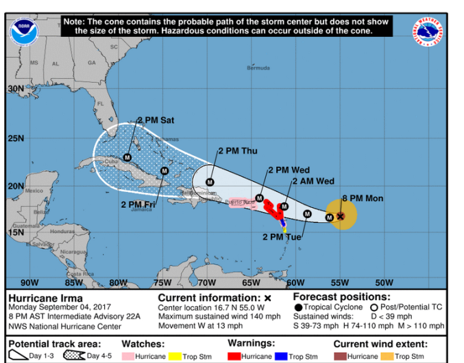
National Weather ServiceThe path of Hurricane Irma on September 4 at 8:30 p.m. Eastern Time.
As for Maria, this was where the National Hurricane Center said her position was on the evening of September 18:
“MARIA BECOMES AN EXTREMELY DANGEROUS CATEGORY 4 HURRICANE…THE EYE AND THE INTENSE INNER CORE IS EXPECTED TO PASS NEAR DOMINICA DURING THE NEXT FEW HOURS…
SUMMARY OF 500 PM AST…2100 UTC…INFORMATION
———————————————-
LOCATION…15.1N 60.7W
ABOUT 45 MI…70 KM ESE OF DOMINICA
ABOUT 35 MI…55 KM NE OF MARTINIQUE
MAXIMUM SUSTAINED WINDS…130 MPH…215 KM/H
PRESENT MOVEMENT…WNW OR 290 DEGREES AT 9 MPH…15 KM/H
MINIMUM CENTRAL PRESSURE…950 MB…28.06 INCHES
WATCHES AND WARNINGS
——————–
CHANGES WITH THIS ADVISORY:
A Hurricane Warning has been issued for Puerto Rico, Culebra, and Vieques.
The Meteorological Service of St. Lucia has changed the Hurricane Warning for that island to a Tropical Storm Warning.
The Government of the Dominican Republic has issued a Hurricane Watch from Isla Saona to Puerto Plata, and a Tropical Storm Watch west of Puerto Plata to the northern Dominican Republic-Haiti border.
SUMMARY OF WATCHES AND WARNINGS IN EFFECT:
A Hurricane Warning is in effect for…
* Guadeloupe
* Dominica
* St. Kitts, Nevis, and Montserrat
* Martinique
* U.S. Virgin Islands
* British Virgin Islands
* Puerto Rico, Culebra, and Vieques
A Tropical Storm Warning is in effect for…
* Antigua and Barbuda
* Saba and St. Eustatius
* St. Maarten
* Anguilla
* St. Lucia
A Hurricane Watch is in effect for…
* Saba and St. Eustatius
* St. Maarten
* St. Martin and St. Barthelemy
* Anguilla
* Isla Saona to Puerto Plata
A Tropical Storm Watch is in effect for…
* St. Vincent and the Grenadines
* West of Puerto Plata to the northern Dominican Republic-Haiti border”