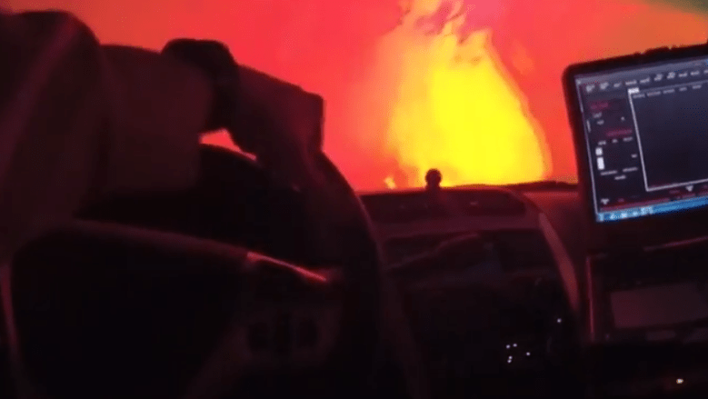
Sonoma Sheriff A scene from the Sonoma County body cam video of the Tubbs Fire in Santa Rosa.
The Sonoma County Sheriff’s Department has released dramatic police body cam video of evacuation and rescue efforts during the California wildfire. The video highlights the heroism of sheriff’s officials as they rescue people at great danger to themselves.
You can see the video here:
Fox 2 reported that a deputy in the video is named Sgt. Brandon Cutting, and the dramatic video was filmed on October 9. None of the sheriff’s officials featured in the video was injured, but the sheriff released it in part to show how quickly the fire spread and how important heeding evacuation orders is as the Tubbs Fire and other Wine Country wildfires have taken the lives of almost three dozen people.
“You’ve got to get her out, you’ve got to get her out, watch her leg!” shouts one deputy in the video. The video shows a perilous drive through the wildfire to rescue a disabled woman and her husband. In another scene, a deputy shouts at vehicles to go as they leave in an evacuation scene.
As the California wildfires continue to rage, the City of Santa Rosa has released an interactive, neighborhood-level map that allows you to see whether individual houses were destroyed in the blaze. The death toll from the California wildfires, including the Tubbs Fire, was at least 34 people on October 14, with more than 5,700 structures destroyed.
You can see the neighborhood damage map here.
UPDATE – Type three Strike Team has been put to work North east of Santa Rosa on the Pocket Fire.

See the state fire map here. Calpoto also has a very detailed burn map of the Tubbs Fire.
As of October 14, the Tubbs Fire in Santa Rosa was only 44 percent contained and had burned more than 35,000 acres. It was only one of the wildfires in the area.
This is also a good map for assessing the fire’s updated location. Here’s how the map looked on October 14:
California wildfire map.
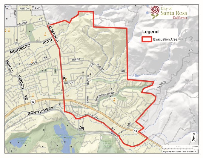
This was the evacuation zone for the Tubbs Fire in Santa Rosa as of October 14.
REPEAT: MANDATORY EVACUATION as of 4:45am All areas & roads north and south off of HWY 12 between Adobe Canyon Rd & Calistoga Rd #NunsFire
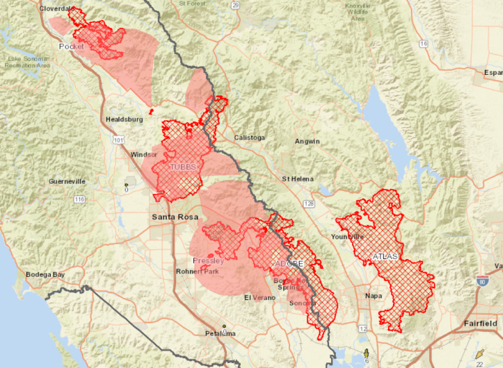
This map from CalFire shows the location of the active wildfires in the Wine Country.
The Santa Rosa Fire Department listed these evacuation zones on October 14:
MANDATORY EVACUATION AREAS
“Mandatory Evacuation means that you need to LEAVE IMMEDIATELY!
NEW- All residents between Calistoga Road and Adobe Canyon Road, and to the north and south of Hwy 12, this includes, Skyhawk, Mountain Hawk, Adobe Canyon and most of Rincon Valley
Annadel Heights area, bordered north by Parktrail Drive and west by Summerfield Road
Oakmont
Cross Creek Road
Sky Farm Drive Neighborhood
Saint Andrews Drive
Fountaingrove Parkway from Mendocino Ave to Daybreak Ct
Coffey Park Area between SMART Rail and Industrial and from City Limits north to Piner Rd”