National Hurricane Center
It’s been a historically busy hurricane season this year and now there’s a tropical depression that could spell trouble for the Florida and the Gulf Coast.
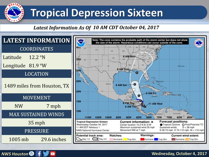
Tropical Depression 16 is currently 45 miles west-southwest of San Andres Island off the coast of Nicaragua, according to the National Hurricane Center.
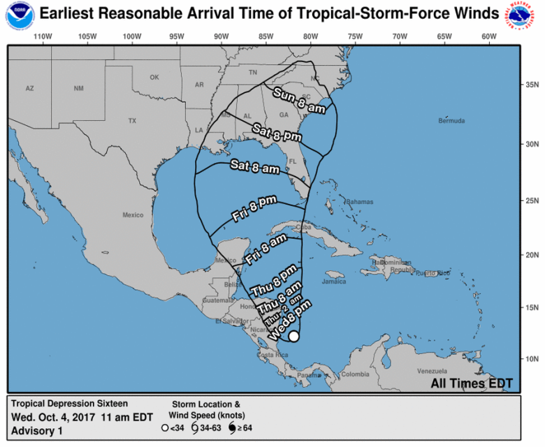
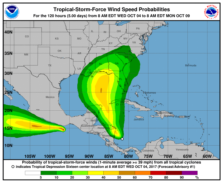
Tropical Depression 16 is expected to head north and is forecast reach the United States sometime this weekend.
Maximum sustained winds are 35 miles an hour. The tropical depression is moving northwest at 7 miles an hour.
…TORRENTIAL RAINS EXPECTED OVER PORTIONS OF CENTRAL AMERICA FROM THE DEPRESSION…
Tropical depression 16 forms in the Caribbean and could strengthen into a hurricane this weekend. t.co/loz4cwTk3U

The National Hurricane Center said the storm the tropical depression “should be nearing the coast of Nicaragua early Thursday, move across northeastern Nicaragua and eastern Honduras late Thursday, and emerge into the northwestern Caribbean Sea on Friday.”
Tropical Depression 16 is expected to become a tropical storm later Wednesday, forecasters said. It would be named Nate.
Tropical Depression 16 has formed in the Caribbean and will likely become Tropical Storm Nate later today.

Rainfall amounts of 15 to 20 inches are expected across portions of Nicaragua, with isolated maximum amounts of 30 inches possible. Across Costa Rica and Panama, 5 to 10 inches of rain are expected, with isolated maximum totals of around 20 inches possible. Across Honduras, rainfall amounts of 2 to 5 inches, with isolated maximum amounts of 8 inches are expected. This rainfall could cause life-threatening flash floods and mudslides.