
Getty
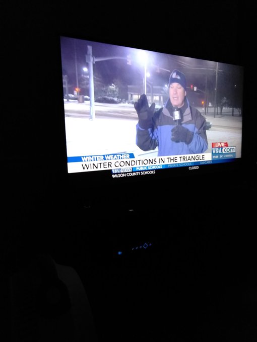
Winter Storm Grayson is expected to bring snow and blizzard-like conditions to the Northeast region, but it’s already brought heavy snow and wintry conditions to Georgia, South Carolina, and North Carolina. On Thursday the storm is expected to undergo bombogenesis, where it rapidly intensifies in a low pressure situation. Grayson’s pressure might drop by 45 millibars in just 24 hours. Already, blizzard warnings have been posted for many areas in the Northeast, including Maine, North Carolina, Boston, Portland, Atlantic City, New Jersey, and parts of Virginia. Winter storm warnings have been issued in areas west of the blizzard warnings. In the meantime, parts of North Carolina saw six inches of snow on Wednesday, parts of South Carolina saw more than seven inches of snow, and even Georgia saw six inches in regions. Here are the snowfall totals as of 10 p.m. Eastern for parts of North Carolina on Wednesday, January 3, 2018, according to the NOAA.
The following are the snow fall totals for Wednesday, January 3, 2018 in North Carolina. This is how much snow fell, in inches, between 12 a.m. Eastern on January 3 and 9 p.m. Eastern on January 3.
- Pinehurst: 6.0 inches
- Pinebluff: 4.5 inches
- Sanford: 3.3 inches
- Hamlet: 3.0 inches
- Cumnock: 2.6 inches
By later Wednesday night, the storm should be off the coast of North Carolina and Virginia, with snow spreading through the mid-Atlantic by midnight and into southern New England by pre-dawn. Winds will increase, with gusts up to 50 mph along the coast of North Carolina into southeastern Massachusetts. Thursday is when the real action will begin in the northeast. Snow will intensify in New England during the day, especially the eastern portions, and should taper off by the evening. Winds will also intensify. Snow south of the New York City Tri-state area should end by mid-day. Wind gusts of up to 70 mph are possible with this storm, along with power outages, and downed trees. Blizzard conditions could last into Thursday night, The Weather Channel reported. The heaviest snow is expected in eastern New England, but much of the storm’s forecast is still unclear. There is also a risk of coastal flooding along parts of the Massachusetts shoreline on Thursday, with the peak impact happening between 12:30 and 2 p.m. Eastern at high tide on Thursday.
People from North Carolina were quick to share photos and reports on social media of what it’s like in the region:
First snow in my part of North Carolina 2k18❄⛄🙌💕
Some areas look positively beautiful:
First snow of 2018 in Cary North Carolina.❄️⛄️ #snow #CaryNorthCarolina #2018 #27degrees #wakecountync #NorthCarolina #CaryNC
The city got a jump on things and already canceled school, the day before the storm hit.
I love North Carolina but they just cancelled school tomorrow because it’s cold. No snow on the ground. It’s just cold. This is exactly why those New Yorkers with leather bubble vests think they’re better than us 😭😭😭😭😭😭😭😭😭😭
And while some people aren’t liking it, their pets are loving it, they say.
I moved to North Carolina to
get away from this disgusting stuff. My Golden’s are in Snow Heaven right now!
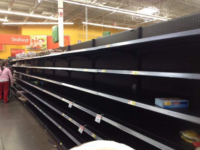
Of course, stores are already sold out of supplies:
Amazing how crazy North Carolina gets just for a couple inches of snow ❄️

https://twitter.com/juliexrod/status/948761063981506560
And many people in the region feel this just shouldn’t be happening:
This is North Carolina.
It’s not supposed to snow here.