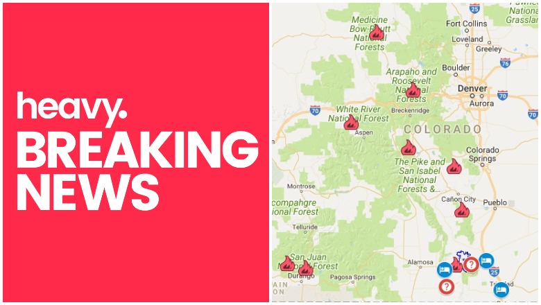
Google Maps & Colorado Colorado Fire Near Me
Hot summer conditions continue to cause fires to grow in Colorado, with the Spring Fire and Lake Christine Fire being among the largest. Here are where all the current fires are located, along with maps and evacuation updates for July 6, 2018.
General Map of Colorado Fires
This map below is an interactive map of some of the bigger fires in Colorado right now, provided by the Colorado Division of Fire Prevention & Control (CDFPC) and Google. Fires in red are active and fires in black are contained.
The map above lists numerous active fires, which this article will describe in more detail in the next section.
List of Active Fires in Colorado as of July 6
416 Fire
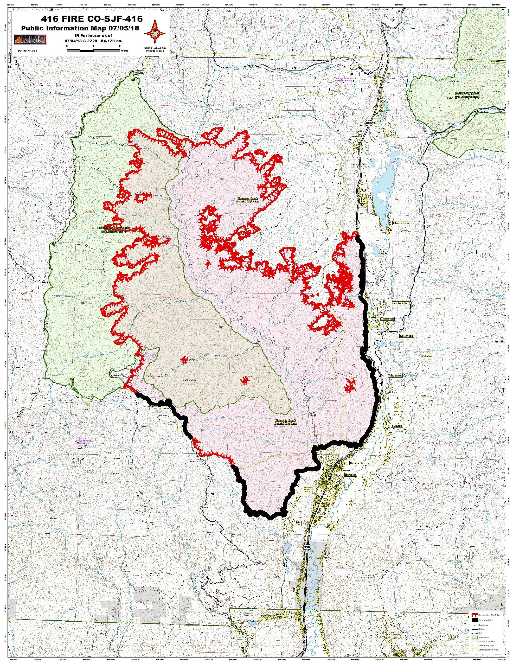
Inciweb416 Fire
This fire is 54,129 acres and 45 percent contained. It has remained around the same size over the last day, and Inciweb maintains the same fire map for it that was used on July 5. The cause of this fire is unknown. It’s located in La Plata County, 13 miles north of Durango and has been burning since June 1. It’s burning in an area of inaccessible terrain and no homes have yet been evacuated. The fire is burning on the west side of State Highway 550 on private land in the San Juan National Forest, according to Inciweb.
Adobe Fire
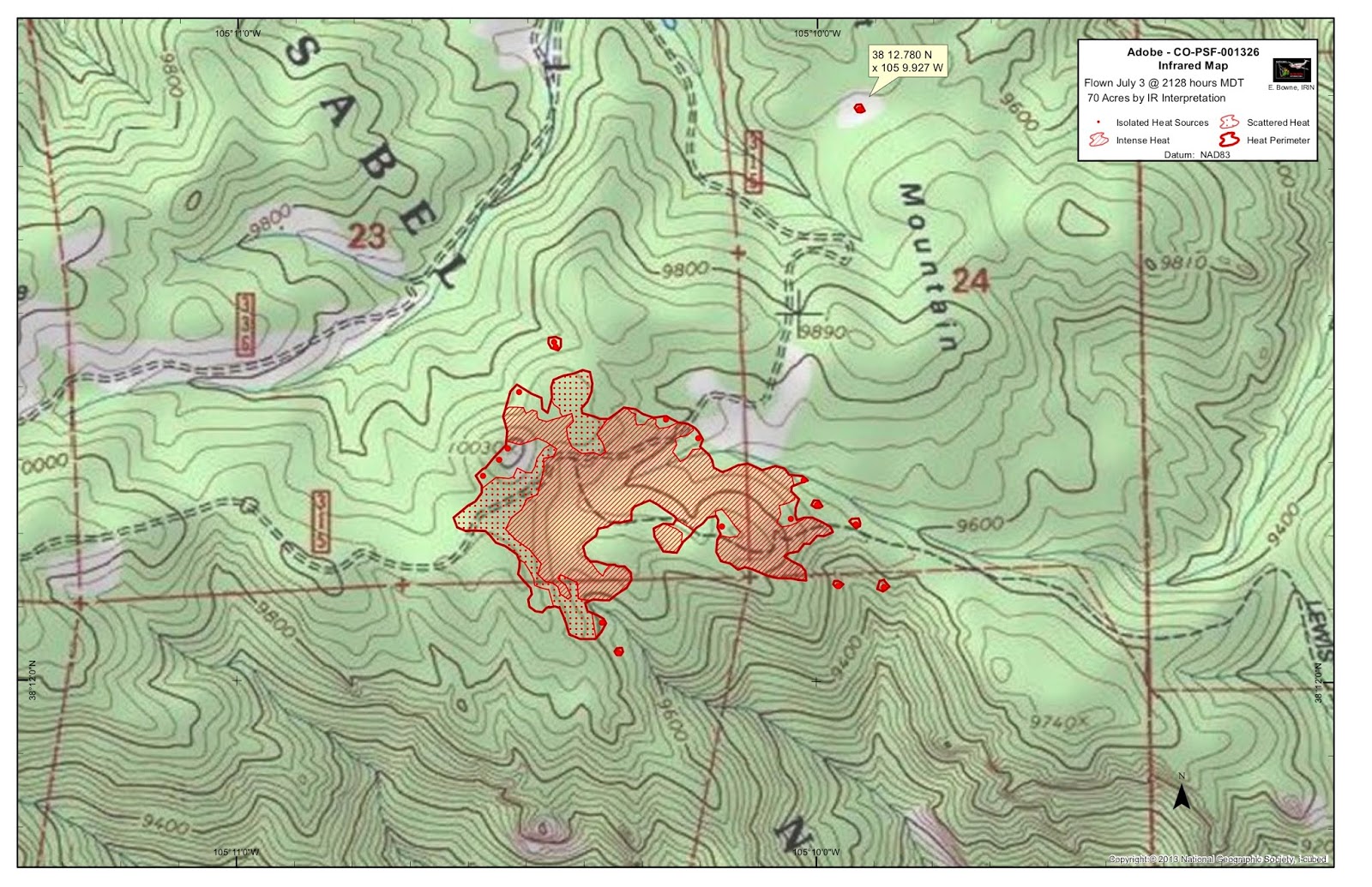
Adobe Fire on July 3
This fire is 85 acres and 27 percent contained. Because of suppression efforts, all pre-evacuation orders have been lifted in Freemont and Custer counties.
Burro Fire
This fire is 4,578 acres and is 40 percent contained. The cause is under investigation and the estimated containment date is currently August 1. It started on June 8 and is located about 14 miles south of Rico.
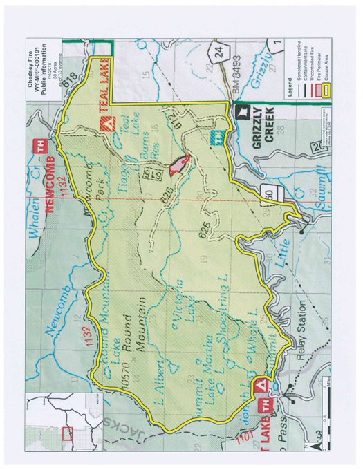
Chedsey Fire
This fire is 30 acres and 45 percent contained. It’s located in Routt National Forest, southwest of Walden, Colorado, near Teal Lake.
#ChedseyFire map for today shows both fire perimeter and emergency closure area. 40% containment, containment lines along both the east & southwest edges of the fire. t.co/Ut34lnp0Y3
High Chateau Fire
This fire is 91 percent contained and 1,423 acres. It started June 29. View a map here.
It’s located west of Wright’s Reservoir and northeast of Cripple Creek. It started Friday afternoon. Visit the Teller County Sheriff’s office or the Park County Sheriff’s office sites for the most recent updates.
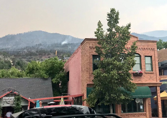
Lake Christine Fire
This newer fire is 5,263 acres and 0 percent contained. Hundreds have been evacuated, CBS Denver reported. It’s burning next to the town of Basalt and close to El Jebel. Three homes have been destroyed, two within El Jebel. More than 500 homes have been evacuated so far, and shelters have been set up at Basalt High School and Roaring Fork High School. The fire grew overnight and spread mostly north, CBS Denver reported.
The fire was caused by human activity when two people shot trace ammunition at the gun range despite local fire bans, CBS Denver reported. The ammunition sparked the fire.
This is how freaking close the fire got to wiping out down #Basalt – crazy. #LakeChristineFire

CONFIRMED: one of the homes lost in the #LakeChristineFire belonged to a local firefighter. 3 homes lost in total so far.
@CSP_Eagle = 📷

You can view a map of the Lake Christine fire here and a screenshot below. The map is not currently embeddable. Keep up with details via the Eagle County Sheriff Twitter account or Facebook. Or call 970-510-0705 with questions.
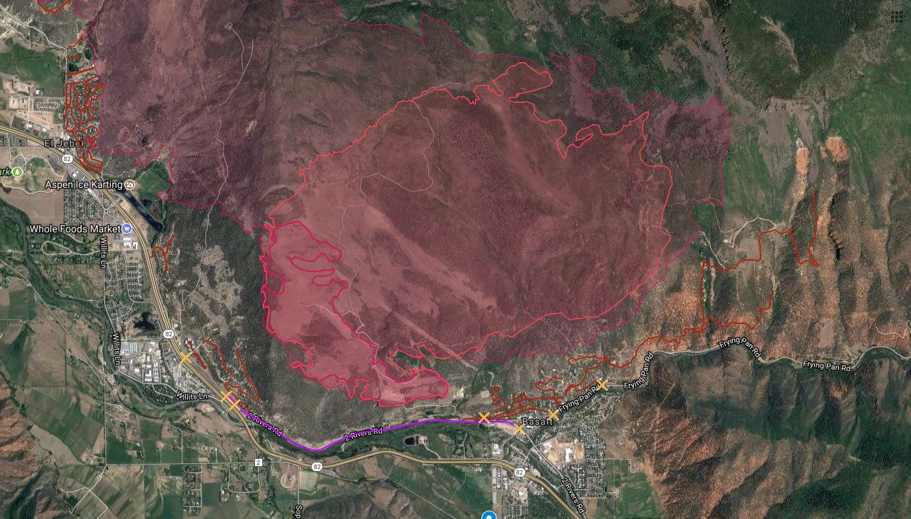
Lake Christine Fire map
#LakeChristineFire 18 hours into
Spring Fire
The Spring Fire has grown to 105,704 acres and is now 35 percent contained, up from 5 percent containment on July 5. You can see a map of the Spring Fire above.
The fire is burning five miles east of Fort Garland and started last week. More than 1,000 personnel are fighting the blaze and 132 homes have been destroyed. But as of Friday morning, some evacuations had been lifted, KOAA reported. These were lifted in Huerfano County in the Spring Fire zone area, per KOAA: “Vega Drive, Indian Creek Drive, Wahatoya Valley, Shangri La, Little Kansas, County Road 363 also known as the Mesa, County Road 362.1, County Road 361, County Road 440, County Road 450, County Road 451, County Road 430, County Road 420, Indian Creek Ranch up to and including gas plant property.” Residents will need a Rapid Tag Re-entry ID to return. Read more about the lifted evacuations here.
Homeowners in the Forbes Park subdivision may be able to return on Saturday for a few hours to survey the damage.
To stay updated on evacuations in Heurfano County, visit here. For updates on evacuations in Costilla County, visit here.
If you’re unsure if your area is under evacuation or need more information, call 719-695-9573 between 7 a.m. to 9 p.m.
Sugarloaf Fire
This fire was reported June 29 and is 1,245 acres. Percent containment isn’t known, but total containment is expected by August 31. It’s located north of Loveland Pass and 13 miles southwest of Fraser in a remote Grand County area. According to Inciweb, trails, roads, and campgrounds are anticipated to close.
Weston Pass Fire
This fire started June 28 and was 1,500 acres, 10 percent contained on Saturday. But it’s since grown and is now 12,939 acres and is 17 percent contained (up from 5 percent containment yesterday.) Officials are hoping to have it contained by July 29.
It was started by lightning and is located 9 miles southwest of Fairplay, in a remote area of Park County. Some evacuation orders have been issued.
South Park Recreation Center is offering free showers to evacuees, firefighters, and any volunteers helping fight the fire.
You can find more details about all the fires on Colorado’s Emergency Management page here.