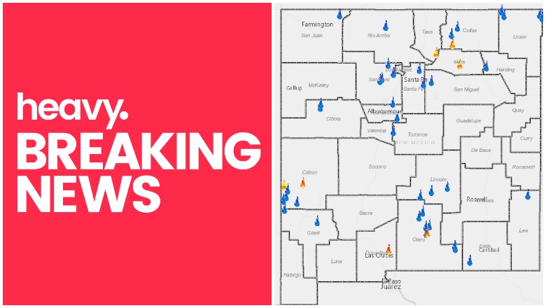
NMWatch New Mexico Fire Near Me
New Mexico has a number of active wildfires right now. Here is the latest information about the fires in New Mexico as of July 14.
To see current, interactive maps of New Mexico fires, there are a few places you can go. First, NMWAtch offers an interactive map with detailed information about current fires. Here’s a screenshot of the map as it currently stands, but you can view the interactive map and zoom into individual fires here.
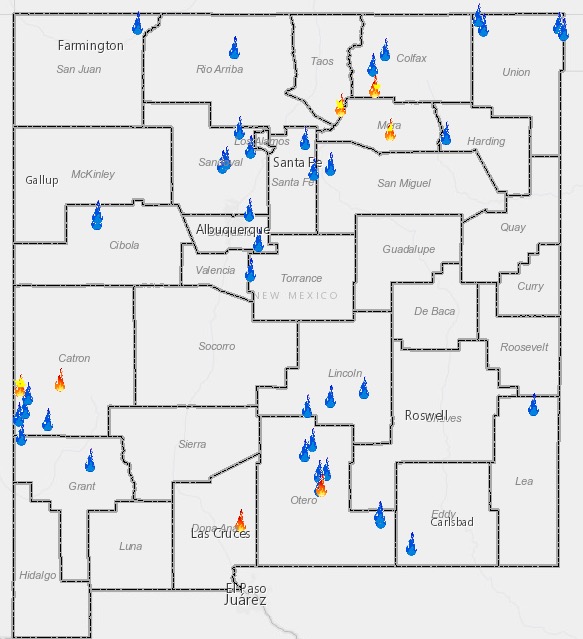
NMWatchNew Mexico Fires Near Me
You can also visit an interactive map provided by GEOMAC here. The map looks like this, and you can zoom into current fires to learn more about them.

New Mexico Fire Map
Here’s a closer look at what’s happening with the major fires in New Mexico right now, according to GEOMAC and NMWatch.
Buzzard Fire
This fire in Catron County is 50,296 acres. But it’s 90 percent contained. It was caused by an illegal abandoned campfire. It’s located in the Gila National Forest, 10 miles east of Reserve.
Emily Fire
This fire is 8,432 acres. It was caused by lighting and currently has 80 percent containment. It’s located north of Las Vegas on Turkey Mountains. It’s 25 miles north of Las Vegas.
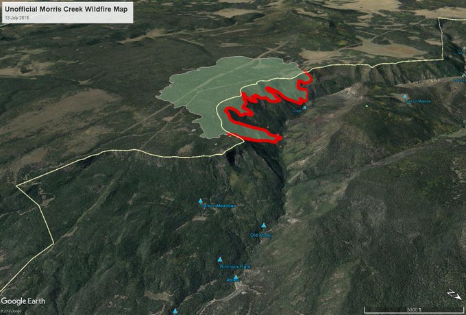
Morris Creek Fire
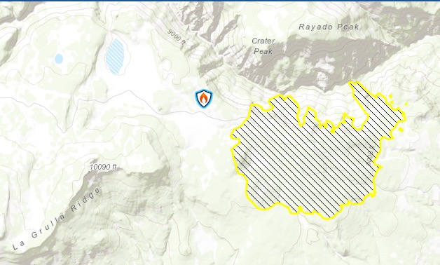
BLM & InciwebMorris Creek Fire
This fire near the border of Colfax County is 1,671 acres and 77 percent contained as of July 13.
Unofficial fire map of #morriscreekfire at #Philmont with backcountry camps for reference. Looks like there may be some heat on the opposite side of the Rayado River there but overall looks like they’ve held it.
Because the fire is expected to be under control, Inciweb is no longer providing updates. It was caused by lighting. It’s located 15 miles west of Miami, New Mexico, in Colfax County. Rain showers have helped slow the fire.
Organ Fire
This fire near Las Cruces is 5,000 acres and 75 percent contained. It was caused by a vehicle fire.
Owl Fire
InciwebOwl Fire Map
This fire, four miles northeast of Saddle, is 4,786 acres and 79 percent contained. It was caused by lightning. The fire is south of Aspen Mountain near Flying T Trail. It’s in Gila National Forest.
According to Inciweb, the following areas are closed: “Starting at the junction of Forest Road 209 and US Highway 180 following US Highway 180 South to County Road 13. Heading west to Forest Road 209. North along Forest Road 209 to Forest Road 4. West along Forest Road 4 to Forest Road 4E. North along Forest Road 4E to Forest Trail 126 Frieborn Canyon. North along Forest Trail 126 to north side of section 5 Township 7S 21W. Following the north end of Section five and section 6 to Forest Road 900B. East along Forest Road 900B to Forest Road 900. Continuing east along Forest Road 900 to Forest Road 209. North along Forest Road 209 back to US Highway 180.”
Inciweb also notes that US Highway 180 and County Road 13 to Pueblo Park Campground are open and accessible to the public. But roads and trail interior are closed.
Pepper Springs Fire
This fire is 74 acres and 20 percent contained. It was caused by lightning. (Note: some sources are saying the fire is fully contained, but it hasn’t been updated as so on maps.)
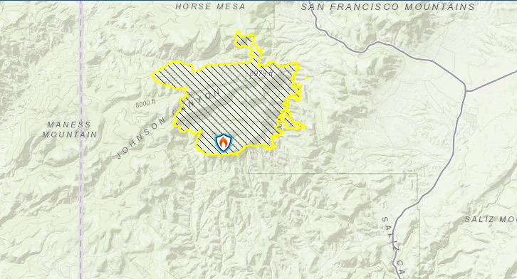
Sardinas Canyon Fire
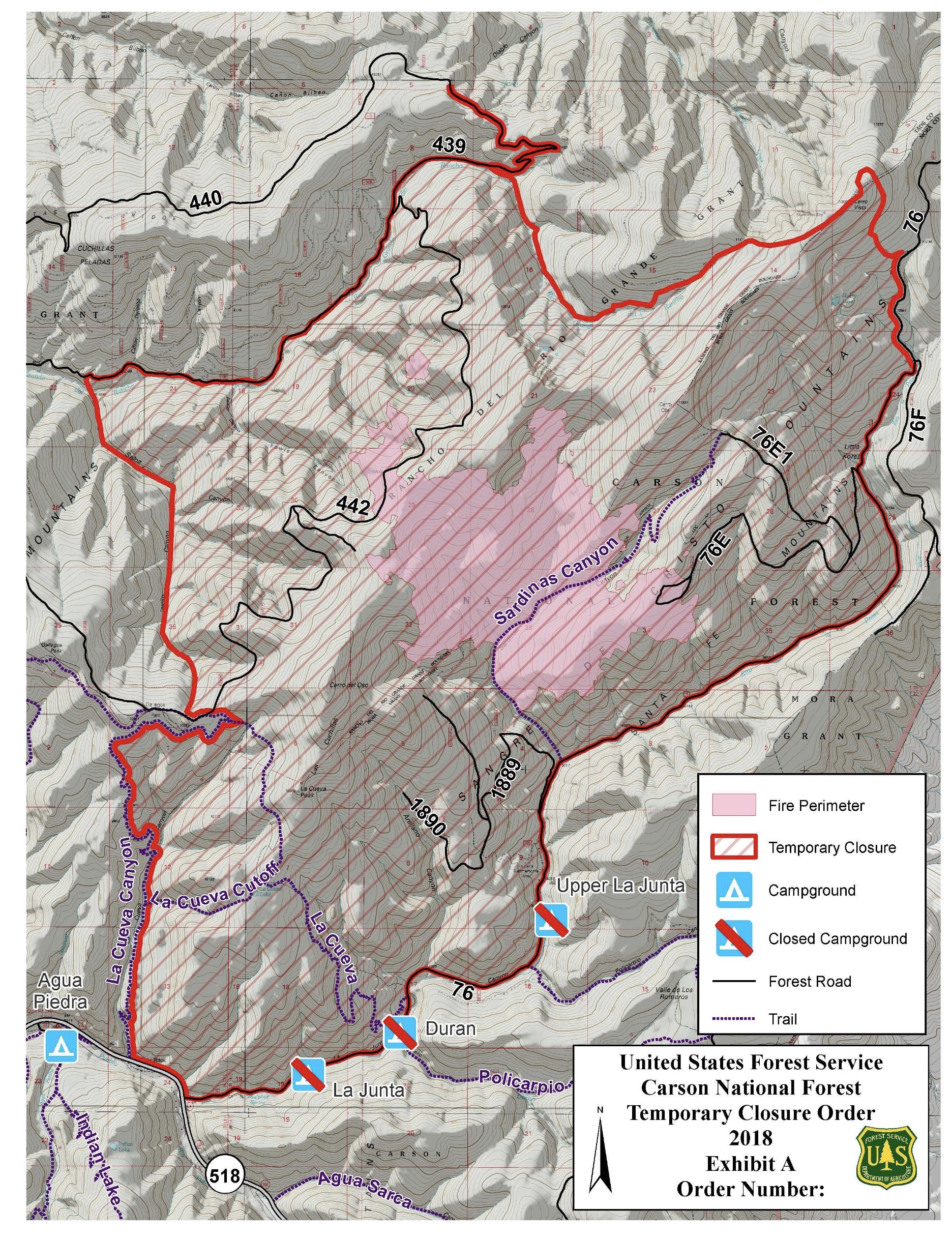
InciwebSardinas Canyon Fire
This fire near the border of Taos County is 2,337 acres and 50 percent contained. The fire was caused by human activity. It started 18 miles southeast of Taos, New Mexico.
7/13/18 UPDATE Sardinas Canyon Fire Temporary Closure t.co/XaHLF1witO
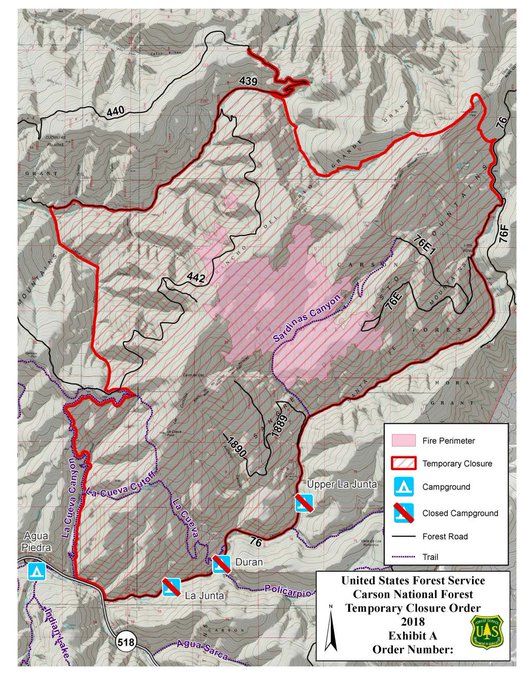
According to Inciweb: “Due to steep and inaccessible terrain, the northeast portion of the fire perimeter will not be fully contained until substantial rainfall occurs over the fire area. Crews will continue to monitor the fire. For more information please contact the Carson National Forest Supervisors Office at (575) 758-6200.”
Willow Fire
This fire is 600 acres and is now 100 percent contained. It was six miles east of Mogollon. It was caused by lightning.