National Weather Service
Hurricane Lane is currently a Category 4 storm that is heading toward Hawaii. While the hurricane isn’t expected to be a direct hit, it will come close enough to the islands to cause significant damage due to heavy rain and high winds.
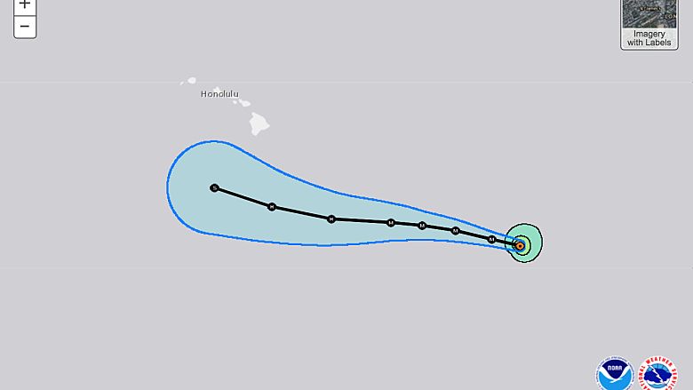
The latest GFS and Euro models tracking Hurricane Lane show that the storm is still very unpredictable as it approaches land. At this time, Lane doesn’t appear to make landfall on any of Hawaii’s islands. The models keep the storm in the Pacific waters off of Hawaii’s coast, approximately 100 miles from Lanai, Maui, Moloka’i, O’ahu, and Kauai.
“Lane, currently a Category 4 hurricane, will weaken slowly. However, its slow forward speed will result in an extended period of rain, wind and high surf, as compared to a fast-moving storm. Lane has turned more to the north since Wednesday and is expected to continue this path through Friday night. During this weekend, a turn back to the west is forecast,” AccuWeather reported on Thursday, August 23.
Although the storm isn’t expected to make landfall, the effects to the islands could be devastating in many areas. Preparations in the area have been underway for days as locals and tourists wait for the storm to arrive. A widespread 6 to 12 inches of rain is expected in many areas, with some predictions reaching 24 inches, especially in the mountainous regions.
Storm surge, flash floods, tornadoes, and mudslides are all possible during this storm. The wind has already picked up in many areas and will worsen as the weekend approaches. The worst of the storm is expected to end by Saturday afternoon.
“Throughout the islands, winds ranging from 30-60 mph will be common over the islands for a several-day stretch in some cases. Long-duration winds of this speed can push weak trees over and cause sporadic power outages,” reports AccuWeather.