Utah Fire Info
Utah is getting its fires under control, but you’ll still want to stay updated on the latest details. Here is a list of the major active fires on August 21, according to Utah Fire Info, NIFC.gov, and other sources, along with maps on where the larger ones are located. NIFC estimates there are four active fires in Utah, accounting for 55,174 acres.
You can view a map of all the Utah fires here. This map is being constantly updated. You can see a screenshot of Utah Fire Info’s current map below:
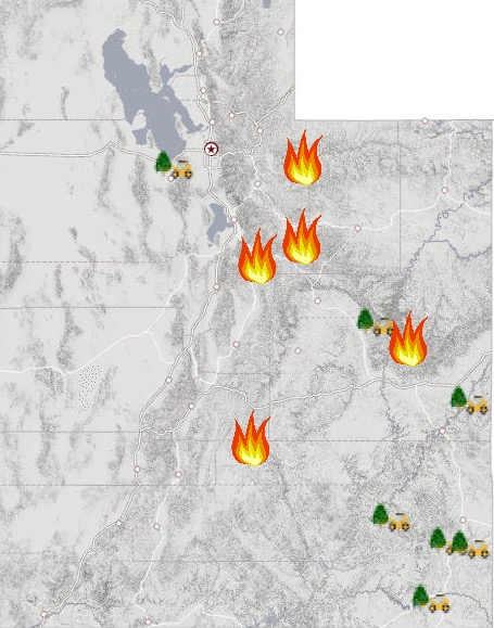
Utah Fire InfoUtah Fire Maps
Bear Trap Fire
This fire is 10.250 acres and 5 percent contained, according to NIFC. It’s 44 miles southeast of Price. It was caused by lightning. This is one of the more significant fire issues in Utah right now. The map above is the most recent map we have for the fire.
The fire is just north of Bear Trap Knoll, and west of Big Springs in Hill Creek. It’s on the Uintah and Ouray Indian Reservation, KUTV reported. Here’s the approximate location of the reservation:
KUTV reported that currently threatened areas include the Ute Tribe Youth Camp, private ranch land, and the Weaver Reservoir Recreation site.
On August 18, BIA Foresty & Wildland Fire – Uintah & Ouray Agency posted the most recent update about the fire on Facebook: “The past two night have brought rain over the Bear Trap Fire with last night receiving significant precipitation. Firefighters have completed cold trailing and securing the portions of line that is accessible bringing 5% containment to the fire. Firefighters are now engaged in road prep along the main Hill Creek road from Post Canyon south to Sun Rise dugway removing dead leaning trees (snags) and heavy ground fuels. In the event the fire becomes active and moves northeast the road will be utilized as a contingency line. Some resources are being demobilized from the fire and the plan is to transition down to two type 2 initial attack crews and two wildland engines by Monday. Firefighters have worked hard to secure the majority of the fire on the east and southeastern flanks of the fire but potential for uphill runs and group tree torching still remains on the north, west and southwest flanks. Total fire acreage remains at 10, 250 acres with 1,846 acres being on the BLM Canyon Country District. One minor injury has occurred but due to properly executed protocol the firefighter was treated, transported to a Price hospital, released and is now back on the fire. No structures have been lost. The Bear Trap started on July 21st as a result form a lighting strike on Bear Trap Ridge.”
Coal Hollow Fire
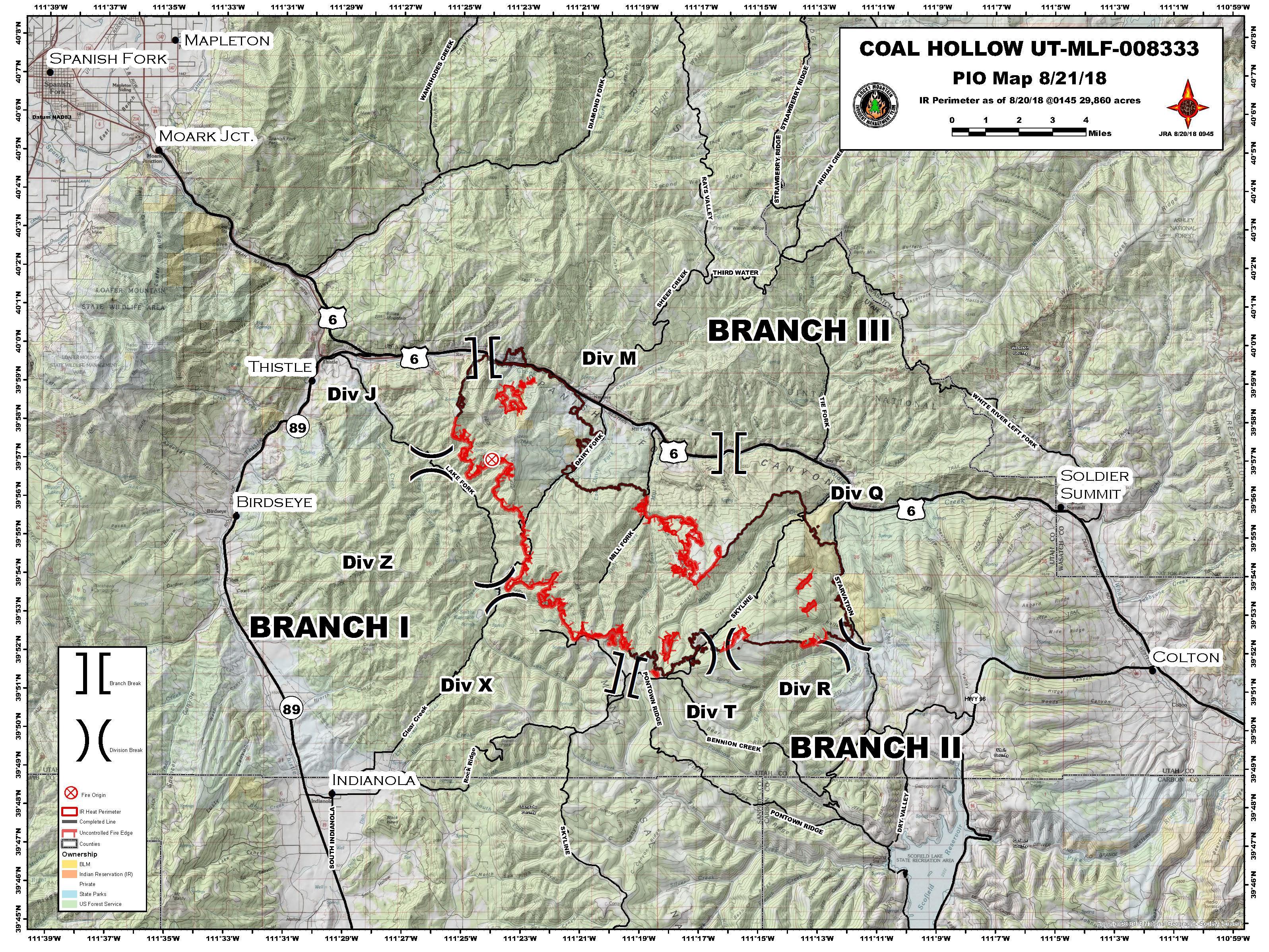
Coal Fire Map
This fire is 29,860 acres and 47 percent contained. It’s 11 miles northeast of Price and 15 miles southeast of Spanish Fork, Utah. It was caused by lightning. It’s near SR-6 and Dairy Fork.
For updated details on this fire, call 435.427.0846 or 435.427.4849.
Current evacuations and closure updates as of August 21 include:
- “The Uinta-Wasatch-Cache National Forest closure orders and the pre-evacuation orders of Zones 2 and 15, north of Hwy 6, have been lifted.
- “On the Manti-La Sal National Forest south of Hwy 6, all evacuation orders and National Forest closures remain in effect today.
- “Forest officials plan to increase the closure order on the west side of the Lake Fork Road as the fire slowly moves into that area as a precautionary measure.”
Here’s an evacuation map from August 21:
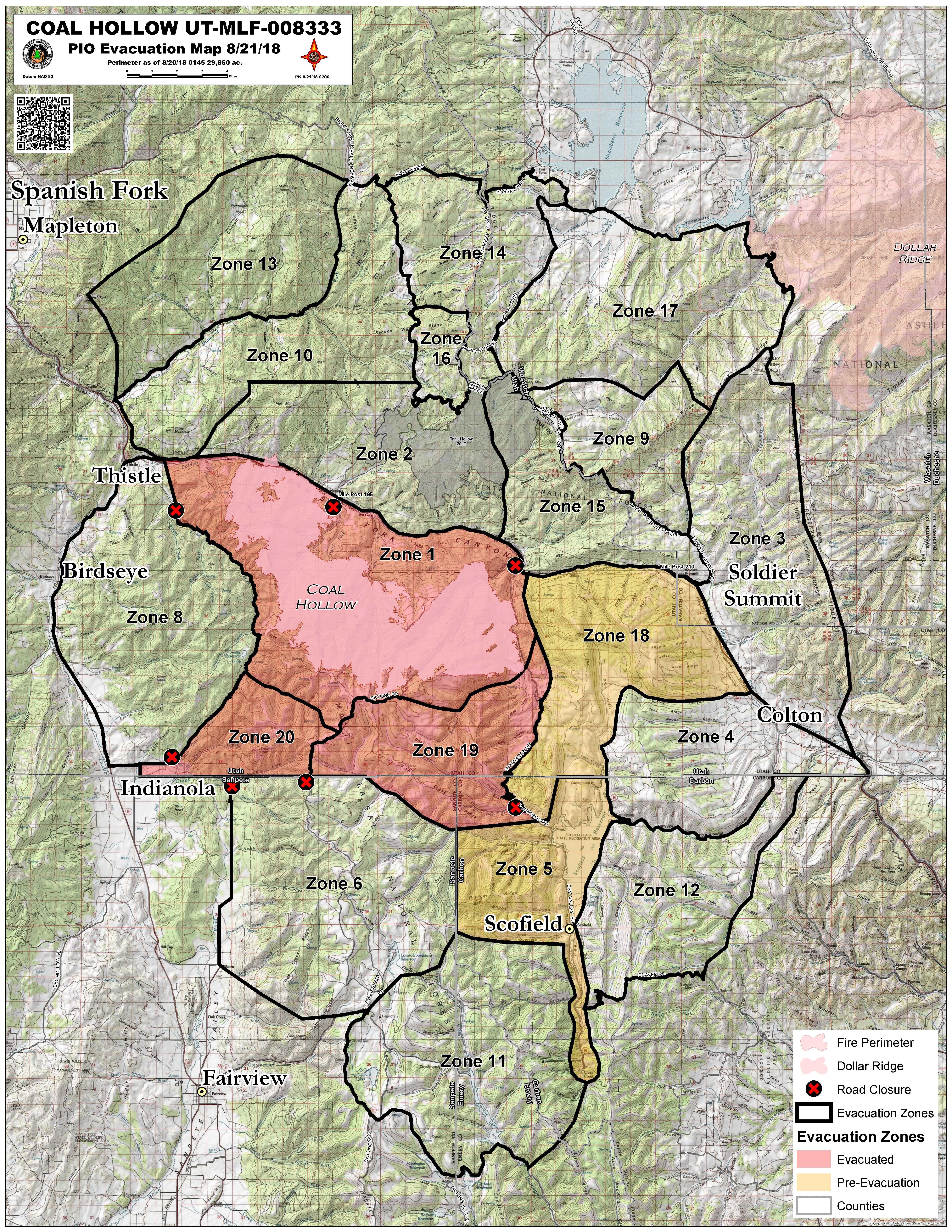
Coal Fire Evacuation Map
Dollar Ridge Fire
The Dollar Ridge fire is southeast of Strawberry Reservoir and has been burning on national forest land. As of August 17, it was 68,869 acres and 94 percent contained. NIFC lists the fire as being 100 percent contained. The fire was caused by human activity.
The fire is located 36 miles southeast of Heber and 8 miles southwest of Duchesne, Utah.
Notch Fire
This is listed on Utah Fire Info’s map. It was caused by lightning and is not making any significant growth, but the terrain is difficult to access. It’s been active since July 31, and is 7 acres in size and 48 percent contained.
It’s located 25 miles northeast of Kama, 4.5 miles north of the Crystal Lake trailhead, and 1/2 mile east of Ibantik Lake.
Pole Canyon Fire
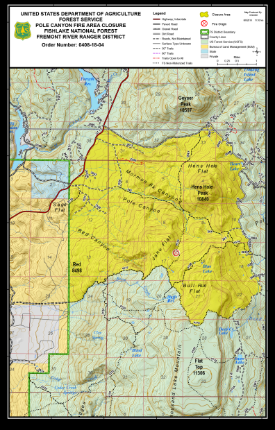
InciwebPole Canyon Fire Closure Map
This fire is in Fishlake National Forest. It’s 365 acres and 50 percent contained. It’s 10 miles northeast of Loa at 38.464 latitude, -111.489 longitude. The fire is on Utah Fire Info’s map but is not listed on NIFC’s list of Utah fires. Inciweb last updated details about this fire four days ago.
Willow Creek Fire
This fire is 1,311 acres and 99 percent contained, per NIFC.gov. It was caused by lightning and is located north of Highway 40 and Strawberry Reservoir on the Heber-Kamas Ranger District. Inciweb no longer considers this an active fire.