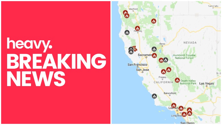
CAL FIRE California Fire Map Near Me
With the Charlie Fire growing in size fast, this is the time to get updated again on all the fires in California and their maps, containment levels, and sizes. Here are the latest updates on all the fires in California as of September 22, with a roundup of maps of the larger fires around the state. News is constantly changing, so call your local officials if you are concerned about evacuations near you.
NOTE: If you are looking for an updated story for October 7, see Heavy’s new story about California fires here.
Interactive Maps of California Fires
This map below is an interactive map of the more significant fires in California, consistently updated and provided by CAL FIRE and Google. Fires in red are active and fires in black are contained. Read the next section for details about the fires listed on the map. You may need to zoom into this map to see California up close.
The California Governor’s office has another active fire map for comparison, which is embedded below. This map periodically is made available only to those with a login, so if it’s not available when you’re reading this story, it might be released to the public again later. This map includes a major incident summary for the day.
Below is another active fire map from Google’s Crisis Map. Zoom in to see areas of interest. This map also includes fires in other states.
Next are more specific details on the fires for September 22. The details are extensive, so if you are looking for a specific fire, search for the name so you can find it faster, or just scroll down and look at the fires, listed in alphabetical order.
List of Active Fires in California as of September 22
Here are the active fires and updates about them, per CAL FIRE. Most of these are in alphabetical order, but newer fires not yet listed on the CAL FIRE map may be included in a separate section at the end.
Charlie Fire
Firefighters are battling 100 acre wildfire near Charlie Canyon Rd and Tapia Canyon Rd, Castaic (Los Angeles County). #CharlieFire t.co/Bh4eUQtKHE
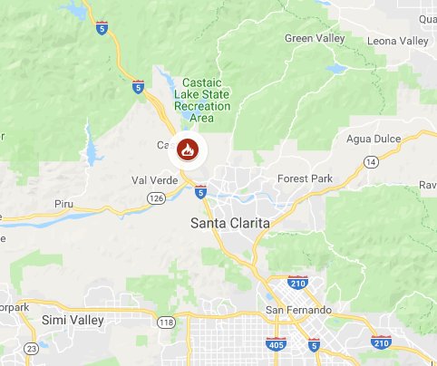
This fire started on September 22 and in just a few hours grew from 100 to 1,200 acres. It started near Charlie Canyon Road in Castaic in Los Angeles County. Around 7 p.m. Pacific Cal Fire updated its numbers and said the Charlie Fire is now 3,000 acres in size. Some sources are saying there is 10 percent containment on this fire.
It was first reported around 2:40 p.m. local time at 31050 Charlie Canyon Road, and then it grew quickly.
Ten structures are threatened. A strike team has been sent to help fight the fire.
Current evacuations include:
- A mandatory evacuation for San Francisquito Road from Tapia to Dry Gulch and Lowridge Place up to Camp 14 (per ABC 7) The LA County Sheriff’s department had said earlier that no residents were being evacuated but this has since changed.
- Now, residents on San Francisquito Canyon Road are being asked to evacuate, as of 9 p.m. Central (7 p.m. Pacific) the LA County Sheriff’s department noted. This includes 20 to 50 homes near Camp 14.
- A paintball park nearby was evacuated early on in the fire’s growth.
- The Castaic Sports Complex on 31230 Castaic Road is an evacuation center now.
Preventative measures are being taken now. Residents on San Fracisquito Cyn Rd are asked to evacuate. The road is now closed from Camp 14 to Lowridge Place. Evacuation Center: Castaic Sports Complex 31230 Castaic Rd, Castaic #LASD @LACOFD #CharlieFIre
Closures include San Francisquito Canyon between Lowridge Place and Camp 14, and Lake Hughes Road between Ridge Route and Dry Gulch Road, KTLA 5 reported.
CAL FIRE’s page for this fire is here. The cause of the fire is being investigated.
This map below may give you a better idea of where the Charlie Fire is, but you may need to zoom in to see it:
Follow CAL FIRE, Santa Clarita City, and the LA County Sheriff’s office for the latest updates.
Copper Fire
Firefighters are battling a 12 acre fire near McKenzie Meadows and Hwy 36, west of Susanville (Lassen County) #CopperFire t.co/HliVZZaSTo
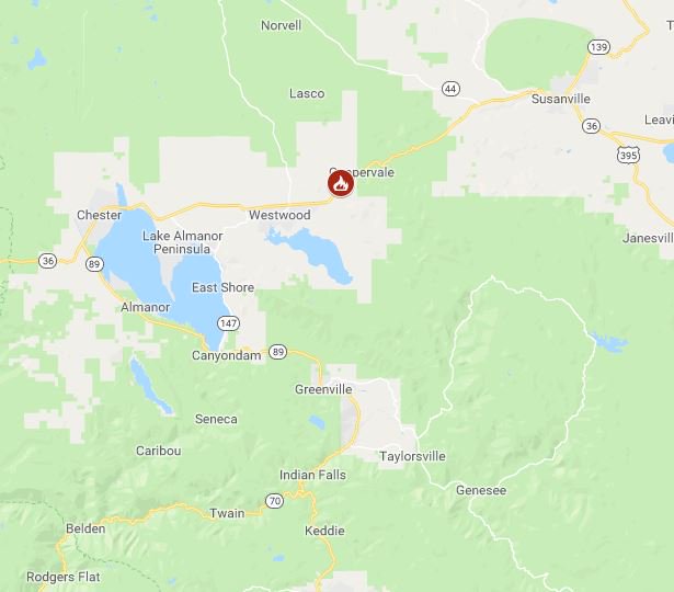
It’s not on CAL FIRE’s map, but as of September 22, officials were battling a 12 acre fire near McKenzie Meadows and Highway 36 in Lassen County, west of Susanville, according to CAL FIRE.
Delta Fire
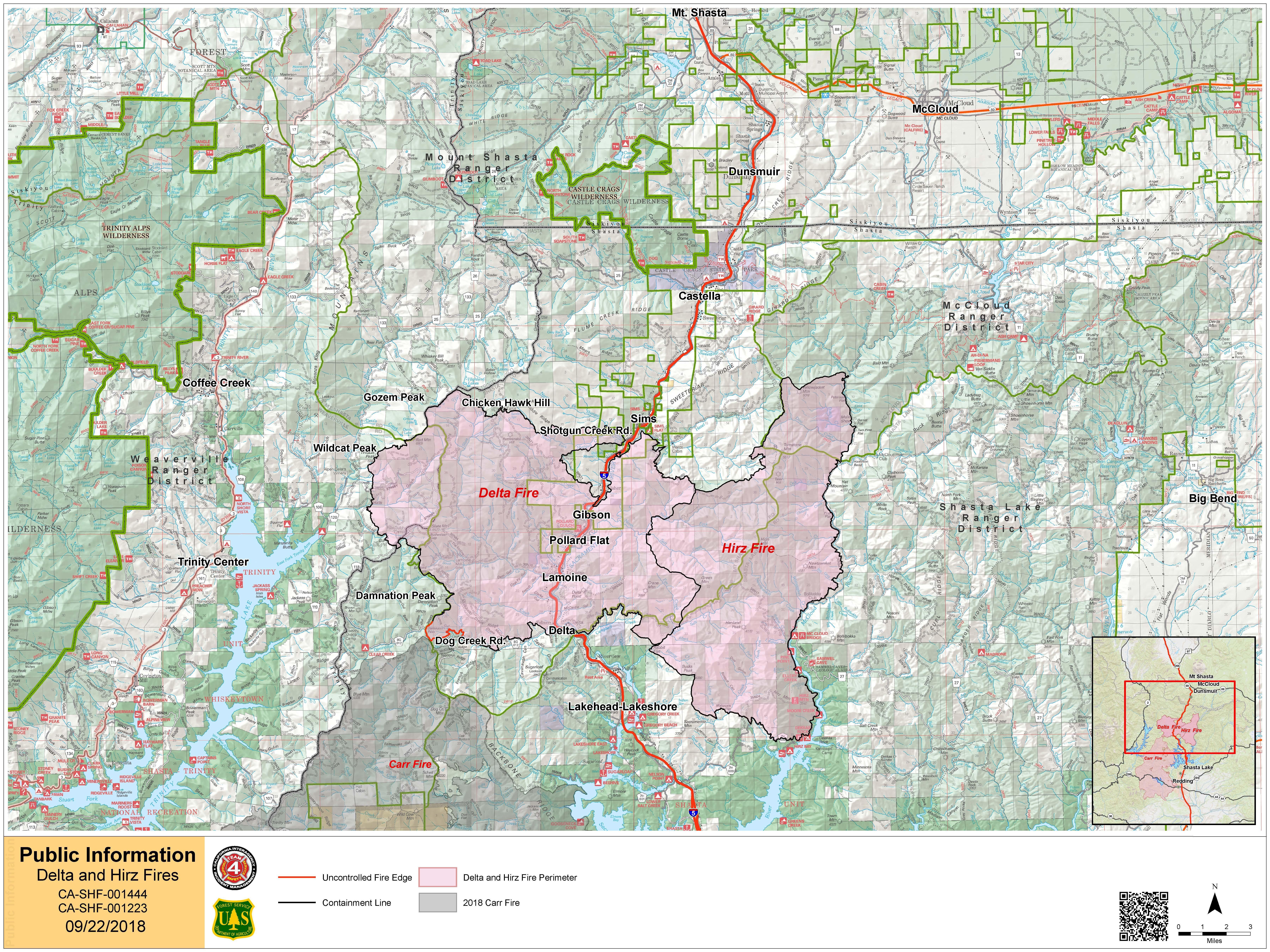
InciwebDelta and Hirz Fire Map
The Delta Fire is 60,705 acres and 96 percent contained as of September 22, after first being reported on September 5 near the Vollmers exit on I-5 north of Lakehead, California. It was initially three fires that merged into one fire. The fire was caused by human activity.
Mandatory evacuations issued by the Shasta County Sheriff’s Office were lifted at 12 p.m. on September 16, so there are no current evacuations or advisories. But the public should stay vigilant of fire conditions. Twenty structures were destroyed in the fire. The Delta Fire information line is 530-498-0953. Leave a message if someone doesn’t answer.
Donnell Fire
This fire is in the Stanislaus National Forest and is 36,450 acres with 90 percent containment, as of September 13. A total of 54 structures were destroyed and there were nine injuries. The fire started at the inlet of the Donnell Reservoir. The cause is not known, and Inciweb is no longer updating details about this fire, as it is now well contained. The fire information line is 209-536-5388.
Essex Fire
CAL FIRE is helping Modoc National Forest with this fire, which is located east of Essex Reservoir and northeast of Canby in Modoc County. The fire is still listed as active on CAL FIRE’s map as of September 19, but CAL FIRE hasn’t released any updates on the fire since September 4.
Fork Fire
“CAL FIRE is assisting the Angeles National Forest with a wildfire off East Fork Rd & San Gabriel Canyon Rd, Azusa (Los Angeles County),” according to CAL FIRE’s map listing. According to Inciweb, the fire is 166 acres and 98 percent contained as of September 19. The cause is under investigation. It’s located at San Gabriel Canyon, Highway 39 near the East Fork junction.
Garner Complex Fire
Although still listed on CAL FIRE’s map as active, it is no longer considered an active fire by Inciweb, which is no longer updating details about it. It’s 8,886 acres and 85 percent contained as of August 9.
Georges Fire
This fire has been inactive for several weeks and is 95 percent contained, per Inciweb on August 24. It is still listed on CAL FIRE’s map, but Inciweb no longer considers it active.
Holy Fire
The Holy Fire formed on August 6 in the afternoon and quickly grew. The Holy Fire was in Orange County, off Holy Jim Canyon Road, west of the North Main Divide. As of September 13, the fire is 23,136 acres according to Inciweb and 93 percent contained.
The cause is under investigation, but authorities have arrested Forrest Gordon Clark on suspicion of felony arson. Read more about Clark in Heavy’s story here.
A public information hotline has been set up at 714-628-7085 for the Holy Jim area. The fire is no longer considered active by Inciweb (although it’s listed as active on CAL FIRE’s map) and Inciweb is no longer updating details about the fire.
Lions Fire
This fire is listed on the CAL FIRE map as active, but Inciweb no longer considers it active. It’s 13,347 acres and 85 percent contained as of September 10. It’s located seven miles southwest of Mammoth Lakes. It was caused by lightning. Most of the fire is on the Sierra National Forest, but about 1,600 acres are on the Inyo National Forest. The fire is now in monitoring status and is no longer considered active.
Meyers Fire
This fire near Meyers Road in Camino in El Dorado County is 12 acres and 95 percent contained, CAL FIRE reported. Evacuations and road closures have been lifted.
Natchez Fire
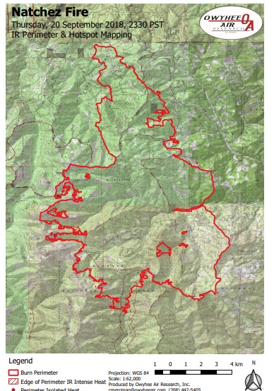
InciwebNatchez Fire Map
This Oregon fire falls under the jurisdiction of the Oregon Department of Forestry Fire, but is also listed on the CAL FIRE map. It’s 33,440 acres acres according to NIFC, and 84 percent contained. It was caused by lightning. It’s located 15 miles southeast of Cave Junction, Oregon, located on the Oregon/California border between Happy Camp, California and Cave Junction, Oregon.
According to Inciweb: “Suppression operations include a mountain-to-mountain containment approach, using natural barriers and fire breaks through sparsely vegetated ridgetops, supplemented with retardant drops from aircraft. Where timber stringers represent a fuel bridge from one valley to the next, low-intensity ground- and aircraft-delivered ignitions have been used to improve control lines. This ridgeline containment strategy has worked to stop the fire spreading from Mud Lake to El Capitan.”
Inciweb notes the following regarding evacuations and closures:
- “Evacuations: Evacuation Warning notices are in place for three private in-holdings northwest of Happy Camp. Changes in these evacuation notices can be obtained directly from the Siskiyou County Sheriff’s Office Facebook page at https://www.facebook.com/SiskiyouCountySheriff/. The community of Sunstar remains in a Level 1 evacuation “Ready” status. Changes in these notifications can be obtained directly from the Del Norte County Sheriff’s Office Facebook page at https://www.facebook.com/DelNorteCountySheriffDepartment/
- “Closure Orders: Two Closure Orders are in effect for the national forest roads, trails, and lands near the Natchez Fire area. Both Closure Orders can be found on Inciweb at:https://inciweb.nwcg.gov/incident/closures/5948/
- “Closure Order No. 18-05-012 is in effect on the Happy Camp/Oak Knoll RD, Klamath NF.
- “Closure Order No. 06-10-22-18-61 is in effect on the Wild Rivers RD, Rogue River – Siskiyou NF.”
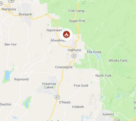
Oak Fire
Seriously? Again? #OakFire
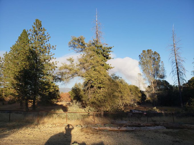
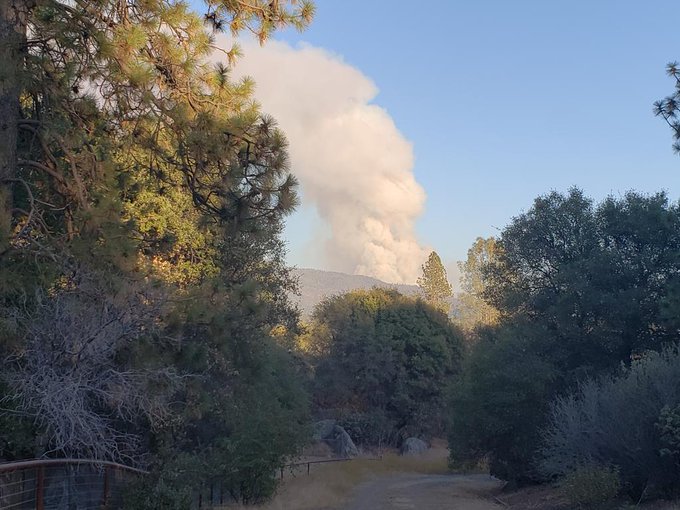
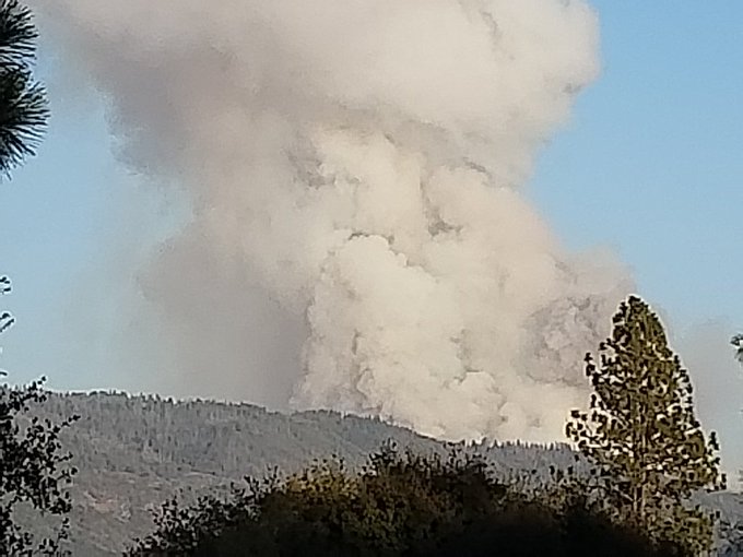
This is a 250-acre fire near Lonesome Oak Road and Bissett Station Road in Ahwahnee. This Mariposa County fire started as a vegetation fire in the area of Rd. 628 and Rd. 620. It’s just three miles north of Oakhurst. From 4 p.m. to 6 p.m. it grew from five acres to 150 acres. Then around 7:30 p.m. Pacific, CAL FIRE upgraded its size to 250 acres.
Evacuations are currently in progress for Road 620, Road 628, and Lonesome Oak, and the Cedarbrook Community of Timber Loft on 6S09 and 6S14B 5S12 Forest Service Road, CAL FIRE reported.
The Red Cross is establishing an evacuation center at Oakhurst Community Center at 39800 Fresno Flats Road.
Oak Fire’s official page is here. Here’s a look at the Oak Fire’s location before it grew:
firefighters are battling a 15 acre wildfire near Lonesome Oak Ln and Bissett Station Rd, Ahwahnee (Maderea County) #OakFire t.co/SUgCIbywiX
Ranch Fire (Mendocino Complex Fire)
This fire was the largest in California’s history at one point, but now it is almost completely contained. It is no longer listed as active on CAL FIRE’s map.
Soboba Fire
According to CAL FIRE’s active listing for this fire: “CAL FIRE is assisting the Soboba Fire Department with a fire off Soboba Rd. San Jacinto, northeast of San Jacinto City, Soboba (Riverside County).” It’s listed as active on CAL FIRE’s map, but more recent reports indicate that it was fully contained a few days ago.
#SobobaFire Indian Creek Road X Soboba Road northeast of San Jacinto City #RiversideCounty. The fire is 100% contained at approximately 25 acres.
Valley Fire
The Valley fire is 1,350 acres and 82 percent contained as of September 10. It’s at the Valley of the Falls Dr. and Service Road 1S08. According to Inciweb, minimal to no growth is expected and very little fire spread is expected. However, hot and dry conditions have helped the fire stay active. Inciweb isn’t actively updating this every day. The cause of the fire is under investigation.
READ NEXT: Forrest Gordon Clark accused of starting a California fire