
The Charlie Fire grew from just 100 acres to 1,200 acres in just a few hours in Castaic in Los Angeles County, and fire officials sent in a strike team to try to get the fire under control. Here are the current updates about the fire, how to see maps of the fire, and additional details. Remember that evacuation details can change quickly, so follow your local news to see if anything has changed since this story was last updated. Here are recent details about the Charlie Fire.
Interactive Maps of the Charlie Fire
Firefighters are battling 100 acre wildfire near Charlie Canyon Rd and Tapia Canyon Rd, Castaic (Los Angeles County). #CharlieFire t.co/Bh4eUQtKHE
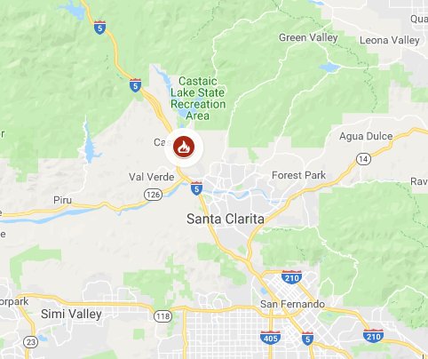
The fire started near Charlie Canyon Road in Castaic in Los Angeles County. This first map below is a Google Crisis Map focused specifically on wildfires. It shows all of California, but should be zoomed in to focus on the location of the Charlie Fire. If it is not, you may need to zoom in the map yourself.
This map below is an interactive map of the more significant fires in California, consistently updated and provided by CAL FIRE and Google. Fires in red are active and fires in black are contained. You can zoom into Los Angeles County to see the Charlie Fire.
Below is another active fire map from Google’s Crisis Map. Zoom in to see the Charlie Fire.
We will add more maps as they become available. This hasn’t yet been added to Inciweb.
Charlie Fire Size & Evacuation Details
This fire started on September 22 and in just a few hours grew from 100 to 1,200 acres. As of 7 p.m. Pacific, CAL FIRE said the Charlie Fire is now 3,000 acres in size.
#CharlieFire [update] near Charlie Canyon Rd and Tapia Canyon Rd, Castaic (Los Angeles County) is now 3000 acres, t.co/Bh4eUQtKHE
The fire is about 10 percent contained, some sources are noting.
Multiple structures are threatened. A strike team has been sent to help fight the fire.
Current evacuations include:
- A mandatory evacuation for San Francisquito Road from Tapia to Dry Gulch and Lowridge Place up to Camp 14 (per ABC 7) The LA County Sheriff’s department had said earlier that no residents were being evacuated but this has since changed.
- Now, residents on San Francisquito Canyon Road are being asked to evacuate, as of 9 p.m. Central (7 p.m. Pacific) the LA County Sheriff’s department noted. This includes 20 to 50 homes near Camp 14.
- A paintball park nearby was evacuated early on in the fire’s growth.
Preventative measures are being taken now. Residents on San Fracisquito Cyn Rd are asked to evacuate. The road is now closed from Camp 14 to Lowridge Place. Evacuation Center: Castaic Sports Complex 31230 Castaic Rd, Castaic #LASD @LACOFD #CharlieFIre
The Castaic Sports Complex on 31230 Castaic Road is an evacuation center now.
Closures include San Francisquito Canyon between Lowridge Place and Camp 14, and Lake Hughes Road between Ridge Route and Dry Gulch Road, KTLA 5 reported.
How to Stay Updated on the Charlie Fire
There are several ways to stay updated on the fire. CAL FIRE’s page for this fire is here. Also, you can follow CAL FIRE, Santa Clarita City, and the LA County Sheriff’s office on Twitter for the latest updates.
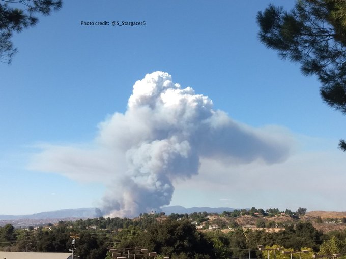
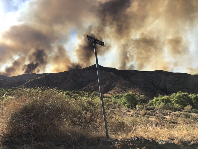
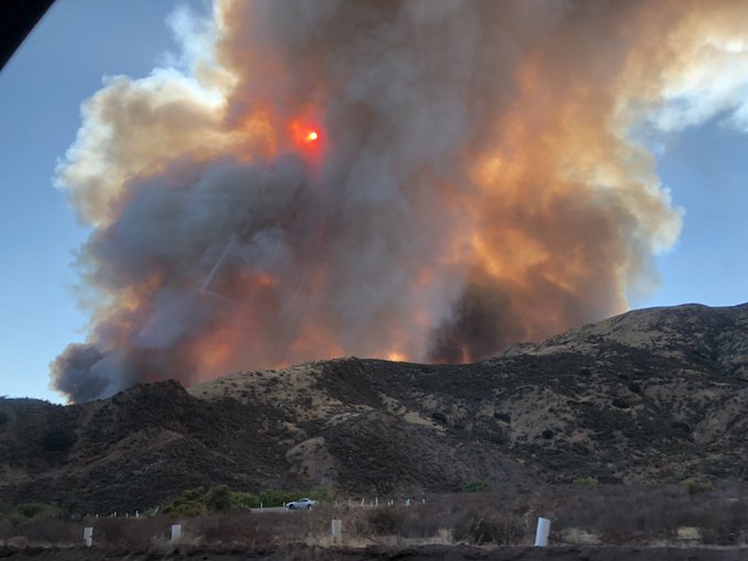
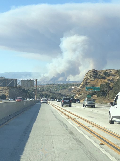
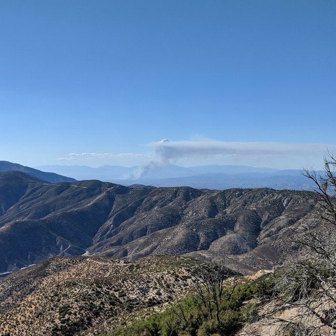
Videos & Photos of the Charlie Fire
Here are some videos and photos of the fire:
#charliefire a view driving down topanga canyon back to the valley.


View from the 14N passing Newhall #charliefire
#CharlieFire now 3000 acres with 10% containment 100 structures up the canyon threatened 20/30 homes be evac’d
Charlie Fire from above Angeles Forest Highway. #CharlieFire @NBCLA @ABC7
READ NEXT: See maps and details of all the fires in California.