FloridaDisaster.org
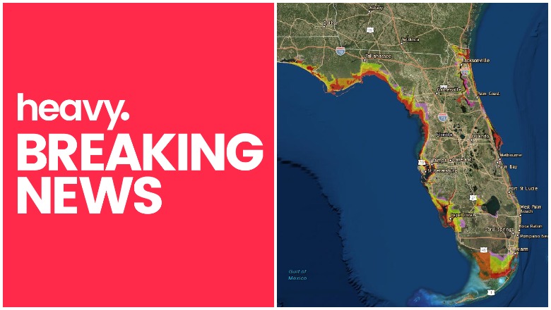
Evacuations are already being ordered in parts of Florida in anticipation of Hurricane Michael’s arrival. Here is a look at the evacuations currently in place, along with details about evacuation zones and routes. Evacuation orders can change quickly, so stay tuned to your local news for the most recent evacuation information.
So far, three Florida counties have issued mandatory evacuations for Hurricane Michael, which might strengthen to a Category 3 by the time it makes landfall, Tallahassee Democrat reported. Bay County, Gulf County, and Wakulla County have all issued mandatory evacuation orders.
This article will start out showing you where to find an interactive map of evacuation routes and zones for all of Florida. Next, it will share maps and route information specifically for the three counties with mandatory evacuation zones so far. After this, you will see a series of links to where you can find evacuation details and PDF maps for all the counties in Florida, whether or not they are under evacuation orders, so you can have the information handy in case you need it.
Interactive Maps of Evacuation Zones & Evacuation Routes in Florida & How to Locate Your Zone
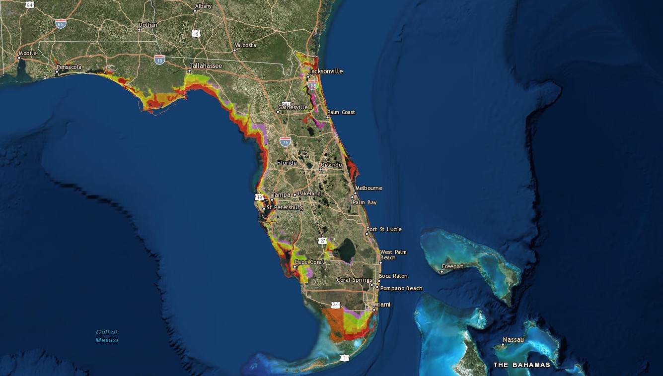
FloridaDisaster.orgFlorida Evacuation Zones
ARCGIS has a map here that shows all of Florida and the state’s evacuation zones. A screenshot of that map is above. The map also has an option for turning on evacuation routes and viewing them. You can enter your address into the map, no matter where you are in Florida, to find out exactly which zone you are in. Zones range from Zone A to Zone L.
Bay County Mandatory Evacuations Issued for Zones A, B, & C
Bay County’s mandatory evacuation affects Zones A, B, & C and goes into effect on Tuesday at 6 a.m., but residents who can evacuate on Monday should do so. Here is an evacuation zone map below. You can see the map in a larger size here. Bay County has four evacuation zones, and only Zone D is not affected.
These evacuation zones include parts of Panama City Beach.

Bay County FloridaBay County Evacuation Zone Map
To find out if you are in the evacuation zone, click here. Zones that are yellow, red, and gold are under mandatory evacuation orders. You can visit www.ready.gov or call 850-248-6040 with any questions or assistance.
A full-sized map where you can enter your address to find your evacuation zone in Bay County is here. You can also stay updated on Bay County Florida’s emergency services Facebook page.
Gulf County Evacuations Have Been Issued
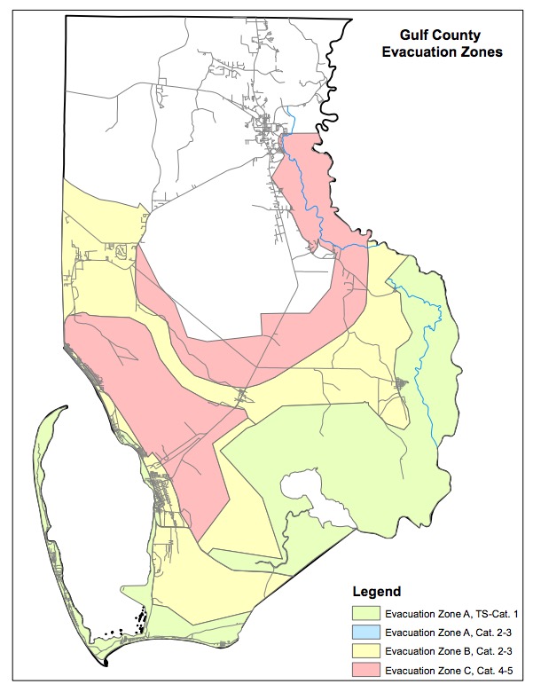
Gulf CountyGulf County Evacuation Zones Map
Mandatory evacuations have also been issued for Gulf County. These include:
- All of Cape San Blas
- All of Indian Pass area
- Simmons Bayou, Highland View
- Windmark
- In the City of Port St. Joe all areas from St. Joseph Bay to Long Avenue.
- St. Joe Beach and Beacon Hill – Waterside of Hwy. 98
- Those with high profile vehicles, living in mobile homes, low lying areas, or anyone who feels unsafe in their current location must evacuate – COUNTYWIDE
Voluntary evacuations were issued for Hwy 98 Inland on St. Joe Beach and Beacon Hill.
Here is a map of evacuation routes in Gulf County:

Gulf CountyGulf County Evacuation Routes Map
Honeyville Community Center will open at 10:00 a.m. Eastern, Tuesday, October 9, as a shelter. Bring food, water, blankets, medicine, comfort items for children, and other items you may need.
You can stay updated on Gulf County evacuation details here.
Wakulla County Evacuations

Wakulla CountyWakulla County Evacuation Zone Map
Meanwhile, in Wakulla County, mandatory evacuations are issued for Zone A (coastal and low-lying areas) as of 8 p.m. Monday night, and for mobile homes and other weak structures. The rest of the county is under a voluntary evacuation order. There will be no shelters in Wakulla County because they are all rated only for a Category 2.
How to Find Evacuation Zones, Maps, & Routes in All Florida Counties, Even If They Are Not Currently Under Evacuation Orders
Florida has extensive evacuation details for all counties. We’re providing links to where you can find evacuation information for any relevant county, whether or not that county is under an evacuation order.
Each of the links in this first section below will take you to county-specific evacuation information and emergency websites for counties that have evacuation zones. This information is provided by FloridaDisaster.org.
- Bay
- Bradford
- Brevard
- Broward
- Charlotte
- Citrus
- Clay
- Collier
- DeSoto
- Duval
- Escambia
- Flagler
- Franklin
- Gulf
- Hernando
- Hillsborough
- Indian River
- Lee
- Leon
- Levy
- Manatee
- Martin
- Miami-Dade
- Monroe
- Nassau
- Okaloosa
- Palm Beach
- Pasco
- Pinellas
- Putnam
- Santa Rosa
- Sarasota
- St Johns
- St Lucie
- Taylor
- Volusia
- Wakulla
- Walton
The following set of links are for counties that do not have designated evacuation zones. Here is where to find more emergency information in these areas. This information is provided by FloridaDisaster.org.
- Alachua
- Baker
- Calhoun
- Columbia
- Dixie
- Gadsden
- Gilchrist
- Glades
- Hamilton
- Hardee
- Hendry
- Highlands
- Holmes
- Jackson
- Jefferson
- Lafayette
- Lake
- Liberty
- Madison
- Marion
- Okeechobee
- Orange
- Osceola
- Polk
- Seminole
- Sumter
- Suwannee
- Union
- Washington
To specifically see Evacuation Zone routes and maps per specific counties, visit the following links. These will take you directly to PDF maps for each county. This information is provided by FloridaDisaster.org. Remember: only three counties are currently under evacuation orders as of the evening of October 8, so these links are for informational purposes.
- Alachua
- Baker
- Bay
- Bradford
- Brevard
- Broward
- Calhoun
- Charlotte
- Citrus
- Clay
- Collier
- Columbia
- DeSoto
- Dixie
- Duval
- Escambia
- Flagler
- Franklin
- Gadsden
- Gilchrist
- Glades
- Gulf
- Hamilton
- Hardee
- Hendry
- Hernando
- Highlands
- Hillsborough
- Holmes
- Indian River
- Jackson
- Jefferson
- Lake
- Lafayette
- Lee
- Leon
- Levy
- Liberty
- Madison
- Manatee
- Marion
- Martin
- Miami-Dade
- MonroeNassau
- Okaloosa
- Okeechobee
- Orange
- Osceola
- Palm Beach
- Pasco
- Pinellas
- Polk
- Putnam
- Santa Rosa
- Sarasota
- Seminole
- St. Johns
- St. Lucie
- Sumter
- Suwannee
- Taylor
- Union
- Volusia
- Wakulla
- Walton
- Washington