National Hurricane Center
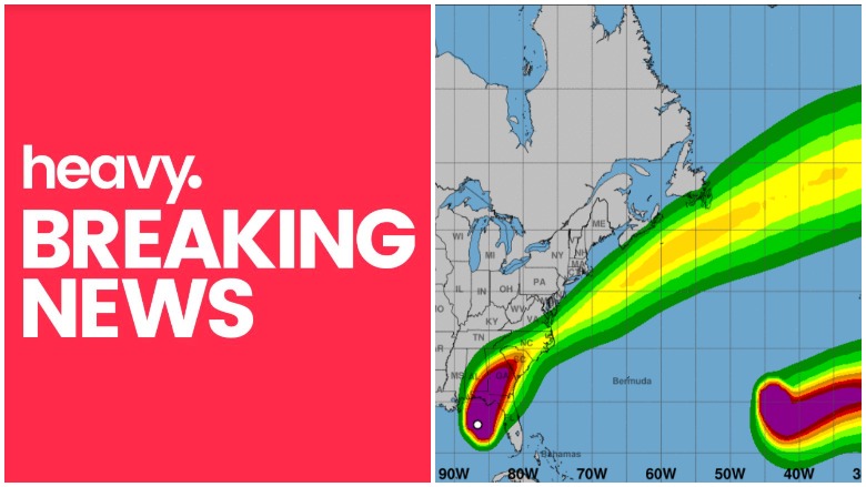
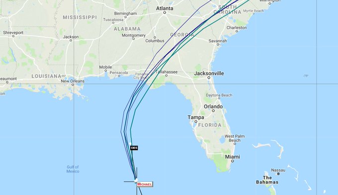
As Hurricane Michael turned into a Category storm and headed toward the Florida panhandle, spaghetti models provide a view of the storm’s path. The storm could become the strongest hurricane to ever strike the panhandle in history.
As a result, many people are closely watching the hurricane’s path to give them a sense of where it might strike (all projections are just that, of course, and are subject to change). It’s expected that the hurricane could make landfall around Panama City Beach, Florida.
Here is a listing of some of the best sites that you can use to track updated spaghetti models for Hurricane Michael:
Cyclocane
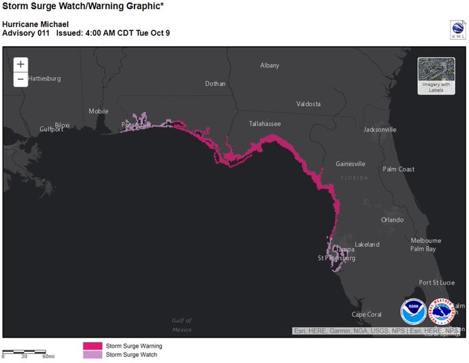
Water levels will rise well in advance of the arrival of #Michael. It’s essential that residents within the storm surge warning area finish preparations to protect life and property today.
Cyclocane has a page that contains continuously updated spaghetti models for Hurricane Michael. You can access it here. The site also has a page with additional weather forecast information about Hurricane Michael that you can see here.
NOAA
Hurricane Michael 2018 Projected Path 11 PM Update, Spaghetti Models #HurricaneMichael #Florida #Hurricane #Michael t.co/ZiDOcgucsc
NOAA is also a good place to check for updated Hurricane Michael spaghetti models and forecasts. Make sure you choose “Michael” via the storm ID tab that you see on the top left of the page.
Other Spaghetti Models
The South Florida Water Management District publishes a page of updated spaghetti models for hurricanes, including Michael. You can access all of the page’s hurricane model plots here. Choose “storm 14.”
Someone forgot to cook the spaghetti. #HurricaneMichael #Michael #FLwx
Local television stations in the Florida area are also broadcasting spaghetti models.
National Weather Service
#Michael continues to strengthen, and Storm Surge and Hurricane Warnings are in effect for portions of the Florida Gulf Coast. Here are the 10 AM CDT Key Messages for #Michael t.co/tW4KeGdBFb

The National Weather Service provides extremely detailed weather forecast, models, and radar for Hurricane Michael broken down by locality.
You can find the National Hurricane Center’s hurricane page here, which includes information about Hurricane Michael.
On the morning of October 10, 2018, the update read as follows:
“At 700 AM CDT (1200 UTC), the eye of Hurricane Michael was located
near latitude 29.0 North, longitude 86.3 West. Michael is moving
toward the north near 13 mph (20 km/h). A turn toward the north-
northeast is expected later this morning, with a turn toward the
northeast expected this afternoon or tonight. A motion toward the
northeast at a faster forward speed is forecast on Thursday and
Friday. On the forecast track, the eye of Michael is expected to
move ashore over the Florida Panhandle later today, move
northeastward across the southeastern United States tonight and
Thursday, and then move off the Mid-Atlantic coast away from the
United States on Friday.
Reports from an Air Force Reserve Hurricane Hunter aircraft
indicate that maximum sustained winds have increased to near 145 mph
(230 km/h) with higher gusts. Michael is an extremely dangerous
category 4 hurricane on the Saffir-Simpson Hurricane Wind Scale.
Some additional strengthening is possible before landfall. After
landfall, Michael should weaken as it crosses the southeastern
United States.
Hurricane-force winds extend outward up to 45 miles (75 km) from
the center and tropical-storm-force winds extend outward up to 185
miles (295 km). A wind gust to 56 mph (91 km/h) was recently
reported at Apalachicola Regional Airport.
The estimated minimum central pressure based on NOAA and Air Force
Reserve Hunter aircraft data is 933 mb (27.55 inches).”