A tornado watch has been issued for areas of Oklahoma and Texas on Monday through to the evening, with several areas in both states receiving the highest likelihood of a tornado in several years. Below you’ll find a compilation of photos and videos of tornadoes in both states, which will be updated through the evening.
The National Weather Service released a rare “high risk” warning for central Oklahoma in particular on Monday, warning the likelihood of tornadoes as well as flash flooding. The warning reads in part,
An outbreak of severe thunderstorms along with strong to violent, long-tracked tornadoes continues to unfold from northwest Texas into central Oklahoma and southwest Missouri this evening. In addition to tornadoes…very large hail, damaging winds and flash flooding are also occurring. Residents should heed any warnings issued and follow local forecast office social media pages for updates
Per KFOR, a tornado watch has been issued for the following counties in Oklahoma, through to 10 p.m. Monday evening:
- Atoka
- Beckham
- Blaine
- Bryan
- Caddo
- Canadian
- Carter
- Cleveland
- Coal
- Comanche
- Cotton
- Creek
- Custer
- Dewey
- Garfield
- Garvin
- Grady
- Greer
- Harmon
- Hughes
- Jackson
- Jefferson
- Johnston
- Kingfisher
- Kiowa
- Lincoln
- Logan
- Love
- Major
- Marshall
- McClain
- Murray
- Noble
- Okfuskee
- Oklahoma
- Okmulgee
- Osage
- Pawnee
- Payne
- Pontotoc
- Pottawatomie
- Roger Mills
- Seminole
- Stephens
- Tillman
- Tulsa
- Washita
According to AccuWeather, the cities under the highest risk of tornado occurrence are: Amarillo, Lubbock and Wichita Falls, Texas; Oklahoma City and Tulsa, Oklahoma; and Wichita, Kansas.
Here’s what you need to know:
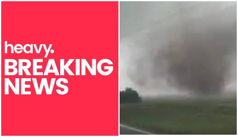
Photos & Videos of ‘Violent’ Tornadoes in Oklahoma & Texas
Our first tornado beginning to rope out near Paducah, TX around 3:00 PM. #TXWX @breakingweather @ReedTimmerAccu

According to AccuWeather, storms on Monday inspired golf ball-sized hail across the Texas panhandle and in Oklahoma. AccuWeather meteorologist Reed Timmer said in part that these Monday warnings are some of the “more prolific severe weather setups we have seen in several years.”
Tornado near Geary, Oklahoma. Tornado outbreak continues on the plains and blizzard conditions possible on the other side of the same storm system into parts of Wyoming and NE Colorado.
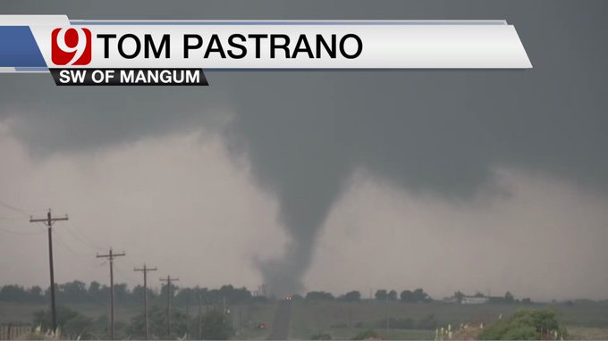
Several tornado sightings have already been reported in Oklahoma; per Tulsa World, they’ve been spotted in the areas of Crescent, Watonga, Perry, and Mangum.
Additionally, winds up to 80 mph have been been recorded in the area.
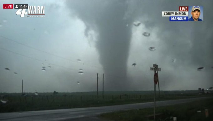
KFOR viewers seeing the formation of a tornado live on the air via Chopper 4– t.co/QCYDypnbuQ

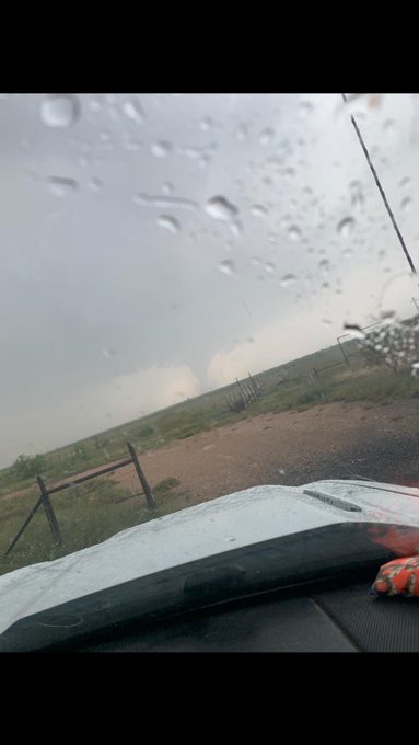
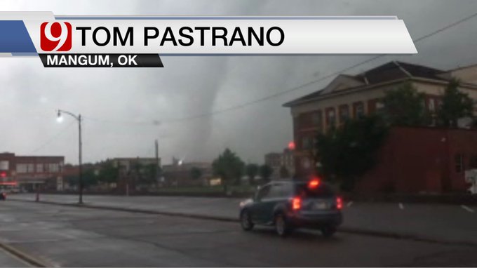
A tornado touched down in Mangum, Oklahoma, just after 6:45 p.m. on Monday, just missing the town itself. Per The Washington Post, this tornado was one of many that was spotted on Monday, but as of early evening there had fortunately been no disastrous incidents.
Oh boy… Mangum, OK 5:23pm (local time)
Many Twitter users have taken the opportunity to share a range of emotions, from fear to flat-out skepticism.
One Twitter user wrote, “Based off of Facebook, all of Oklahoma will be sucked up by a tornado.”
526pm – tornado crossing Hwy 283 north of Mangum @okcfoxweather

Another user wrote, “Living in Oklahoma during tornado season is so weird because on days like today, everyone just kinda walks around wondering if they’ll have a house by the end of the day and you can’t act too anxious but you also can’t ignore it ???”
Oh boy… Mangum, OK 5:23pm (local time)
“I better see a tornado today after all this hype #Oklahoma,” one person tweeted.
Mangum #okwx #tornado just missing the town earlier @accuweather @breakingweather
Meteorologist Ed Russo took the time to explain what exactly it means when there’s a tornado warning for an area. He tweeted, “On any given day the chance of a tornado within 25 miles of you is well below 0.1%. Yesterday, the chance of a tornado was 2% since we had strong t’storms. Statistically, that’s significant. The probabilities across Texas & Oklahoma today are remarkable, & terrifying. #txwx #okwx”
This was near 1788 west near Pleasant Farms. Sent into our newsroom about 5 minutes ago
Tornado looks to be on the ground in Midland County