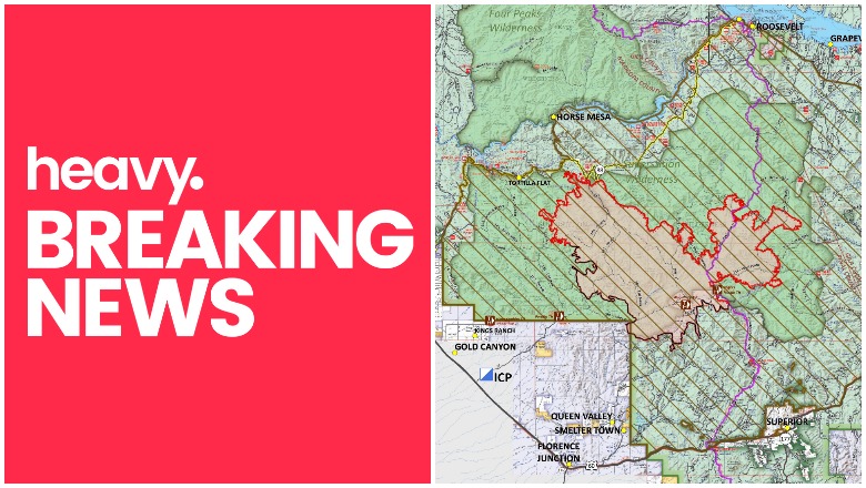
Inciweb
The Woodbury Fire on the Superstition Mountains in Arizona is still growing and for the first time, evacuations have been issued for the fire as it begins to move out of the Superstition Mountains. As of the evening of June 20, the fire is now more than 50,000 acres in size. Even though containment has increased, evacuations had to be ordered for some nearby communities. Stay tuned to local media for the latest reports and see our list at the end of this story of local social media sites providing updates. Here is what we know so far about the Woodbury Fire as of June 20, 2019.
Woodbury Fire Maps & Size
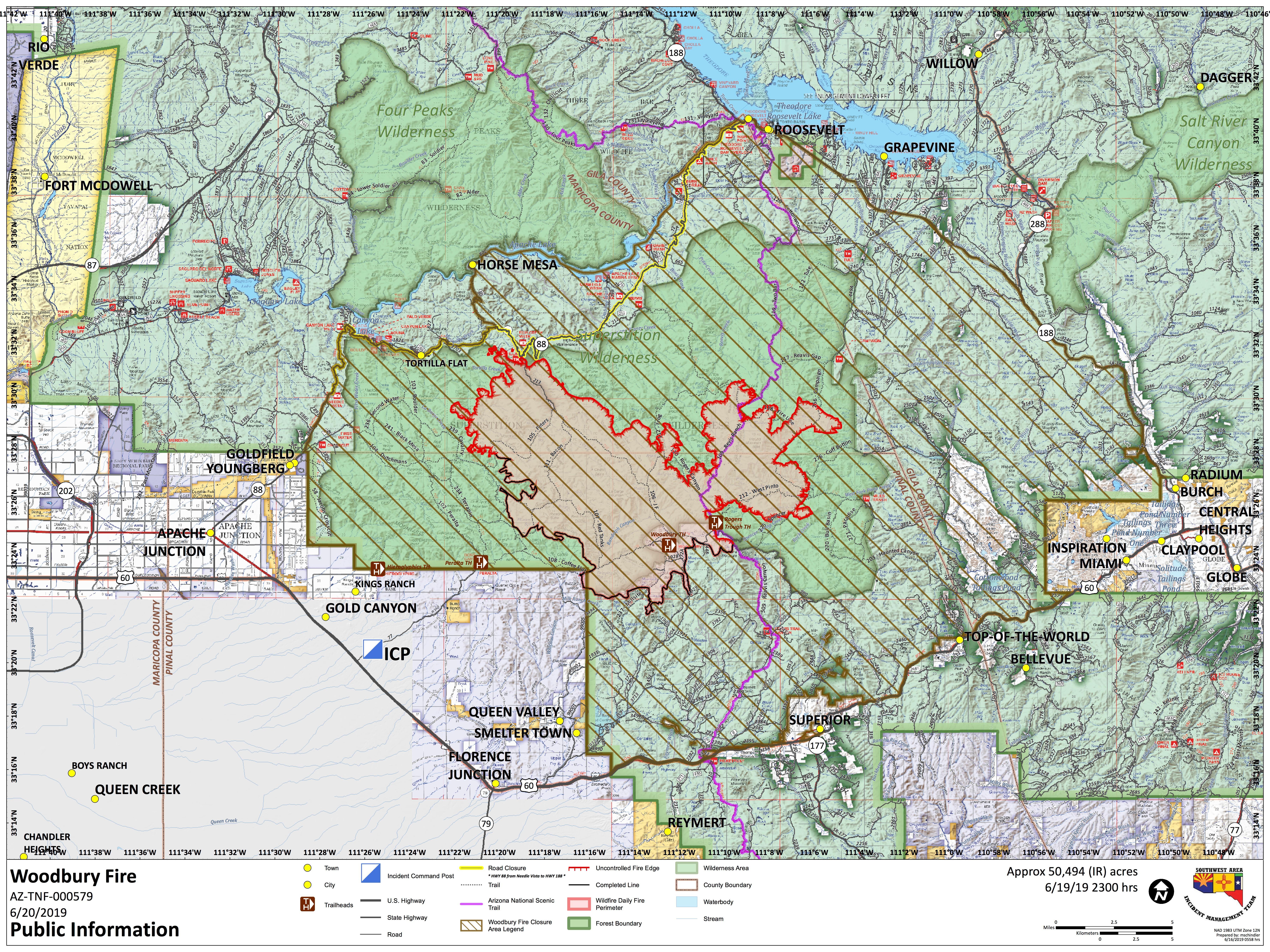
The Woodbury fire is in the Superstition Mountains northwest of Superior, Arizona, but now it is poised to move east out of the Superstitions, Inciweb noted on June 20 at 6 p.m.
The fire is now 50,494 acres in size and containment has increased to 41 percent. But because of the fire’s movements, there are dangers now that did not exist several days ago.
The following embedded map of the fire is provided by MappingSupport.com and Joseph Elfelt.
The fire was originally noted as being human-caused, but now the cause has changed to “unknown.” Here is a perimeter map of the fire for June 20:
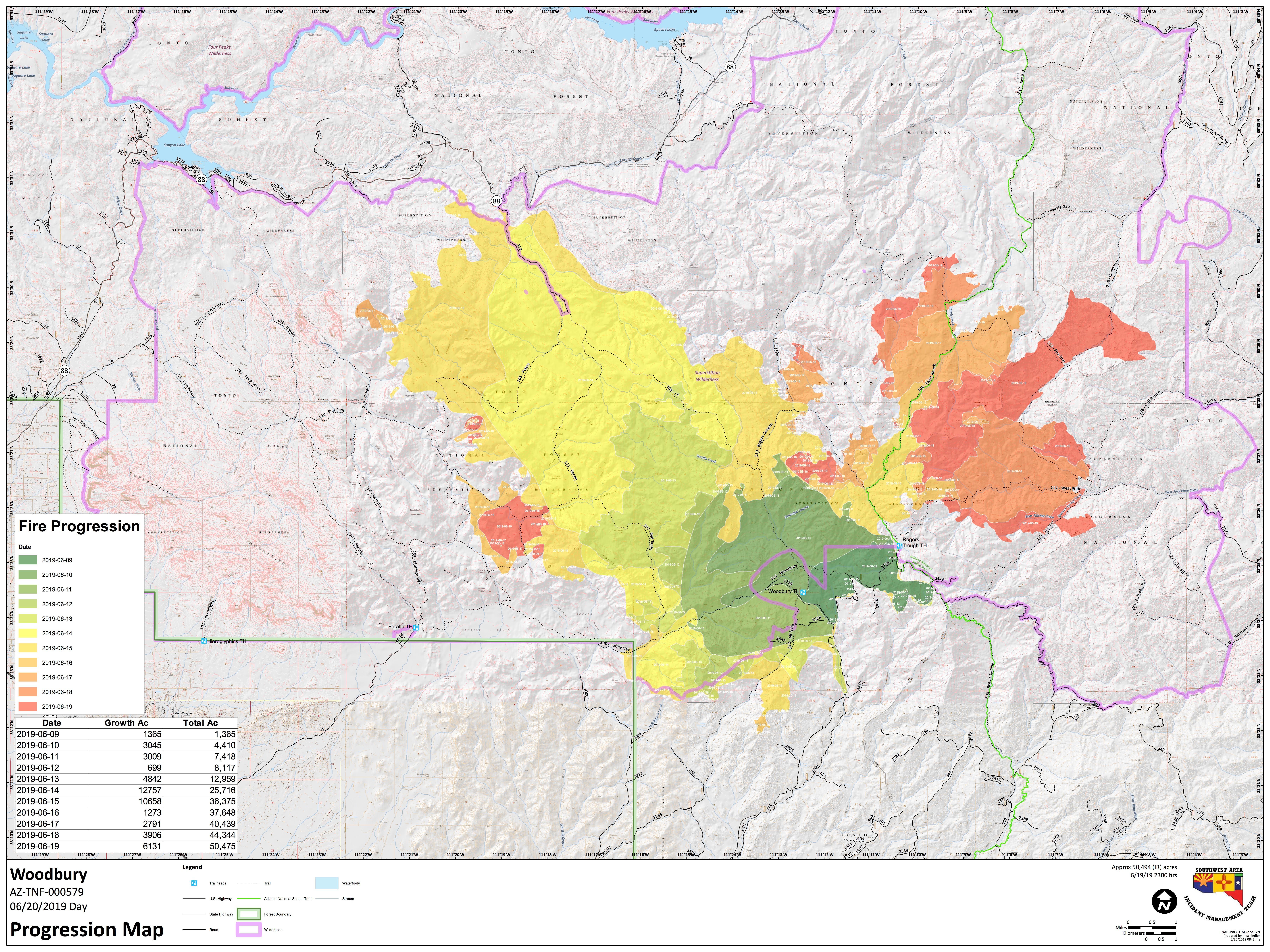
Here’s a look at a fire progression map for June 20.
Inciweb
Current Evacuations for the Woodbury Fire
Roosevelt Lake is being evacuated because the 50,000+ acre #WoodburyFire is just a few miles south. Here are the latest aerial pictures. #azfire
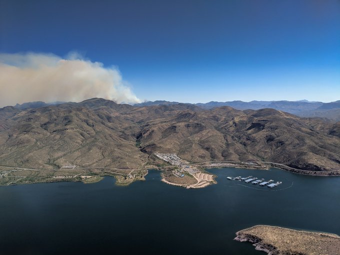
The Gila County Sheriff’s Office issued an evacuation alert on June 20 for residents in the Roosevelt Lake area, KTAR reported. This alert includes the Roosevelt community, where residents were told to leave immediately, bringing pets, medications, money, and valuables. They were told to close windows and doors before leaving.
A temporary shelter’s been set up for residents and small pets at Lee Kornegay School at 4735 S. Ragus Road in Miami.
Livestock can be sheltered at the Gila County Fairgrounds.
If owners can’t evacuate their livestock, they are asked to paint phone numbers on the animals and set them loose.
For evacuation updates or details on livestock or pet shelters, please call 928-402-8888.
Closures for the Fire
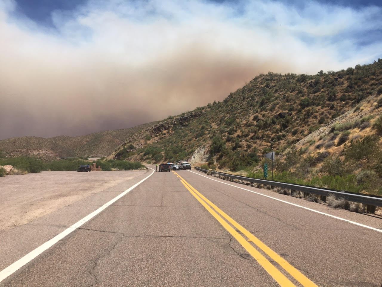
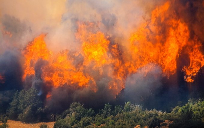
It’s like driving into the sun. #WoodburyFire #azfamily

Closures include (per Inciweb, unless otherwise noted):
- “The Tonto National Forest has closed the Superstition Wilderness and adjacent Forest.”
- Campgrounds along state Highway 188 east of the Roosevelt dam.
- “State Highway 88 is closed from beyond Tortilla Flat east to the junction of State Highway 88 and State Highway 188. This includes Apache Lake. The National Park Service Tonto National Monument is also closed.”
- “The Forest Service Campgrounds at Roosevelt Lake east of Roosevelt Dam will be closed this morning June 20th.”
- “SR 188 between SR 288/188 junction to Roosevelt Dam,” per the Gila County Sheriff’s Office.
REMINDER: SR 88 is now closed from Tortilla Flat (milepost 213) to SR 188 at Roosevelt due to the Woodbury Fire. Also, SR 188 is closed from SR 88, just west of Roosevelt at milepost 244, to SR 288.
#aztraffic
#WoodburyFire
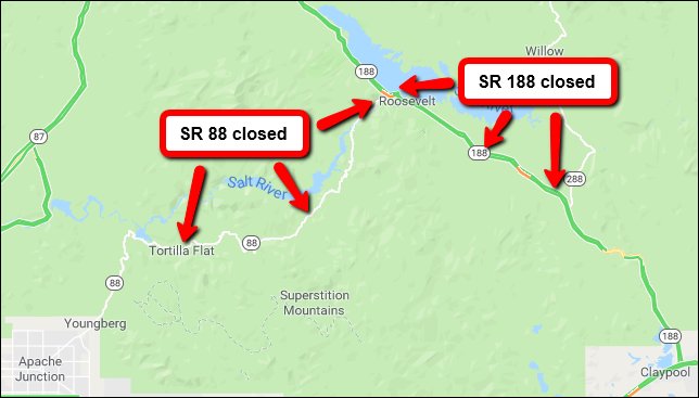
Here’s a map of some closures:
Woodbury Fire Predictions
Inciweb said that weather concerns are still a factor in the fire’s possible growth. Hot and dry conditions along with instability could help the fire grow, along with southwest ridge winds for Thursday through Saturday.
Here are the dangers over the next 24 hours, per Inciweb on the morning of June 20:
Strong SW ridge winds expected to develop on Thursday with threat of increased fire activity. Potential high ROS in grass/shrub fuels will increase with topography and wind alignment where heat is present. During the day fire spread is expected to continue to the NE at higher elevations in continuous heavy shrub fuels (with Pinyon PineJuniper mix) with areas of high intensity fire behavior on steeper slopes. Wind-slope alignment issues are likely with stronger winds. Variable smoke production depending on fire activity.”
Inciweb noted the following concern for 48 hours:
Continued hot/dry conditions with strong W-SW winds that may provide similar burning conditions that have been observed in previous days. Heavy shrub fuels at higher elevations (NE side of fire) will produce areas of high intensity fire activity and increased acres; while lighter fuels on the south and west side of the fire continue to show diminished heat due to suppression action – most areas are now “checked-up”.
And over the next 72 hours:
Threat of strong ridge winds continues through the period. Combination of low RH and increasing winds will maintain conditions favorable for fire growth. Continuous shrub fuels on upper slopes will continue to burn and retain heat. Portions of the fire will encounter fuel type change from Pinyon Pine and Juniper to lighter grass/shrub models as activity spreads to the north and east.
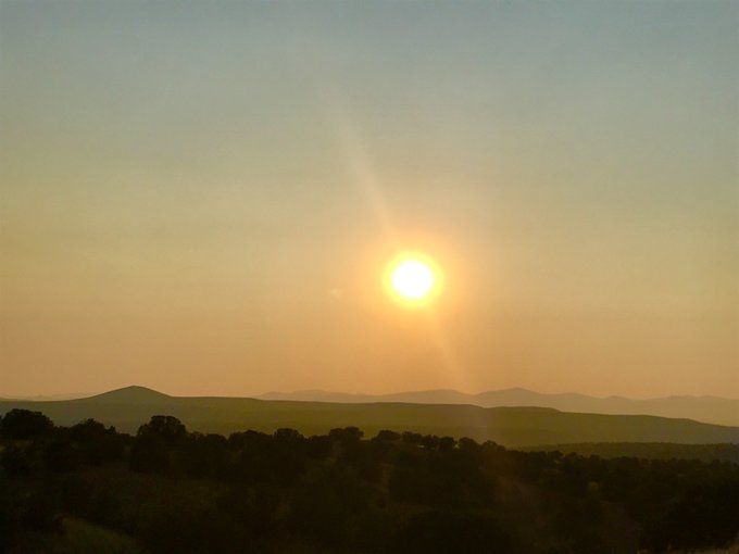
Smoke from the fire is currently being seen in New Mexico.
The #WoodburyFire sends its #smoke to northern #NewMexico
#AZFire
#nmwx
Here are some more stories and photos from the fire.
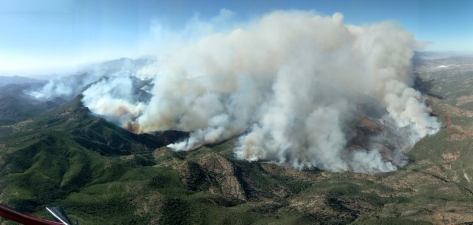
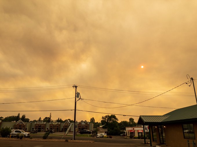
Impressive amount of smoke rising from the #WoodburyFire today.
.Eastern Arizona #WoodBuryFire Smoke in Show Low is getting thick! #azfire #azwx
How To Get Updates about the Woodbury Fire
Follow Tonto Forest on Twitter, the U.S. Forest Service for Tonto National Forest on Facebook, the Gila County Sheriff’s Office on Facebook, and the fire’s Inciweb page for the latest updates about the fire.
The fire information line is 505-399-2439 or 480-288-6110, from 7 a.m. to 9 p.m.
You can sign up for emergency notifications from Gila County here.