Inciweb
Fires continue to be an issue in California, with new fires developing nearly every day. Alert fire crews are quickly putting most of the blazes out. Read on for more details about fires around the state as of July 22, 2019. This article first includes interactive maps for all of California, including Cal Fire and other sources. Then the second section details specific fires in the region in alphabetical order.
Interactive Map of California Fires
There are three interactive maps to follow for updates about California fires.
The first is this map below, which is an interactive map of the more significant fires in California, provided by CAL FIRE and Google. Fires in red are active and fires in black are contained. If the map doesn’t show below, just go here. Depending on how your browser works, you may need to zoom into the map for more details.
The second good interactive map is Inciweb’s map. You can see the full map here. The screenshot below gives you a basic idea of wildfires in the area on July 23.
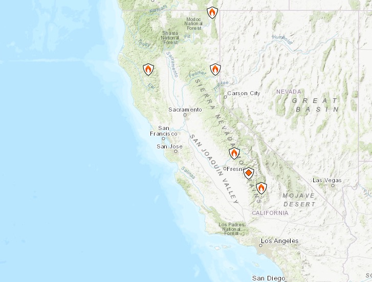
Inciweb
There’s an embeddable Google Map that includes Inciweb fires which you can see below. Depending on your browser, you may need to zoom in or change settings:
Another good map can be found here from Ca.gov. A screenshot is below, but you’ll want to see the full map for all the details.
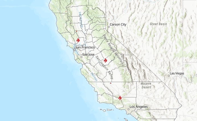
Ca.gov
Each of these maps often contains details the others are missing, so you’ll need to view all three for a full update on the fires.
Next are more specific details on the fires for July 22, 2019. If you are looking for a specific fire, search for the name so you can find it faster, or just scroll down and look at the fires, listed in alphabetical order.
List of Active Fires in California on July 22, 2019
Here are the active fires and updates about them. Most of these are in alphabetical order.
Canyon Fire
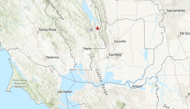
Ca.gov
This fire is listed on Ca.gov’s map. It’s in Napa County and is 45 acres and 0 percent contained. The fire is at Highway 128 and Wragg Canyon Road, 16 miles east of St. Helena. Evacuations are in place for this fire.
The fire is blowing smoke toward Winters. Some evacuations have started in the Napa County area. ABC 7 reported that evacuations are happening on the south side of SR-128, at the 6500 to 7000 block of Wragg Canyon.
Traffic Alert!!
Vegetation fire near #lakeberryessa. SR-128 will be closed from Markley Cove to Wragg Canyon RD. Use alternate routes. @NapaRegister @SolanoSheriff @ChpSolano @CalFireNews @CaltransD4 @993thevine
SR-128 is closed from Markley Cove to Wragg Canyon Road, ABC 7 reported.
Doyle Fire
This fire started on July 14 and is now 100 percent contained, according to Ca.gov. It was in Lassen County off Old Highway and Cowboy Joe Road. It’s located northwest of Doyle. It grew to 193 acres according to Inciweb and the cause is under investigation, according to Inciweb’s last update on July 15. A residence and two outbuildings were lost. It was on the east and west sides of Highway 395.
East Fire
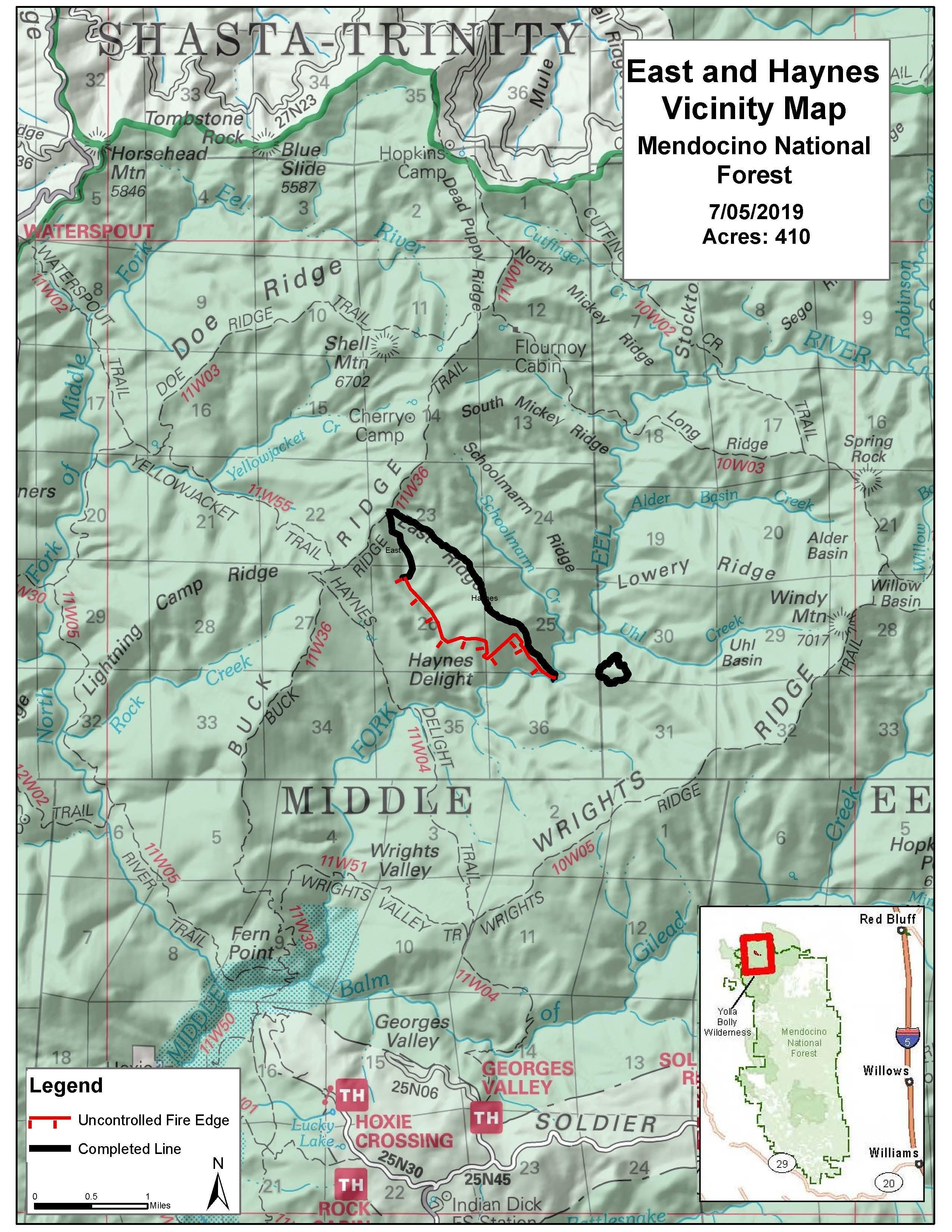
Inciweb
This fire, listed on Inciweb but not Cal Fire, is 410 acres and 95 percent contained as of July 12, the most recent update from Inciweb. It’s 23 miles northeast of Covelo and was caused by lightning. The vicinity map from four days ago, shown above, is the most recent map available.
Inciweb notes the following: “Incident Commander Terry Warlick says, ‘The Mendocino National Forest has guidance to permit lightning fires to play, as nearly as possible their natural and ecological role within the wilderness to reduce unnatural accumulation of fuels as well as decrease exposure and risk to fire personnel. With firefighter and public safety at the forefront, we are managing this incident toward an outcome which will help improve forest health, protect wilderness characteristics and reduce the potential for a high severity wildfire in this area in the future.'”
The fire was first reported on June 17.
Fish Fire
Listed on Inciweb’s map, the Fish Fire was 77 acres is now 100 percent contained as of July 19. It was in the Sierra National Forest and was discovered on the afternoon of July 15, near the Fish Creek Campground. No structures were threatened.
Goose 2 Fire
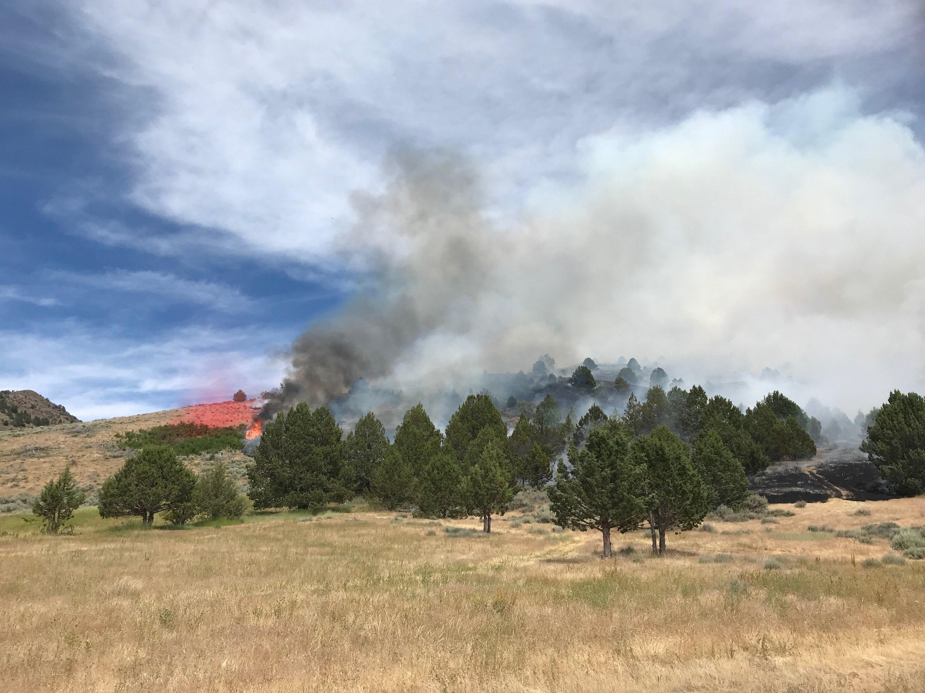
Inciweb
This fire is listed on Inciweb. It’s 150 acres and was discovered on July 17 in the Forest Protection Area. Its spread was slowed and crews remain on the scene to make sure it doesn’t grow. The cause is under investigation.
June Lightning Fires 2019 (Bald Fire and Lost Fire)

Inciweb
In Kernville, California, two fires were discovered in the Sequoia National Forest from lightning, Inciweb wrote. These are the Bald Fire and the Lost Fire. Together they have burned about 122 acres as of July 16. The good news is that as of July 22, both fires are 100 percent contained at 122 acres.
The Bald Fire, discovered June 17, was 5 miles northeast of Bald Mountain Lookout.
The Lost Fire, discovered June 18, was east of Jackass and north of Dead Horse Meadow.
Lonoak Fire
This fire, listed as active on Cal Fire’s map on July 23, is off Lonoak Road and Airline Highway, east of King City in Monterey County. It’s 2,500 acres and 80 percent contained. Forward spread has been stopped, Cal Fire noted.
Midway Fire
#MidwayFire [final] I-580 near Grant Line Rd, Tracy
(Alameda County) is 4.7 acres and 100% contained. Firefighters are completing mop up and patrol efforts so the roadway can be reopened soon.
If you saw news about a Midway Fire earlier today on I-580 near Grant Line Road in Tracy (Alamada County), you can rest easy. The fire has now been 100 percent contained at 4.7 acres.
Rock Fire
This fire, still listed as active on Cal Fire’s map as of July 23, is off Del Puerto Canyon Road in Stanislaus County, west of Patterson. It’s 2,242 acres and 50 percent contained according to Cal Fire’s map, but Cal Fire SCU noted on Twitter on June 28 that it’s now 100 percent contained. So it’s unclear why it’s still on Cal Fire’s map.
#RockFire [final] Del Puerto Canyon Road, 4 miles west of I5 (Stanislaus County) is now 100% contained at 2442 acres. Del Puerto Canyon Road is open. #CALFIRE #SCU #SCUWildfires2019
Sherman Prescribed Burn
Listed on Inciweb, this is a prescribed fire to help prevent wildfires from getting out of control.
Tejon Fire
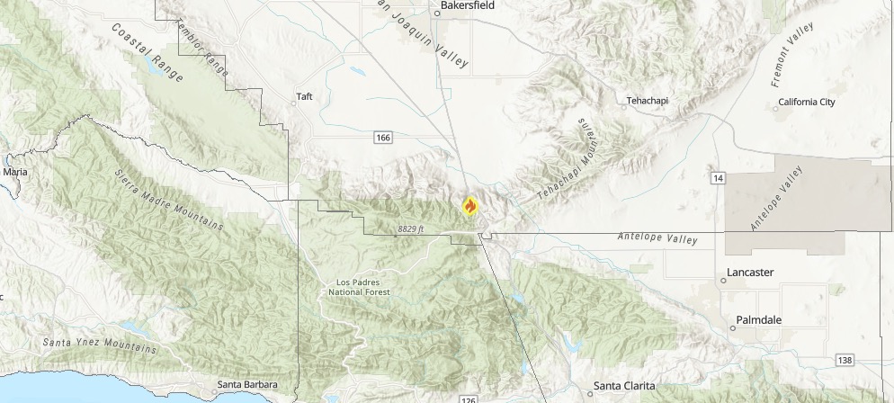
This fire was reported on July 21. It’s in Kern County at I-5 and Diger Road, south of Bakersfield. It’s 215 acres and 60 percent contained, Ca.gov reported.
Valley Fire
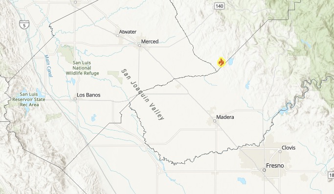
Ca.gov
This fire is in Mariposa County at Old Highway and Guadalupe, east of Mariposa. The fire is 155 acres and 80 percent contained, Ca.gov reported. The cause is under investigation. The fire started on July 21.