PG&E
Hundreds of thousands of residents in the Southern California region are facing their power being cut off and the impact could last for several more days in some regions. Additional areas are being added to the cutoffs today due to gusty winds and dry conditions that can cause an increased fire risk. Here’s a look at maps of the affected regions and additional outages that may be coming, along with approximate outage times as of October 10, 2019.
To stay updated on shutoffs in your area, call 1-866-743-6589 or fill out an online form here. You can get power shutoff alerts here. You can also get text updates by texting ENROLL to 976-33. Or enroll in ZIP code alerts by calling 1-877-9000-PGE.
You can find the latest updates on PG&E’s website here.
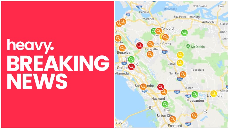
PG&E Outage Maps
Due to high demand shutting down PG&E’s previous links, the company launched a new critical outage map webpage that you can see here. This outage information is updated every 15 minutes, but you’ll need to refresh the map to see those updates. You can enter your address to find exactly what’s affected in your region. Hit the + or – buttons to zoom in.
You can look up your address to see the potential that your area will be impacted here. If the map is working, it will look like the screenshot below, which you can then zoom into for more details. The map was not made to be embeddable.
PG&E
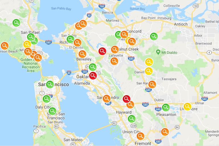
An alternative map to track power outages, planned shutoff areas, and power outage incidents, is found on ARCGIS here and is embedded below. It was shared on Reddit originally by u/CPhTonReddit, who said they found the map while looking at updates. The map was created by Solano County, but also appears to have other areas included. This is an alternative map if PG&E’s main maps listed above go down again.
The only issue with this map above is that sometimes it requires a login to view. So if the embedded map above is showing a login requirement, that’s actually an easy and free fix. You can sign up for a free 21-day account, which should cover you during the outage to keep viewing the map above. Go to this link to sign up for an ArcGIS online free trial. Once you submit your information, you’ll be asked to click a link sent to your email, and then you’ll be asked to create a username and password. After that, you can go back to the map above and sign in and view the map whenever you want during your 21-day free trial.
An alternative Bay Area outage map is provided by the San Francisco Chronicle here.
Affected Counties & Details
The first phase of outages was implemented on October 9, affecting 500,000 customers. That phase was completed by 11:45 a.m. on Wednesday. If you are in one of the counties listed below and still have power, then you won’t be losing power this time around, per PG&E.
- Amador County
- Butte
- Colusa
- El Dorado
- Glenn
- Humboldt
- Lake
- Marin
- Napa
- Nevada
- Plumas
- Shasta
- Sierra
- Solano
- Tehama
- Trinity
- Yolo
- Yuba
- Placer
The second phase of counties, amounting to about 234,000 customers, had their power turned off early this morning on October 10. If you are in one of these counties and still have power, then you will not be affected.
- Alameda County
- Alpine
- Contra Costa
- Mariposa
- San Joaquin
- San Mateo
- Santa Clara
- Santa Cruz
- Stanislaus
- Toulumne
Kern County is also expected to have a power shutoff sometime this morning, PG&E noted on its website. This will impact 4,000 customers rather than the previously predicted 40,000.
Some customers who are not predicted to be part of the shutoff may still experience outages due to damage to PG&E equipment from the event, PG&E warned on its website today.
About 600,000 customers are currently impacted by the outages. The good news is that PG&E is beginning to restore power in some areas. About 126,000 customers were restored in the Bay Area by 6 a.m. today.
READ NEXT: EEE Virus Map Near Me: State-by-State List of Cases & Deaths