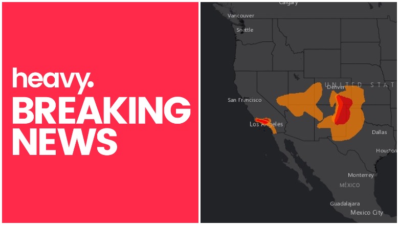
Weather.gov Red Flag Warnings
Red Flag warnings and watches mean that conditions can be favorable for wildfire development. High winds can also raise the chances of fires developing or of current wildfires growing stronger. That’s why it’s important to know if there are any Red Flag warnings or watches in your area. Warnings seem to be prevalent in California, but other states are affected too. Read on to see interactive maps that can help you determine what’s going on in areas near where you live.
A Red Flag warning lets fire managers know that conditions are highly unfavorable for prescribed burns and dangerous fire growth could occur, Weather.gov reported. Red Flag warnings require that vegetation in an area hold “ten-hour fuels of 8% or less,” a relative humidity of less than 25% for several hours, and winds of at least 15 mph 20 feet off the ground for several hours. These are typically issued in the spring and fall.
Red Flag warnings also require residents to be cautious too, Weather.gov noted. If you can burn in your area, burn barrels must be covered with a weighted metal cover and holes smaller than 3/4-inch. Residents shouldn’t throw cigarettes or matches out of a moving vehicle. All outdoor fires should be extinguished with care and left cold to the touch. And fires should never be left unattended.
Interactive Maps Showing Red Flag Warnings Near You
A number of interactive maps can help you see Red Flag warnings throughout the country and if any are near you. One of the best is provided by MappingSupport.com. It’s embedded below.
Joseph Elfelt writes in his description on Twitter: “Each time you open this interactive map you will see any #RedFlagWarning areas. Click any red area and follow the link for the official details. The map can also display many other fire related #GIS layers. Click ‘Map tips’ for help.”
Another map is a seven-day significant fire potential map, provided by NWCG.gov. This map allows you to scroll through the coming days and see areas in the United States and their risk levels. Grey means no data, green is little or no risk, yellow is low risk, and beige is moderate risk. Then orange through red indicates higher risk. Depending on your browser, you may need to use the + sign to zoom into the map. A screenshot of the map is below but you can see the full interactive map here.

NWCG.gov
This next map is an experimental map provided by Weather.gov and the National Weather Service. It shows many layers of weather outlooks and potential risks, including fire potentials. To see only the fire risk, you’ll want to make sure that everything on the “Quick Layer” legend to the left is turned to OFF. Then go to the Outlooks bar and click on the small orange icon to the far right. From there you can click on 1- or 2-day outlooks. A screenshot of what the legend looks like and where you should click is below.
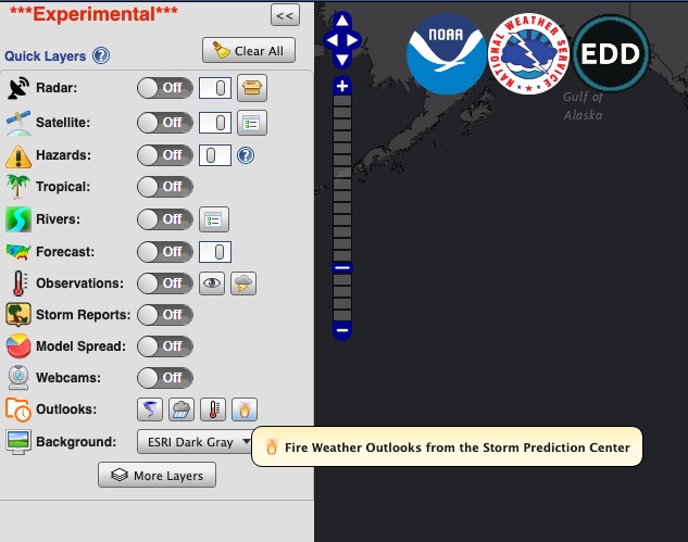
Weather.gov
The map is here. The screenshot below shows the two-day outlook for October 20. You can use the + or – sign to zoom in or out. You can also click on the red or orange areas for more details.
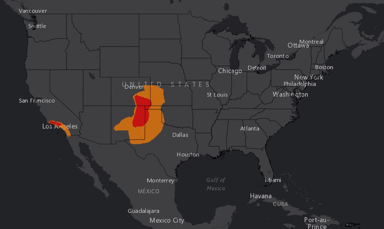
Weather.gov
Remember that this map is experimental, so use other maps to confirm what it shows. Click here to go to the interactive map and see the full display.
Finally, Google Maps has a crisis map that provides details about wildfire watches and warnings for the country. To see only the watches and warning, go to “Layers” on the Legend and unclick Traffic Conditions and Unclick InciWeb Wildfire Information. Keep “Public Alerts” clicked, which includes evacuation notices, storm warnings, and the like, if you want. This will show you only the wind advisories and Red Flag warnings that could indicate fire potential.
Click on any of the red shaded areas in the map below to see the specific watch or warning. Then click on that box to get more details about the warning. The map is below. Depending on your browser, you may need to use the + button to zoom into the map and see your state or city’s region.
Remember, it’s important to keep up with wind advisories and Red Flag warnings, as these can clue you into times when you should pay closer attention to weather updates so you can know if any fires have started in your region.