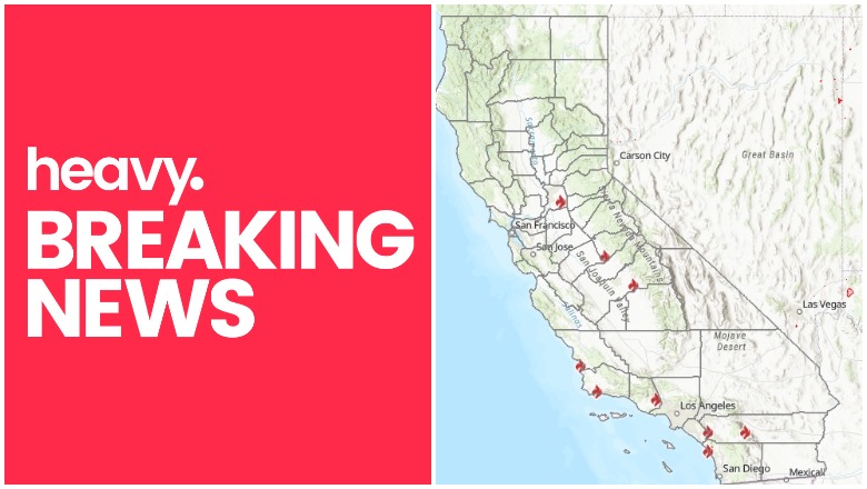
CalFire California fires near me
Many people in California are keeping a close eye on fires now that it’s fire season again. A fire is currently burning near San Luis Obispo called the Avila Fire, but there are others too. Here’s a look at the latest wildfires in California on June 15. The first section of this story will show interactive maps for the state and the second section will detail updates on specific fires.
Interactive Maps of California Fires
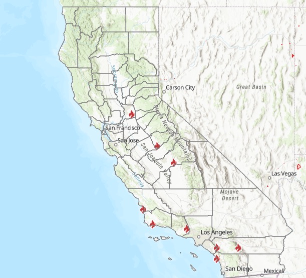
A number of interactive fire maps below can help you stay updated on the latest details about California fires. Don’t rely on just one map, since details can change quickly and some maps will have fires listed that others do not.
A good interactive map to follow is Inciweb’s map. You can see the full map here. There’s an embeddable Google Map that includes Inciweb fires which you can see below. Depending on your browser, you may need to zoom into the map below using the + button within the map or change settings to only show Inciweb fires. It should be noted that Inciweb fires are not always the same as wildfires reported on by CalFire.
Another helpful interactive map is provided here from Ca.gov. A screenshot is below.
Cal Fire
A new interactive fire map is below, provided by UCANR.edu here. A live version is below. You may need to click “OK” before you can view the map to indicate you’re not using it as an evacuation resource. This map below is one of the more detailed fire maps for California.
The California Governor’s Office of Emergency Services also has an interactive map of red flag warnings and new and active fires. The map is here. This map is updated every weekday morning, so it’s not always the best for emergency planning but is still informative.
Below is a list of individual fires in alphabetical order.
List of Active Fires in California on June 15, 2020
Ant Fire
This fire is 10 acres and 75% contained according to Inciweb. It started on June 13 and was caused by human activity. The fire was in Ant Canyon along Mtn. 99 and the Kern River, north of Kernville, according to Inciweb.
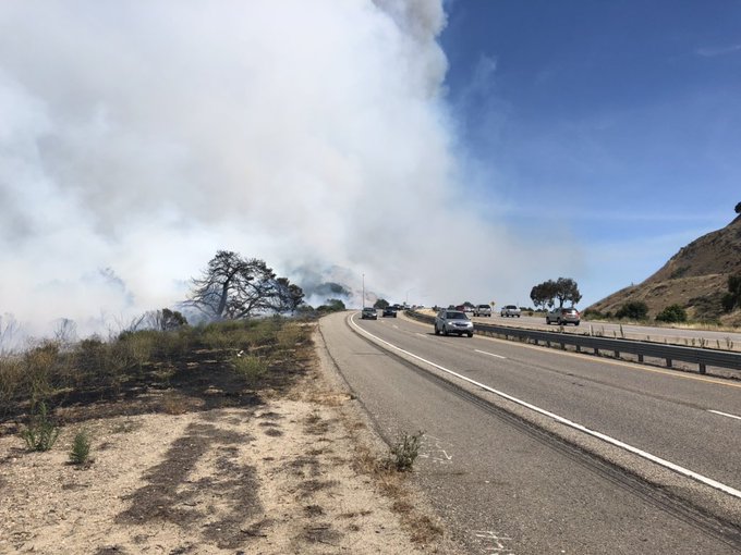
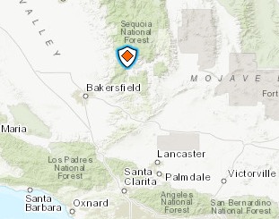
Avila Fire near San Luis Obispo

Cal Fire
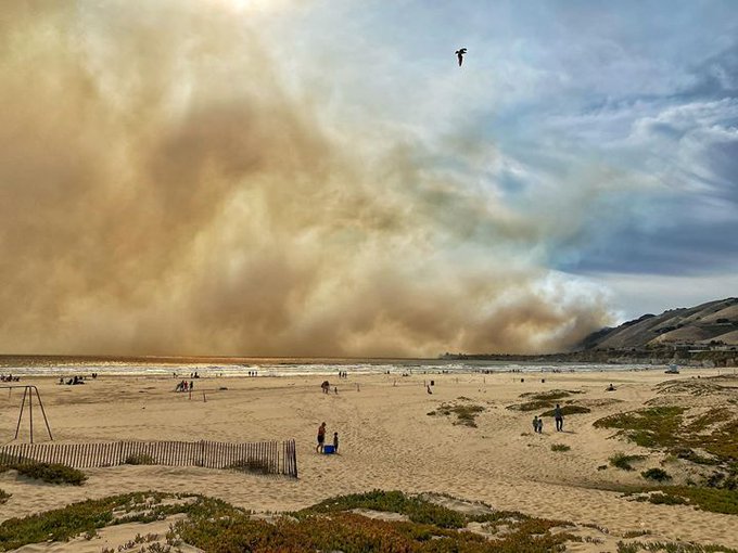
The Avila Fire near San Luis Obispo started Monday afternoon and quickly grew out of control, Weather.com reported. It’s threatening homes northeast of Avila Beach and Highway 101 is closed near the fire in both directions.
Not the kind of photos I like to post… 5pm Pismo Beach #beonksby
According to Cal Fire, it started near Avila Beach Drive and Highway 101, east of Avila Beach.
Ominous view of the rapidly spreading #AvilaFire near Avila Beach. @805Webcams @CALFIRE_SLO
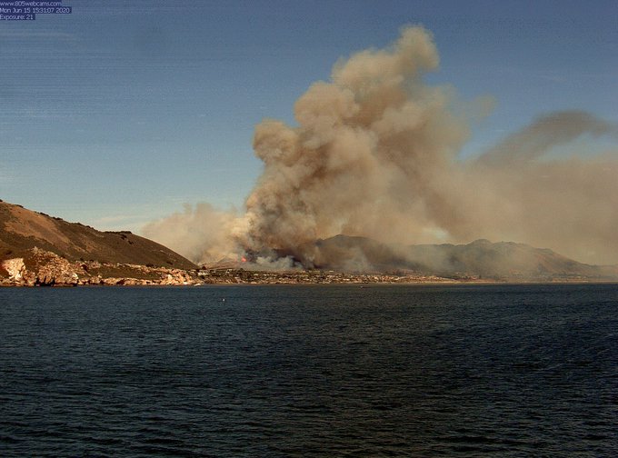
The fire is at least 300 acres in size as of 5 p.m. on Monday. It is 0% contained.
[UPDATE] #AvilaIC Per air attack fire is 300 acres. Red Cross has been ordered to set up an evacuation center. Additional helicopters have also been ordered.
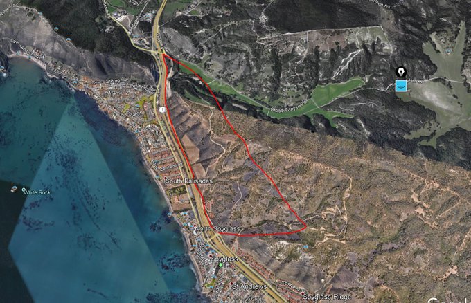
Here’s another approximate location of the fire:
This is a 300 acre map of the general fire location.
#AvilaFire Hwy.101 at Avila Beach. RROS and structures threatened. @CALFIRE_SLO #AvilaBeach #Breaking
According to KEYT, evacuations were reported for areas on Live Oak Lane, Indian Knob Road, and Monte Road, along with Gragg Canyon Road and Pismo Preserve. Evacuations were also reported for neighborhoods that were on the east side of Highway 101 above Mattie Road.
Cal Fire SLO on Twitter is a good resource for staying updated on this blaze.
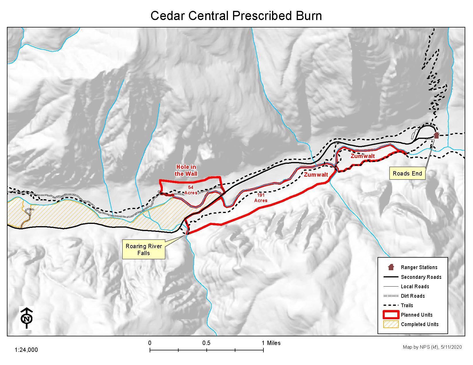
Cedar Central Prescribed Burn
Inciweb
Inciweb notes: “Fire staff completed ignitions on the last segment of the Cedar Central Prescribed Burn unit on Monday, May 25, 2020, for a total of 245 acres treated since Sunday. With ignitions complete, firefighters will continue to patrol the area as vegetation inside the unit self-extinguishes.”
These are burns purposefully set to help mitigate unexpected wildfires later.
Cornetts Fire
This fire was first reported on June 13, according to Cal Fire, and is 95% contained at 191 acres. It’s near Cornetts Road and Old Highway South.
Dawson Fire
This fire was reported on June 13. It’s 10 acres and still listed as active, according to Cal Fire. The fire is in Riverside County at Dawson Canyon Road and Park Canyon Road.
Drum Fire
#DrumFire-UPDATE- Overnight cooler temperatures & marine layer helped FF’s increase containment to 30%. The acreage remains 600 acres, however, GPS mapping later today, coupled with large swaths of unburned vineyards inside perimeter may reduce acres burned.

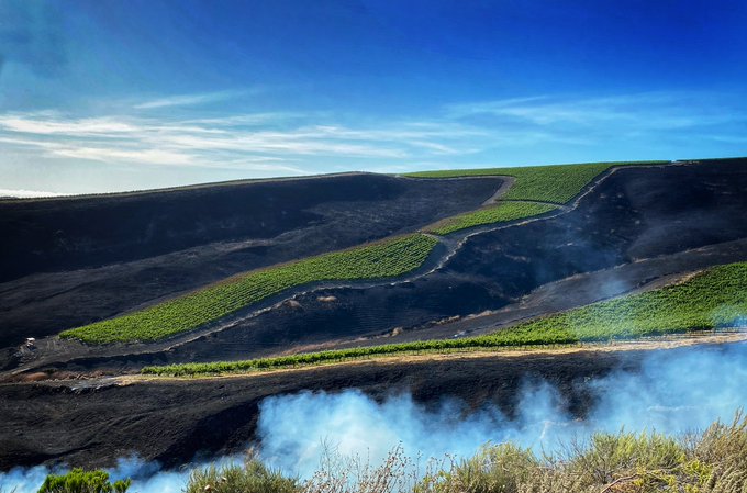
This fire was reported on June 14 on Drum Canyon Road and Highway 246, west of Buellton. It’s 600 acres in Santa Barbara County and 30% contained. The cause is under investigation.
Grant Fire
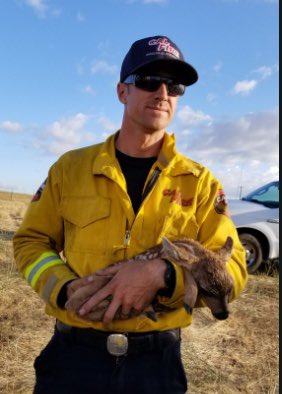
#UPDATE The fawn rescued from the #GrantFire last week is going strong thanks to @CALFIREAEU and @SierraWildlife

This fire started on June 12 and is 5,042 acres and 90% contained, according to Cal Fire. The cause is under investigation. It’s in Sacramento County near Grantline Road and Keifer Blvd. Cal Fire notes: “Fire crews have made good progress today and continue to patrol for hotspots within the interior of the burn area.”
The information line for details about this fire is(530) 647-5218.
Hog Fire
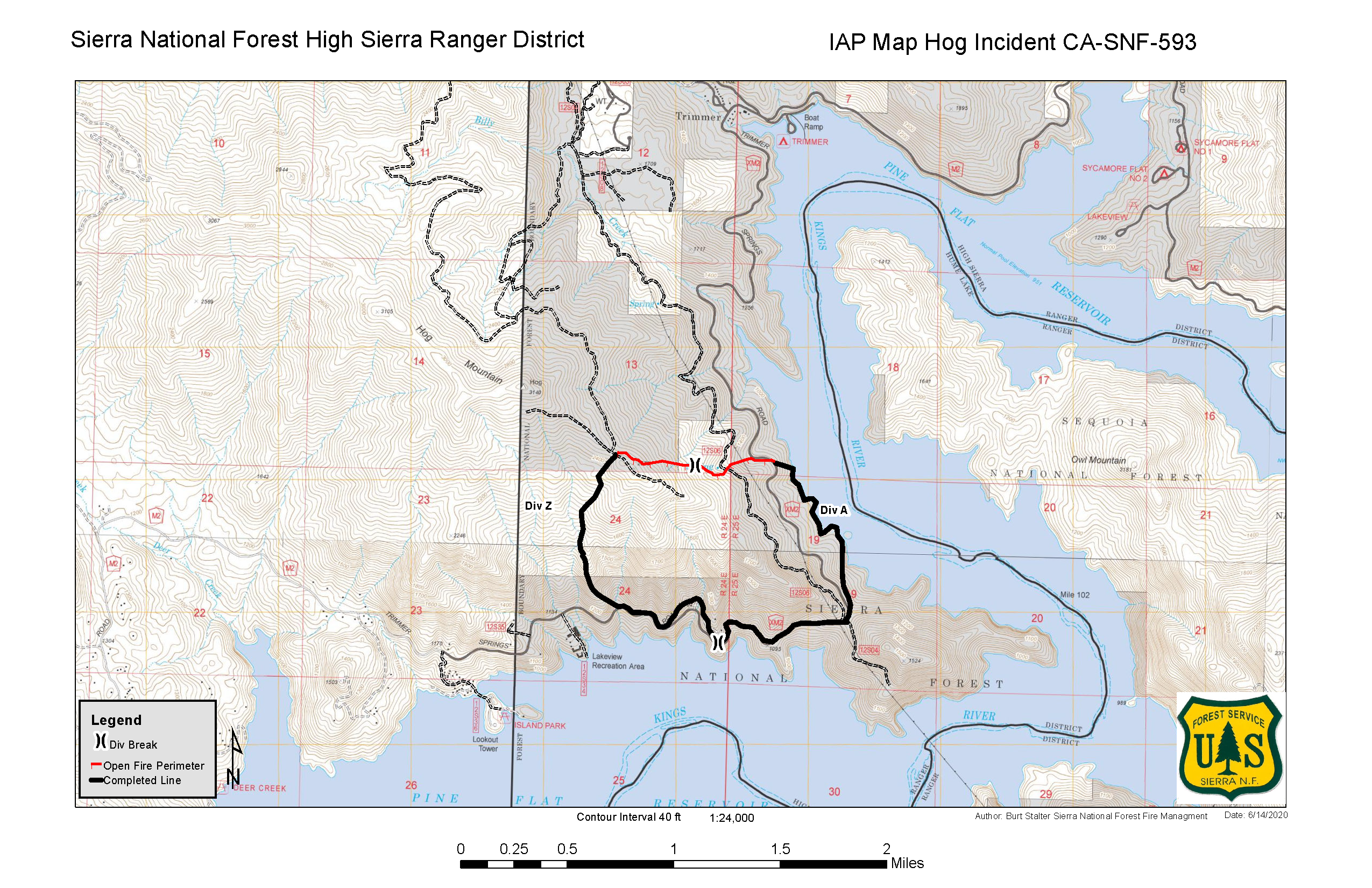
Inciweb
This fire was first reported on June 12 in Fresno County and the cause is under investigation, Cal Fire reported. It’s still listed as active at E Trimmer Springs Road and Pine Flat Lake.
According to Inciweb, the fire is 533 acres and 95% contained as of June 15. Inciweb noted: “Fire behavior is very minimal with scattered oak fuels burning down well into the interior.”
Inciweb also noted: “Vegetation fire along Trimmer Springs Road near Maxon Road in the area of Pine Flat Reservoir, on the south slope of Hog Mountain.”
India Fire
This fire started June 9 and the cause is under investigation. It was on Camp Pendleton Base near Roblar Road and Basilone Road. The fire is still listed as active, according to CalFire.
According to Camp Pendleton, the fire is 75% contained and 1,100 cares in size as of its last update on June 11.
There are no threats to personnel or structures.
June Lightning 2020
These are a series of lightning strikes in a particular area that caused fires, as listed on Inciweb’s map. They total six acres from earlier in June.
Kern River Ranger District Prescribed RX
Inciweb
Inciweb notes: “Preparation work has started on the Shirley Loop broadcast burn on Greenhorn Mountain, located just south of the Shirley Meadow Ski Area with plans to burn approximately 67 acres this week. This prescribed burn has been divided into manageable pieces, from 30-100 acres. (Plans call for 350 acres total within this area)… Be advised smoke will be visible from most communities surrounding Isabella Lake. Use caution when driving.”
Klamath NF Winter RX Burning
Inciweb notes that prescribed fires in this region are actually postponed until further notice, even though it’s listed on the map.
Lime Fire
This fire is 898 acres and 95% contained as of June 15. The cause is under investigation. It’s located west of Lake Piru near Lime Canyon Road and Piru Canyon Road. Firefighters are building and improving containment lines.
You can see updated evacuation orders and details in the map below.
SHF Lightning Fires 2020
Inciweb has grouped these together. Many are out, and a 15-acre fire has been 100% contained and is almost out. These are from lightning storms and are listed on Inciweb’s map.
Smoketree Fire
This fire, first reported on June 2, is at East Murray Canyon Road and S. Toledo Ave. in Riverside County. The cause is under investigation. Cal Fire last updated details about the fire on June 6, listing it as still active.
As of June 5, it was 80% contained.
READ NEXT: Daily COVID-19 Updates