Inciweb California fires near me
Many people in California are keeping a close eye on fires now that it’s fire season again. Here’s a look at the latest wildfires in California on July 7. The first section of this story will show interactive maps for the state and the second section will detail updates on specific fires.
Interactive Maps of California Fires
A number of interactive fire maps below can help you stay updated on the latest details about California fires. Don’t rely on just one map, since details can change quickly and some maps will have fires listed that others do not.
A good interactive map to follow is Inciweb’s map. You can see the full map here. There’s an embeddable Google Map that includes Inciweb fires which you can see below. Depending on your browser, you may need to zoom into the map below using the + button within the map or change settings to only show Inciweb fires. It should be noted that Inciweb fires are not always the same as wildfires reported on by CalFire.
Another helpful interactive map is provided here from Ca.gov.
A new interactive fire map is below, provided by UCANR.edu here. A live version is below. You may need to click “OK” before you can view the map to indicate you’re not using it as an evacuation resource. This map below is one of the more detailed fire maps for California.
The California Governor’s Office of Emergency Services also has an interactive map of red flag warnings and new and active fires. The map is here. This map is updated every weekday morning, so it’s not always the best for emergency planning but is still informative.
Below is a list of individual fires in alphabetical order.
List of Active Fires in California on July 7, 2020
Ant Fire
This fire is 10 acres and 100% contained according to Inciweb as of June 19. It started on June 13 and was caused by human activity. The fire was in Ant Canyon along Mtn. 99 and the Kern River, north of Kernville, according to Inciweb.
Brandon Fire
#RT @CAL_FIRE: New Incident: #BrandonFire off Brandon Road in El Dorado County is 15 acres and 10% contained. @CALFIREAEU

This fire started July 7 on Brandon Road in El Dorado County. It’s 15 acres and 10% contained.
CAL FIRE is on scene of a grass fire on Brandon Rd., off French Creek Rd. In Shingles Springs. The fire is approximately 10 acres in the grass. Full ground and air resources are assigned.
#BrandonFire #CALFIREAEU #FireSeason2020


California Fire
Dozens of firefighters keeping a close watch over the #californiafire near Rodeo and I-80. The blaze was 60% contained as of this morning, about 225 acres burned. Firefighters looking for any hot spots and tightening containment today. @24_7_News @NBCNewsRadio.
This fire was discovered on July 6. As of July 7 it was 225 acres and 60% contained. It’s east of Rodeo in Contra Costa County near California Street and Springwood Street.
Crews Fire
The Crews Fire in California started on July 5 and grew rapidly. According to Cal Fire, the Crews Fire was 5,400 acres and 20% contained as of July 7.
Evacuations are issued from Highway 152 north to Gilroy Hot Springs and southeast to Prunedale Ave.
An Evacuation Center is at the Gilroy Senior Center, 7371 Hanna Street, Gilroy, CA 95020.
Below is an auto-updated map of the Crew Fire provided by Mapping Support. They note: “Interactive map of #CrewsFire with MODIS and VIIRS satellite hotspots. Satellite data is *always* several hours old and locations are approximate. Click links in upper left corner for more information.” See the full map here.
Cal Fire noted on July 7: “Firefighters worked through the evening strengthening control lines and mopping up. The fire had little forward progress last night however, gusty winds this afternoon will create the potential for significant runs. Firefighters will remain vigilant throughout the day to maintian control lines and control spotting.”
Take a behind the scenes #bts look at the #CrewsFire Incident Command Post here in #Gilroy, CA.
The public information line for the fire is 530-645-9663. The fire’s cause is under investigation.
Here are some sources for updates about the fire or other emergencies:
- Santa Clara County’s ReadySCC App
- Santa Clara County AlertSCC App
- Evacuation center updates: Red Cross Northern California Coastal
- Cal Fire SCU
Flat Fire
This fire was last updated on CalFire’s website on June 30 but it’s still listed as active. It’s in Trinity County near Highway 299W and Mill Creek Road, southeast of Burnt Ranch.
As of July 5, Inciweb noted that the cause was under investigation and it was 65 acres and 50% contained.
Hog Fire
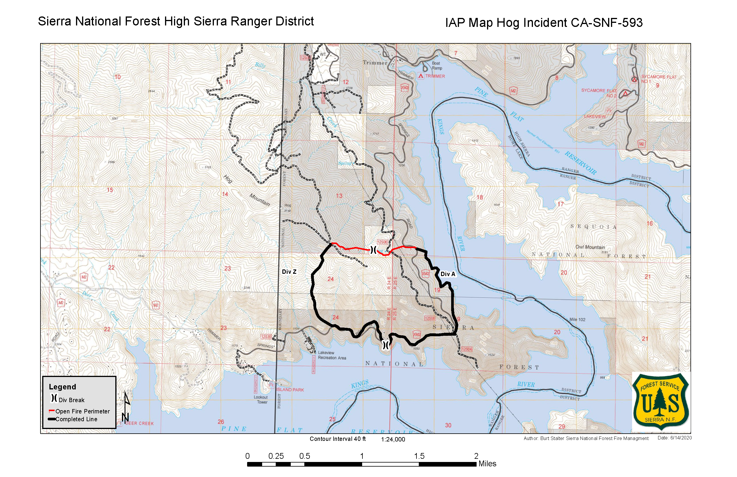
Inciweb
This fire was first reported on June 12 in Fresno County and the cause is under investigation, Cal Fire reported. It’s still listed as active at E Trimmer Springs Road and Pine Flat Lake.
The Hog Fire was last updated on Inciweb on June 15 when it was 533 acres and 95% contained. The cause is unknown.
On June 15 Inciweb wrote:
This will be the last update on the Hog Fire unless significant changes/events occur. Fire behavior June 14th, 2020 with cooler temperatures and light winds, minimal behavior allowed crews to strengthen lines and begin their mop-up phase, and containment goals reached that have mitigated risk to private property. The fire was unstaffed last night, and today crews will continue patrol and mop-up work around the incident where fire allows for safe access. Fire behavior is minimal with scattered oak fuels burning down well into the interior of the burn area.”
June Lightning 2020
These are a series of lightning strikes in a particular area that caused fires, as listed on Inciweb’s map. They total six acres from earlier in June.
Kings Fire
#KingsFire [Update] Firefighters continue to gain ground – 67 acres and 80% contained. Pictured below: @CalGuard firefighters working to improve containment lines around the #KingsFire
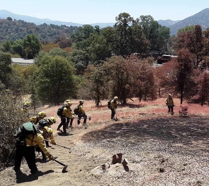
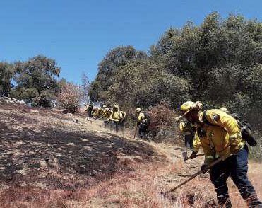
This fire was discovered July 5. As of July 7, it was 67 acres and 80% contained, located in Fresno County east of Squaw Valley near King Canyon Road and Dunlap Road.
Mountain Meadow Fire
Burned grass on Nelson Hill off of Sierra Ct. in Fairfield. This is what’s left behind from #mountainmeadowfire. Evacuation orders lifted for families in The Ranch community, but, woah did it get close to their homes!
Sound on for wind effects. Story on @kcranews 10p/11p
This fire started July 6 in Solano County. It’s located southwest of Fairfield near Mountain Meadows Drive and Cedar Creek Court. Evacuation orders were lifted. It grew to 50 acres but nothing was destroyed.
No longer in unified command: #MountainMeadowFire off of Mountain Meadows Drive and Cedar Creek Court, Southwest of Fairfield in Solano County is 50 acres. For future updates see lead agencies @Fairfieldfire and Cordelia Fire Protection District.

Nail Fire
This fire started July 7 in Colusa County near Fouts Springs, southwest of Stonyford. It’s more than 5 acres in size.
Aircraft supporting firefighters on the #NailFire. #MendocinoNF @R5_Fire_News
Quarter Fire
Inciweb
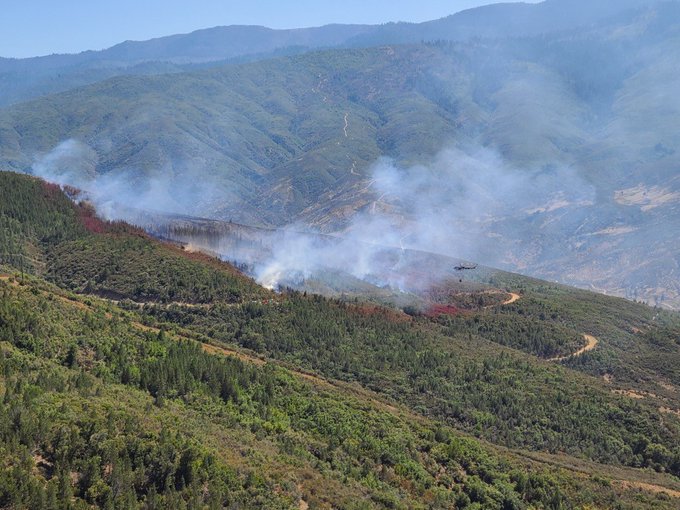
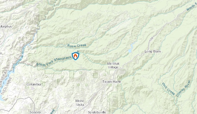
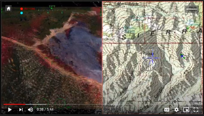
This fire was first reported on June 20 and is 10 acres in size and 100% contained as of July 7. It’s at the South Fork of the Stanislaus River near FS Road 3N11, according to Inciweb.
SHF Lightning Fires 2020
Inciweb has grouped these together. Many are out, and a 15-acre fire has been 100% contained and is almost out. These are from lightning storms and are listed on Inciweb’s map.
Ridge Fire
This fire is 83 acres and 100% contained as of June 22, according to Inciweb. The cause is unknown. It’s in the Los Padres National Forest on Plaskett Ridge Road about 1 1/2 miles from Highway 1. It is still listed as active on Inciweb’s map.
Rowher Fire
This fire started July 1 and CalFire last updated its information about the fire on July 3. However, it’s still listed as active on CalFire’s map. The fire’s in Los Angeles County, north of Santa Clarita, near Spring Canyon Road and Anthony Road.
Rowler Fire Update, 1300 hrs: 92% containment on 648 acre. Firewatch’s combo display, IR/Topo, shows one corner of the battle & steepness of the rugged terrain. Tough ground. A hard fight. 160 Firefighters still on the line. Outstanding work! #RowherFire #WildfireHeroes #Heroes
As of July 5, the fire was 92% contained at 648 acres.
Soda Fire
This fire was discovered on July 3. CalFire last updated information about it on July 4 although it’s still listed as active on the map. The cause is under investigation. The fire’s in San Luis Obispo County in California Valley, near Soda Lake Road and Culver City Road.
As of July 4, it was 125 acres and 75% contained.
Soledad Fire
The Soledad Fire started around 3:30 p.m. on July 5 and quickly grew, , Inciweb reported. As of July 7, it’s 1,498 acres in size and 68% contained. Full containment is estimated for July 10.
The cause has not yet been determined. A map of the fire, shared by the city of Santa Clarita, is below. You can see the full map here.
The following map indicates the fire’s location and the evacuation area. You can see the full map here. You may need to click “OK” before you can see the full map below, and you may need to click the “x” on the upper right to get rid of the legend.
Inciweb wrote: “The combination of hot temperatures, low relative humidities, locally gusty winds, and dry fuels will bring elevated fire weather conditions to the Soledad Fire burn area today. Crews will monitor hot spots and reinforce containment lines. One firefighter suffered a minor injury while working on the fire line yesterday. Crews will work through the day scouting for any potential flare-ups, while performing mop-up of hot spots and holding containment lines.”
Here are some sources for breaking updates:
- Santa Clarita City Twitter
- LACoFDPIO on Twitter for fire updates
- PalmdaleSheriff on Twitter for evacuation updates
- CaltransDistrict7 on Twitter for road closure updates
- LA County Fire Department on Twitter and the LA County Fire Department
READ NEXT: Daily COVID-19 Updates