Cal Fire
The Apple Fire is growing in Riverside County, California, and evacuation orders have been issued for areas in the fire’s path. The fire started in the late afternoon on July 31 and was already more than 1,700 acres in size just a little more than six hours later. Read on to see maps of the fire, photos, evacuation updates, and details on how to stay updated on the latest news.
UPDATE: For the most recent maps and updates on the Apple Fire, see Heavy’s story here.
The Fire Grew to More than 1,700 Acres in Size in Just 6 Hours
According to the Riverside County Fire Department, the Apple Fire started around 4:55 p.m. on Friday, July 31. By 7:30 p.m. it had grown to 350 acres and by 10:05 p.m. Pacific it was already 900 acres and 0% contained. By 11:25 p.m., the fire was 1,720 acres and 0% contained.
The Apple Fire started out as two fires that were near each other and eventually merged into a single fire.
KTLA 5 reported that the fire started in the 9000 block of Oak Glen Road. It’s burning northeast of Cherry Valley and north of Beaumont.
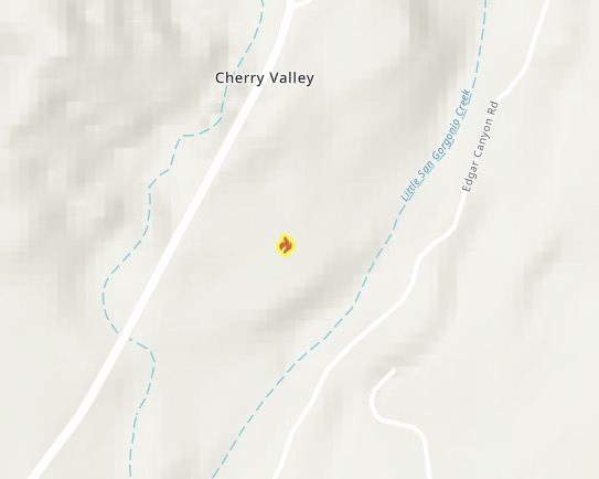
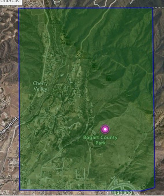
Below is a map provided by Fire Mappers showing the general location of the fire. You may need to click “Do not show this splash screen again” and “OK” to see the map. The full map is here.
The fire started in Cherry Valley along Oak Glen Road and the cause is under investigation. You can also see a map of the fire’s location on Cal Fire’s state map here. A screenshot is below.
Cal Fire
Evacuation Orders Have Been Issued
According to the Riverside County’s Incident Page for the fire, evacuation orders were in place for residents in the Cherry Valley area, in the following regions:
- Residents north of Cherry Valley Blvd West of Highland Springs East of Beaumont Avenue (as of 11 p.m.)
- Residents north of Gilman Street cross of Bluff Street (as of 10:05 p.m.)
- Residents South of the County Line, North of Dutton Street and East of Oak Glen Road. (first evacuation order)
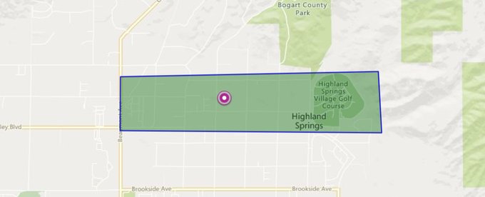
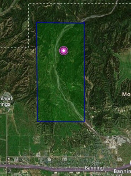
Here’s a map of the newest evacuation region as of 11 p.m. Pacific:
#AppleFIRE [UPDATE] Evacuation ORDERS have extended to north of Cherry Valley Blvd./west of Highland SpringsAve./East of Beaumont Ave. in Cherry Valley. An evacuation center has been established at Beaumont High School.
Evacuation centers are set up in the following locations:
- Beaumont High School at 39139 Cherry Valley Boulevard, Beaumont, California
- An animal evacuation center is also set up at Beaumont High School, with Animal Control on the scene.
On Twitter, RivCoReady tweeted this map about the expansion of evacuation orders earlier in the evening:
ALERT RIVCO MESSAGE—#AppleFire Evacuation Orders expanded to north of Gilman St in the Banning Bluff area. For more info, go to t.co/uEtOFKm1hT @CALFIRERRU @RSO
This next map shows the original evacuation orders:
ALERT RIVCO MESSAGE
#AppleFire—EVACUATION ORDER ISSUED for Cherry Valley area North of Dutton, East of Oak Glen Rd, South of County Line Rd. Evacuation center at Beaumont High School (39139 Cherry Valley Blvd) t.co/uEtOFKm1hT for more info.
Road closures are also in place in some regions.
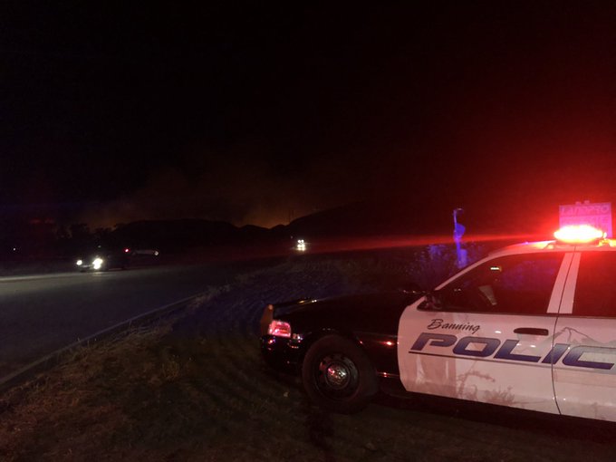
⚠️ ROAD CLOSURES ⚠️ Hard closure (NO ACCESS) for the Banning bench via N. Sunset at Wilson AND N. San Gorgonio at Summit. Evacuations commencing
#APPLEFIRE UPDATE❕
Evacuations currently mandatory and underway for the Banning Bench Area.
-Evacuee center at Beaumont High School
– Animal evacuation inquiries please contact Riverside County Animal Control at Beaumont High School

The fire was nearing homes in the Camino del Norte, Apple Tree Lane, and Quail Road regions, KTLA 5 reported.
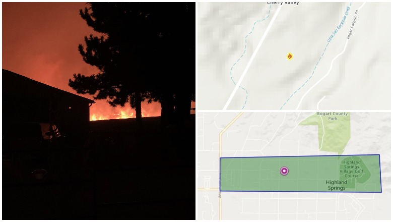
Photos & Videos of the Fire
KTLA 5 had a live stream up for the fire that is now a rewatchable video.
If the video above does not embed, you can watch it here.
Here’s a video of the fire from earlier in the day, showing how close it was to homes.
#BREAKING: A wild fire burning in #CherryValley has large flames VERY close to homes. The #AppleFire is burning near Oak Glen Road. We’ve seen one structure burn, a few cars and a boat. @CALFIRERRU is on the ground and in the air fighting this fire. #Sky2 overhead.
How to Stay Updated on the Fire
The following sources will help you stay updated on the fire.
- Riverside County Fire Department‘s Apple Fire Incident Page
- Cal Fire Riverside County’s Twitter Page
- Riverside Emergency Management’s Twitter Page
- Banning Police Department’s Twitter page
READ NEXT: The latest COVID-19 deaths, cases, and updates