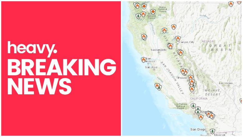
Inciweb California fires near me as of December 8.
Wildfires in California are a problem again in December, as conditions favorable for fire growth kick in, prompting warnings of power outages in the state. Here’s a look at the latest wildfires in California on December 8, 2020. The first section of this story shows interactive maps for the state and the second section provides updates on specific fires.
Here’s what you need to know:
Interactive Maps of California Fires
Interactive fire maps can help you stay updated on the latest details about California fires. Don’t rely on just one map, since details can change quickly. If you live near a fire, stay tuned to your local media.
One good interactive map to follow is from Inciweb, “an interagency all-risk incident information management system.” You can see the full map here. There’s an embeddable Google Map includes Inciweb fires, which you can see below and also here. Depending on your browser, you may need to zoom into the map using the + button within the map or go to the “Layers” dropdown box and turn off everything but Wildfire Preparedness and Inciweb Wildfire Information. Inciweb fires may vary slightly from fires reported on by Cal Fire, the California Department of Forestry and Fire Protection. The map below doesn’t just include active fires, but may also include fires that are 100% contained but not quite yet completely out.
Another helpful interactive map is provided here from Ca.gov.
A interactive fire map is below, provided by the University of California Division of Agriculture and Natural Resources. You may need to click “OK” before you can view the map to indicate you’re not using it as an evacuation resource. The map below is one of the more detailed fire maps for California.
The California Governor’s Office of Emergency Services also has an interactive map of red flag warnings and new and active fires. This map is updated every weekday morning, so it’s not always the best for emergency planning but is still informative.
Below is a list of active fires in alphabetical order. Note that not all the fires on Inciweb’s map will be listed below, as some that are 100% contained were not included.
List of Active Fires in California on December 8, 2020
August Complex Fire
This fire is 100% contained as of November 12, but still listed on Inciweb’s map. It had grown to more than one million acres in size.
Airport Fire
#AirportFIRE Morning Update 12/08/2020 : Fire remains 1,087 acres and 50% contained. Mop-up efforts continue.
This fire was first noted on December 1 in Riverside County near Butterfield and Aviation. It’s 1,087 acres and as of December 8 it’s 50% contained. The cause is under investigation.
Bond Fire
This fire is 75% contained and 6,686 acres as of December 8 at 7:47 a.m. It started December 2 in Silverado Canyon in Orange County. All evacuations have been reduced to evacuation warnings.
You can see a fire map here or a larger version here.
Cal Fire noted: “Decrease in acreage reflected in today’s update is due to more accurate mapping. Overnight, strong, gusty winds developed over the fire area. Firefighters worked to construct and improve fireline, and patrol the fire area. Firelines continue to hold and today crews will continue to patrol diligently in areas where strong winds could have the potential to spread the fire and threaten adjacent communities.”
Cornell Fire
This fire was first noted on December 7 in Ventura County, Cal Fire noted, east of Santa Paula near Cornell Drive and Shell Road. All evacuation warnings have been lifted, hot spots are being mitigated, and containment is at 20%.
#CornellFire Update: All evacuation warnings have been lifted. @VCFD FFs continue to extinguish hotspots to mitigate embers blowing into unburned areas. Containment now at 20%. #SantaPaula @VENTURASHERIFF @vcstar @santapaulacity
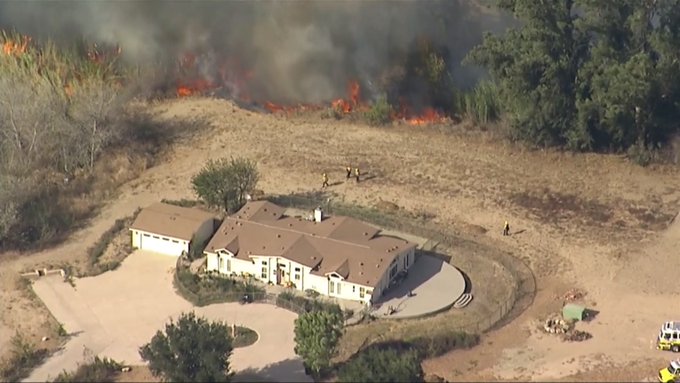
Here’s an example of why homes need defensible space.
Why #DefensibleSpace is so important. #CornellFire
Canyon Fire
This fire was first noted in Sequoia National Forest. It was north of Lake Isabella near Gold Ledge Camp Ground, Cal Fire noted.
#CanyonFire – Pacific Highlands Ranch – The fire is now extinguished. Copter 2 is on scene has picked up water from the vernal pond south of Caminito Mendiola. The fire is located north of the pond and south of Caminito Mendiola.

Although still listed as active on Cal Fire, it hasn’t been updated in a few days. As of December 5, it was 136 acres and 70% contained.
#CanyonFire #TulareCounty #KernCounty 136 acres 70% contained t.co/gENbjruVJk inciweb
According to Inciweb, as of December 7 it’s 83 acres and 80% contained. The cause is under investigation. It was north of Kernville, along the east side of Mountain 99. The plan is to “mop up and extinguish any pockets of heat.”
Dolan Fire
This fire started in August and as of December 3, according to Inciweb, it was 98% contained at 124,924 acres. The cause is unknown. It was 10 miles south of Big Sur and north of Limekiln State Park. Dry weather may bring activity in small, isolated areas.
Fork Fire
Although Inciweb still lists this fire on its map, it was 100% contained as of November 9 at 1,673 acres.
Laura 2 Fire
This fire listed on Inciweb’s page is 100% contained as of November 24. It had grown to 2,400 acres.
Mountain View Fire
This fire was first reported November 17 in Mono County near Meadow Drive and Springer Court. It’s still listed as active on Cal Fire maps.
North Complex Fire
This fire was first reported August 18. The fire is in Plumas and Butte counties and it began near Flemmings Sheep Camp. It’s 318,935 acres and 100% contained and was started by lightning. There were 16 fatalities and 2,455 structures damaged in the fire.
A December 7 update notes: “The fire closure remains in effect until conditions improve. The closure area follows (generally) the actual fire perimeter and affects all national forest land, roads, trails and campgrounds within the fire closure area. County roads and private land within the perimeter are not affected by the federal land closure. For more information about the closure, please check the forest website at: https://www.fs.usda.gov/alerts/plumas/alerts-notices. Within the closure area, falling trees (often falling without warning), smoldering stump holes, are some of the public safety hazards that exist within the fire perimeter. Longer term hazards include landslides and flash flooding caused by erosion or suppression activities not yet repaired. These hazards may lead to serious injury or death. Fire suppression repair will continue as conditions allow, mitigating these threats to public safety and resource values.”
Pinehaven Fire
This fire is out-of-state in Washoe County, Nevada, but close enough to be listed on Cal Fire’s page.
Rattlesnake Fire

This fire is 8,177 acres and 85% contained as of December 2. It was caused by lighting and is burning in Sequoia National Park and Inyo National Forest. It’s being monitored by air as necessary.
Red Salmon Complex
This fire is in Humboldt County and was first seen near Salmon Mountain, northeast of Willow Creek. It started July 27 in the Trinity Alps Wilderness Area, Inciweb noted, in steep and rugged terrain. It’s now 144,698 acres and 100% contained as of November 23. Although it’s listed as active on Cal Fire’s website, Inciweb is no longer providing updates.
Slater/Devil Fires
These fires listed on Inciweb’s map are 100% contained.
SQF Complex Fire

This fire is 90% contained at 174,178 acres as of December 1, according to Inciweb. It was caused by lightning, 25 miles north of Kernville. The fire is not expected to spread and is in patrol and monitor status. Forest closure is expected through the end of December.
Woodward Fire
This fire is listed on Inciweb’s map, but was 100% contained as of October 9 at 4,929 acres.
READ NEXT: Daily COVID-19 Updates