
The Apple Fire in Riverside County, California, has exploded in size in just a day. By Friday night it was 1,700 acres in size, but by Sunday it was more than 20,000 acres in size. Read on to see maps of the fire, photos, evacuation updates, and details on how to stay updated on the latest news. Remember that fires can change rapidly, so follow your local news for the latest updates if you are in a region near the fire.
See Maps for the Apple Fire
The Apple Fire started around 4:55 p.m. on Friday, July 31 as two fires that eventually merged into one. By Sunday it had exploded in size to 20,516 acres with no containment, Inciweb reported.
KTLA 5 reported that the fire started in the 9000 block of Oak Glen Road. Below is a map by MappingSupport.com of the fire. This shows satellite hotspots, but it should not be used for emergency planning since satellite data is a couple of hours behind real-time. You can see the full map here.
Below is a map provided by Fire Mappers showing the general location of the fire. You may need to click “Do not show this splash screen again” and “OK” to see the map. The full map is here.
The fire started in Cherry Valley along Oak Glen Road and the cause is under investigation. You can also see a map of the fire’s location on Cal Fire’s state map here. Another map from Inciweb is below:
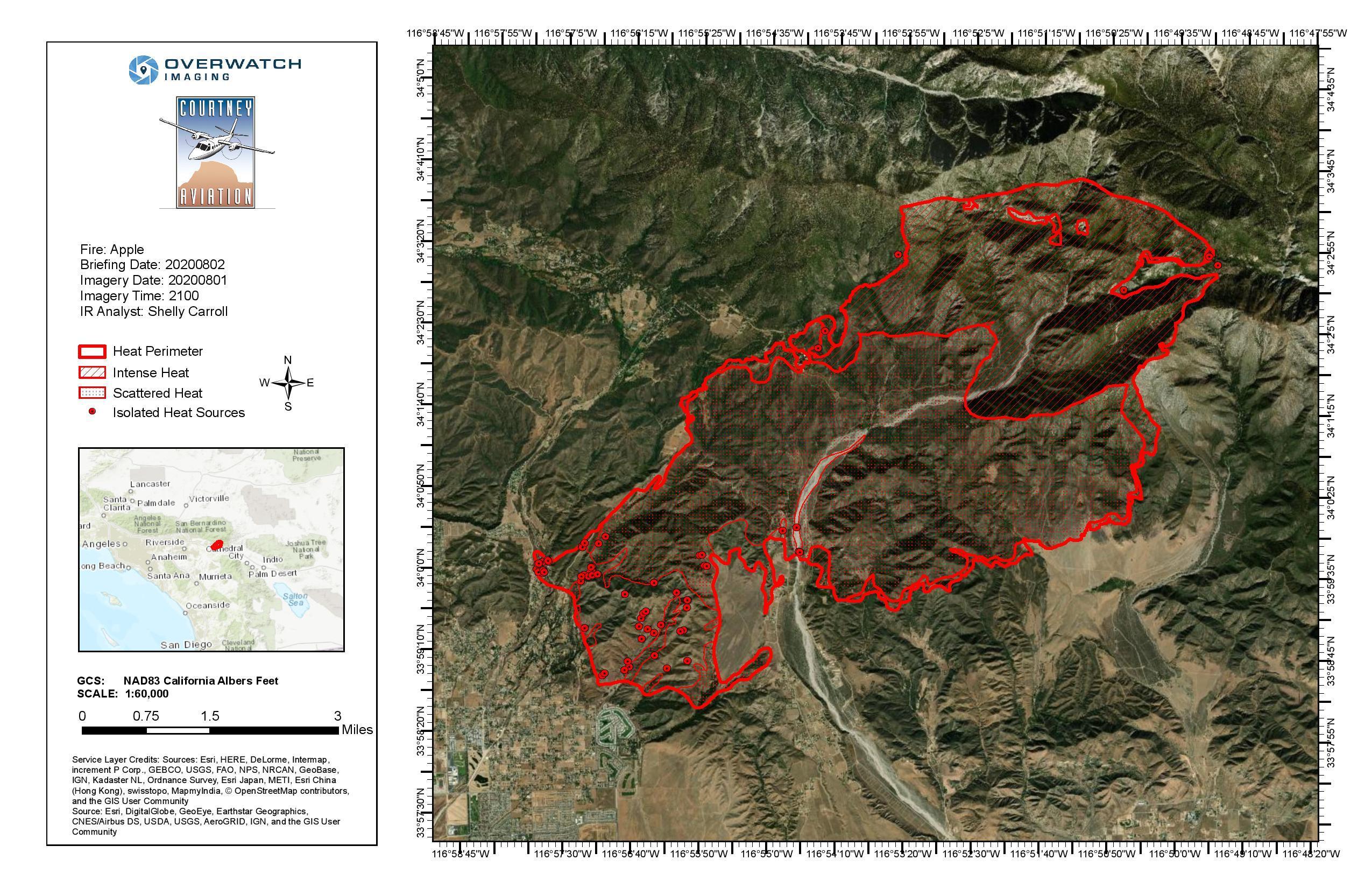
So far, one family dwelling and two outbuildings have been destroyed in a region near Avenida Miravilla, Riverside County reported.
Evacuation Orders & Maps
According to the Riverside County’s Incident Page for the fire, evacuation orders were in place for the following regions. As of the time of publication, no evacuation orders previously issued had been lifted.
- (Note: See the map below for the most updated evacuation information for Riverside County)
- North of Morongo Rd East of Millard Canyon Rd West of Whitewater Canyon Rd
- Potato Canyon Area West to Raywood Flat, in San Bernardino County
- North of Wilson St, east of Sunset Ave and west of Hathaway St.
- East of Oak Glen Rd West of Banning Canyon Rd and along Pine Beach Rd
- Residents north of Cherry Valley Blvd West of Highland Springs East of Beaumont Avenue (this was first issued on 7/31)
- Residents north of Gilman Street cross of Bluff Street (this was first issued on 7/31)
- Residents South of the County Line, North of Dutton Street and East of Oak Glen Road (this was first issued on 7/31)
Evacuation warnings (which mean to be prepared to leave at any time) are issued in the following areas:
- North of Morongo Rd East of Millard Canyon Rd West of Whitewater Canyon Rd (8/1)
Below is a map of the evacuation zones. Red is under an evacuation order and yellow is under an evacuation warning. You can see the full map here. This map will be updated by emergency management as evacuation orders change.
Evacuation centers are set up in the following locations:
- Beaumont High School at 39139 Cherry Valley Boulevard, Beaumont, California (Beaumont Ave. and Cherry Valley Bl.)
- An animal evacuation center is also set up at Beaumont High School, with Animal Control on the scene.
In San Bernardino County, evacuation updates are being shared on Twitter. Here are some of their recent updates:
Road closures are also in place in some regions. About 2,586 homes and 7,800 people are under evacuation orders, according to Cal Fire.
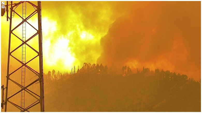
Photos & Videos of the Fire
Here’s a video of the fire from Friday night:

If the video above does not embed, you can watch it here.
How to Stay Updated on the Fire
The following sources will help you stay updated on the fire.
- Riverside County Fire Department‘s Apple Fire Incident Page
- Riverside County Emergency Management webpage
- Cal Fire Riverside County’s Twitter Page
- Cal Fire San Bernardino’s Twitter Page
- Riverside Emergency Management’s Twitter Page
- Banning Police Department’s Twitter page (not being frequently updated)
- San Bernardino County Sheriff’s Twitter Page
- Apple Fire Inciweb page
READ NEXT: The latest COVID-19 deaths, cases, and updates