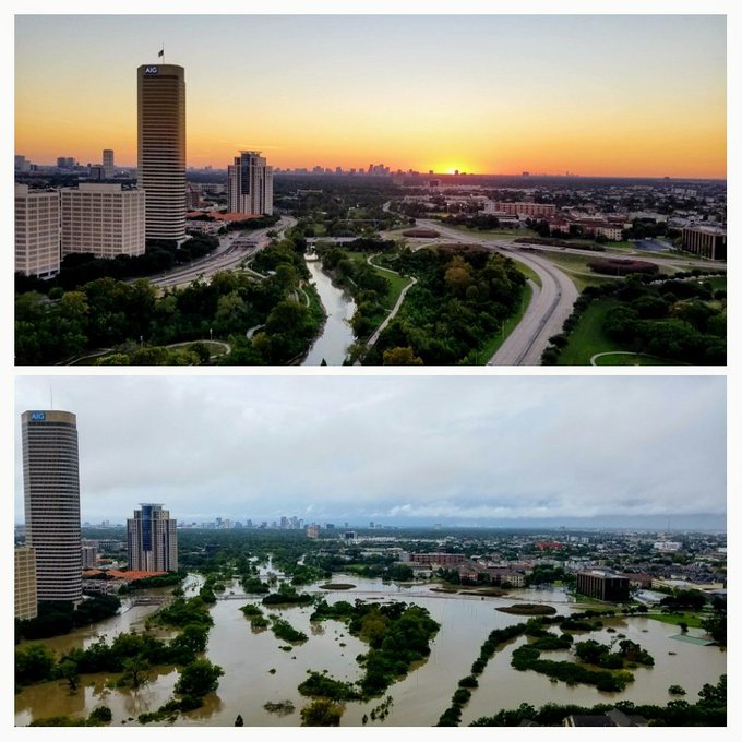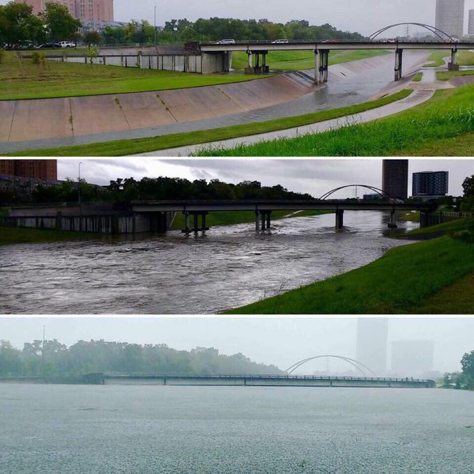
As Houston deals with massive flooding, attention has turned to the city’s complex system of bayous. In fact, Houston is known as “Bayou City,” a nickname dating at least to the middle of the 20th century.
You can check bayou levels in real time here. Track water levels in bayous here. Get precise local rainfall data here.
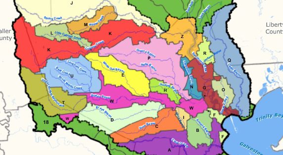
According to the Bayou Preservation Association, there are “22 bayou systems and waterways in the greater Houston region. Most of these watersheds are located within Harris County and extend to Spring Creek, Clear Creek, and Cedar Bayou, plus Lake Houston.” On August 29, a bridge over Greens Bayou collapsed.
ABC News reported on August 29 that the U.S. Army Corps of Engineers “began releasing water into the Buffalo Bayou from two flood-control dams in Houston on Monday — a move that could affect thousands of area residents.” The measure was taken for flood control. “Engineers were forced to start the process earlier than previously announced because water levels in the reservoirs had ‘increased dramatically in the last few hours,'” ABC reported.
According to ABC, “Both dams were constructed by the federal government in the 1940s to reduce flooding along Buffalo Bayou, a narrow body of water that runs through downtown Houston.”
KHOU-TV reported, “Barker and Addicks reservoirs continue to rise and are impacting residents in neighboring areas after a controlled water release.”
According to the BPA, “The Buffalo Bayou watershed is primarily located in west-central Harris County with a small portion crossing into Fort Bend County. Buffalo Bayou travels through heavily wooded residential areas and much of the bayou remains in a natural state. Near downtown Houston, White Oak Bayou flows into Buffalo Bayou. Lower Buffalo Bayou consists of the portion that runs east of Shepherd Drive and includes 10-square miles of the bayou corridor.”
There is concern about what’s in the bayous.
The bayous are as follows, with facts about them from BPA:
Addicks Reservoir: Drainage Area, 138 Sq. Miles and Primary Streams: Bear Creek, Horsepen Creek, Langham Creek, South Mayde Creek.
Armand Bayou: Drainage Area, 60 Sq. Miles and Open Stream Miles: 86 Miles. Primary Streams: Armand Bayou , Horsepen Bayou , Big Island Slough , Willowspring Creek , Spring Gully
Barker Reservoir Drainages: Drainage Area, 126 Sq. Miles and Open Stream Miles: 47 Miles. Primary Streams: Mason Creek, Upper Buffalo Bayou
Brays Bayou: Drainage Area, 127 Sq. Miles, Open Stream Miles: 121 Miles. “Crosses southern Harris County from west of Highway 6 eastward to the Houston Ship Channel.”
Buffalo Bayou: Drainage Area of 102 Sq. Miles and 106 miles of Open Stream Miles. “Starts just west of Katy, Texas and winds its way through Katy and West Houston towards Downtown Houston.”
Carpenters Bayou: Drainage Area, 25 Sq. Miles, Open Stream Miles: 44 Miles. Primary Streams: Carpenters Bayou
Cedar Bayou: Drainage Area, 202 Sq. Miles, Open Stream Miles: 128 Miles. “With 128 miles of open stream passage, Cedar Bayou flows south from its headwaters in Liberty County, widening into a series of small lakes before eventually emptying into Galveston Bay.”
Clear Creek / Clear Lake: Drainage Area, 197 Sq. Miles, Open Stream Miles: 154 Miles. “Starts in southern Harris County and runs eastward to Clear Lake.”
Cypress Creek: Drainage Area, 317 Sq. Miles, Open Stream Miles: 250 Miles. “Begins in Waller County and flows east to join Spring Creek in northern Harris County.”
Dickinson Bayou: Open Stream Miles, 23 Miles.
Goose Creek/Spring Gully: Drainage Area, 32 Sq. Miles, Open Stream Miles: 60 Miles. “Segment 1 is Riley Fuzzel Rd. Bridge to Jesse H. Jones County Park. Segment 2 is Jesse H. Jones Park to Hwy. 59 N. Bridge.”
Greens Bayou / Halls Bayou: Drainage Area, 212 Sq. Miles, Open Stream Miles: 308 Miles. “Upper reach flows east from northwestern Harris County (west of State Highway 249 near Willowbrook); lower reach flows south into the Houston Ship Channel.”
Hunting Bayou: Drainage Area, 30 Sq. Miles and Open Stream Miles: 45 Miles. “Southeast from just east of the Hardy Toll Road to the Houston Ship Channel.”
Jackson Bayou: Drainage Area, 25 Sq. Miles, Open Stream Miles: 36 Miles. Primary Streams: Jackson Bayou.
Lake Houston Drainage: Drainage Area, 2,600 Sq. Miles. Primary Streams: East and West Forks of the San Jacinto River, San Jacinto River, Luce Bayou
Little Cypress Creek: Drainage Area: 50 Sq. Miles, Primary Streams: Cypress Creek
Lower San Jacinto River: Drainage Area: 487 Sq. Miles, Open Stream Miles: 310 Miles. “Primary Streams: San Jacinto River, Houston Ship Channel, Cotton Patch Bayou, East Fork San Jacinto River, Boggy Bayou, Patricks Bayou, Panther Creek.”
Sims Bayou: Drainage Area: 94 Sq. Miles, Open Stream Miles: 121 Miles. “Begins near Missouri City inside Beltway 8 and meanders northeast across southern Harris County until joining Buffalo Bayou east of Loop 610.”
Spring Creek: Drainage Area: 284 Sq. Miles, Open Stream Miles: 121 Miles. “Originates north of Prairie View and forms the northern boundary of Harris County as it flows east into the West Fork of the San Jacinto River and ultimately into Lake Houston.”
Upper Galveston Bay Shoreline Tributaries: Drainage Area: 20 Sq. Miles, Open Stream Miles: 24 Miles. Primary Streams: Little Cedar Bayou, Pine Gully
White Oak Bayou: Drainage Area: 111 Sq. Miles, Open Stream Miles: 146 Miles. “Flows southeast across Harris County from northwest of FM1960 to Buffalo Bayou in downtown Houston.” The Jersey Village, TV Facebook page wrote on August 29, “We are aware that the Flood Control District has said the Addicks reservoir could overflow and impact the White Oak Bayou. It appears that any impact would be well south and southeast of Jersey Village. We will certainly monitor this but we do not anticipate any impact to Jersey Village because of this.”
Willow Creek: Drainage Area, 54 Sq. Miles. Open Stream Miles: 56 Miles. Primary Streams: Willow Creek.
The early settlers of Houston were attracted to the area by the bayous. “The bayous themselves promised easy transportation and easy access to water. The fact that such an atmosphere could be found in Texas, a newly sovereign nation which suffered from water shortages, seemed to be a boon,” reports HoustonBayou.
The site added, “Flooding is perhaps one of the few ways that suburbanites connect to the bayou. In 2002, a particularly rainy summer caused snakes and turtles to seek refuge from the flooding bayous in the backyards of local suburbanites.”
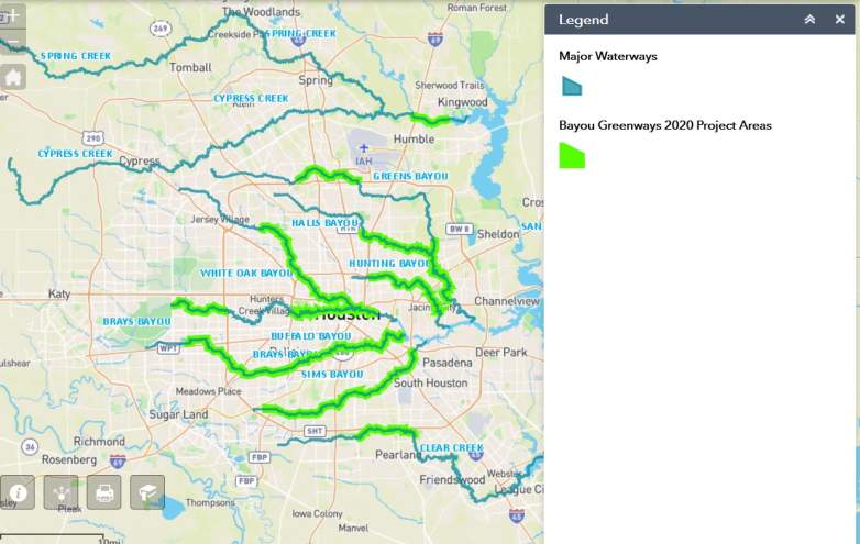
The Houston Parks Board has launched a major project to create green space along the Bayous. “One of the most ambitious parks projects in the nation is happening right here in Houston: Bayou Greenways 2020,” its website reads.

Bayou Greenways 2020 is transforming 3,000 underutilized acres of land along the bayous into linear parks with 150 miles of hike-and-bike trails connecting parks and communities like never before.


