Getty
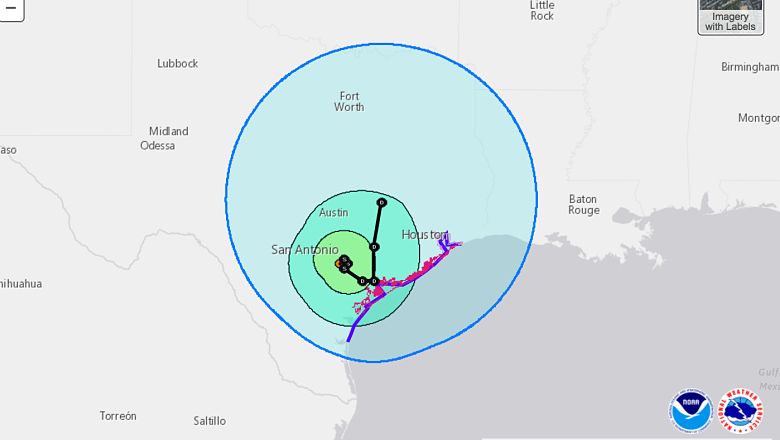
Hurricane Harvey has been downgraded to a Tropical Storm, but is still bringing a great deal of rain and damaging wind to the Austin area. Wind and rain is expected to continue throughout the remainder of the weekend and could continue into early next week if Harvey stalls as expected.
Throughout most of the day, Austin has experienced sustained winds of 30 mph and gusts up to 43 mph. There is currently steady rain in the area and localized flooding is a possibility. The National Weather Service has issued a tornado watch for the Austin area. There is also a Flash Flood Watch in the Austin – San Antonio area through Tuesday morning.
“Copious amounts of rain are expected to continue and will last through at least Tuesday as Tropical Storm Harvey moves onshore. This watch may need to be expanded in time and area over the
next several days if Harvey lingers around beyond Tuesday. Rainfall totals in the watch area through early next week will average 10 to 20 inches along and east of Interstate 35 with isolated amounts in excess of 30 inches possible along and south of Interstate 10. Significant flash flooding is possible as Harvey slowly moves or even stalls. Devastating mainstem river flooding is possible east of Interstate 35 and south of Interstate 10.”
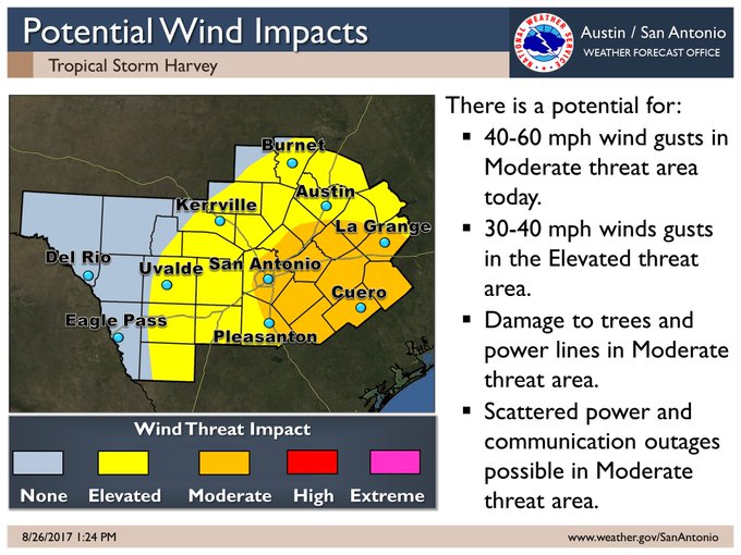
1:37p 8/26 – Wind threat continues to slowly decrease, but 30-60mph gusts are possible across various parts of South Central Texas today.
1:38p 8/26 – While the main threat of tornadoes is currently east of the area towards Houston, there remains a small risk east of I-35
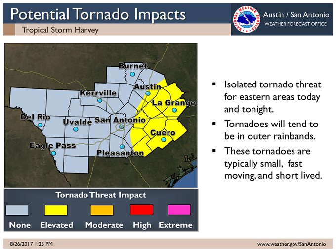
WHAT TO DO IF THERE’S A TORNADO IN YOUR AREA: If you are inside a home or building structure during a tornado, you should head to the lowest level of the home (preferably the basement). If possible, go to a room where there are not any windows. If this is not possible, you should stay as far away from the windows as possible. In many cases, a closet or a bathroom are the safest places to be if a tornado makes landfall near your home. For a full run-down of tornado preparedness, click here.