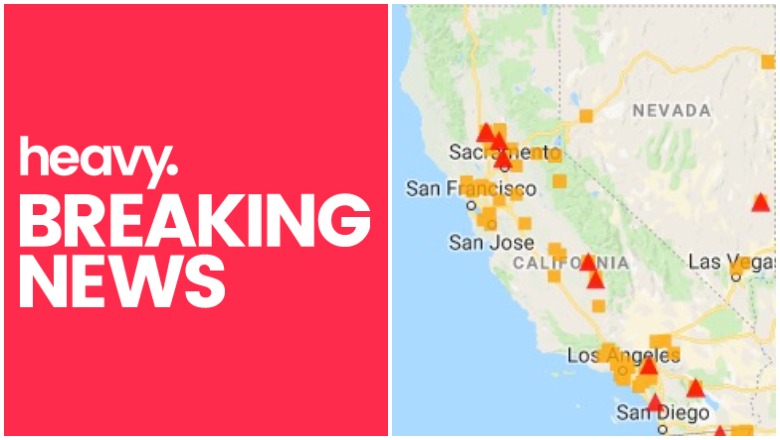
Mapping Support California fires
A number of fires are growing in the state of California. Here is a list, with maps, of the larger fires that are around the state, their current containment levels, and where they are located. Read on for more details. (Note: If you came here looking for details on the fires on June 30, see Heavy’s updated story here.)
California Fire Maps
First, below, is a general, interactive map of some of the fires in California right now, provided by Google and CAL FIRE. Fires in red are active and fires in black are contained.
List of Active Fires in California
Not every active fire in California that you might be concerned about is listed on a general map. Here is a list of the biggest active fires going on right now, as of the time of publication.
Chrome Fire
The Chrome Fire, located off Highway 162 and Forest Highway 7 north of Elk Creek in Glenn County is 70 percent contained and 2,290 acres, per Cal Fire.
Grape Fire
This wildfire is at Black Bennet Rd., near Grape Creek, eight miles southwest of Burnt Ranch in Humboldt County. It is 60 percent contained at 244 acres, per Cal Fire.
Santiago Fire
#SantiagoFire [update] off Highway 241 and Santiago Canyon Road (Orange County) per @OCFA_PIO is now 155 acres and 30% contained. Forward spread stopped. t.co/0mLh1DPvwM

This fire is at 155 acres and 30 percent contained, with the forward spread stopped. It’s off Highway 241 and Santiago Canyon Road in Orange County, per Cal Fire.
Chino Hills / Euclid Fire / Riverside Fire
Firefighters are battling a 100 acre fire off Highway 71 south of Euclid Avenue in Chino (Riverside County). #EuclidFire t.co/QJQ2DKTie5
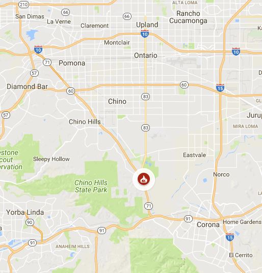
The Euclid Fire in Chino (Riverside County) is 100 acres and 0 percent contained at this time. It is a wildland fire located at Highway 72 south of Euclid Avenue. There are currently no structure threats or evacuations as of the time of publication. About 120 firefighters are responding, along with two helicopters and five fire crews.
Portola Fire / Beverly Hills Fire
#PortolaFire in Beverly Crest now estimated at 32 acres. t.co/Nd1pWnayYa
Here is map of the Portola Fire evacuation warning areas and mandatory evacuation areas:
This fire in West LA is 32 acres in size. The brush fire in Beverly Hills was originally reported at 1:57 p.m. in the 9800 block of West Portola Drive in the Beverly Crest area. Although the fire was smaller in size, its location prompted the evacuation of nearby homes. The fire was threatening homes in Portola and Yoakum Drive, NBC reported, and was burning uphill toward Benedict Canyon Drive. Evacuations were ordered in the area of San Ysidro Drive, between Beeson Drive and Milboro Place. An evacuation center was set up at Westwood Recreation Center.
This fire is also being referred to as the Benedict Canyon fire, as officials have advised residents in areas of Benedict Canyon Drive from Portola to Yoakum to consider evacuating, ABC 7 reported.
To stay updated on evacuations for this fire, follow @ReadyLA or @LAFD.
Beaver Fire
Firefighters are battling a 20 acre fire off Coalinga Highway and Airline Highway, East of King City (San Benito County). #BeaverFire
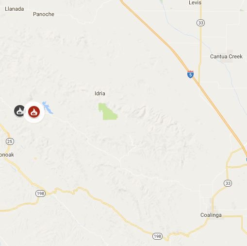
This fire in San Benito is 20 acres. It’s located near Coalinga Highway and Airline Highway east of King City.
Coronado Fire
#SantaPaula Update: E55 onscene of a 1/2 acre brush fire running uphill near the Santa Paula Hospital.. this is the #CoronadoFire
This fire is active in Ventura County, appearing to be about half an acre but nearing the Santa Paula Hospital. Some sources are reporting that forward progress for the fire was stopped, but follow #CoronadoFire on Twitter for updates. This may also be called the Santa Paula fire.
De Luz Fire
.@CALFIRESANDIEGO is at scene of a vegetation fire near the 3400 blk of Conquistador Rd in De Luz.
#DeLuzFire

This fire is active in the San Diego region. It’s a smaller vegetation fire near the 3400 block of Conquistador in De Luz. It’s six acres in size and it appears the forward spread of the fire has been stopped.
#DeLuzFire, vegetation fire near the 3400 blk of Conquistador Rd in De Luz, Fallbrook has consumed about 6 acres & 0% containment.
#DeLuzFire [update] IC reports that the forward rate of spread has been stopped. The fire is still estimated to be 6 acres.
Prado Dam
A fire from a burning car on Corona (71) Expressway near Prado Dam set off a brush fire that partially closed the expressway, Patch.com reported. The fire was on 71 north, near Riverside (91) Freeway. The fire had burned to about 120 acres as of 4:07 p.m., but not structures were immediately threatened.
According to the California Fire Map, the following fires are now contained:
- South Fire: An LA county fire that grew to 175 acres off I-5 and Calgrove Blvd. in Santa Clarita.
- Apple Fire: Now 100 percent contained, this was in Tehama County and grew to 2,956 acres.
- Eastern Fire: This fire in San Benito County grew to 513 acres and is now 100 percent contained.
- Airline Fire: This fire in San Benito County grew to 1,314 acres and is now 100 percent contained.
- Stone Fire: This fire in Los Angeles County grew to 1,352 acres and is now 100 percent contained.
- Liberty Fire: This fire was quickly put out at 62 acres in size in San Joaquin County.
To stay updated on current fire statuses, follow @Cal_Fire.
This is a developing story.