The Pawnee Fire was coming under control today when a flareup prompted more evacuations of residents and businesses in California. According to CAL FIRE’s latest update, the fire is 13,700 acres and 73 percent contained. But the latest flareup might change those numbers slightly. Here is what we know so far.
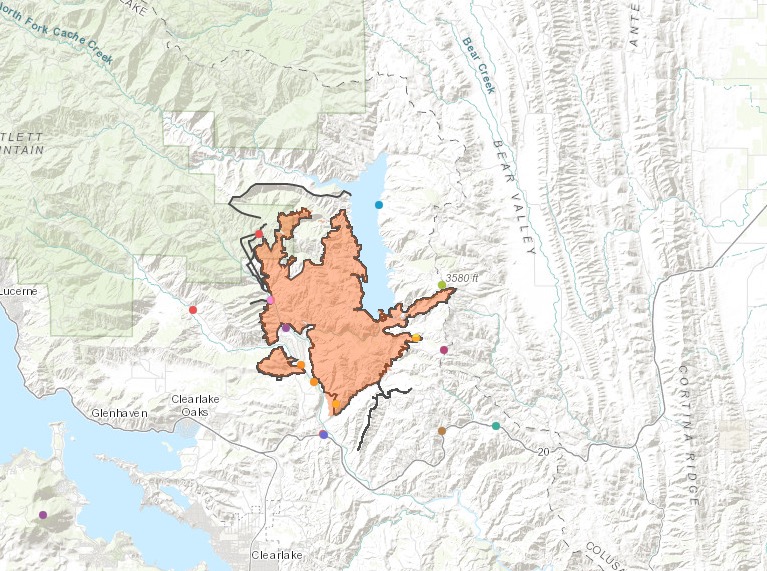
Map of the Pawnee Fire
Before the latest flare up happened, the fire was at 13,700 acres and 73 percent contained, according to CAL FIRE. You can see a map of the fire above, from YubaNet.com and Google. Twenty-two structures have been destroyed by the fire.
Here’s another map, provided by the Bureau of Land Management.
Bureau of Land ManagementPawnee Fire Map
You can also use this general map of California fires, provided by Google and CAL FIRE. Find the Pawnee fire and zoom into the location for more details.
Evacuation Notices Issued on June 30
At 4:38 p.m. local time, the Lake County Sheriff’s office issued new mandatory evacuation notices, YubaNet.com reported. These evacuations were issued for all residents and businesses in the Double Eagle Subdivision area because of a flare up. Two days earlier, the Double Eagle Ranch Community’s evacuation had been lifted.
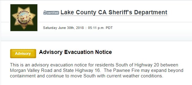
Now, there’s a chance the new mandatory evacuation may be extended. According to YubaNet, an advisory evacuation notice is also in effect for residents south of Highway 20 between Morgan Valley Road and State Highway 16. Current weather conditions may result in the Pawnee Fire expanding.
Advisory Evacuation notice for residents South of Hwy 20 between Morgan Valley Road & State Hwy 16.
Earlier, the Walker Ridge area had been under an evacuation notice, but on Friday night they were allowed to return home.
An evacuation center is being set up at Lower Lake High School, KTVU reported.
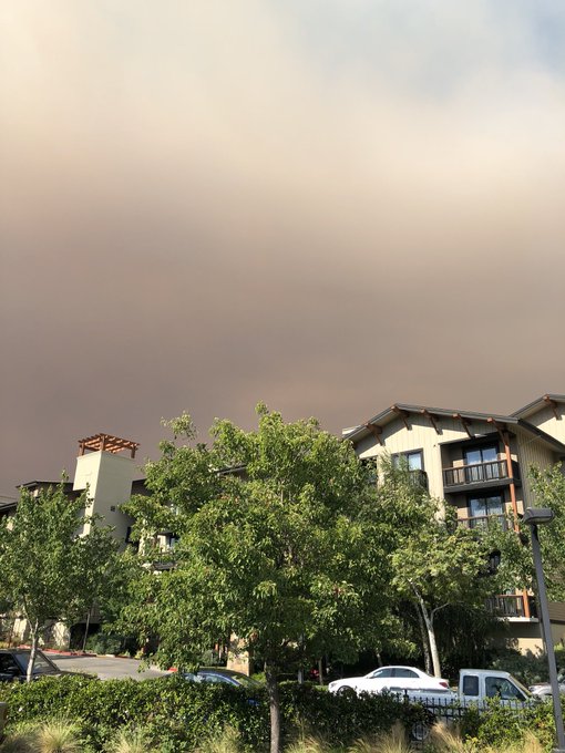
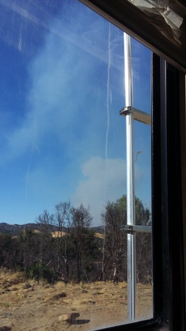
Photos & Videos of the Pawnee Fire
Here are maps and videos of the fire, shared by people in the area.
Behind the @Westin Napa. #Guindafire and #pawneefire
Updated #GOES16 visible satellite imagery late Saturday afternoon shows smoke from #GuindaFire in northwest Yolo County covering nearly all of Napa County. Meanwhile, there has been a flare up of the #PawneeFire in Lake County. #CAwx
#PawneeFire FLAREUP Heading Right TOwARDS My Town & I EVAC ADVISORY ISDUED
#PawneeFire closes Hwy 20. New FIre on Hwy 16–the #GuindaFire relatively closeby.
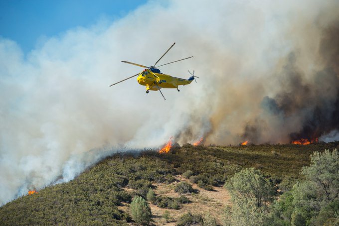
The Pawnee Fire on June 24:
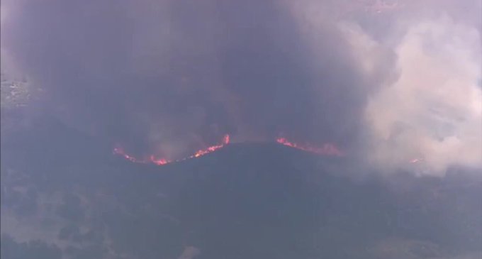
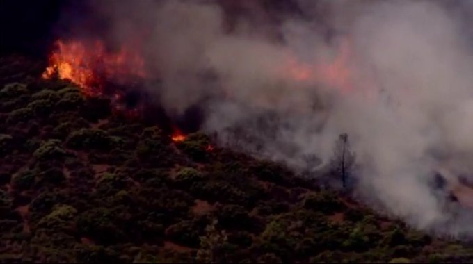
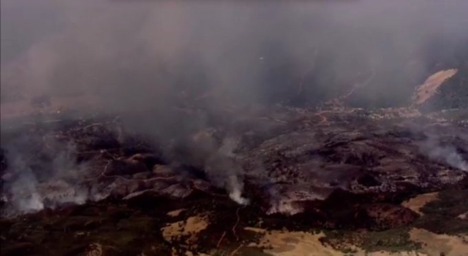
Live aerials of the #PawneeFire in Lake County, CA, courtesy of @KTVU FB page. #cawx #cafire

This is a developing story.