Colorado Division of Homeland Security and Emergency Management Colorado Fires
Fires continue to be a problem in Colorado on July 11, 2018. Here are where all the current fires are located, along with maps and evacuation updates.
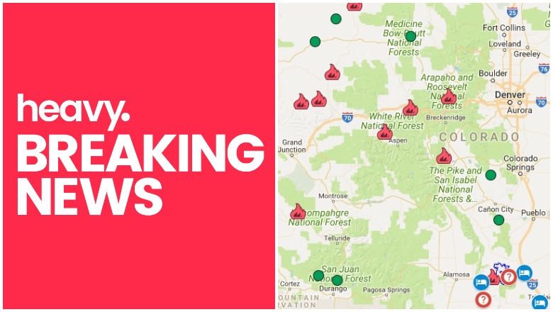
General Map of Colorado Fires
The map below is an interactive map of some of the bigger fires in Colorado, produced and managed by the Colorado Division of Homeland Security and Emergency Management and Google. Fires in red are active and fires in black are contained.
The map above lists numerous active fires. We will describe those fires in more detail in the next section.
List of Active Fires in Colorado as of July 11
416 Fire
This fire is no longer listed as active.
Burro Fire
This fire is no longer listed as active.
Fawn Fire
This fire is 1,400 acres and 75 percent contained. It’s burning in a rugged, remote section of the Piceance Basin, about 30 miles southwest of Meeker, according to Inciweb. The location is at 39.746 latitude, -108.406 longitude.
Lake Christine Fire
This fire is 6,180 acres and 43 percent contained (it was only 0 percent contained on Friday, so progress has been made on this fire.) Although the fire is still growing a bit, containment has also increased. Three homes were destroyed by the fire. The fire is located one mile north of Basalt, Colorado. Minimal growth is expected in the next 24 hours.
The fire was caused by human activity when two people shot trace ammunition at the gun range despite local fire bans, CBS Denver reported. The ammunition sparked the fire and arrest warrants were issued for the people involved.
You can view a map of the Lake Christine fire here. The map is not currently embeddable. Keep up with details via the Eagle County Sheriff Twitter account or Facebook. Or call 970-510-0705 with questions.
Unfortunately, the fire has left a lot of destruction in its wake.
Take a closer look at what evacuated residents in El Jebel returned home to after evacuations due to the #LakeChristineFire were lifted Sunday morning on today’s #frontpage. t.co/LU6oZT1cE0

1,793 residents from 664 homes had to be evacuated. Of those, 782 have been allowed to return to their homes as of July 9.
Red Canyon 2 Fire
This fire is 26 acres and 60 percent contained. The cause is unknown. It’s located about 2.5 miles east of Wolcott, Colorado. It was originally reported on Sunday, July 8 near the Eagle Springs Golf Course on a ridge to the east of the Red Canyon subdivision on the White River National Forest lands.
Sprague Gulch Fire
This fire is 91 acres and 0 percent contained.
Skunk Fire
This fire is 650 acres with 0 percent containment. It was started by lightning and is located 30 miles north of Craig at 40.976 latitude, -107.529 longitude. According to Inciweb, firefighters have been successful at keeping the fire from moving south toward Wilderness Ranch and Bakers Peak.
Smith Fire
This fire is 76 acres and 0 percent contained. It was caused by lightning and is located at 40.117 latitude, -107.899 longitude.
Spring Fire
The Spring Fire is now 107,627 acres and 77 percent contained. You can see a map of the Spring Fire above. Containment efforts have gone well, with a lot of progress made in recent days and no growth. The fire was determined to be caused by human activity and the suspect was arrested.
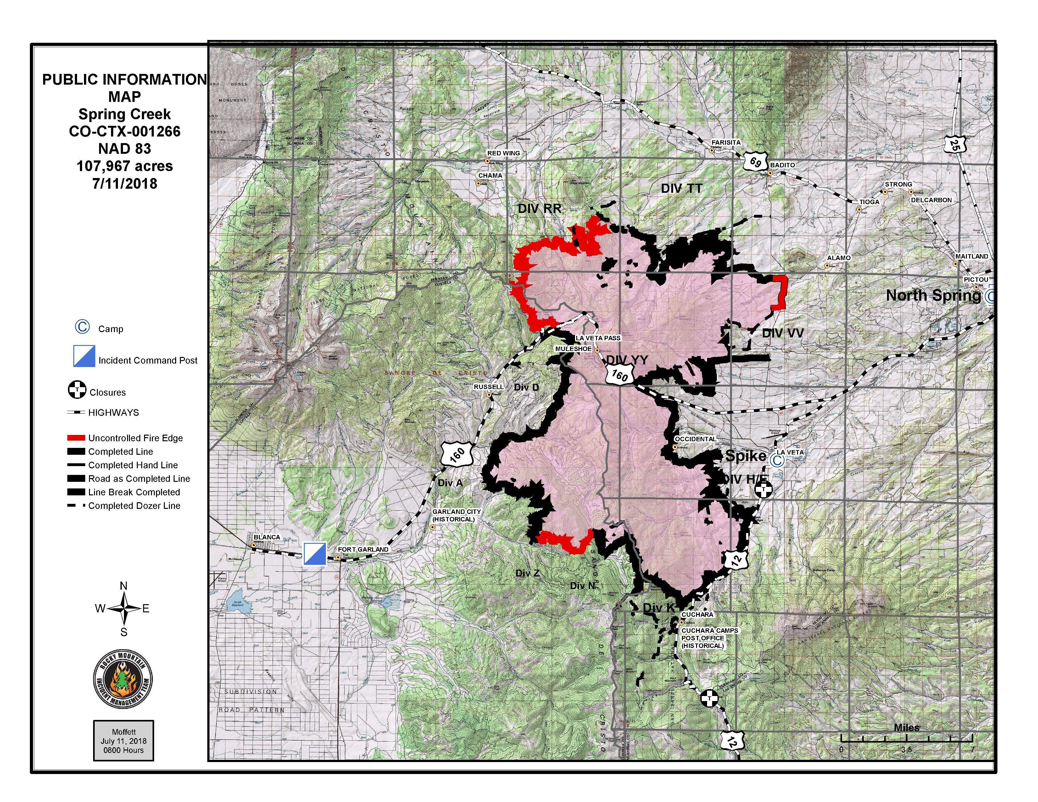
InciwebSpring Fire on July 11.
The fire is burning five miles east of Fort Garland and minimal activity is expected today. This is the third-largest fire in the state’s history. Some evacuations are starting to be lifted. The fire is being managed as two separate incidents, separated by Highway 160.
To stay updated on evacuations in Heurfano County, visit here. For updates on evacuations in Costilla County, visit here. You can also call 211 for current details about re-entry for evacuated areas.
If you’re unsure if your area is under evacuation or need more information, call 719-695-9573 between 7 a.m. to 9 p.m.
Sugarloaf Fire
This fire is 1,279 acres and 20 percent contained. Total containment is expected by August 31. It’s located north of Loveland Pass and 13 miles southwest of Fraser in a remote Grand County area. According to Inciweb, the fire is not immediately threatening homes or businesses.
Tabeguache Fire
This fire is 500 acres and 85 percent contained. In the last day, containment has increased with no growth. It’s located seven miles northeast of Nucla.
Weston Pass Fire
7/7 Saturday #WestonPassFire, Park County CO. 13,019 acres per overnight infrared analysis by fire staff. Open online map: t.co/1ZLj7f0SJ7 Want map legend? Need help? Open the map then click “Map tips” upper left corner. #GeoSpatial
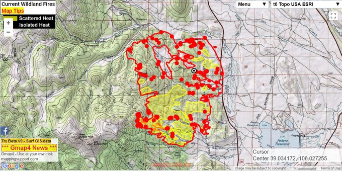
This fire started June 28 and is now 13,023 acres and is 64 percent contained. Officials are hoping to have it contained by July 29.
It was started by lightning and is located 9 miles southwest of Fairplay, in a remote area of Park County. A wind shift to the east is expected to push fire activity farther into the wilderness, Inciweb reported. But dry thunderstorms with possible gusty wind may increase fire behavior. CR 22 is closed to traffic right now. Three structures have been lost in the fire.
South Park Recreation Center is offering free showers to evacuees, firefighters, and any volunteers helping fight the fire.
You can find more details about all the fires on Colorado’s Emergency Management page here.
Additional Fires
On Tuesday night, a large fire broke out at the EVRAZ Recycling plant in Denver, 9 News reported. The metal recycling facility in Adams County (at 5601 York Street) still had crews on the scene on Wednesday. Heavy black smoke was still in the air.