Colorado Division of Homeland Security and Emergency Management Colorado Fires Near Me
Fires continue to be a problem in Colorado on July 17, 2018. Here are where all the current fires are located, along with maps and evacuation updates.
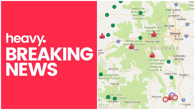
General Map of Colorado Fires
The map below is an interactive map of some of the bigger fires in Colorado, produced and managed by the Colorado Division of Homeland Security and Emergency Management and Google. Fires in red are active and fires in black are contained.
The map above lists numerous active fires. We will describe those fires in more detail in the next section.
List of Active Fires in Colorado as of July 17
Fawn Fire
This fire is 1119 acres and is now 100 percent contained. It was burning in a rugged, remote section of the Piceance Basin, about 30 miles southwest of Meeker, according to Inciweb. The location is at 39.746 latitude, -108.406 longitude. The fire was caused by lightning.
Lake Christine Fire
This fire is 6,822 acres and 59 percent contained. Although the fire is still growing a bit, containment has also increased. The fire is located one mile north of Basalt, Colorado. The fire was caused by human activity when two people shot trace ammunition at the gun range despite local fire bans, CBS Denver reported. The ammunition sparked the fire and arrest warrants were issued for the people involved. The two suspects, Allison Marcus, 22, and Richard Miller, 23, were arrested on charges of fourth-degree arson and firing woods or prairie, Aspen Times reported. They are both now free on a $7,500 bond each. They were arrested just after midnight on Saturday. They were initially approached by a deputy and an off-duty Forest Service officer at the gun range, and Marcus confessed and had called 911 to report the fire shortly after it started. Miller said he didn’t realize his type of ammunition was banned, because he saw a sign that said fires and fireworks were prohibited.
Photographer Pete McBride got front-row seats to the massive #LakeChristineFire as it nearly destroyed his 120-year-old home
@outsidemagazine t.co/ENSn66gq7X
You can view a map of the Lake Christine fire here. The map is not currently embeddable. Keep up with details via the Eagle County Sheriff Twitter account or Facebook. Or call 970-510-0705 with questions.
The fire may continue to creep in some areas due to a return to a dray weather pattern this week. Repopulation of evacuated Eagle County areas has been completed. At the height of the fire, 2,100 residents were evacuated.
Spring Fire
The Spring Fire is now 108,045 acres and 91 percent contained. You can see a map of the Spring Fire above or below. Containment efforts have gone well, with a lot of progress made in recent days and no growth. The fire was determined to be caused by human activity and the suspect was arrested.
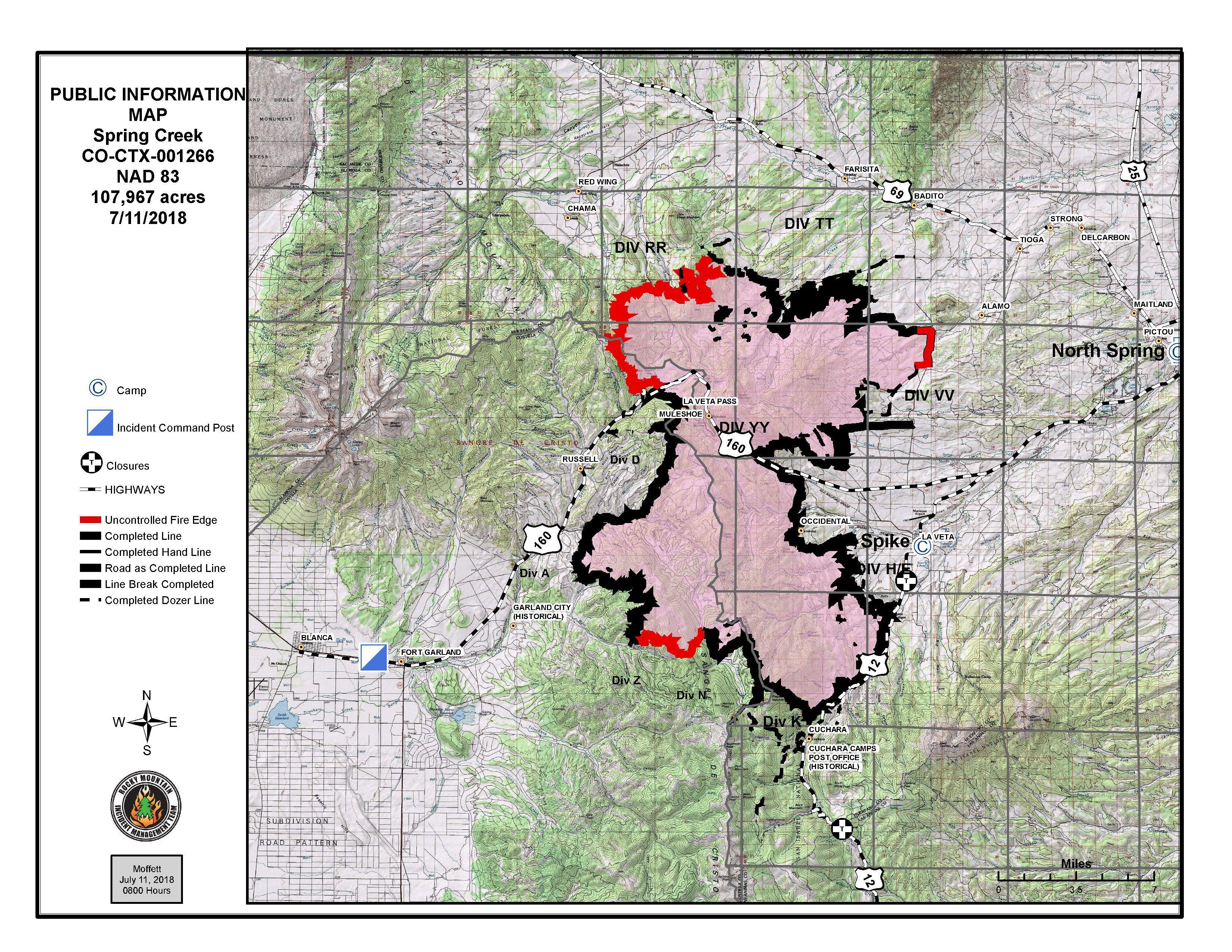
InciwebSpring Fire on July 11.
The fire is burning five miles east of Fort Garland and minimal activity is expected today, limited to highly isolated areas, Inciweb reported. This was the third-largest fire in the state’s history.
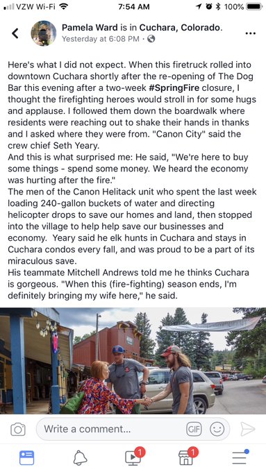
Looks like the #SpringFire firefighters were doing more to help than just put out the flames.
To stay updated on evacuations in Heurfano County, visit here. For updates on evacuations in Costilla County, visit here. You can also call 211 for current details about re-entry for evacuated areas. If you’re unsure if your area is under evacuation or need more information, call 719-695-9573 between 7 a.m. to 9 p.m.
Sugarloaf Fire
This fire is 1,280 acres and 35 percent contained. Total containment is expected by August 31. It’s located north of Loveland Pass and 13 miles southwest of Fraser in a remote Grand County area. According to Inciweb, the fire has slowed its spread but continued to creep and smolder. It may continue to spread in the upper reaches of the Darling Creek drainage. It was caused by lightning.
Weston Pass Fire
#FTB: The stage is set for scattered t’storms capable of heavy rainfall. HIGH #COFlood threat for the #SpringFire, #WestonPassFire, & #ChateauFire. A large, Moderate threat area includes #Denver, #COSprings. Details: t.co/nqnQK95QjO #COwx
This fire started June 28 and is now 13,023 acres and is 93 percent contained. Officials are hoping to have it contained by July 29. Minimal activity is expected today, and the potential for spread is limited to the southwestern portion, Inciweb reported.
It was started by lightning and is located 9 miles southwest of Fairplay, in a remote area of Park County.
You can find more details about all the fires on Colorado’s Emergency Management page here.