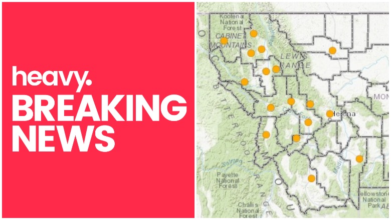
Montana Department of Natural Resources and Conservation Montana Fire Map Near Me
Seven wildfires are currently burning in Montana, for a total of 4,877 acres. Although the fires are much smaller in acreage than places like California, Washington, or Oregon are seeing, residents in the region will still want to keep an eye on the fires for changes and updates.
Two interactive wildfire maps for Montana are currently available. The first is provided by ArcGIS and the Montana State Library here and utilizes details from the USGS’s GeoMAC web services, including only wildfires that are 100 acres or larger and currently active in the state. You can visit this map here or view it below.
The next interactive map is provided by Montana.gov (the Montana Department of Natural Resources and Conservation) and you can view it here.
Here is a list of the current active wildfires in Montana, according to NIFC.
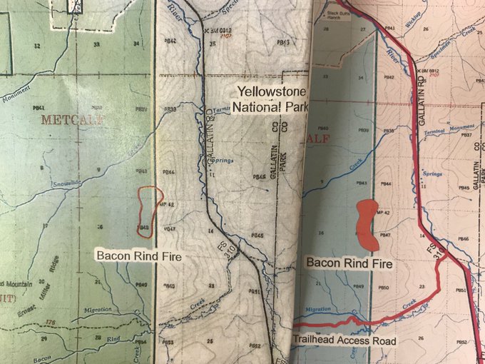
Bacon Rind Fire
Here’s a visual of how the #BaconRindFire has evolved.
On the left: July 23
On the right: July 24
Maps courtesy of Gallatin @forestservice
This fire is in the Custer-Gallanting National Forest. It’s 551 acres and 16 percent contained, located 17 miles north of West Yellowstone. It was caused by lightning. The location is 44.968 latitude, -111.102 longitude.
New Yellowstone Fire Emerges; Bacon Rind Fire Keeps Growing, Albeit Slowly t.co/J72QWF6Utp

The fire has had minimal growth in the last few days. It can be seen from Highway 191 but is currently not impacting the road. Few values are at risk from this fire currently. According to Inciweb: “The Bacon Rind Fire is a great opportunity to remove dead vegetation from the forest understory and maintain a healthy ecosystem that will be conducive to new growth.”
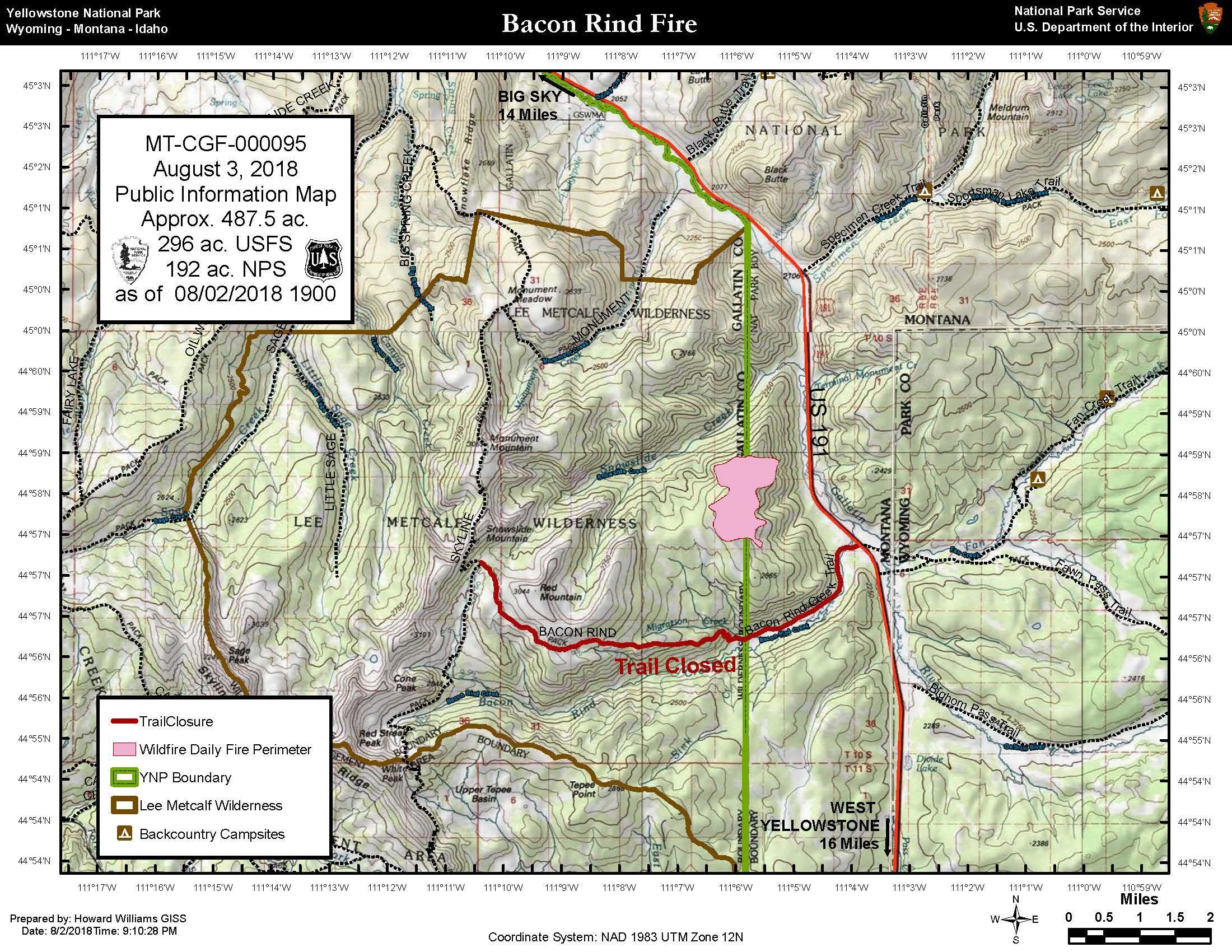
InciwebBacon Rind Fire Map
There are no current closures from this fire.
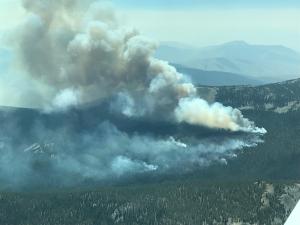
Brownstone Fire
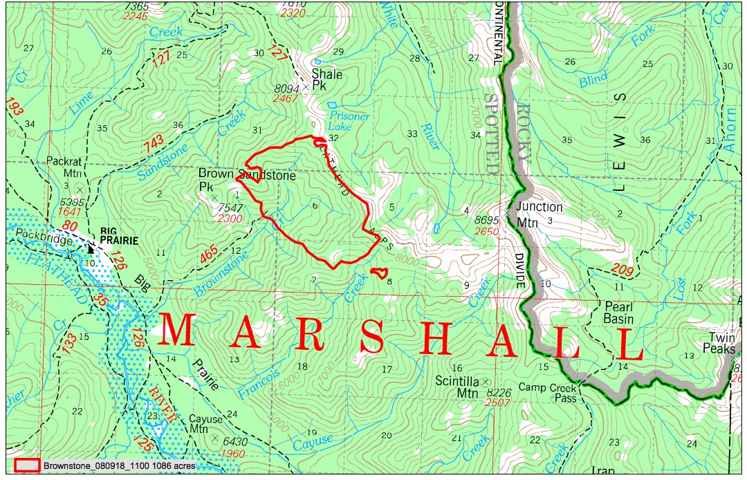
InciwebBrownstone Fire Map
This fire is in the Flathead National Forest. It’s 1,084 acres and 0 percent contained. It’s 25 miles east of Condon and was caused by lightning. It’s located at Brownstone Creek/Brown Sandstone Peak in the Bob Marshall Wilderness. The fire’s been moving to the southeast. Minimal movement to the west is expected. There are no current closures from this fire.
Davis Fire
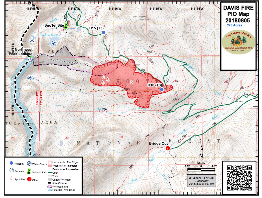
Davis Fire Map
This fire, in the Kootenai National Forest, is 380 acres and 25 percent contained. It’s located 10 miles northwest of Yaak at 48.958 latitude, -115.933 longitude.
Garden Creek Fire
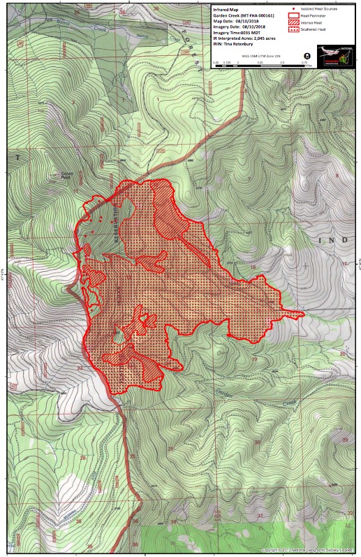
Garden Creek Fire Map
This fire, overseen by the Flathead Agency, is 2,018 acres and 10 percent contained. It’s located two miles north of Ronan, two miles north of Hot Springs, at 47.67 latitude, -114.76 longitude, and was caused by lightning. According to KPAX, the following roads are closed:
- HS-4000 road
- HS-5000 road
- HS-1000 road at the HS-5030 junction to the north of the fire
- HS-1000 road at the McGinnis road junction to the south of the fire.
Goldstone Fire
This fire, in the Beaverhead/Deerlodge National Forest, is 440 acres and 0 percent contained. It’s 12 miles south of Jackson and was caused by lightning. It’s burning in a high elevation basin near Goldstone Pass, according to Inciweb. It’s about five miles west of Reservoir Lake in the Park Creek drainage near Goldstone Pass in the Bitterroot Mountains, near the Montana and Idaho border. It’s in mountainous terrain. About 25 acres of the fire is now in Idaho.
#GoldstoneFire Info share from the @BvrhdDrldgeNF Refer to the Incident Overview @ t.co/PE3CWqOeZt
A section of the Continental Divide Trail is now closed at Lemhi Pass, north to Jahnke Mine. The Reservoir Lake Campground and Bloody Dick Rental Cabin are also closed, as of August 10.
There are no current maps of the fire provided by Inciweb since it grew in size.
Porcupine Fire
This fire is 17 acres and 95 percent contained. It’s 15 miles east of Eureka and was caused by lightning.
Tenmile Fire
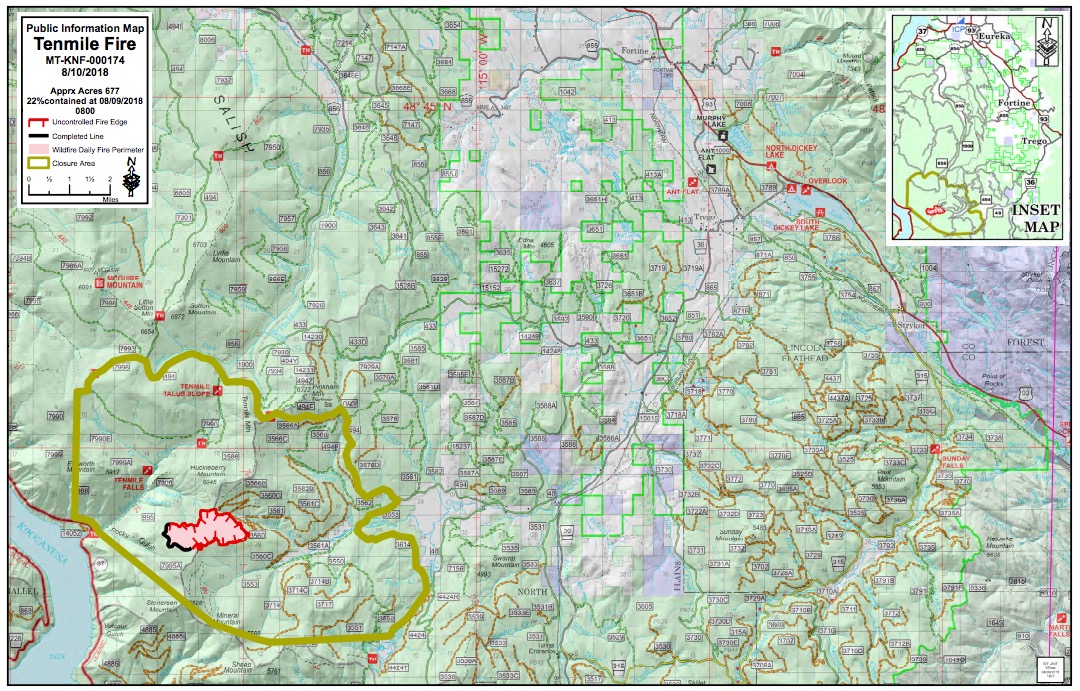
InciwebTenmile Fire Map
This fire is 677 acres and 22 percent contained. It’s 19 miles south of Eureka, at Highway 37-Ten Mile Drainage, 48.594 latitude, -115.164 longitude. It was caused by lightning. Crews have been having productive days fighting this fire, according to Inciweb.