NWS See latest Hurricane Florence spaghetti model plots.
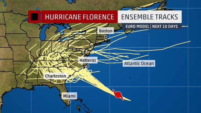
Hurricane Florence spaghetti models can provide some sense of the storm’s direction and shifting nature. You can find a round-up of some of the best, constantly updated, spaghetti model pages below for Hurricane Florence.
Here’s what spaghetti models showed for Hurricane Florence on September 12, 2018:
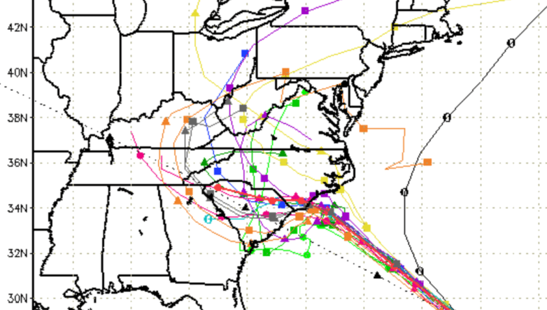
Hurricane Florence spaghetti model
It’s important to remember that spaghetti models are only predictions, and the hurricane could shift suddenly.
Here are some other spaghetti models:
This one doesn’t count, but it does speak to spaghetti model fatigue:
Cyclocane
Cyclocane is one of the best sites that has constantly updated Hurricane Florence spaghetti models. You can access that site’s spaghetti models here. As of the early morning of September 11, 2018, the Cyclocane spaghetti model showed the hurricane making landfall in North Carolina.
The Cyclocane Hurricane Florence page contains other useful information, such as radar loops and imagery and watches and warnings.
NOAA
NOAA is also a good site to check for constantly updated spaghetti models. You can access the page here. The drop-down menu on the site allows you to narrow the spaghetti model maps by storm. Look for the “storm ID” tab in the top left of the page to zoom in on Hurricane Florence spaghetti models.
The NOAA spaghetti models for Hurricane Florence also show the storm turning north and threatening North Carolina and Virginia more than South Carolina at the moment. NOAA stands for the The National Oceanic and Atmospheric Administration.
Other Spaghetti Models
The South Florida Water Management District has a page of updated spaghetti models for hurricanes, including Florence. You can access it here.
Choose “storm 6” on the site to see Hurricane Florence plots.
National Weather Service
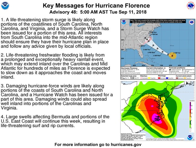
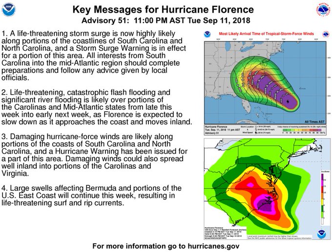
You can access the National Weather Service’s Hurricane Florence page here.
At 11 p.m. on September 11, 2018, the National Weather Service provided this information:
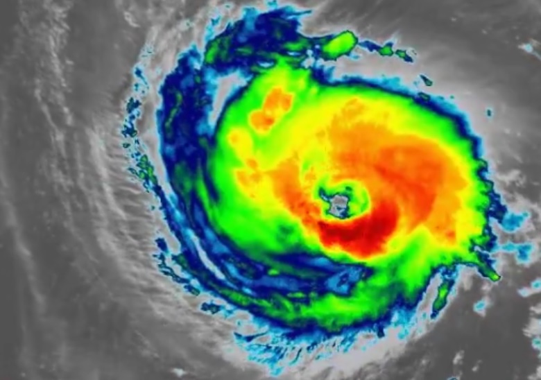
Florence’s eye became a little ragged in appearance on satellite
images a couple of hours ago, but recently it has become better
defined. There has also been a little cooling of the tops
surrounding the eye. These features suggest that Florence is
maintaining its intensity. The current intensity is kept at 120
kt, which is a little above the adjusted flight-level winds from
the Air Force Hurricane Hunters and a little below the latest
SATCON estimate from UW-CIMSS. Over the next couple of days, the
hurricane is expected to move over a warm ocean and through an
environment of low vertical shear. This would allow some
additional strengthening until about 48 hours. From that time
and up to landfall, the global models suggest some increase in shear
which would cause some weakening. However, Florence is still likely
to remain a dangerous major hurricane when its center crosses the
coast. The official intensity forecast is a blend of the
Decay-SHIPS and ICON intensity model consensus.The initial motion estimate is west-northwestward, or 300/15 kt. A
mid-level ridge to the northeast should continue to steer Florence
on a west-northwestward to northwestward heading until the
hurricane nears the coast. The steering pattern from 72 hours and
beyond becomes more complicated and uncertain. The latest GFS
model run shows a mid-level ridge building over the east-central
United States in 3-4 days. This temporarily blocks the forward
progress of the hurricane and forces a southwesterly turn in the
model run. Later in the period, the ridge rebuilds to the north of
Florence allowing the system to move inland. The official track
forecast is somewhat to the left of the previous NHC track, but to
the right of the latest consensus predictions. It should be noted
that, due to increased model spread, there is substantial
uncertainty in the 3-5 track forecast.
