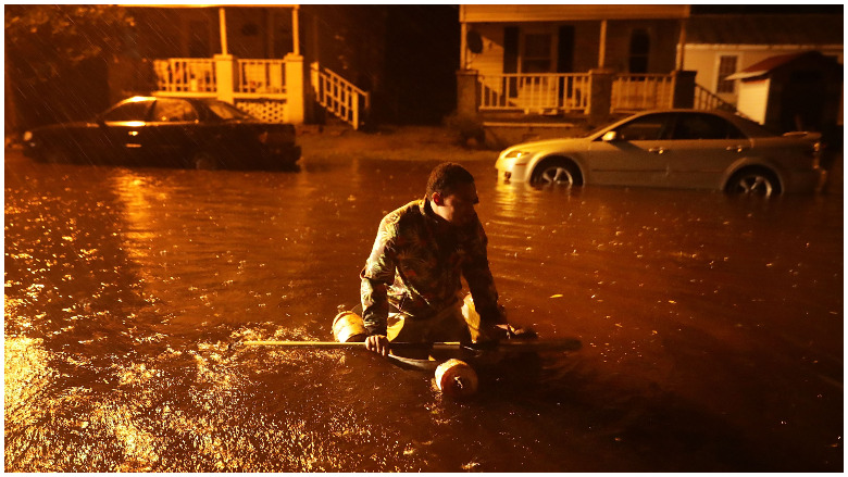
Hurricane Florence hit New Bern, North Carolina, and videos and photos captured significant flooding, a store without a roof, and other signs of damage in the riverfront community near the coast. New Bern was one of the communities that was hardest hit.
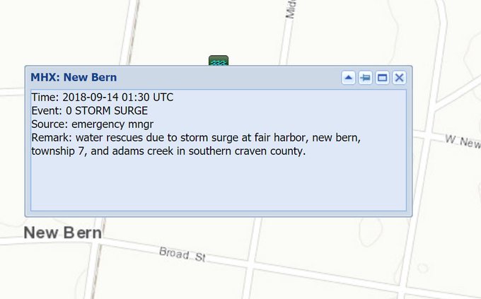
There were reports on social media of water rescues and people who needed help in New Bern on September 14, 2018. For example, one woman wrote on Twitter, “@CityofNewBern there is a young couple and their 2 yr old son who need evacuation from 3129 Woodland Ave New Bern! Can you get to them.”
Rescuers were out in full force on September 14, 2018.
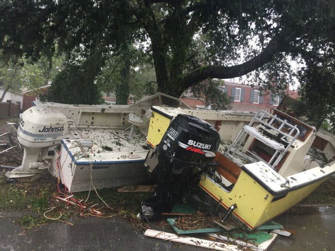
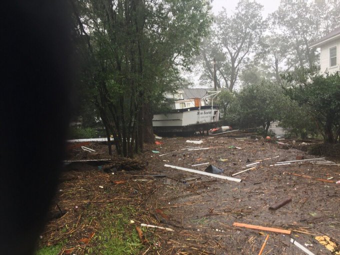
Some photos showed a boat that landed in a yard.
Others showed New Bern’s famous bear statues afloat. “Some of our beloved bears have wandered off. These statues, which New Bern is known for, are extremely heavy & bolted down at sponsoring businesses. This one ended up in the middle of S. Front St!” the city wrote.
The governor of North Carolina said that more than 100 people had been rescued from New Bern.
It was still raining on Friday.
Later, local news media station Newson6 reported that between 150-200 people were rescued in New Bern and about 100 more still needed rescuing.
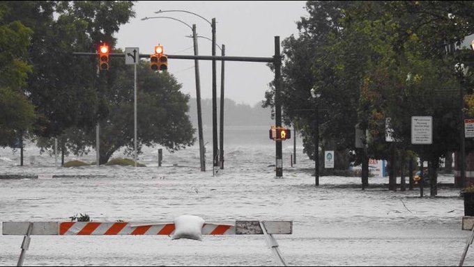
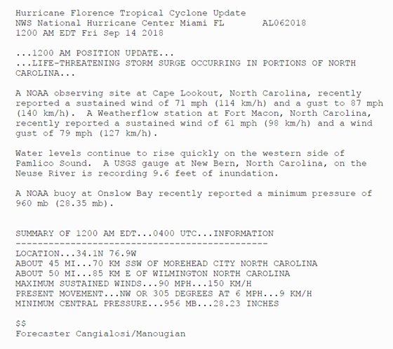
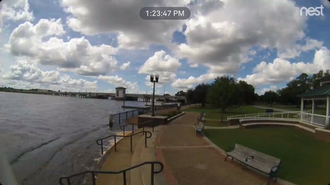
The community sits at the juncture of two rivers, which was contributing to the flooding. A 10-foot storm surge was reported in New Bern.
The city released a constantly updated ArcGIS map showing the flooding areas. You can access it here.
The Neuse and Trent Rivers intersect at New Bern, causing additional flooding concerns.
Videos showed that the roof had blown off a store.
Photos also captured the rising waters. One local television station was forced to evacuate as waters rose.
New Bern had one of the highest storm surge risks from Florence. “Currently ~150 awaiting rescue in New Bern. We have 2 out-of-state FEMA teams here for swift water rescue. More are on the way to help us. WE ARE COMING TO GET YOU. You may need to move up to the second story, or to your attic, but WE ARE COMING TO GET YOU. #FlorenceNC,” the City of New Bern wrote on Twitter.
Water levels were rising quickly. There were already unconfirmed reports of people on rooftops. “I am told by people living in a retired community called Fairfield harbour across from New Bern, over the bridge people already on their roofs. Water pouring into homes,” wrote one Twitter user.
NOAA was reporting a life-threatening storm surge.
People were urged to seek higher ground immediately.
Many people expressed fond memories of New Bern, with one man writing on Twitter, “Visited a friend in New Bern a few years ago, also spent an afternoon at Atlantic Beach. Sad to see how bad things are getting down there. Lovely area with super nice people. Hope casualties are low and the recovery is swift.”
See satellite radar imagery for New Bern here.
People offered and asked for prayers for New Bern on social media.
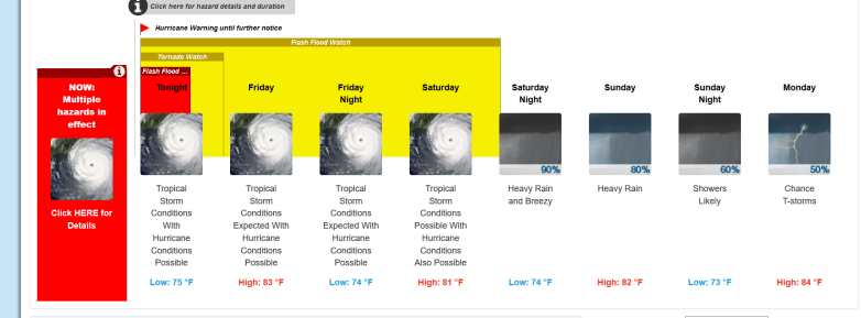
This was the extended forecast for New Bern as of September 14, 2018:
NWS
Here’s what else you need to know:
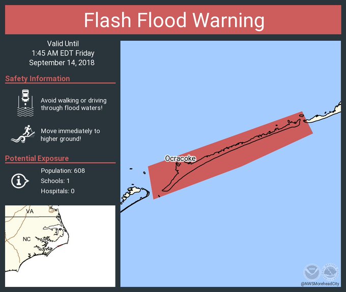
The National Weather Service Warned of Potentially Life-Threatening Flash Floods
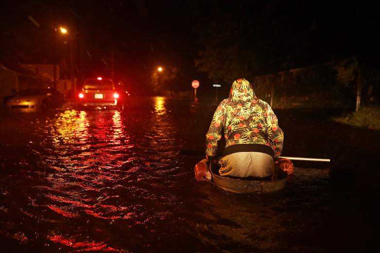
Michael Nelson floats in a boat made from a metal tub and fishing floats after the Neuse River went over its banks and flooded his street during Hurricane Florence September 13, 2018 in New Bern, North Carolina.
New Bern weather is managed out of the Newport/Morehead City, North Carolina office of the National Weather Service. See the hourly forecast for that region here.
Read the full briefing document for the hurricane here.
That office put out a flash flood watch for the area on the evening of September 13, writing, “…EXTREMELY HEAVY RAIN ASSOCIATED WITH HURRICANE FLORENCE WILL LIKELY PRODUCE LIFE THREATENING FLASH FLOODING…Hurricane Florence will impact the area into the weekend, bringing potentially historic rainfall amounts and unprecedented flooding across southern portions of eastern North Carolina.”
How much rain is expected? “Widespread and extremely heavy rain associated with Hurricane Florence will continue into the weekend. Many coastal areas have already received several inches of rainfall. Rainfall totals of around 20 to 30 inches, with isolated amounts up to 40 inches, are possible through Saturday,” NWS wrote.
Potential perils include flash floods, tornados, and storm surges. The evening hazardous weather outlook for the area was as follows on the evening of September 13, 2018:
“Hazardous Weather Outlook
National Weather Service Newport/Morehead City NC
527 PM EDT Thu Sep 13 2018
NCZ029-044>047-080-081-092>094-142130-
Martin-Pitt-Washington-Tyrrell-Mainland Dare-Beaufort-Mainland Hyde-
Jones-Craven-Pamlico-
527 PM EDT Thu Sep 13 2018
…FLASH FLOOD WATCH IN EFFECT THROUGH SATURDAY EVENING…
…TORNADO WATCH 371 IN EFFECT UNTIL 9 PM EDT THIS EVENING…
…HURRICANE WARNING IN EFFECT…
…STORM SURGE WARNING IN EFFECT…
This Hazardous Weather Outlook is for eastern North Carolina.
.DAY ONE…Tonight.
Please listen to NOAA Weather Radio or go to weather.gov on the
Internet for more information about the following hazards.
Tornado Watch.
Flash Flood Watch.
Storm Surge Warning.
Hurricane Warning.
.DAYS TWO THROUGH SEVEN…Friday through Wednesday.
Please listen to NOAA Weather Radio or go to weather.gov on the
Internet for more information about the following hazards.
Flash Flood Watch.
Storm Surge Warning.
Hurricane Warning.”
Extended Weather Forecast for New Bern, NC
As of the evening of September 13, 2018, this was the weather forecast for Bern, NC:
Detailed Forecast
“Tonight (September 13, 2018)
Tropical storm conditions, with hurricane conditions possible. Showers and possibly a thunderstorm. Some of the storms could produce heavy rainfall.
Friday
Tropical storm conditions expected, with hurricane conditions possible. Showers and possibly a thunderstorm. Some of the storms could produce heavy rainfall. High near 83. Chance of precipitation is 100%. New rainfall amounts in excess of 4 inches possible.
Friday Night
Tropical storm conditions expected, with hurricane conditions possible. Showers and possibly a thunderstorm. Some of the storms could produce heavy rainfall. Low around 74. Chance of precipitation is 100%. New rainfall amounts between 2 and 3 inches possible.
Saturday
Tropical storm conditions possible, with hurricane conditions also possible. Showers and possibly a thunderstorm. Some of the storms could produce heavy rainfall. High near 81. Chance of precipitation is 100%. New rainfall amounts between 1 and 2 inches possible.
Saturday Night
Showers and possibly a thunderstorm. Some of the storms could produce heavy rainfall. Low around 74. Breezy, with an east wind 13 to 21 mph, with gusts as high as 31 mph. Chance of precipitation is 90%. New rainfall amounts between three quarters and one inch possible.
Sunday
Showers and possibly a thunderstorm. Some of the storms could produce heavy rainfall. High near 82. Chance of precipitation is 80%. New rainfall amounts between a half and three quarters of an inch possible.
Sunday Night
Showers likely and possibly a thunderstorm before 9pm, then a chance of showers. Mostly cloudy, with a low around 73. Chance of precipitation is 60%.
Monday
A chance of showers, with thunderstorms also possible after 9am. Mostly cloudy, with a high near 84. Chance of precipitation is 50%.
Monday Night
A chance of showers and thunderstorms. Mostly cloudy, with a low around 72. Chance of precipitation is 50%.
Tuesday
A chance of showers, with thunderstorms also possible after 9am. Mostly cloudy, with a high near 86. Chance of precipitation is 50%.
Tuesday Night
A chance of showers and thunderstorms. Mostly cloudy, with a low around 73. Chance of precipitation is 50%.
Wednesday
A chance of showers and thunderstorms. Partly sunny, with a high near 87. Chance of precipitation is 40%.
Wednesday Night
A chance of showers and thunderstorms. Partly cloudy, with a low around 71. Chance of precipitation is 40%.
Thursday
A chance of showers and thunderstorms. Mostly sunny, with a high near 86. Chance of precipitation is 40%.”
