
Multiple fires are raging in Canada near Alberta, causing concern for officials and residents in the region. Read on to learn more about the High Level Fire, the Trout Lake Fire, additional fires, evacuations, interactive maps, and more.
For updated details on Alberta fire maps, see Heavy’s newest story here.
Trout Lake Fire
The Trout Lake fire is new, just sparking this weekend and leading to an evacuation notice for communities in northwestern Alberta, Global News shared. The fire is located 14 km southeast of Trout Lake, and near the Peerless Lake First Nation. It’s in the Slave Lake forest area about 300 km northeast of Grand Prairie, CBC reported.
As of 6 p.m. on Sunday, the fire was 300 hectares in size and smoke was making driving in the area hazardous.
Chuckegg Creek Fire (High Level Fire)
The High Level Fire (known officially as the Chuckegg Creek Fire) continues to rage on and a cold front with dry conditions on Monday may make things worse, Global News shared. The Chuckegg Creek Fire is 127,000 hectares in size. Approximately 5,000 people have been evacuated in the High Level area so far. The cause of the fire is under investigation.
Here’s a map of the fire, released on May 27, 2019 at 11 a.m.:
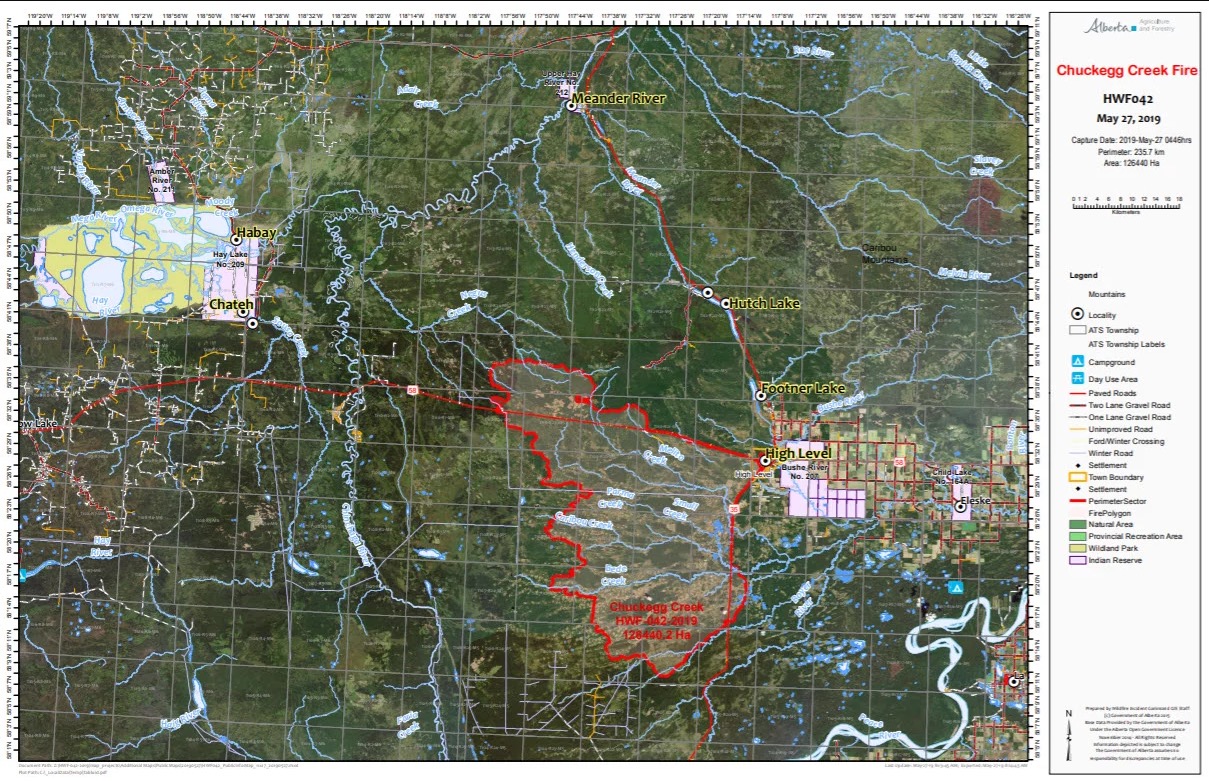
High Level Fire Map
A containment boundary has been created along Highway 35 south of High Level and Highway 58 west of High Level, according to the Town of High Level’s official Facebook page.
This fire is located about 3 km southwest of the Town of High Level. Here’s the latest public notice on the fire from Mackenzie County, released at 12 p.m. on Monday, May 27, 2019:
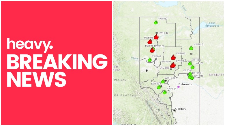
Here is a map of all the wildfires in the High Level Forest area, as shared by Alberta Wildfire. Below is a screenshot, but you can see the interactive map here. Red fires are active and out of control, green fires are active but under control.

Alberta Wildfire
Additional Fires
Additional active fires in the High Level area include Fire Number PWF070, which is 239 hectares in size, located at 57.8757 lat and -118.3220 long. The cause is under investigation.
Another fire is PWF052, which is 22,422 hectares in size, located at 57.0874 lat and -117.9288 long. It was caused by lightning.
Another is fire SWF069, 300 hectares in size, and located at 56.4097 lat and -114.3955 long. The cause is under investigation.
A fourth fire is SWF050. It’s 1,457 hectares in size at 55.6552 lat and -114.5441 long. The cause is under investigation.
You can see the interactive map here.
Evacuations in Alberta
According to Alberta’s emergency update, mandatory evacuations are currently in place for:
- The Town of High Level (and areas south/southeast of the town)
- Mackenzie County rural residents south and southeast of High Level
- Dene Tha’ First Nation communities of Bushe River, Meander River, and Chateh
High Level evacuees are asked to register at one of the following evacuation centers: Slave Lake Legacy Centre, High Prairie Gordon Buchanan Centre, Grande Prairie Regional College (GPRC), Peace River Misery Mountain Ski Resort, La Crete Heritage Centre, and Fort Vermilion Community Cultural Complex. If you can’t register, call 780-502-0778 and leave a voicemail.
Animal control is collecting pets that were left behind. Call 780-926-2201 for details about your pets if you have any that need to be picked up.
Voluntary evacuations are in place for:
- Areas north of the Town of High Level and parts of Mackenzie County, south of High Level.
- Vulnerable residents in Paddle Prairie Metis Settlement.
Any Alberta resident affected by the wildfire can apply for a one-time evacuation payment of $1,250 per adult and $500 per child under 18. Apply here.
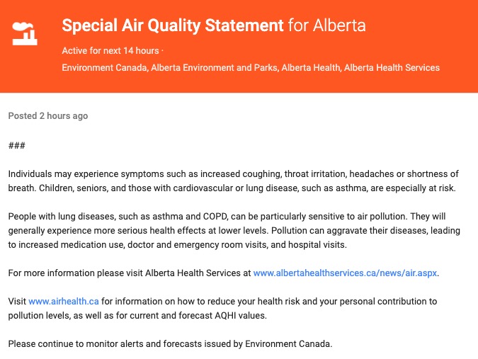
Smoke in the Area
Northern Alberta is under a smoke advisory. If you have breathing difficulties, stay indoors.
Here’s another air quality alert posted today for the area near Mackenzie County:
Google Public Alert
Here’s a crisis map for Canada (you may need to zoom in for details.) This doesn’t list fires, but it does list air quality statements for specific regions.
How to Stay Updated on Alberta Fires
To stay updated on fire conditions, download the Alberta Emergency Alerts app. You can also learn about evacuations and road closures at the 511 Alberta road reports.
You can stay updated specifically about High Level on their Facebook page.
To stay updated about Mackenzie county, follow them on Twitter or Facebook.
To stay updated on Dene Tha’ First Nation, follow their Facebook page.
For updates on Paddle Prairie Metis Settlement, see their Facebook page.
You can also follow Alberta’s Emergency Alert website here.