Fires in California continue to burn in many parts of the state today. What is the current condition of fires in California? Read on for more details about fires around the state as of June 13. News on the fires is constantly changing, so keep an eye on your local news too.
This article first includes interactive maps for all of California. Then the second section details specific fires in the region in alphabetical order.
Interactive Map of California Fires
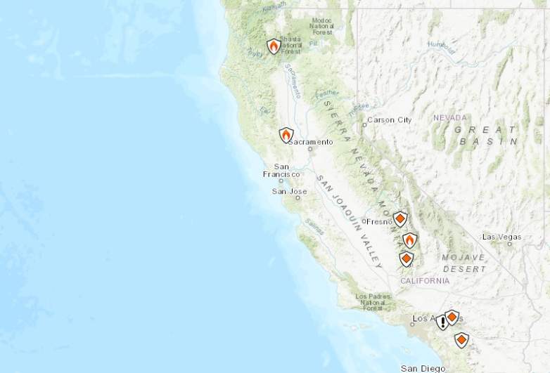
This map below is an interactive map of the more significant fires in California, consistently updated and provided by CAL FIRE and Google. Fires in red are active and fires in black are contained. If the map doesn’t show below, just go here.
Here’s Inciweb’s map. See the full map here.
Next are more specific details on the fires for June 13, 2019. If you are looking for a specific fire, search for the name so you can find it faster, or just scroll down and look at the fires, listed in alphabetical order.
List of Active Fires in California on June 13, 2019
Here are the active fires and updates about them. Most of these are in alphabetical order.
66 Fire
The 66 Fire is off Avenue 66 in Thermal in Riverside County. It’s 77 acres as of the end of May and still listed on Cal Fire’s map. It was first reported on May 29 and was 75 percent contained as of May 30. Forward progression was stopped. On May 31 the fire was transitioned to the Bureau of Indian Affairs.
Bluff Mesa Prescribed Burn
Listed on Inciweb, this is a prescribed fire to help prevent wildfires from getting out of control.
Cedar Central Prescribed Burn
Listed on Inciweb, this is a prescribed fire to help prevent wildfires from getting out of control.
Jordan Fire
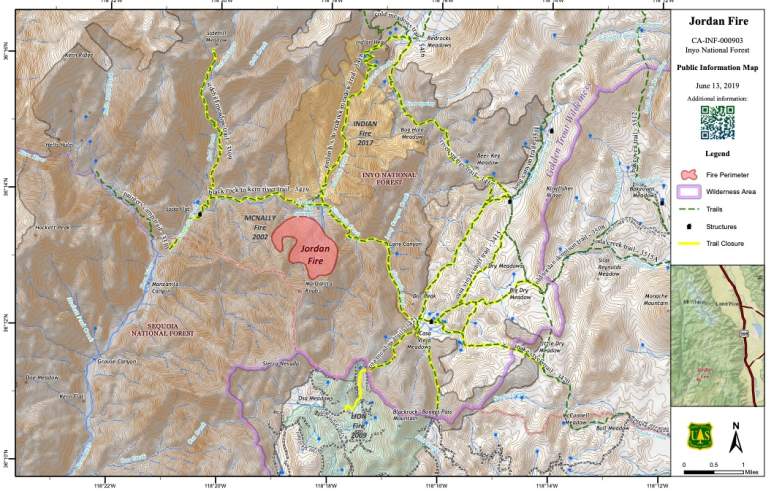
Listed by Inciweb, this fire is in the Golden Trout Wilderness area near Jordan Hot Springs. It’s 485 acres and it’s 12 percent contained as of June 13. It’s 26 miles southwest of Lone Pine, California. It was caused by lightning
Inciweb wrote on June 13: “While the fire continued to grow the reported fire acreage was reduced due to improved mapping of the fire edge. The fire remains south of Nine Mile Creek and north of Manzanita Knob. Manzanita Knob, at 9,121 feet of elevation, is a prominent peak on a ridge that forms the boundary between the Inyo and Sequoia National Forests. Close coordination between the Forests continues in mutual support of the Jordan Fire objectives. The fire is approximately 26 miles southwest of Lone Pine, California in the Golden Trout Wilderness. Firefighters work to minimize the impacts of line construction and camping to maintain the wilderness character of the land.”
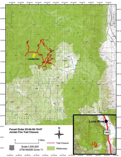
A heat-related illness was caused by the fire yesterday. Inciweb reported on June 13: “Inyo Forest Supervisor Tammy Randall-Parker said, ‘To ensure the public can continue to safely enjoy the Golden Trout Wilderness, I am closing a limited number of trails that lead into the Jordan Fire area. The Pacific Crest Trail remains open and will not be affected by this decision.'”
Here’s a map of trail closures:
Smoke may be impacting the Kernville and Lake Isabela areas at night.
Kern River Ranger District Prescribed Burn
Listed on Inciweb, this is a prescribed fire to help prevent wildfires from getting out of control.
Levee Fire
Listed by Cal Fire, this is off Highway 20 and E 22nd Street in Marysville in Yuba County. About seven to eight homes were evacuated along Simpson Lane and Levee Road on Saturday, CBS reported. Those evacuation orders were later lifted and the fire is now 100 percent contained even though it’s still listed as active on CalFire’s map.
McMillan Fire
This fire is still listed as active on Cal Fire’s map. It’s off Highway 46 East and McMillan Canyon Road, in San Luis Obispo County. It’s north of Shandon. The fire is 2,000 acres and 75 percent contained with forward spread stopped, according to Cal Fire. However, a more recent update from Cal Fire indicated that it’s now 95 percent contained and down to 1,764 acres total.
Nelson Fire
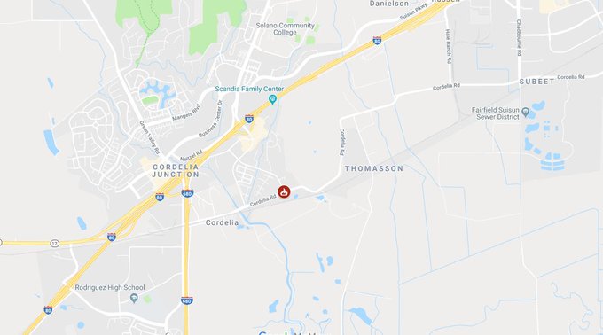
This fire is off Cordelia Road and Link Road in Fairfield in Solano County. It’s 25 acres and 50 percent contained the last time there was an update several days ago. Here’s the location on a map:
Updates have not been issued for the fire recently, but it is still listed on Cal Fire’s map.
Sand Fire
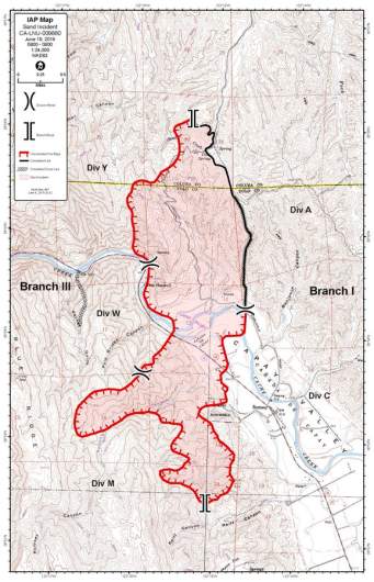
Listed by Cal Fire, this fire is off County Road 41 and Highway 16 in Rumsey in western Yolo County. It was 125 acres on June 8, but has since grown to 2,512 acres as of June 13. The fire is 9j0 percent contained, which is a 10 percent improvement over the day before with no growth. So the fire is almost fully contained.
It was first reported Saturday at 2:37 p.m. North winds are helping the fire grow. Highway 16 at Guinda was closed off because of the flames, Sacbee reported.
The cause is unknown. It’s several miles north of areas where PG&E shut down power earlier on Saturday. According to Cal Fire on June 13: “Fire crews continue constructing fire line and strengthening current lines. Fire crews will continue these operations while patrolling and mopping up hot spots. All evacuation and road closures have been lifted, we are asking the public to please drive safely as fire crews and emergency personnel are still working in the area.”
SHF Lightning Fires 2019
A series of small forest fires have ignited in the Shasta-Trinity National Forest area, caused by lightning. Here’s the incident list from Inciweb:
- 06/04/2019 15:13 PORTER Lat, Lon – 41 3.876, -122 38.454 Geographic – S of Bonanza King north of Trinity Lake, 3 acres, Controlled 06/06/19 1450 (This fire is patrolled daily by firefighters. No new growth has been noted.)
- 06/03/2019 17:42 GROUSE Lat,Lon – 40 24.882, -123 22.068 Geographic – NW of Forest Glen on the Trinity River Management Unit, .25 acreage, Declared out on 06/05/19 0856
- 06/03/2019 17:24 DEVIL Lat,Lon – 40 18.888, -123 17.484 Geographic NW of Horse Ridge on the Trinity River Management Unit, 0.10 acres, Declared out on 06/07/19 1344
- 06/03/2019 14:48 PICKETT Lat,Lon – 40 21.486, -123 23.172 Geographic SW of Forest Glen on the Trinity River Management Unit, .34 acreage, Declared out on 06/05/19 at 1230
- 06/02/2019 16:44 RUSH Lat,Lon 40 49.596, -122 51.330, Geographic between Tannery Gulch and Hwy 3 on the Trinity River Management Unit, 01 acreage, Declared out on 06/10/19 1213
Thomas Mountain Prescribed Burn
Listed on Inciweb, this is a prescribed fire to help prevent wildfires from getting out of control.
West Butte Fire (Sutter North Fire)
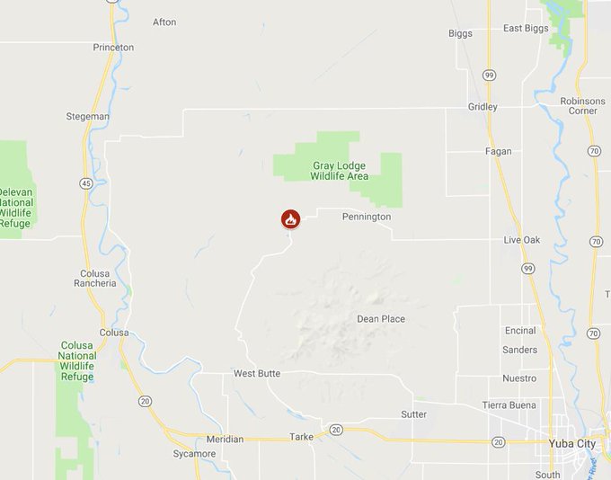
Listed on the Cal Fire map, this fire is off North Butte Road and West Butte Road, northeast of Colusa in Sutter County. It started on June 8, 2019. Follow the Sutter County Facebook page for updates. On June 9 an update was shared that the fire had grown to 1,300 acres and was 80 percent contained. It is also called the Sutter North Fire. But a later update on June 12 indicated that it’s now 100 percent contained.
This is a developing story.
