Go to main menu
Go to search form
Heavy
Sports
Alerts
Hi,
Subscriber
Search
Sports
News, stats, rumors, predictions and roster moves around the NFL, NBA, MLB, NHL and more.
More From Sports
St. Louis Blues Acquire Young Ducks Star in Draft Night Shocker
15 minutes ago
Ducks Trade Mason McTavish To Western Rival For Major Draft Haul
18 minutes ago
Denny Hamlin Fires Back at NASCAR Social Media Critic: ‘Show Your Face’
1 minute ago
Aqueduct Racetrack Set to Close After More Than a Century of Racing History
26 minutes ago
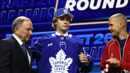
“Electric”: Maple Leafs Fans Sound Off After Gavin McKenna Pick
30 minutes ago
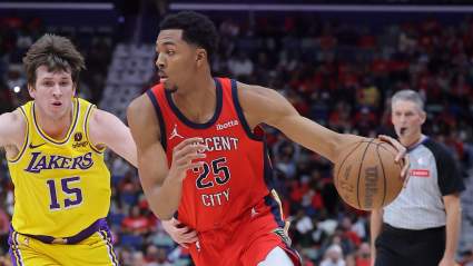
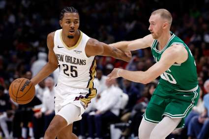
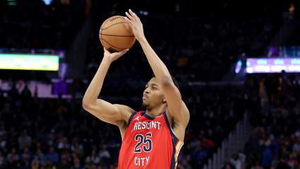
Los Angeles Lakers Get Clarity on Trey Murphy III Trade Price
34 minutes ago
Insider Reveals CM Punk Has Some Backstage Issues With WWE
39 minutes ago
Mets Get Intriguing Manager Take After Carlos Mendoza Firing
46 minutes ago
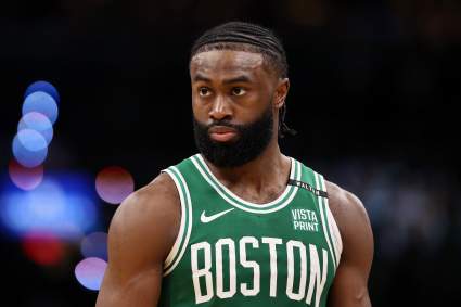
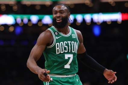
Celtics Get Major Trade Price Update for Trey Murphy III After Insider Report
48 minutes ago
Golden State Warriors Get Major Trade Price Update for Trey Murphy III
1 hour ago
Jets Pushed to Strike Trade for 23-Year-Old Super Bowl Backup
1 hour ago
New York Knicks Sign Intriguing Shooter After NBA Draft
23 minutes ago
Who Are the Best Players on Egypt’s 2026 World Cup Squad?
1 hour ago
Longtime Guardians Star Cut Loose By New Team Amid Injury Struggles
1 hour ago
Dodgers Provide Kyle Tucker Injury Update Ahead of Padres Series
1 hour ago
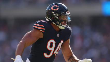
Bears’ Biggest X-Factor for 2026 Isn’t Who You Think It Is
1 hour ago
NASCAR’s SVG on San Diego Heartbreak: ‘Took Me a Couple of Days’
1 hour ago
Report: Timberwolves Make Decision on Jaylen Brown Amid LaMelo Ball Trade
1 hour ago
Report: Miami Heat Get Major Ja Morant Trade Update After Giannis Blockbuster
1 hour ago
Report: Lakers Receive Major Update on Celtics’ Trade Price for Jaylen Brown
2 hours ago
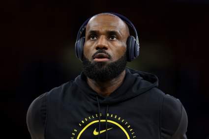
Miami Heat Receive Eye-Opening LeBron James Message From Insider
2 hours ago
Anthony Edwards Had Strong Reaction To LaMelo Ball Trade
2 hours ago
Rangers Land 37-Goal Star In Blockbuster Trade With Vegas
2 minutes ago
Detroit Pistons Pushed To Pursue Kyrie Irving After Recent NBA Moves
2 hours ago
Cubs $14.5 Million Free Agent Bust Hits Injured List, Pitching Crisis Continues
2 hours ago
Patriots Can’t Ignore ‘Super Power’ Warning About Romeo Doubs
2 hours ago
Alabama’s Newest 2027 Commit Didn’t Need Time to Think After Kalen DeBoer’s Offer
2 hours ago
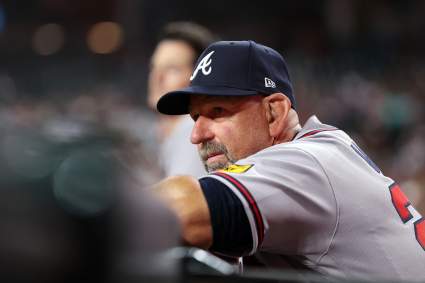
MLB Veteran Officially Becomes Free Agent After Release From Atlanta Braves
4 minutes ago
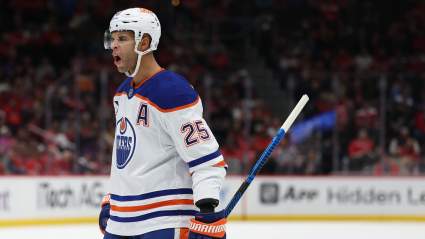
Oilers Defenseman Darnell Nurse Drawing Interest From a Division Rival
2 hours ago
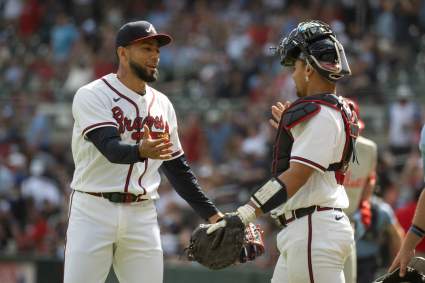
Atlanta Braves Announce Robert Suarez News Before Giants Series
8 minutes ago
More from Sports
Load More Sports ↓
Close sidebar
Home
NFL
Expand sub-menu
Arizona Cardinals
Atlanta Falcons
Baltimore Ravens
Buffalo Bills
Carolina Panthers
Cincinnati Bengals
Cleveland Browns
Chicago Bears
Dallas Cowboys
Denver Broncos
Detroit Lions
Green Bay Packers
Houston Texans
Indianapolis Colts
Jacksonville Jaguars
Kansas City Chiefs
Los Angeles Chargers
Los Angeles Rams
Las Vegas Raiders
Miami Dolphins
Minnesota Vikings
New England Patriots
New Orleans Saints
New York Giants
New York Jets
Philadelphia Eagles
Pittsburgh Steelers
San Francisco 49ers
Seattle Seahawks
Tampa Bay Buccaneers
Tennessee Titans
Washington Commanders
NBA
Expand sub-menu
Atlanta Hawks
Boston Celtics
Brooklyn Nets
Charlotte Hornets
Chicago Bulls
Cleveland Cavaliers
Dallas Mavericks
Denver Nuggets
Detroit Pistons
Golden State Warriors
Houston Rockets
Indiana Pacers
Los Angeles Clippers
Los Angeles Lakers
Memphis Grizzlies
Miami Heat
Milwaukee Bucks
Minnesota Timberwolves
New Orleans Pelicans
New York Knicks
Oklahoma City Thunder
Orlando Magic
Philadelphia 76ers
Phoenix Suns
Portland Trail Blazers
Sacramento Kings
San Antonio Spurs
Toronto Raptors
Utah Jazz
Washington Wizards
MLB
Expand sub-menu
Arizona Diamondbacks
Athletics
Atlanta Braves
Baltimore Orioles
Boston Red Sox
Chicago Cubs
Chicago White Sox
Cincinnati Reds
Cleveland Guardians
Colorado Rockies
Detroit Tigers
Houston Astros
Kansas City Royals
Los Angeles Angels
Los Angeles Dodgers
Miami Marlins
Milwaukee Brewers
Minnesota Twins
New York Mets
New York Yankees
Philadelphia Phillies
Pittsburgh Pirates
San Diego Padres
San Francisco Giants
Seattle Mariners
St. Louis Cardinals
Tampa Bay Rays
Texas Rangers
Toronto Blue Jays
Washington Nationals
NHL
Expand sub-menu
Anaheim Ducks
Boston Bruins
Buffalo Sabres
Calgary Flames
Carolina Hurricanes
Chicago Blackhawks
Colorado Avalanche
Columbus Blue Jackets
Dallas Stars
Detroit Red Wings
Edmonton Oilers
Florida Panthers
Los Angeles Kings
Minnesota Wild
Montreal Canadiens
Nashville Predators
New Jersey Devils
New York Islanders
New York Rangers
Ottawa Senators
Philadelphia Flyers
Pittsburgh Penguins
San Jose Sharks
Seattle Kraken
St. Louis Blues
Tampa Bay Lightning
Toronto Maple Leafs
Utah Mammoth
Vancouver Canucks
Vegas Golden Knights
Washington Capitals
Winnipeg Jets
More Sports
Expand sub-menu
College Basketball
College Football
Cricket
Formula 1
Golf
NASCAR
UFC
WNBA
Olympics
Pro Wrestling
Heavy on Soccer
Tennis