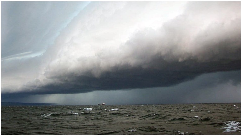
National Oceanic and Atmospheric Administration Storm clouds gathering over Lake Michigan .
Maryland was one of many states that was hit by thunderstorms July 6, but it was also the location of a rare weather event that scientists, according to the National Oceanic and Atmospheric Administration, are just beginning to understand: the meteotsunami.
A meteotsunami touched down near Kent County’s Tolchester Beach, which is located in the Chesapeake Bay to Maryland’s east and is roughly 20 miles east of Baltimore, the National Weather Service noted.
The weather event is believed to have been brought about by severe thunderstorms in the area, as local TV station WJZ-13 reported from Baltimore.
What Is A Meteotsunami?
The NOAA defines a meteotsunami as:
… large waves … driven by air-pressure disturbances often associated with fast-moving weather events, such as severe thunderstorms, squalls and storm fronts. The storm generates a wave that moves towards the shore and is amplified by a shallow continental shelf and inlet, bay, or other coastal features.
Another definition from a paper examining meteotsunami climatology on the East Coast
describes meteotsunamis as “atmospherically forced ocean waves in the tsunami frequency band with periods ranging from 2 min to 2 h … They are typically caused by moving atmospheric disturbances such as sharp pressure gradients and/or changes in wind speed.”
Typical tsunamis are driven by seismic activity, such as earthquakes and volcanic eruptions, and these can cause bodies of water to reach heights of 100 feet, according to National Geographic. Meteotsunamis, on the other hand, typically only reach heights of six feet although most stay below two, the NOAA reported.
Scientists typically distinguish between a meteotsunami and a tsunami by examining other factors, such as the presence of a storm or recorded seismic activity. The NOAA also tells people how not to confuse seiches with meteotsunamis. According to NOAA, “Seiches are standing waves with longer periods of water-level oscillations (typically exceeding periods of three or more hours), whereas meteotsunamis are progressive waves limited to the tsunami frequency band of wave periods (two minutes to two hours).”
Why Did A Meteotsunami Hit the Chesapeake Bay?
The storm which passed over the Chesapeake Bay July 6 caused barometric pressure to become unstable, making the water much more volatile, according to the National Weather Service. The fall of high air pressure caused combined with a sudden change in wind speed and direction caused water levels to suddenly drives, resulting in the meteotsunami wave which peaked in the Chesapeake Bay near Tolchester Beach.
“There was a 66 mile per hour wind gust that occurred at that time,” meteorologist Danielle Banks said.
A tidal chart from the National Weather Service’s Philadelphia/Mount Holly station showed the tell-tale signs of a meteotsunami; a sharp incline (the meteotsunami) followed by a declining series of peaks (smaller waves):
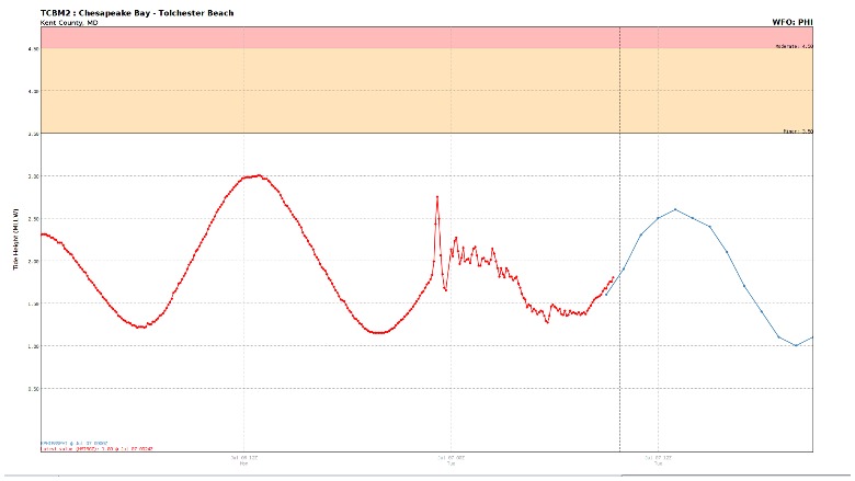
National Weather ServiceThe tidal chart of Chesapeake Bay’s meteotsunami.
Cathy Bramble, president of the Tolchester Marina, told the Chesapeake Bay Bulletin the wind gusts were so strong that they caused the rain to come down sideways, blew a sign straight into the trunk of a palm tree where it stayed and bent Tolchester’s 20-foot-high steel flagpole. Boaters also told the Bay Bulletin that they saw hail and gusts close to 70 miles per hour.
Although these types of storms are rare across the country, they are much more common along the east coast. The NOAA reported that roughly 25 of these meteotsunamis with waves above one meter take place along the East Coast every year.
READ NEXT: Here’s What A Solar Minimum Is And Why NASA Says It’s Nothing To Worry About