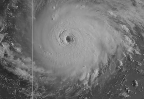
National Weather Service Hurricane Irma on September 5.
Hurricane Irma is now a powerful Category 5 storm with 175 mph winds. Is Bermuda in its projected path?
“HURRICANE IRMA IS NOT A THREAT TO BERMUDA AT THIS TIME,” Bermuda’s weather service wrote at on the morning of September 7. The same was true of Hurricane Jose and Hurricane Katia.
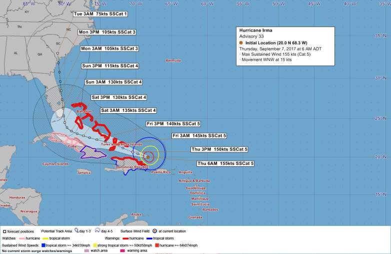
A map of Irma released September 7 by the Bermuda Weather Service.
On the morning of September 7, the Bermuda Weather Service wrote: “Winds decrease today and high pressure will slowly weaken through the weekend. Tropical moisture persists in the area, maintaining the likelihood of a few passing showers through the weekend as well. Winds become moderate later Saturday through Sunday as a cold front approaches. The front may bring a few showers through Monday. Distant Hurricane Jose remains closely monitored.”
The BWS added: “Closest point of approach to Bermuda within 72 hrs (3 days) is forecast to be 758 nm to the SSW, 10 am Thu, Sep 7, 2017. However, this system may move closer to Bermuda after this time period.”
That’s good news, obviously. On the morning of September 7, the weather service said of the storm:
Current Position: 20.0N 68.3W approx. 762 nm S of Bermuda
Recent Movement: WNW or 290 degrees at 15 kt
Central Pressure: 921 mb / 27.19 in
Max Winds: 155kt gusts 190kt
Here’s the latest map provided by the Bermuda weather service:
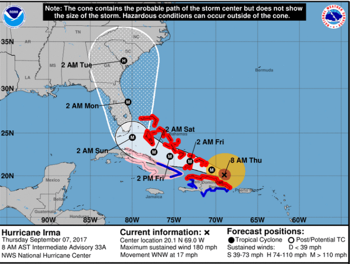
NWSThe Irma forecast cone as of the morning of September 7.
The September 7 news matches earlier forecasts, for the most part.
On September 5, The Royal Gazette reported that the Hurricane Irma is “expected to pass 875 miles south of Bermuda on Thursday morning. But the Bermuda Weather Service’s 6pm update last night warned that the storm, due to be closest at 11am, could move closer to the island after that.”
“Hurricane Irma is not a threat to Bermuda at this time,” Bermuda’s Weather Service reported on September 5. “Closest point of approach to Bermuda within 72 hrs (3 days) is forecast to be 761 nm to the S, 9 am Thu, Sep 7, 2017. However, this system may move closer to Bermuda after this time period.”
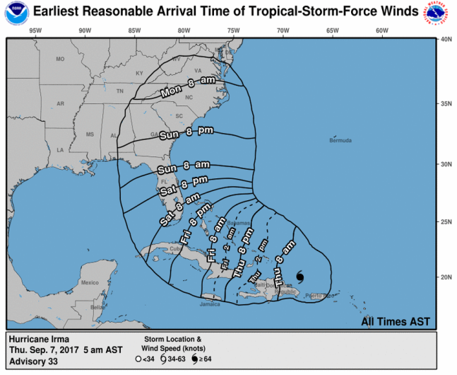
National Hurricane CenterSeptember 7 wind arrival projections for Irma.
On the continental U.S., the storm is projected to threaten the Florida Keys and Southern Florida and possibly South Carolina and Georgia. See updated Bermuda weather forecasts here.
You can see an updated map of Hurricane Irma here.
Here are the latest Key Messages on #Irma t.co/tW4KeGdBFb

The governors of Florida and Puerto Rico have issued state of emergency declarations in advance of Hurricane Irma and mandatory evacuations were ordered in the Florida Keys. “#Irma is the strongest #hurricane in the Atlantic basin outside of the Caribbean Sea & Gulf of Mexico in NHC records,” the National Hurricane Center reported on September 5.