Inciweb
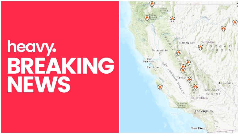
Fires are still an issue in California as hot, dry weather continues in the region. Here’s a look at the latest wildfires being reported on August 13, 2019, including the Moose fire, Ward fire, and others. This article first includes interactive maps for all of California, including Cal Fire and other sources. Then the second section details specific fires in the region in alphabetical order. Remember that when it comes to fires, details can change quickly, so also stay tuned to your local news sources if there is a fire in your region.
Interactive Maps of California Fires
There are two interactive maps to follow to get the best updates about California fires this summer. In many cases, the fires don’t always overlap so it’s good to review all the maps for the latest information.
A previously helpful map is an interactive map provided by CAL FIRE and Google. Unfortunately, this map hasn’t been updated in a while and as of August 13 it still hasn’t been updated, which is unusual. So we’re no longer embedding the map in the story. You can view the map here.
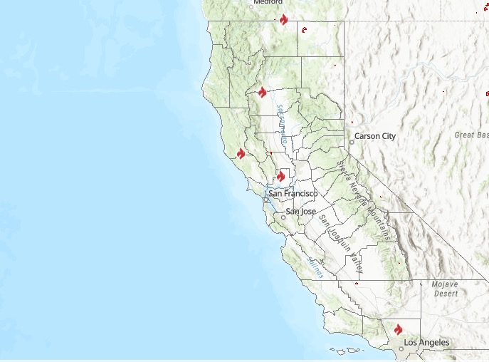
The second good interactive map is Inciweb’s map. You can see the full map here. There’s an embeddable Google Map that includes Inciweb fires which you can see below. Depending on your browser, you may need to zoom in using the + button within the map or change settings on the Layers tab of Legend to only show Inciweb fires:
Another good map can be found here from Ca.gov. A screenshot is below since the map can’t be embedded, but you’ll want to go to the full map for details. You can input your address to see how close the fires are to your location.
Ca.gov
Each of these maps often contains details the others are missing, so you’ll need to view all three for a full update on the fires. However, brand new fires may not be listed on any of the above maps until they’ve been around for a few hours.
Next are more specific details on the fires for August 13, 2019. If you are looking for a specific fire, search for the name so you can find it faster, or just scroll down and look at the fires, listed in alphabetical order.
List of Active Fires in California on August 13, 2019
Here are the active fires and updates about them. Most of these are in alphabetical order.
Bowler Fire
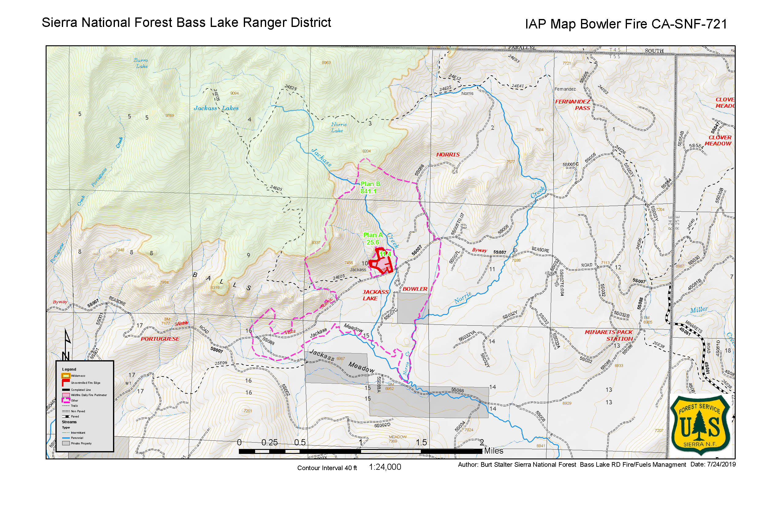
This fire was first spotted on July 24. As of August 1 and August 12, the fire was 100 percent contained, although it’s still listed as active on Inciweb’s map. It grew to 40 acres.
Dixon Fire
This fire is nine acres in size as of August 4, the latest update, and was caused by lightning. It’s east of Silver Peak on Carson Iceberg Wilderness, Inciweb reported. Inciweb noted: “Humboldt-Toiyabe National Forest fire managers are making use of a lightning-caused fire to meet multiple resource objectives in the Carson-Iceberg Wilderness. The Dixon Fire is located east of Silver Peak on the north side of Dixon Creek and was discovered on July 28 by aerial reconnaissance after storms passed through the area.”
Fish Fire
Listed on Inciweb’s map as an active fire, the Fish Fire was 77 acres is now 100 percent contained as of July 19. It was in the Sierra National Forest and was discovered on the afternoon of July 15, near the Fish Creek Campground. No structures were threatened.
June Lightning Fires 2019 (Bald Fire and Lost Fire)

Inciweb
In Kernville, California, two fires were discovered in the Sequoia National Forest from lightning, Inciweb wrote. These are the Bald Fire and the Lost Fire. Together they have burned about 122 acres as of July 16. The good news is that as of July 23, both fires are 100 percent contained at 122 acres.
Mill Fire
This fire in Monterey County is 280 acres and 100 percent contained as of August 13.
#MillFire 🔥 unofficial, automated update.
@LosPadresNF; ~20mi WSW of Pine Canyon, CA. ⚠️ DO NOT USE FOR SAFETY PURPOSES – See officials instead. May be incorrect; disclaimers in images.
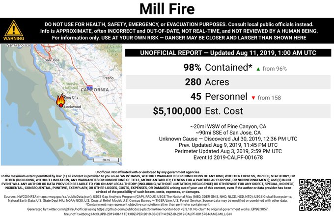

It was in Los Padres National Forest, west of Fort Hunter Liggett, according to Ca.gov.
Best wishes for #SmokeyBear75 from the remaining crews mopping up the #MillFire along the Big Sur coast on @LosPadresNF. With the fire 95 percent contained, firefighters were able to pause & acknowledge 75 yrs of fire prevention messaging from @smokey_bear

The cause is being investigated.
Lower Fire
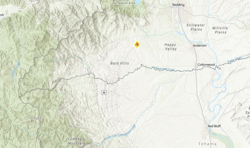
Ca.gov
This fire was reported August 12. As of August 13, it’s 46 acres and 90 percent contained. The fire is at Gas Point Road and Lower Gas Point Road in Igo, located in Shasta County.
Moose Fire
The #moosefire in Mendocino County, August 12, 2019 t.co/HCJpqRaWP4 @NorthBayNews #wildlandfirefighter @CALFIRE_MEU
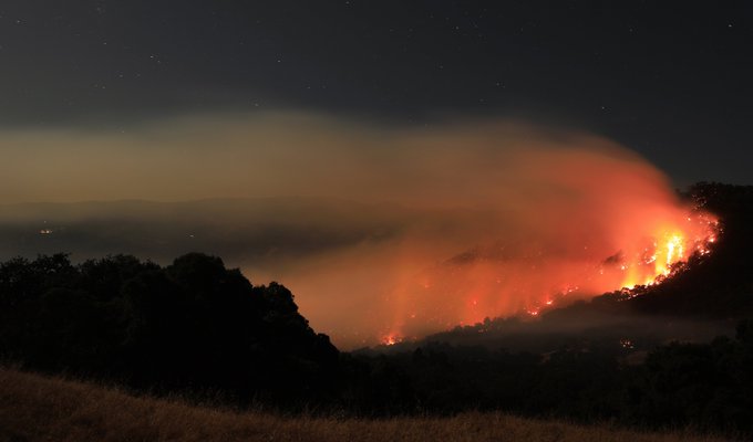
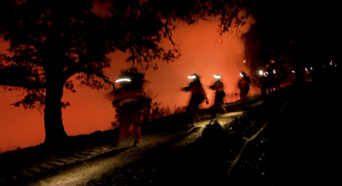
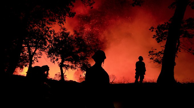
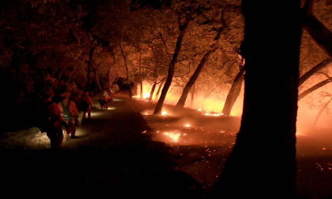
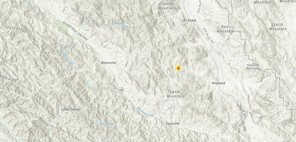
This is one of the more worrisome fires at the moment because it caused evacuations despite its smaller size. The fire is 225 acres and 25 percent contained as of August 13. It’s in Mendocino County, off Moose Road and Bus McGall Road, northwest of Hopland.
Ca.gov
According to CA. gov: “The Moose Fire is currently burning south east from Moose Road in an area known as McNab Ranch, north of Hopland. The fire is burning in brush and grass oak woodland in steep terrain. Structures are threatened. There are approximately 300 firefighters at the Incident with additional personnel and equipment arriving throughout the night.”
The following evacuation orders were given, according to Ca.gov:
- McNab Ranch Area
- Valley View Road
- Bus McGall Road
- Moose Road
Mendocino’s Sheriff’s office noted:
#MOOSEFIRE The Evacuation Orders for the Moose Fire in the Hopland area have been reduced to an Evacuation Warning. Moose Rd, Bus McGall Rd, Valley View Rd, Feliz Creek Drive, and the north end of Feliz Creek Rd are all still currently under an Evacuation Warning.
Evacuation warnings were issued for:
- McNab Ranch Area
- North end of Feliz Creek Road
- Feliz Creek Drive
Road Closures were issued for Bus Mcgall Road at Valley View Road.
Ten structures are threatened.
Palermo Fire
BRUSH FIRE #PalermoFire | Battalion 5 units are currently assisting @LAFD with a 7 acre brush fire in LAFD’s area.
#LACoFD
This fire is in the LAFD area (Los Angeles county) and it’s a seven-acre brush fire that just started on August 13 around 4:15 p.m.
Brush Fire @LAFD on scene with @LACoFDPIO enroute to assist #PacificPalisades #PalermoFire 2 acres moving uphill away from homes in med-heavy brush @FOXLA
Some resources being released from the #PalermoFire in Palisades, which is holding at 7 acres. Smoke visible from Topanga Canyon is visibly dispersing, which is generally a good sign.
Smoke is beginning to disperse from this fire.
Location of fire start:

The fire’s general location is above.
Sherman Prescribed Burn
Listed on Inciweb, this is a prescribed fire to help prevent wildfires from getting out of control.
SHF Lightning 2019
As of August 12, 31 lightning fires had started from recent storms from August 8-10. Here’s a look at the current status of those fires:
SFMU
08/09/2019 19:56, PINE, W of Brushy Mtn, 0.25, acre, Out
TRMU
08/10/2019 19:11, MONTGOMERY, Montgomery Ridge near Hwy 3 0.1 acre, Contained
08/10/2019 07:21, TANGLE, Tangle Blue Creek and Hwy 3, 0.1 acre, Out
08/11/2019 12:51, STONEY, Stoney Point Trinity Lake, 0.1 acre, Controlled
08/12/2019 13:22, SUNFLOWER, Near Sunflower Creek, 0.5 acre, Staffed
08/12/2019 15:00, SHERER, S of Sherer Ridge, 0.71 acre, Staffed
08/12/2019 15:00, BARNUM, Near Big French Creek, 1.7 acres, Staffed
08/12/2019 16:00, PANSY, Near Swift Creek, 4.2 acres, Staffed
08/12/2019 16:00, BUSHY, Granite Peak Rd, .75 acres, Staffed
NRA
08/10/2019 09:15, DONEY, NW of Lakehead, 0.1 acre, Out
08/10/2019 11:21, DOOLES, N of Salt Creek Mtn, 0.1 acre, Controlled
08/10/2019 10:41, SPRING, Across canyon from Prospect Creek, 0.1 acre, Out
08/10/2019 11:24, SALT, N of Salt Creek Mtn, 0.1 acre, Controlled
08/10/2019 19:00, CHARLIE, NW of Lakeshore East, 0.1 acre, Out
08/10/2019 09:57, PROSPECT, W of Shoeinhorse Mtn, 0.1 acre, Out
08/10/2019 07:14, BRUSHY, Near Brushy Canyon, 0.25 acre, Out
08/10/2019 09:57, HAPPY, Happy Hunting Grounds, 0.1 acre, Out
08/10/2019 17:58, HUNTING, W of Iron Canyon Reservoir, 0.1 acre, Out
08/11/2019,12:45, HOOVER, Squaw Arm Shasta Lake, 0.5 acre, Controlled
08/11/2019 10:44, MUDDY, East side of Garden Ridge, 3.5 acres, Staffed
SMMU
08/10/2019 11:28, ZOT, Near Hazel Creek Rd, 0.1 acre, Patrol
08/10/2019 13:15, TOAD, E of Toad Mtn, 0.1 acre, Patrol
08/10/2019 16:41, CINDER, E of Hotlum near Cinder Cone, 0.1 acre, Patrol
08/10/2019 16:16, BEAR, N of Gumboot Lake, 0.1 acre, Patrol
08/10/2019 19:25, FISCHER, Across from Sims Flat, 0.1 acre, Patrol
08/10/2019 12:13, SISSON, Rocky high elevation on Mt Eddy, 0.1 acre, Patrol
08/10/2019 16:17, WHITE, N of Bear Ridge, S of 0.1 acre, Patrol
08/10/2019 15:53, FRENCH, W of Sugarloaf 0.1 acre, Patrol
08/10/2019 20:01, PICAYUNE, W of Porcupine Lake, 0.1 acre, Patrol
08/12/2019 16:54, GAZELLE, Near Dewey Mine, 0.1 acre, Out
Springs Fire
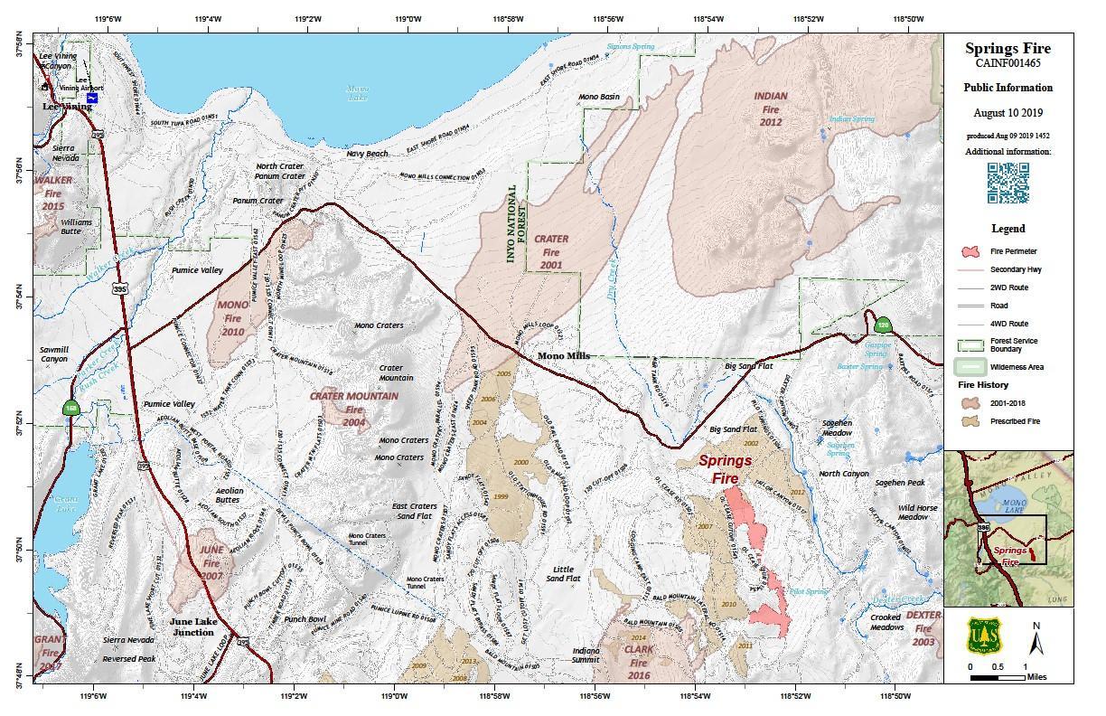
Inciweb
This fire is now 888 acres and 13 percent contained, according to Inciweb on August 12, the latest update. It grew from 200 acres in just a few days. It was caused by lightning. It’s located 13 miles southeast of Lee Vining. The map above is from August 10, the most recent Inciweb map.
Here’s a map of road closures from the fire:
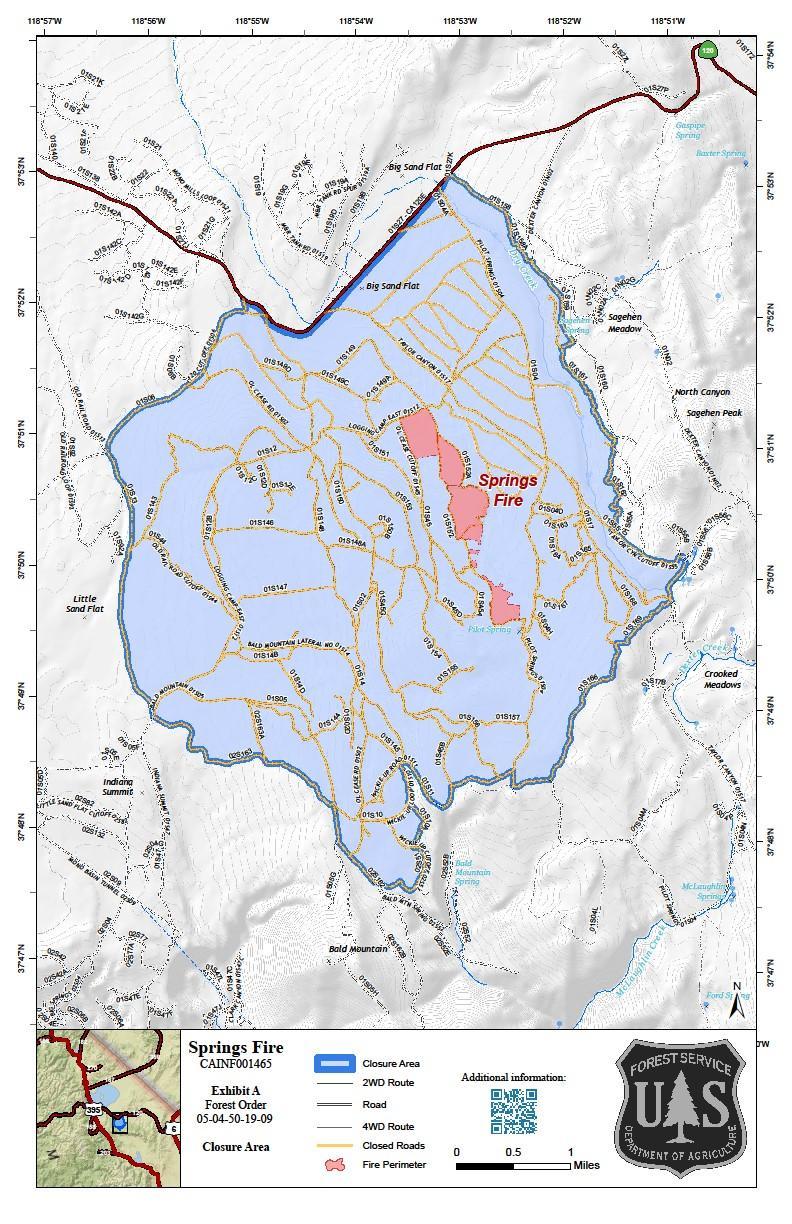
inciweb
On August 12, Inciweb wrote in part: “The Inyo National Forest Type 3 Incident Management Organization is managing the Springs Fire. Fire management have based strategic and tactical decision making on historical and scientific data for the purpose of managing for multiple objectives including protection, suppression and resource benefit. Firefighters continued with holding and mop-up operations through the day. Crews assigned to night shift continued with tactical firing operations, for a total fire growth of 268 acres over the past few days. This continues to provide more depth to the control line securing the established anchor point. Minimal growth occurred on Sunday due to Easterly winds throughout day. Early morning light smoke/haze is also likely to spread west toward the Big Sand Flat area and possibly as far south as the Bishop/Owens Valley. Afternoon winds will spread towards the Benton/Hammil Valley area.”
Timm Fire
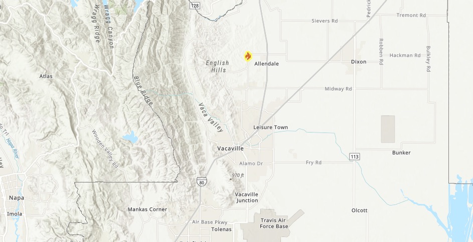
Ca.govTimm Fire
This fire was first reported on August 13. It’s 25 acres and 0 percent contained, located in Solano county off Timm Road and Allendale Road, south of Winters. The cause is under investigation.
Ward Fire
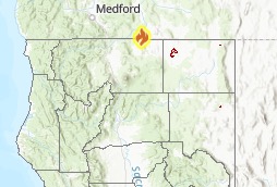
Ca.gov
This fire is in Oregon but near the border with California. It’s currently 1,301 acres and 34 percent contained as of August 13. The cause is under investigation. The fire started August 9 and is near Highway 66 and Ward Road, about 13 miles west of Keno, Oregon. It’s also 18 miles southwest of Klamath Falls.
Drier weather today may help some areas flare back up.
You can follow updates on the fire’s Facebook page.
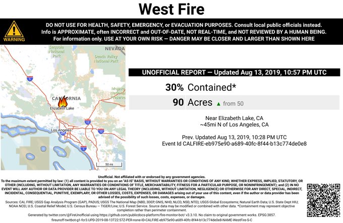
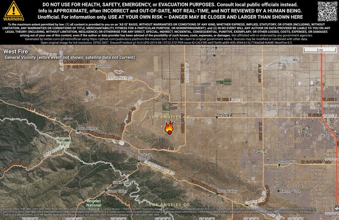
West Fire
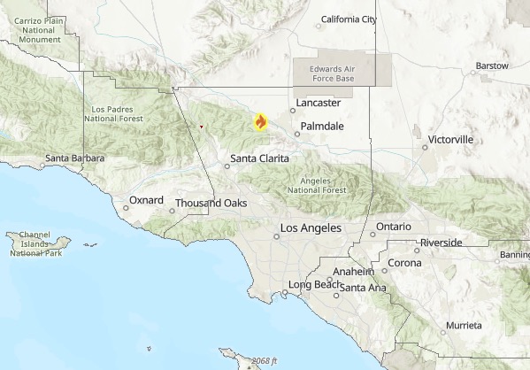
Ca.gov
This fire was reported on August 13. It’s in Los Angeles County, off 120th Street West and Coppermill Road in Lancaster.
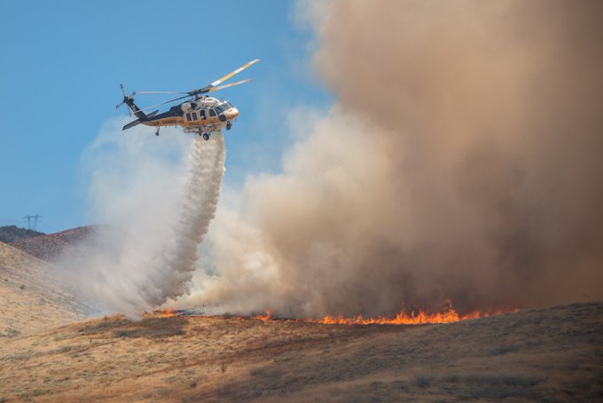
BRUSH FIRE 8/13/19 @LACoFireAirOps Firehawk helicopter makes a drop to fight the #WestFire in the Antelope Valley earlier this afternoon. (📷@DaveMillsPhoto) with @LACoFD @LANLASD @CHPANTELOPEVALL @Angeles_NF
The fire is 90 acres and 30 percent contained. The cause is under investigation.
#WestFire 🔥 unofficial, automated update.
Near Elizabeth Lake, CA. ⚠️ DO NOT USE FOR SAFETY PURPOSES – See officials instead. May be incorrect; disclaimers in images.
t.co/wwcygEplaH
Stay tuned to local news for the latest evacuation updates if there are fires near your area, as fire news can change quickly.