Fires continue to cause issues during the hot, dry summer months in Oregon and Washington as the month of August comes to a close. These fires include a new fire in Portland, Oregon that has spread to at least one structure and prompted some evacuations. If you’re seeing smoke in Portland, it’s likely due to the new Portland fire. Here are the details about the latest fire and red flag warning information for the states as of August 26, 2019. Read on for the latest details about the wildfires’ locations, containment, evacuations. Remember to also check your local news sources, as fire details can change quickly and with little warning.
To see details on the Portland fire, scroll to the second section and it is the first fire listed. You can also see it on the first interactive map below.
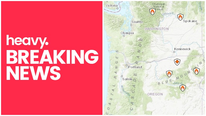
Interactive Fire Maps for Oregon & Washington
A great way to keep track of fire activity is by looking at interactive maps. You can see an interactive map of the Oregon and Washington fires here, provided by Oregon.gov, or view details from NIFC.gov here. The same interactive fire map for the two states is also embedded below:
Here’s another real-time fire map via Public RAPTOR for the Oregon area:
You can see Inciweb reported fires in the interactive map below or here. You may need to zoom into the map below to see the fires using the + button within the map, depending on your browser. You may also need to go to the Legend’s Layers Tab and unclick public alerts, traffic condition, and California wildfires, only clicking Inciweb Wildfire Information to see the Oregon and Washington fires.
Red Flag Warnings for Oregon & Washington
You can see weather warnings and Inciweb fire notices in Washington and Oregon in Google’s Crisis map at this link or on the map below. Depending on your browser, you may need to click the + sign to zoom into your region.
Here are details on the individual fires for August 26, 2019. Oregon fires are listed first, followed by Washington fires.
Oregon Fires
Portland, Oregon Fire
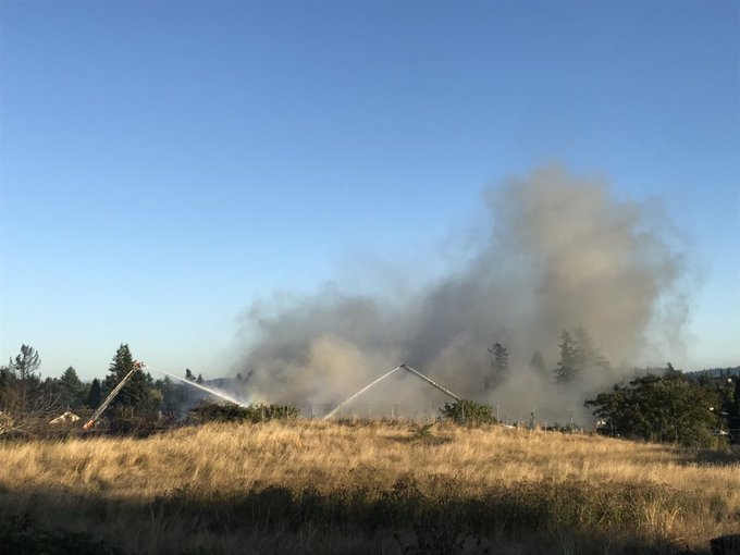
This fire doesn’t have a name yet and since it’s the newest fire, we’re listing it first. The fire started on August 26, 2019. It was a grass fire that spread to buildings in northeast Portland, Fox 12 reported. The fire is four alarms (possibly just upgraded to five alarms) and has knocked down some power lines in the area.
The fire’s near Northeast 85th Avenue and Siskiyou Street.
This is now a 4 alarm fire. Please avoid the NE 82nd Ave area. Several structures are involved. Homes are being evacuated on NE Knott St. PIO is enroute. @PBOTinfo
The fire was first reported around 5:20 p.m. in the 8500 block region of Northeast Siskiyou Street, KATU 2 reported. Homes on Northeast Knott Street were evacuated, and Northeast 82nd Avenue was closed near the fire. The fire is near the Dharma Rain Zen Center and the Lumberyard Indoor Bike Park, according to OPB.
If you’re seeing smoke in the Portland region, it’s likely because of this fire. More than 12,000 customers also lost power so crews can better battle the fire.
The Portland Fire Department has requested we de-energize our lines to assist in safely working the fires in NE Portland near 85th Ave & Siskiyou St. We currently have 12,128 customers without power & the estimated time of restoration is 9:30 pm. For updates text STAT to 722797.
The fire may be more under control, OPB reported. But people in the area should still watch the local news closely for changes. Two businesses and a home were damaged by the fire. Air quality is bad and people within 12 blocks are asked to stay indoors, and keep their AC off and their windows shut.
UPDATE: @PDXFire advising everyone in a 10-12 block radius to close windows, stay indoors. This 5-alarm fire scorched a skate park, at least one home and continues to burn at this hour #KOIN6News

The cause of the fire is not known.
163 HK Complex Fire
Inciweb
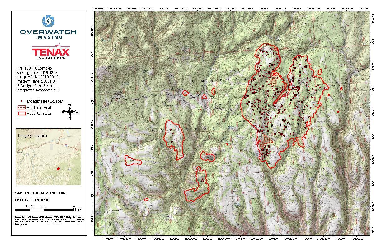
This refers to a series of fires. It’s 2,705 acres and 95 percent contained. Inciweb noted: “The HK Complex is a combination of 14 lightning fires that were reported on Aug.5, 2019 following a lightning storm on the Forest. The fires are located near the Alder Creek Skookum Trailhead, approximately two miles east of Tupper Guard Station. The fire is burning in grass, brush and timber. Firefighters and aerial resources were promptly dispatched to the fires, however strong evening winds produced rapid fire growth, causing some of the fires to grow together and increasing the overall fire size to approximately 2,455 acres. A Type 2 Incident Management Team took command of the fire at 6 a.m. on Aug. 8, 2019.”
Inciweb last updated the details about this fire on August 19. It’s 15 miles north of Monument, Oregon.
204 Cow Fire
The 204 Cow Fire is 17 miles southwest of Unity, Oregon. It was caused by lightning and is 2,371 acres and 0 percent contained. Two minor structures are threatened but no residences are threatened, according to NIFC.
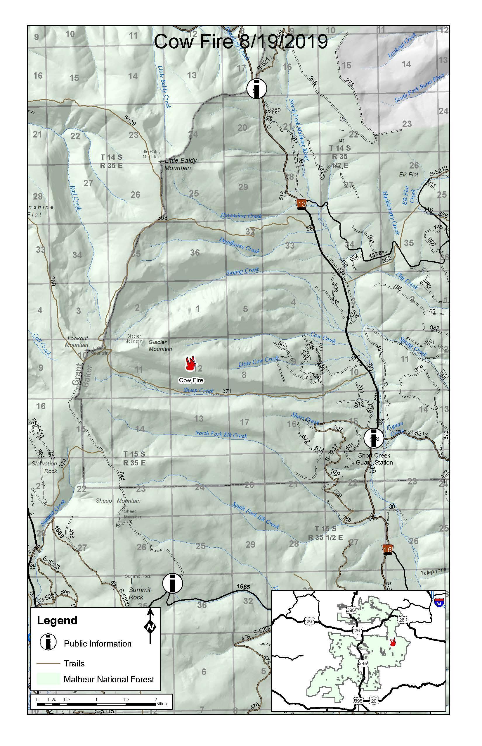
NIFC noted: ” The fire is burning in the remote high elevation area within the Glacier (1998) and Sheep Mountain (1990) fire scars. On August 22, 2019, the Northwest Interagency Incident Management Team 9, led by Incident Commander Brian Goff, took command of the fire. Overall objectives for the fire include: prevent the fire from impacting high values such as private lands, historic guard station, Cow Camp, active grazing allotments, and timber sales. Control features will be established where firefighter exposure to hazards is minimized and there is a high probability of success in containing the fire… Firefighters working on the northeast and southeast areas of the fire were able to use hand and aerial ignitions to reduce surface fuels between the fire’s active edge and the control lines planned for final containment. The current weather has been favorable to this careful and deliberate process.”
You can stay updated on this fire on the Facebook page here.
2019 Umatilla NF Prescribed Fire
These are fires purposefully set by officials in order to mitigate wildfire damage in the future.
Granite Gulch Fire
Inciweb
This fire is 4,734 acres in size and was caused by lightning, according to Inciweb on August 25. It’s in the Eagle Cap Wilderness in Granite Gulch of Upper Minam River.
According to Inciweb: “The lightning-caused Granite Gulch Fire is burning in a remote part of the Eagle Cap Wilderness within the Wallowa-Whitman National Forest. It remains far from private lands, structures, or improvements. Forest Service fire managers are pursuing a confinement strategy that calls for active management to keep the wildfire within specific, pre-identified areas of the upper Minam River drainage and well-within the Eagle Cap Wilderness. Fire managers will take appropriate suppression actions, as necessary, to meet multiple objectives: keeping the fire confined to specific areas of the Wilderness, allowing it to play a natural role in maintaining the ecosystem…”
Inciweb also noted: “Area residents and visitors should expect to see some smoke, and when the fire is active a column of smoke may be visible above the Wallowa Mountains.”
On August 26 Inciweb added: “Cooler temperatures and higher humidity Sunday slowed the movement of the Granite Gulch Fire, which continues to do what nature intended clear the forest floor of excess fuels which encourages the growth of forage.”
Ward Fire
This fire is right on the border between Oregon and California. It’s 1,301 acres and 78 percent contained as of August 16, the last update. It was caused by lightning and is 13 miles west of Keno, Oregon. The fire is being watched and secured, and no further updates are expected unless the fire causes problems again. The Facebook page monitoring the fire also closed down.
Washington Fires
Devore Creek Fire
This fire was 460 acres as of August 20, the last update from Inciweb. It’s three air miles southwest of Stehekin, Washington. Inciweb noted: “The fire will likely continue to smolder and creep in heavy fuels until a season ending rain or snow event…This Devore Creek Fire is burning entirely within the Glacier Peak Wilderness, between 5,700 – 6,800 feet of elevation. Lightning storms came through the area on July 23 and 24, 2019. The fire was reported on July 26 and first observed at by aerial reconnaissance at five acres. Rapellers arrived within two hours of the initial report and the fire had grown to approximately 75 acres. They could not safely engage the fire directly due to its size, the extremely steep terrain, and the amount of fuel available to burn… The fire has seen minimal growth in recent days, but due to the fire’s remote location and the heavy fuels it’s burning in, the fire will be on the landscape for the rest of the season.”
South Fork Creek Fire
This fire is 160 acres and 10 percent contained, located 12 miles northwest of Leavenworth. It’s listed by NIFC.
Williams Flats Fire
This fire is 44,446 acres and now 100 percent contained, according to Inciweb on August 25. Full containment has been achieved for the fire that was five miles southeast of Keller, Washington. The focus now shifts to general rehabilitation of the area.